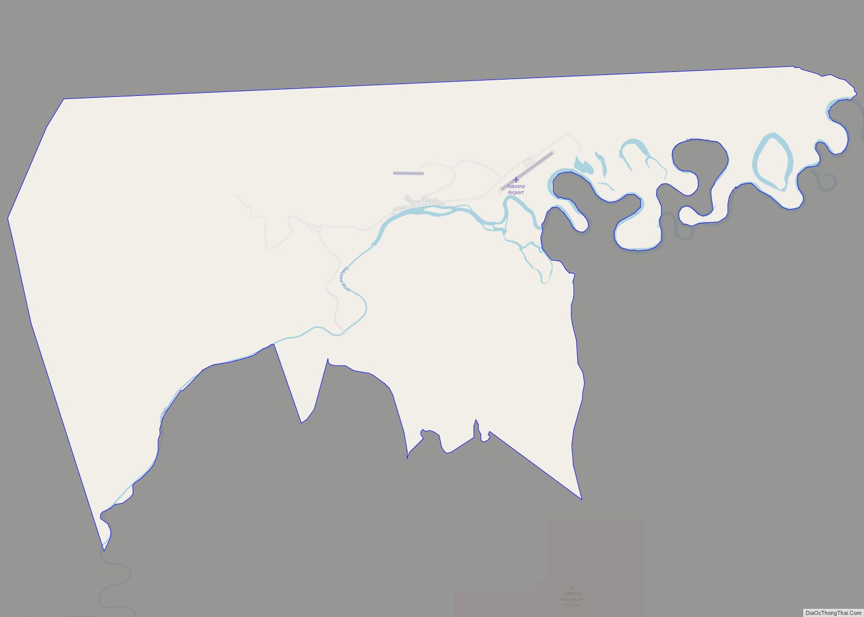
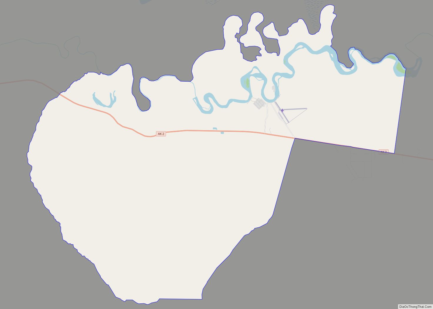
Map of Sutton-Alpine CDP

Map of Sutton-Alpine CDP

Sutton (Ahtna: Ts’es Tac’ilaexde; Dena’ina: Ts’es Tuk’ilaght) is a census-designated place (CDP) in the Matanuska-Susitna Borough in the U.S. state of Alaska. At the 2020 census the population was 1,038, down from 1,447 in 2010. The CDP includes the former coal mining community and road construction camp of Sutton, as well as the former mining camps of … Read more

Map of Susitna CDP

Map of Susitna CDP

Susitna is a census-designated place (CDP) in Matanuska-Susitna Borough, Alaska, United States. It is part of the Anchorage Metropolitan Area. As of the 2020 census, the population of the CDP was 11. Susitna was once home to the legendary Athabaskan elder, historian and ethnologist Shem Pete (c1896-1989), who documented countless locations travelling thousands of miles … Read more

Map of Tanaina CDP

Map of Tanaina CDP

Tanaina is a census-designated place (CDP) in the Matanuska-Susitna Borough in the U.S. state of Alaska. Located 4 miles north from Wasilla, it is part of the Anchorage, Alaska Metropolitan Statistical Area. At the 2020 census the population was 8,817, up from 8,197 in 2010. Tanaina is the sixth-most populated CDP in Alaska. Tanaina CDP … Read more

Map of Tanacross CDP

Map of Tanacross CDP

Tanacross (Taats’altęy in Tanacross Athabascan) is a census-designated place (CDP) in Southeast Fairbanks Census Area, Alaska, United States. At the 2010 census the population was 136, down from 140 in 2000. It hosts an air tanker base. Tanacross CDP overview: Name: Tanacross CDP LSAD Code: 57 LSAD Description: CDP (suffix) State: Alaska County: Southeast Fairbanks … Read more

Map of Talkeetna CDP

Map of Talkeetna CDP

Talkeetna (Dena’ina: K’dalkitnu) is a census-designated place (CDP) in Matanuska-Susitna Borough, Alaska, United States. At the 2020 census the population was 1,055, up from 876 in 2010. Talkeetna CDP overview: Name: Talkeetna CDP LSAD Code: 57 LSAD Description: CDP (suffix) State: Alaska County: Matanuska-Susitna Borough Elevation: 348 ft (106 m) Total Area: 96.35 sq mi (249.54 km²) Land Area: 94.22 sq mi … Read more

Map of Tazlina CDP

Map of Tazlina CDP

Tazlina /tæzˈliːnə/ (Tezdlen Na’ in Ahtna Athabascan) is a census-designated place (CDP) in the Copper River Census Area, Alaska, United States. At the 2020 census the population was 244, down from 297 in 2010. Tazlina CDP overview: Name: Tazlina CDP LSAD Code: 57 LSAD Description: CDP (suffix) State: Alaska County: Valdez-Cordova Census Area Elevation: 2,418 ft … Read more

Map of Tatitlek CDP

Map of Tatitlek CDP

Tatitlek /təˈtɪtlɪk/ (Alutiiq: Taatiilaaq; Russian: Татитлек) is a census-designated place (CDP) in Chugach Census Area, United States. The population was 88 at the 2010 census, down from 107 in 2000. Tatitlek is in the Chugach School District and has one school, Tatitlek Community School, serving about 15 students from preschool through high school. Tatitlek CDP … Read more

Map of Tanana city

Map of Tanana city

Tanana /ˈtænənɑː/ (Hohudodetlaatl Denh in Koyukon) is a city in the Yukon-Koyukuk Census Area in the U.S. state of Alaska. At the 2010 census the population was 246, down from 308 in 2000. It was formerly known as Clachotin, adopted by Canadian French. Jules Jetté (1864–1927), a Jesuit missionary who worked in the area and … Read more

Map of Teller city

Map of Teller city

Teller (Inupiaq: Tala or Iġaluŋniaġvik) is a city in the Nome Census Area, Alaska, United States. At the 2010 census the population was 229, a decrease from 268 in 2000. It is situated on the southern half of the spit called Nuuk in Inupiaq, which separates Port Clarence Bay (see also Port Clarence, Alaska) and … Read more

Map of Tetlin CDP

Map of Tetlin CDP

Tetlin (Teełąy in Upper Tanana Athabascan) is a census-designated place (CDP) in Southeast Fairbanks Census Area, Alaska, United States. At the 2010 census the population was 127, up from 117 in 2000. Tetlin CDP overview: Name: Tetlin CDP LSAD Code: 57 LSAD Description: CDP (suffix) State: Alaska County: Southeast Fairbanks Census Area Total Area: 69.13 sq mi … Read more

Map of Tenakee Springs city

Map of Tenakee Springs city

Tenakee Springs (Tlingit: Tʼanag̱eey) is a city on Chichagof Island in Hoonah-Angoon Census Area, Alaska, United States. At the 2010 census the population was 131, up from 104 at the 2000 census. Tenakee Springs city overview: Name: Tenakee Springs city LSAD Code: 25 LSAD Description: city (suffix) State: Alaska County: Hoonah-Angoon Census Area Incorporated: October … Read more

Map of Tok CDP

Map of Tok CDP

Tok /ˈtoʊk/ is a census-designated place (CDP) in Southeast Fairbanks Census Area, Alaska, United States. The population was 1,243 at the 2020 census, slightly down from 1,258 in 2010. Tok CDP overview: Name: Tok CDP LSAD Code: 57 LSAD Description: CDP (suffix) State: Alaska County: Southeast Fairbanks Census Area Elevation: 1,620 ft (490 m) Total Area: 133.52 sq mi … Read more