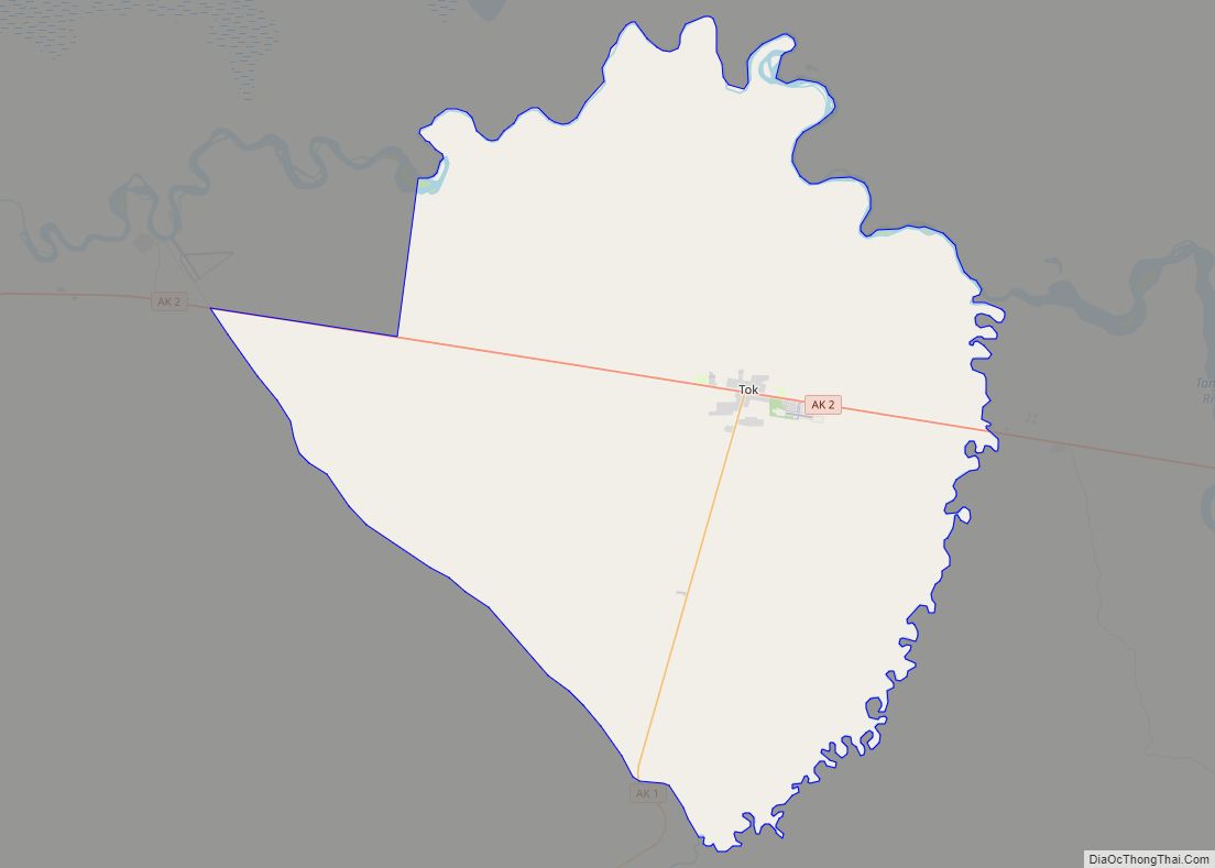
Map of Togiak city

Map of Togiak city

Togiak (Central Yupik: Tuyuryaq) is a city in Dillingham Census Area, Alaska, United States. At the 2010 census the population was 817, up from 809 in 2000. Togiak city overview: Name: Togiak city LSAD Code: 25 LSAD Description: city (suffix) State: Alaska County: Dillingham Census Area Incorporated: June 23, 1969 Elevation: 3 ft (1 m) Total Area: … Read more

Map of Thorne Bay city

Map of Thorne Bay city

Thorne Bay is a city in Prince of Wales-Hyder Census Area, Alaska, United States. As of the 2020 census the population was 476, up from 471 in 2010. Thorne Bay city overview: Name: Thorne Bay city LSAD Code: 25 LSAD Description: city (suffix) State: Alaska County: Prince of Wales-Hyder Census Area Incorporated: August 9, 1982 … Read more

Map of Tonsina CDP

Map of Tonsina CDP

Tonsina /tɒnˈsiːnə/ is a census-designated place (CDP) in Copper River Census Area, Alaska, United States. At the 2020 census the population was 55, down from 78 in 2010. Tonsina is part of the Copper River Valley area. The centerpiece of Tonsina valley is the Tonsina River Lodge. This roadhouse alongside the Richardson Highway consists of … Read more

Map of Tolsona CDP

Map of Tolsona CDP

Tolsona (/təlˈsoʊnə/) is a census-designated place (CDP) in Copper River Census Area, Alaska, United States. The population was 12 at the 2020 census, down from 30 in 2010. Tolsona CDP overview: Name: Tolsona CDP LSAD Code: 57 LSAD Description: CDP (suffix) State: Alaska County: Valdez-Cordova Census Area Elevation: 2,188 ft (667 m) Total Area: 46.47 sq mi (120.37 km²) Land … Read more

Map of Toksook Bay city

Map of Toksook Bay city

Toksook Bay (TOOK-sook or TUCK-sook) is a city and village on Nelson Island in Bethel Census Area, Alaska. The population was 590 at the 2010 census, up from 532 in 2000. As of 2018, the estimated population was 667, making it the largest village on the island. Toksook Bay (pronounced Tuqsuk Bay in Yup’ik) was … Read more

Map of Tuntutuliak CDP

Map of Tuntutuliak CDP

Tuntutuliak (Central Yupik: Tuntutuliaq) is a census-designated place (CDP) in Bethel Census Area, Alaska, United States. At the 2010 census the population was 408, up from 370 in 2000. Tuntutuliak CDP overview: Name: Tuntutuliak CDP LSAD Code: 57 LSAD Description: CDP (suffix) State: Alaska County: Bethel Census Area Total Area: 116.17 sq mi (300.88 km²) Land Area: 115.89 sq mi … Read more

Map of Tuluksak CDP

Map of Tuluksak CDP

Tuluksak (Central Yupik: Tuulkessaaq) is a census-designated place (CDP) in Bethel Census Area, Alaska, United States. At the 2010 census the population was 373, down from 428 in 2000. Tuluksak CDP overview: Name: Tuluksak CDP LSAD Code: 57 LSAD Description: CDP (suffix) State: Alaska County: Bethel Census Area Incorporated: October 28, 1970 Total Area: 3.02 sq mi … Read more

Map of Trapper Creek CDP

Map of Trapper Creek CDP

Trapper Creek is a census-designated place (CDP) in Matanuska-Susitna Borough, Alaska, United States. It is part of the Anchorage Metropolitan Area and is known as the southern gateway to Denali State Park. According to the 2020 census the population of Trapper Creek was 499. Trapper Creek CDP overview: Name: Trapper Creek CDP LSAD Code: 57 … Read more

Map of Two Rivers CDP

Map of Two Rivers CDP, Alaska

Two Rivers is a census-designated place (CDP) in Fairbanks North Star Borough, Alaska, United States. It lies between mile 13 (the Little Chena River) and mile 25 (the Chena River) on the Chena Hot Springs Road, northeast of Fairbanks. As of the 2010 United States Census, the CDP had a population of 719, up from … Read more

Map of Twin Hills CDP

Map of Twin Hills CDP

Twin Hills (Central Yupik: Ingricuar) is a census-designated place (CDP) in Dillingham Census Area, Alaska, United States. The population was 74 at the 2010 census, up from 69 in 2000. Although Twin Hills wasn’t settled until 1965, the present CDP encompasses the original settlement of Togiak (then Togiagamute) on the northeast side of Togiak Bay. … Read more

Map of Tununak CDP

Map of Tununak CDP

Tununak (Too-new-nak) (Central Yupik: Tununeq) is a census-designated place (CDP) in Bethel Census Area, Alaska, United States. At the 2020 census, the population was 411. Tununak CDP overview: Name: Tununak CDP LSAD Code: 57 LSAD Description: CDP (suffix) State: Alaska County: Bethel Census Area Total Area: 60.95 sq mi (157.85 km²) Land Area: 60.71 sq mi (157.23 km²) Water Area: 0.24 sq mi … Read more

Map of Ugashik CDP

Map of Ugashik CDP

Ugashik (Ugaasaq in Sugpiaq) is a census-designated place (CDP) in Lake and Peninsula Borough, Alaska, United States. The population was 4 at the 2020 census, down from 12 in 2010. Ugashik CDP overview: Name: Ugashik CDP LSAD Code: 57 LSAD Description: CDP (suffix) State: Alaska County: Lake and Peninsula Borough Elevation: 30 ft (9 m) Total Area: … Read more