Map of Kanopolis city
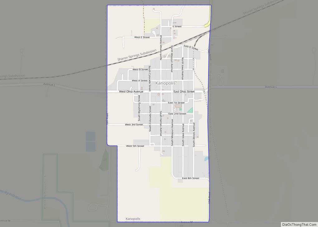
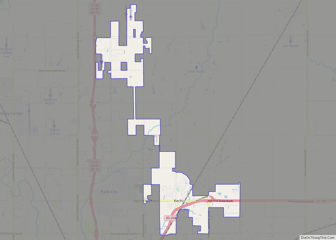
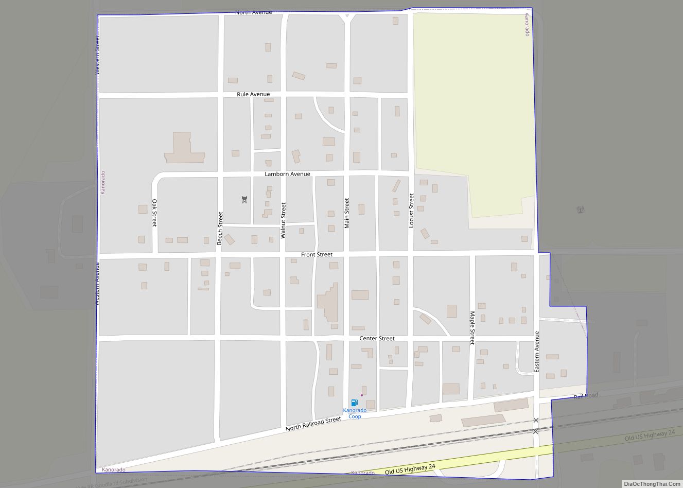
Kanopolis is a city in Ellsworth County, Kansas, United States. As of the 2020 census, the population of the city was 443. It was built on the site of Fort Harker, a United States Army post that housed infantry and cavalry troops involved in the Indian Wars from 1867 to 1872. Kanopolis city overview: Name: ... Read more
Map of Kanopolis city
Map of Junction City, Kansas
Junction City is a city in and the county seat of Geary County, Kansas, United States. As of the 2020 census, the population of the city was 22,932. Fort Riley, a major U.S. Army post, is nearby. Junction City city overview: Name: Junction City city LSAD Code: 25 LSAD Description: city (suffix) State: Kansas County: ... Read more
Map of Junction City, Kansas
Map of Johnson City, Kansas
Johnson City is a city in and the county seat of Stanton County, Kansas, United States. As of the 2020 census, the population of the city was 1,464. Johnson City city overview: Name: Johnson City city LSAD Code: 25 LSAD Description: city (suffix) State: Kansas County: Stanton County Founded: 1885 Incorporated: 1888 Elevation: 3,340 ft (1,020 m) ... Read more
Map of Johnson City, Kansas
Map of Kensington city, Kansas
Kensington is a city in Smith County, Kansas, United States. As of the 2020 census, the population of the city was 399. Kensington city overview: Name: Kensington city LSAD Code: 25 LSAD Description: city (suffix) State: Kansas County: Smith County Founded: 1887 Incorporated: 1900 Elevation: 1,778 ft (542 m) Total Area: 0.34 sq mi (0.87 km²) Land Area: 0.34 sq mi (0.87 km²) ... Read more
Map of Kensington city, Kansas
Map of Kechi city
Kechi /ˈkiːtʃaɪ/ is a city in Sedgwick County, Kansas, United States, and a suburb of Wichita. As of the 2020 census, the population of the city was 2,217. Kechi city overview: Name: Kechi city LSAD Code: 25 LSAD Description: city (suffix) State: Kansas County: Sedgwick County Founded: 1880s Incorporated: 1957 Elevation: 1,381 ft (421 m) Total Area: ... Read more
Map of Kechi city
Map of Kanorado city
Kanorado is a city in Sherman County, Kansas, United States. The name is a portmanteau of Kansas and Colorado, because it is near the state line. As of the 2020 census, the population of the city was 153. Kanorado city overview: Name: Kanorado city LSAD Code: 25 LSAD Description: city (suffix) State: Kansas County: Sherman ... Read more
Map of Kanorado city
Map of Kickapoo Site 5 CDP
Kickapoo Site 5 is a unincorporated community on the Kickapoo Reservation in Brown County, Kansas, United States. As of the 2020 census, the population of the community and nearby areas was 59. Kickapoo Site 5 CDP overview: Name: Kickapoo Site 5 CDP LSAD Code: 57 LSAD Description: CDP (suffix) State: Kansas County: Brown County Elevation: ... Read more
Map of Kickapoo Site 5 CDP
Map of Kickapoo Site 2 CDP
Kickapoo Site 2 is a unincorporated community on the Kickapoo Reservation in Brown County, Kansas, United States. As of the 2020 census, the population of the community and nearby areas was 27. Kickapoo Site 2 CDP overview: Name: Kickapoo Site 2 CDP LSAD Code: 57 LSAD Description: CDP (suffix) State: Kansas County: Brown County Elevation: ... Read more
Map of Kickapoo Site 2 CDP
Map of Kickapoo Site 1 CDP
Kickapoo Site 1 is a unincorporated community on the Kickapoo Reservation in Brown County, Kansas, United States. As of the 2020 census, the population of the community and nearby areas was 110. Kickapoo Site 1 CDP overview: Name: Kickapoo Site 1 CDP LSAD Code: 57 LSAD Description: CDP (suffix) State: Kansas County: Brown County Elevation: ... Read more
Map of Kickapoo Site 1 CDP
Map of Kickapoo Tribal Center CDP
Kickapoo Tribal Center is a unincorporated community on the Kickapoo Reservation in Brown County, Kansas, United States. As of the 2020 census, the population of the community and nearby areas was 177, making it the most populous location within the reservation. Kickapoo Tribal Center CDP overview: Name: Kickapoo Tribal Center CDP LSAD Code: 57 LSAD ... Read more
Map of Kickapoo Tribal Center CDP
Map of Kickapoo Site 7 CDP
Kickapoo Site 7 is a unincorporated community on the Kickapoo Reservation in Brown County, Kansas, United States. As of the 2020 census, the population of the community and nearby areas was 104. Kickapoo Site 7 CDP overview: Name: Kickapoo Site 7 CDP LSAD Code: 57 LSAD Description: CDP (suffix) State: Kansas County: Brown County Elevation: ... Read more
Map of Kickapoo Site 7 CDP
Map of Kickapoo Site 6 CDP
Kickapoo Site 6 is a unincorporated community on the Kickapoo Reservation in Brown County, Kansas, United States. As of the 2020 census, the population of the community and nearby areas was 13. Kickapoo Site 6 CDP overview: Name: Kickapoo Site 6 CDP LSAD Code: 57 LSAD Description: CDP (suffix) State: Kansas County: Brown County Elevation: ... Read more
Map of Kickapoo Site 6 CDP