Map of Bayou Country Club CDP
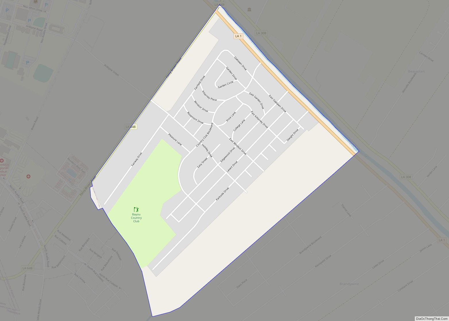
Bayou Country Club is an unincorporated community and census-designated place in Lafourche Parish, Louisiana, United States. Its population was 1,396 as of the 2010 census. Louisiana Highway 1 passes through the community. Bayou Country Club CDP overview: Name: Bayou Country Club CDP LSAD Code: 57 LSAD Description: CDP (suffix) State: Louisiana County: Lafourche Parish Elevation: ... Read more
Map of Bayou Country Club CDP
Map of Bayou Corne CDP
Bayou Corne is an unincorporated community and census-designated place (CDP) in Assumption Parish, Louisiana, United States, along the bayou of the same name. It is in the northwestern part of the parish along Louisiana Highway 70, 7 miles (11 km) west of Paincourtville and 6 miles (10 km) northeast of Pierre Part. The Bayou Corne sinkhole is ... Read more
Map of Bayou Corne CDP
Map of Bayou Cane CDP
Bayou Cane is a census-designated place (CDP) in Terrebonne Parish, Louisiana, United States. It is located just north of Houma and had a population of 19,770 in 2020. Bayou Cane is the principal city of the Houma–Bayou Cane–Thibodaux metropolitan statistical area, which includes all of Terrebonne and Lafourche parishes. Bayou Cane CDP overview: Name: Bayou ... Read more
Map of Bayou Cane CDP
Map of Bayou L’Ourse CDP
Bayou L’Ourse is a census-designated place (CDP) in Assumption Parish, Louisiana, United States. The population was 1,978 at the 2010 census. Bayou L’Ourse CDP overview: Name: Bayou L’Ourse CDP LSAD Code: 57 LSAD Description: CDP (suffix) State: Louisiana County: Assumption Parish Elevation: 5 ft (2 m) Total Area: 2.72 sq mi (7.05 km²) Land Area: 2.72 sq mi (7.05 km²) Water Area: 0.00 sq mi ... Read more
Map of Bayou L’Ourse CDP
Map of Bayou Goula CDP
Bayou Goula is an unincorporated community and census-designated place (CDP) in Iberville Parish, Louisiana, United States. Its population was 612 as of the 2010 census. Bayou Goula is a name derived from the Choctaw language meaning “river people”. Bayou Goula CDP overview: Name: Bayou Goula CDP LSAD Code: 57 LSAD Description: CDP (suffix) State: Louisiana ... Read more
Map of Bayou Goula CDP
Map of Bayou Gauche CDP
Bayou Gauche is a census-designated place and fishing village, with an adjacent natural bayou and wetlands. It is located in St. Charles Parish, Louisiana, United States. As of 2020, its population was 2,161. Bayou Gauche CDP overview: Name: Bayou Gauche CDP LSAD Code: 57 LSAD Description: CDP (suffix) State: Louisiana County: St. Charles Parish Elevation: ... Read more
Map of Bayou Gauche CDP
Map of Belle Chasse CDP
Belle Chasse (/bɛl ˈtʃeɪs/ bel CHAYSS) is a census-designated place (CDP) in Plaquemines Parish, Louisiana, United States, on the west bank of the Mississippi River. Belle Chasse is part of the Greater New Orleans metropolitan area. The population was 10,579 at the 2020 United States census. Belle Chasse is the largest community in Plaquemines Parish. ... Read more
Map of Belle Chasse CDP
Map of Belcher village
Belcher is a village in Caddo Parish, Louisiana, United States. The population was 263 at the 2010 census. It is part of the Shreveport- Bossier city metropolitan statistical area. Belcher village overview: Name: Belcher village LSAD Code: 47 LSAD Description: village (suffix) State: Louisiana County: Caddo Parish Elevation: 187 ft (57 m) Total Area: 1.57 sq mi (4.08 km²) Land ... Read more
Map of Belcher village
Map of Bayou Vista CDP, Louisiana
Bayou Vista is a census-designated place (CDP) in St. Mary Parish, Louisiana, United States. The population was 4,652 at the 2010 census. It is part of the Morgan City Micropolitan Statistical Area. Bayou Vista CDP overview: Name: Bayou Vista CDP LSAD Code: 57 LSAD Description: CDP (suffix) State: Louisiana County: St. Mary Parish Elevation: 7 ft ... Read more
Map of Bayou Vista CDP, Louisiana
Map of Belmont CDP, Louisiana
Belmont is an unincorporated community and census-designated place in Sabine Parish, Louisiana, United States. Its population was 361 as of the 2010 census. The community is located at the junction of Louisiana highways 120 and 175. Belmont CDP overview: Name: Belmont CDP LSAD Code: 57 LSAD Description: CDP (suffix) State: Louisiana County: Sabine Parish Elevation: ... Read more
Map of Belmont CDP, Louisiana
Map of Belle Rose CDP
Belle Rose is a census-designated place (CDP) in Assumption Parish, Louisiana, United States. The population was 1,902 at the 2010 census. It is part of the Pierre Part Micropolitan Statistical Area. Belle Rose CDP overview: Name: Belle Rose CDP LSAD Code: 57 LSAD Description: CDP (suffix) State: Louisiana County: Assumption Parish Elevation: 20 ft (6 m) Total ... Read more
Map of Belle Rose CDP
Map of Benton town, Louisiana
Benton is a town in, and the parish seat of, Bossier Parish, in the U.S. state of Louisiana. The population was 2,048 in 2020. The town is named for 19th century U.S. Senator Thomas Hart Benton, a Democrat from Missouri and an ally of U.S. President Andrew Jackson. Benton town overview: Name: Benton town LSAD ... Read more
Map of Benton town, Louisiana