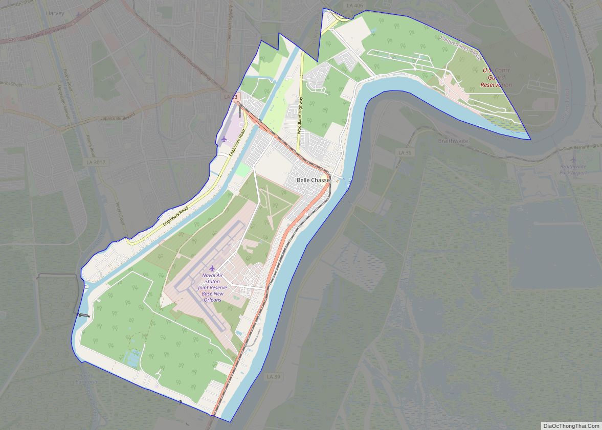
Belle Chasse (/bɛl ˈtʃeɪs/ bel CHAYSS) is a census-designated place (CDP) in Plaquemines Parish, Louisiana, United States, on the west bank of the Mississippi River. Belle Chasse is part of the Greater New Orleans metropolitan area. The population was 10,579 at the 2020 United States census. Belle Chasse is the largest community in Plaquemines Parish. It is home to Naval Air Station Joint Reserve Base New Orleans, a Naval Air Station for the U.S. Navy Reserve.
| Name: | Belle Chasse CDP |
|---|---|
| LSAD Code: | 57 |
| LSAD Description: | CDP (suffix) |
| State: | Louisiana |
| County: | Plaquemines Parish |
| Elevation: | 7 ft (2 m) |
| Total Area: | 10.10 sq mi (26.16 km²) |
| Land Area: | 8.17 sq mi (21.16 km²) |
| Water Area: | 1.93 sq mi (5.00 km²) |
| Total Population: | 10,579 |
| Population Density: | 1,295.18/sq mi (500.04/km²) |
| Area code: | 504 |
| FIPS code: | 2206120 |
Online Interactive Map
Click on ![]() to view map in "full screen" mode.
to view map in "full screen" mode.
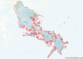
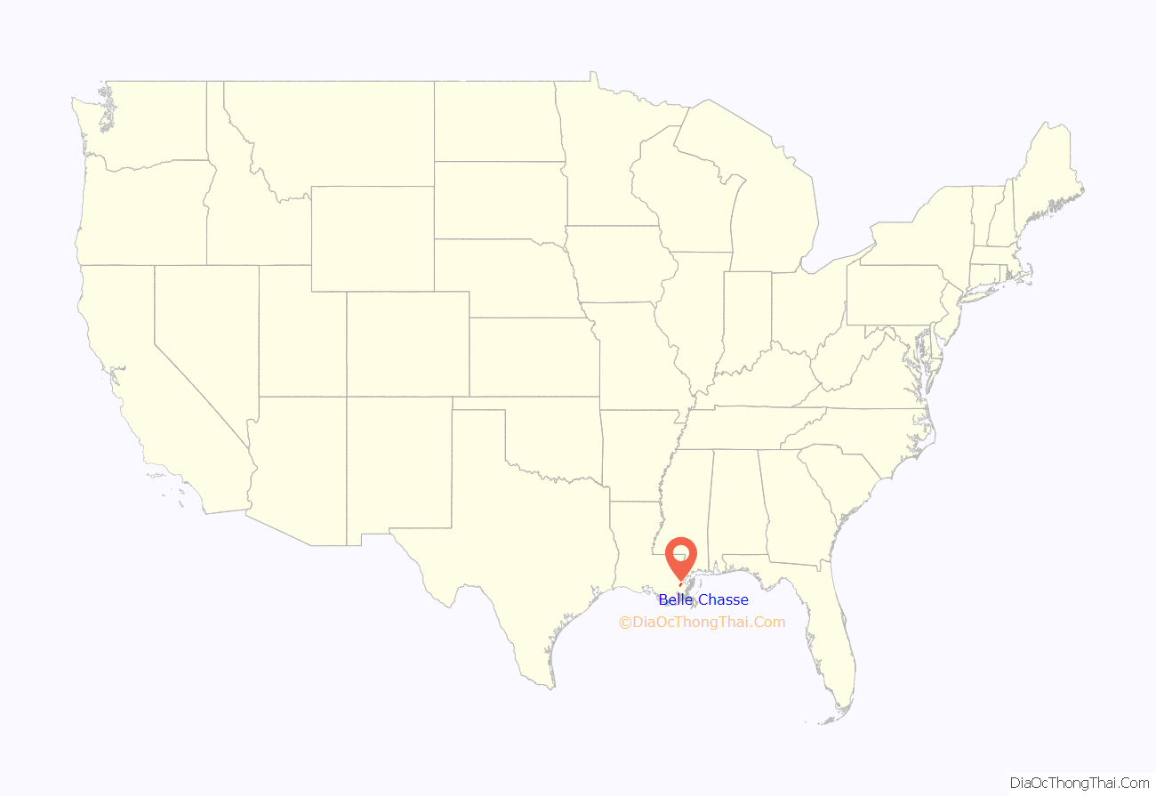
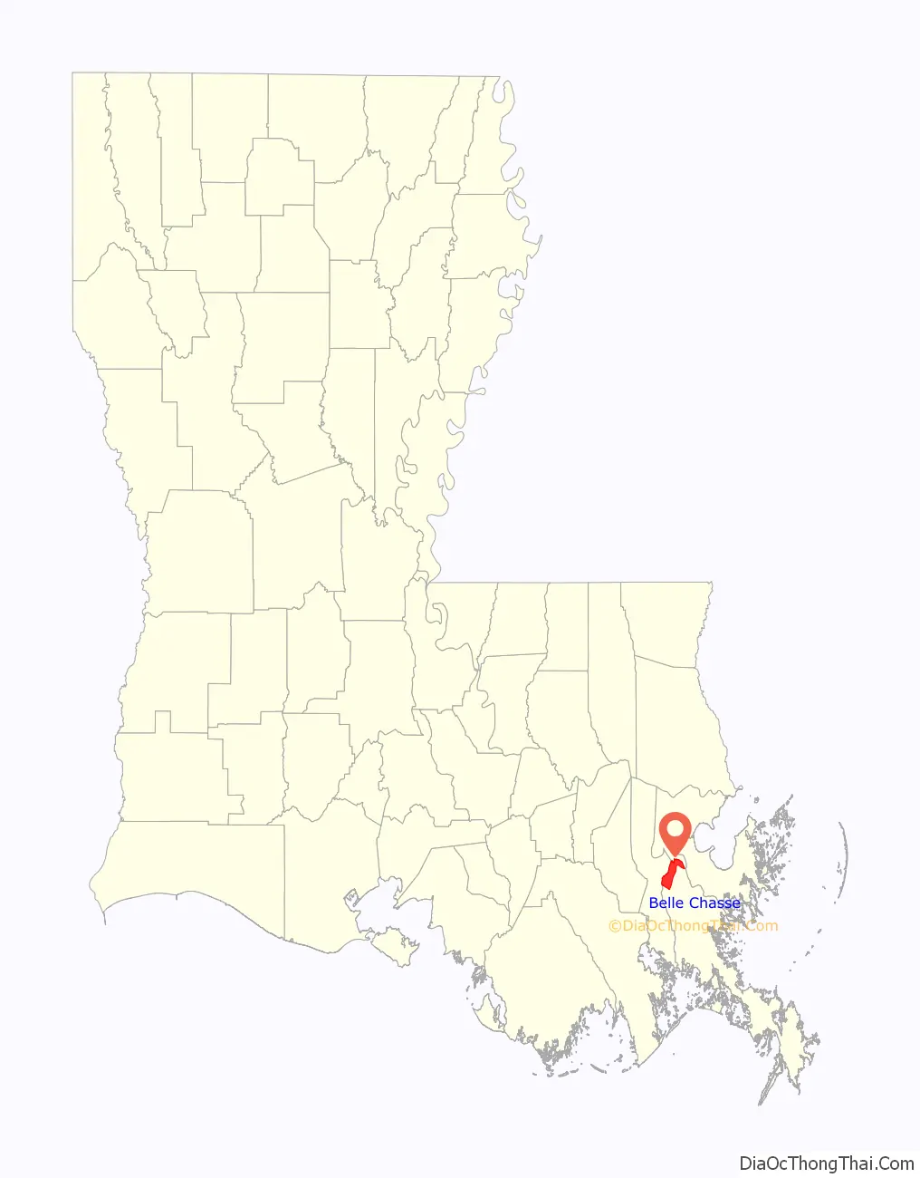
Belle Chasse location map. Where is Belle Chasse CDP?
History
There is little consensus regarding the origin of the name Belle Chasse. In French, belle chasse literally means “beautiful hunting.” It is widely believed that it was so named due to the richness of wildlife which the initial French colonists observed when they settled in the region. Others say that Belle Chasse was named after a Colonel Joseph D. Bellechasse, who lived in New Orleans around the late 18th and early 19th century. Alternatively, it was named after the plantation of Deville de Goutin Bellechasse.
The Confederate statesman Judah P. Benjamin was the most famous owner of the Belle Chasse plantation. After falling into decay and abandonment by the 1930s, the landmark plantation house was demolished in 1960. The bell was salvaged and today is in front of the Belle Chasse Public Library.
The Naval Air Station was founded in 1920 on the south shore of Lake Pontchartrain, but in 1957 it relocated to its current location (Belle Chasse, Louisiana). It has been designated as a Joint Forces Reserve Air Station. It is home to various naval air units as well as an Air Force Reserve fighter squadron and a Marine Corps Reserve helicopter unit. In March 2009, U.S. Navy Reserve Airborne Early Warning Squadron 77 (VAW-77) relocated its six E-2C aircraft from NAS Atlanta, GA to Belle Chasse. The squadron routinely deploys to the Caribbean on counter-narcotic operations. The squadron aircrew are all U.S. Naval Reservists while the maintenance department for the aircraft is run by Northrop Grumman Field Services.
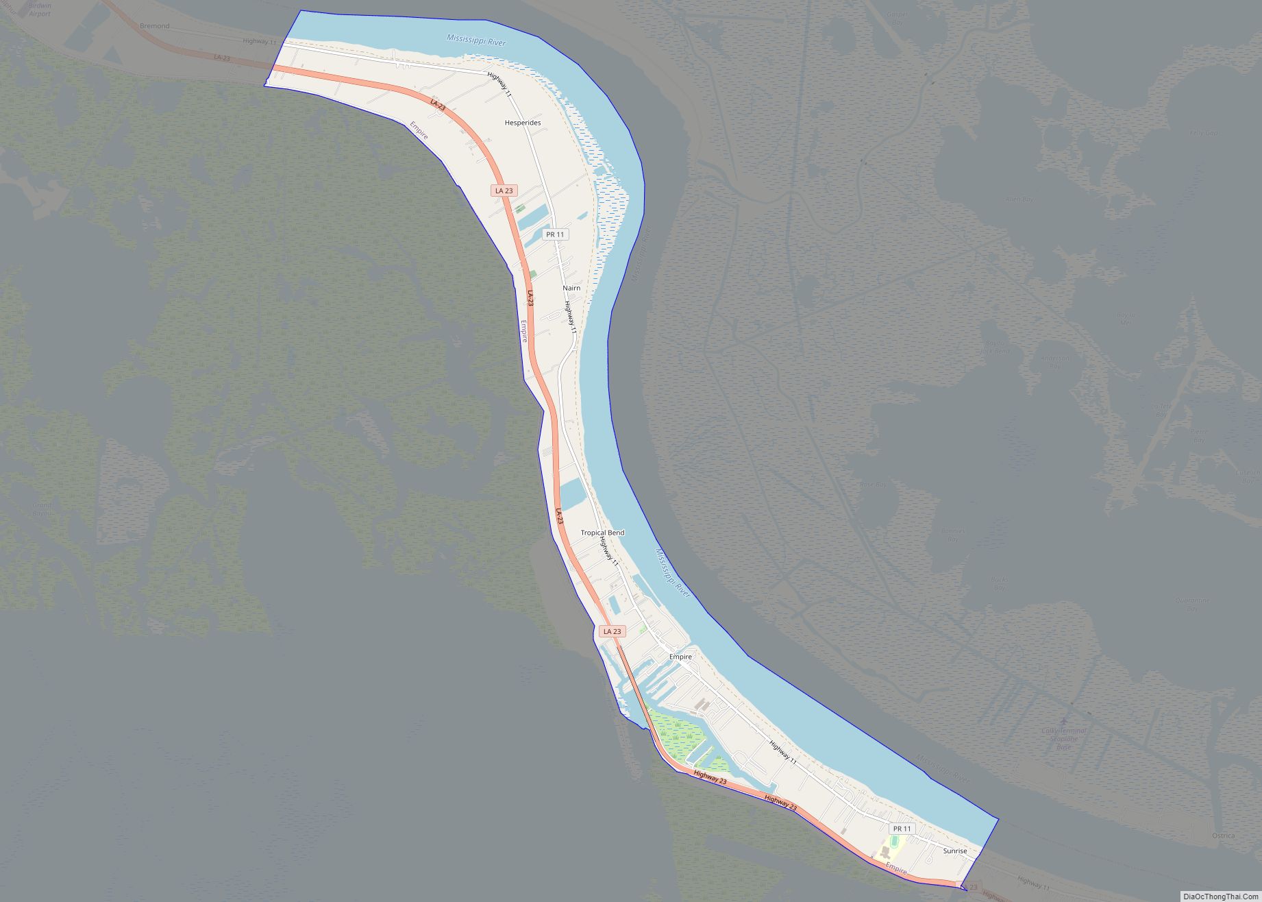
Belle Chasse Road Map
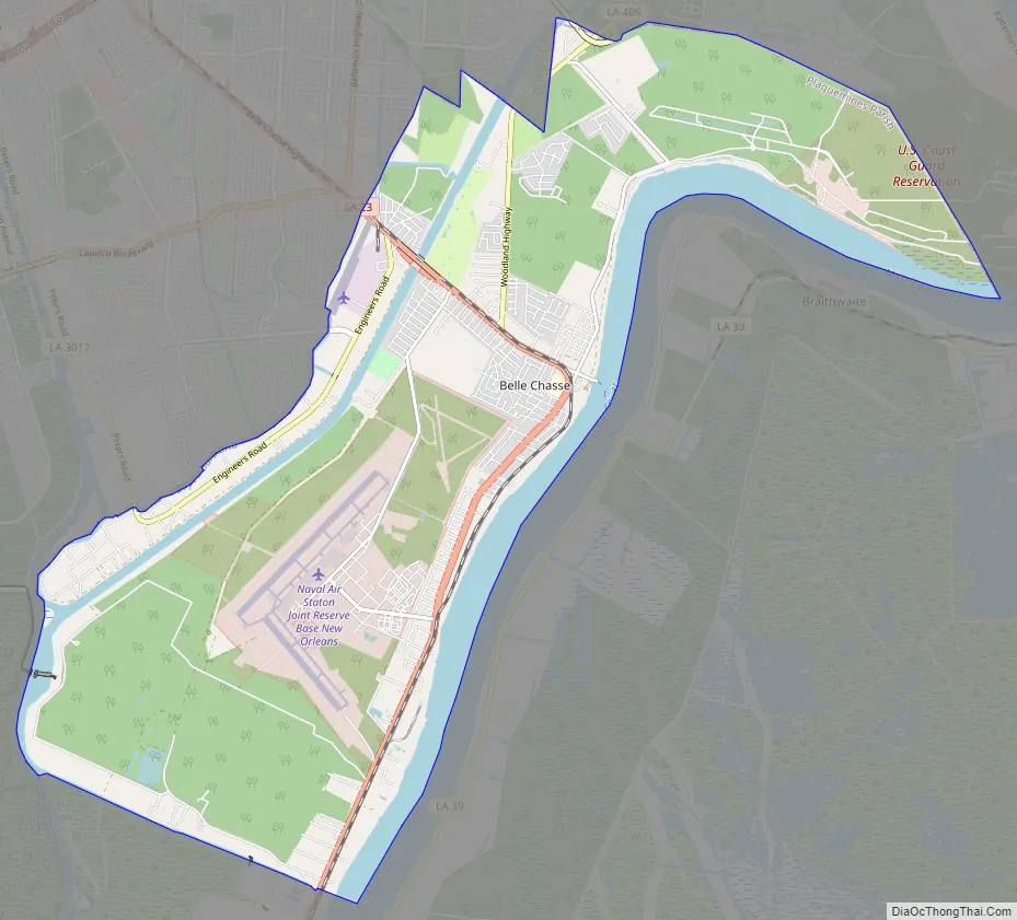
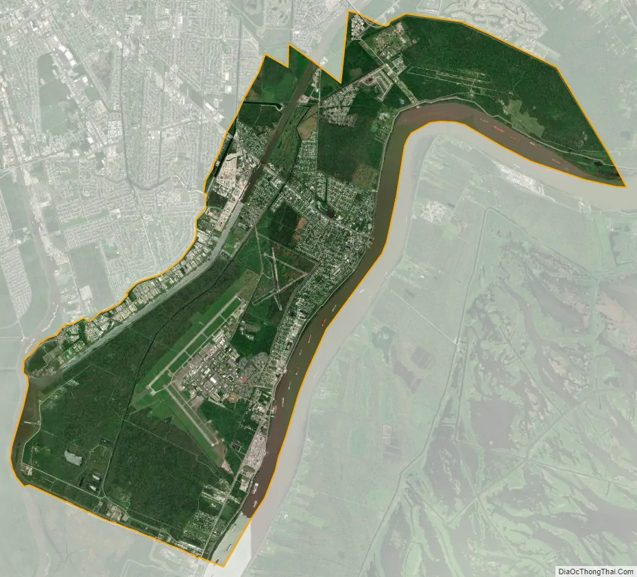
Belle Chasse city Satellite Map
Geography
Belle Chasse is located at 29°51′48″N 89°59′54″W / 29.86333°N 89.99833°W / 29.86333; -89.99833 (29.852243, -89.9983335), in the New Orleans metropolitan area. According to the United States Census Bureau, the CDP has a total area of 28.4 square miles (74 km), of which 24.9 square miles (64 km) is land and 3.5 square miles (9.1 km) (12.21%) is water.
See also
Map of Louisiana State and its subdivision:- Acadia
- Allen
- Ascension
- Assumption
- Avoyelles
- Beauregard
- Bienville
- Bossier
- Caddo
- Calcasieu
- Caldwell
- Cameron
- Catahoula
- Claiborne
- Concordia
- De Soto
- East Baton Rouge
- East Carroll
- East Feliciana
- Evangeline
- Franklin
- Grant
- Iberia
- Iberville
- Jackson
- Jefferson
- Jefferson Davis
- La Salle
- Lafayette
- Lafourche
- Lincoln
- Livingston
- Madison
- Morehouse
- Natchitoches
- Orleans
- Ouachita
- Plaquemines
- Pointe Coupee
- Rapides
- Red River
- Richland
- Sabine
- Saint Bernard
- Saint Charles
- Saint Helena
- Saint James
- Saint John the Baptist
- Saint Landry
- Saint Martin
- Saint Mary
- Saint Tammany
- Tangipahoa
- Tensas
- Terrebonne
- Union
- Vermilion
- Vernon
- Washington
- Webster
- West Baton Rouge
- West Carroll
- West Feliciana
- Winn
- Alabama
- Alaska
- Arizona
- Arkansas
- California
- Colorado
- Connecticut
- Delaware
- District of Columbia
- Florida
- Georgia
- Hawaii
- Idaho
- Illinois
- Indiana
- Iowa
- Kansas
- Kentucky
- Louisiana
- Maine
- Maryland
- Massachusetts
- Michigan
- Minnesota
- Mississippi
- Missouri
- Montana
- Nebraska
- Nevada
- New Hampshire
- New Jersey
- New Mexico
- New York
- North Carolina
- North Dakota
- Ohio
- Oklahoma
- Oregon
- Pennsylvania
- Rhode Island
- South Carolina
- South Dakota
- Tennessee
- Texas
- Utah
- Vermont
- Virginia
- Washington
- West Virginia
- Wisconsin
- Wyoming