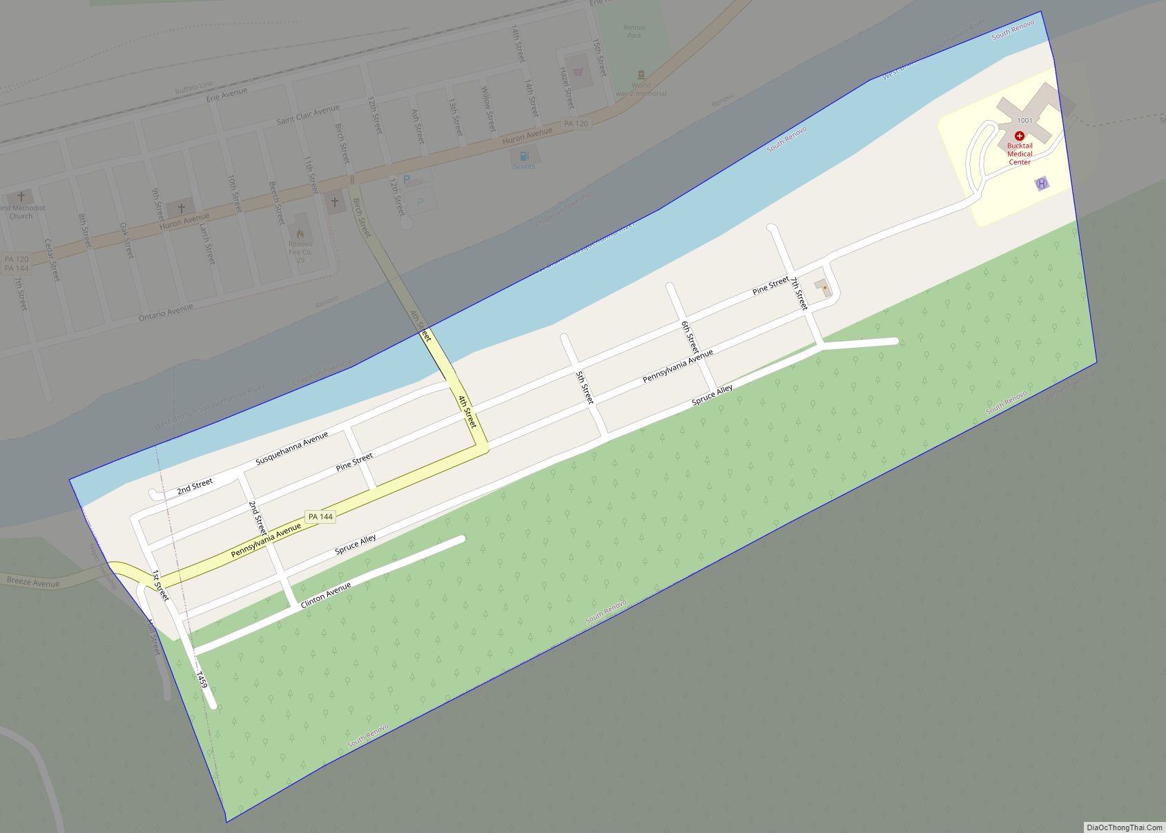
Map of South New Castle borough
South New Castle is a borough in Lawrence County, Pennsylvania, United States. The population was 649 at the 2020 census. It is primarily a residential community which lies south of the city of New Castle, and is part of the New Castle micropolitan area. South New Castle borough overview: Name: South New Castle borough LSAD ... Read more
Map of South New Castle borough
Map of South Heights borough
South Heights is a borough in Beaver County, Pennsylvania, along the Ohio River. The population was 389 at the 2020 census. South Heights was first known as Ethel’s Landing, a docking point on the Ohio River. The name of the town was changed to Shannopin when the Pittsburgh and Lake Erie Railroad established a station ... Read more
Map of South Heights borough
Map of South Greensburg borough
South Greensburg is a borough in Westmoreland County, Pennsylvania, United States. The population was 2,117 at the 2010 census. South Greensburg borough overview: Name: South Greensburg borough LSAD Code: 21 LSAD Description: borough (suffix) State: Pennsylvania County: Westmoreland County Incorporated: 1891 Elevation: 1,073 ft (327 m) Total Area: 0.71 sq mi (1.83 km²) Land Area: 0.71 sq mi (1.83 km²) Water Area: 0.00 sq mi ... Read more
Map of South Greensburg borough
Map of South Fork borough, Pennsylvania
South Fork is a borough in Cambria County, Pennsylvania, United States. It is part of the Johnstown, Pennsylvania Metropolitan Statistical Area. The population was 928 at the 2010 census, down from 1,138 at the 2000 census. South Fork borough overview: Name: South Fork borough LSAD Code: 21 LSAD Description: borough (suffix) State: Pennsylvania County: Cambria ... Read more
Map of South Fork borough, Pennsylvania
Map of South Connellsville borough
South Connellsville is a borough in Fayette County, Pennsylvania, United States. The population was 1,919 at the 2020 census, a decline from the figure of 1,970 tabulated in 2010. South Connellsville borough overview: Name: South Connellsville borough LSAD Code: 21 LSAD Description: borough (suffix) State: Pennsylvania County: Fayette County Elevation: 1,034 ft (315 m) Total Area: 1.71 sq mi ... Read more
Map of South Connellsville borough
Map of South Coatesville borough
South Coatesville is a borough in Chester County, Pennsylvania, United States. The population was 1,604 at the 2020 census. South Coatesville borough overview: Name: South Coatesville borough LSAD Code: 21 LSAD Description: borough (suffix) State: Pennsylvania County: Chester County Elevation: 397 ft (121 m) Total Area: 1.76 sq mi (4.57 km²) Land Area: 1.74 sq mi (4.50 km²) Water Area: 0.03 sq mi (0.07 km²) Total ... Read more
Map of South Coatesville borough
Map of South Williamsport borough
South Williamsport is a borough in Lycoming County, Pennsylvania, United States. It is famous for hosting the Little League World Series. The population was 6,259 at the 2020 census. It is part of the Williamsport, Pennsylvania Metropolitan Statistical Area. South Williamsport borough overview: Name: South Williamsport borough LSAD Code: 21 LSAD Description: borough (suffix) State: ... Read more
Map of South Williamsport borough
Map of South Waverly borough
South Waverly is a borough in Bradford County, Pennsylvania, United States. It is part of Northeastern Pennsylvania. The population was 1,070 at the 2020 census. South Waverly is part of the Penn-York Valley (called “The Valley”), a group of four contiguous communities in New York and Pennsylvania: Waverly, New York, South Waverly, Sayre, and Athens, ... Read more
Map of South Waverly borough
Map of South Uniontown CDP
South Uniontown is a census-designated place in South Union Township, Fayette County, Pennsylvania, United States. As of the 2010 census, the population was 1,360. The community borders the southwestern side of the city of Uniontown, the Fayette County seat. U.S. routes 40 and 119, a four-lane bypass of the city and in this area part ... Read more
Map of South Uniontown CDP
Map of South Temple CDP
South Temple is a census-designated place in Muhlenberg Township, Berks County, Pennsylvania, United States. It is located approximately four miles north of the city of Reading. As of the 2010 census, the population was 1,424 residents. Originally a streetcar suburb of Reading, South Temple retains the look of a 1920s residential community, with decent-sized properties, ... Read more
Map of South Temple CDP
Map of Spinnerstown CDP
Spinnerstown is a census-designated place in Milford Township, Bucks County, Pennsylvania, United States. It is located just northwest of the Quakertown interchange of I-476 with Route 663. As of the 2010 census, the population was 1,826 residents. The community was named for the Spinner family, which settled in 1753. While the village has a PO ... Read more
Map of Spinnerstown CDP
Map of Speers borough
Speers is a borough in Washington County, Pennsylvania, United States. The population was 1,087 at the 2020 census. Speers borough overview: Name: Speers borough LSAD Code: 21 LSAD Description: borough (suffix) State: Pennsylvania County: Washington County Total Area: 1.07 sq mi (2.77 km²) Land Area: 0.95 sq mi (2.46 km²) Water Area: 0.12 sq mi (0.31 km²) Total Population: 1,088 Population Density: 1,144.06/sq mi (441.76/km²) ... Read more
Map of Speers borough