Map of Media borough, Pennsylvania
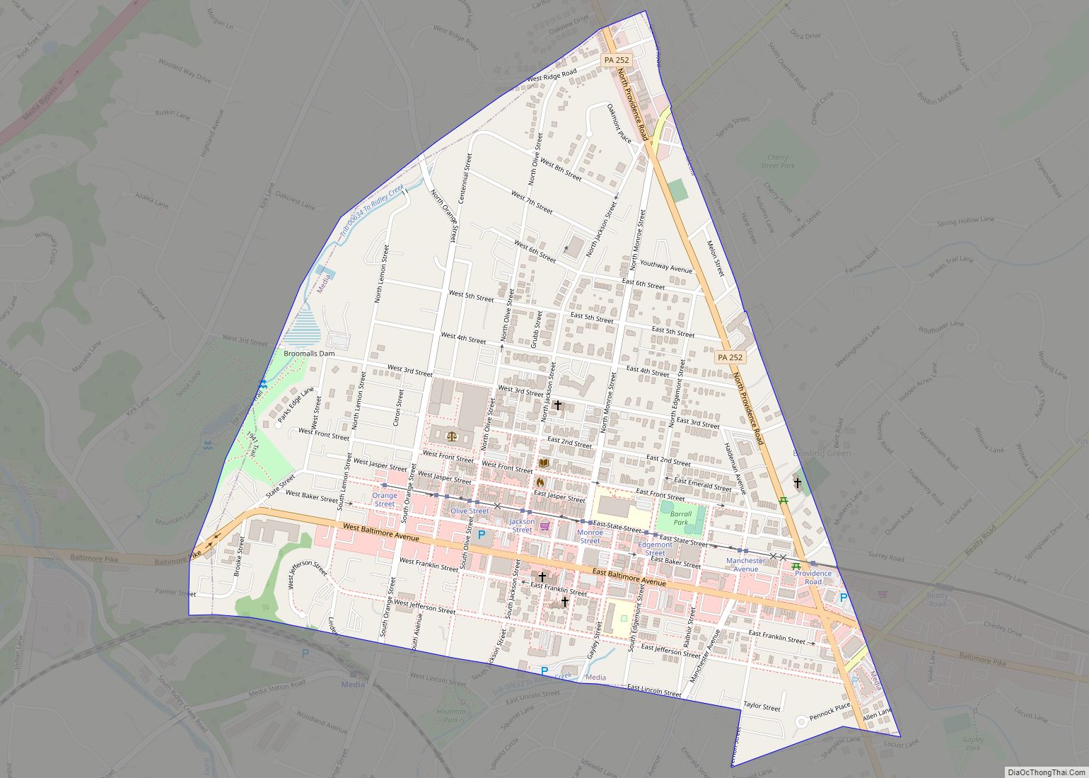
Media is a borough in and the county seat of Delaware County, Pennsylvania, United States. It is located about 13 miles (21 km) west of Philadelphia, the sixth most populous city in the nation with 1.6 million residents as 2020. It is part of the Delaware Valley (i.e. the Philadelphia metro area). Media was incorporated in ... Read more
Map of Media borough, Pennsylvania
Map of Mechanicsville borough, Pennsylvania
Mechanicsville is a borough in Schuylkill County, Pennsylvania, United States. Part of the Pottsville Area School District, it lies between Pottsville and Port Carbon. Pottsville Street is the community’s main street. The population was 463 at the time of the 2020 census. Mechanicsville borough overview: Name: Mechanicsville borough LSAD Code: 21 LSAD Description: borough (suffix) ... Read more
Map of Mechanicsville borough, Pennsylvania
Map of Mechanicsburg borough, Pennsylvania
Mechanicsburg is a borough in Cumberland County, Pennsylvania, United States. The borough is eight miles (13 km) west of Harrisburg. It is part of the Harrisburg–Carlisle metropolitan statistical area. As of the 2010 census it had a population of 8,981. Mechanicsburg borough overview: Name: Mechanicsburg borough LSAD Code: 21 LSAD Description: borough (suffix) State: Pennsylvania County: ... Read more
Map of Mechanicsburg borough, Pennsylvania
Map of Meadville city, Pennsylvania
Meadville is a city in and the county seat of Crawford County, Pennsylvania, United States. The population was 13,050 at the 2020 census. The first permanent settlement in Northwestern Pennsylvania, Meadville is within 40 miles (64 km) of Erie and within 90 miles (140 km) of Pittsburgh. It is the principal city of the Meadville micropolitan area, ... Read more
Map of Meadville city, Pennsylvania
Map of Meadowood CDP
Meadowood is a census-designated place (CDP) in Butler County, Pennsylvania, United States. The population was 2,693 at the 2010 census. Meadowood CDP overview: Name: Meadowood CDP LSAD Code: 57 LSAD Description: CDP (suffix) State: Pennsylvania County: Butler County Elevation: 1,300 ft (400 m) Total Area: 1.58 sq mi (4.09 km²) Land Area: 1.57 sq mi (4.06 km²) Water Area: 0.01 sq mi (0.03 km²) Total Population: ... Read more
Map of Meadowood CDP
Map of Meadowlands CDP, Pennsylvania
Meadowlands is a census-designated place in Washington County, Pennsylvania, United States. The community is located in Chartiers Township, in central Washington County about 8 miles (13 km) north of the city of Washington. As of the 2020 census the population was 839. Meadowlands CDP overview: Name: Meadowlands CDP LSAD Code: 57 LSAD Description: CDP (suffix) State: ... Read more
Map of Meadowlands CDP, Pennsylvania
Map of McVeytown borough
McVeytown is a borough in Mifflin County, Pennsylvania, United States, on the west bank of the Juniata River. Formerly known as Waynesburg, it was settled in 1762, laid out in 1795, and incorporated in 1833. The population was 344 at the 2020 census. The “Father of Pennsylvania Forestry”, Dr. Joseph Rothrock was born in McVeytown ... Read more
Map of McVeytown borough
Map of McSherrystown borough
McSherrystown is a borough in Adams County, Pennsylvania, United States. The population was 3,077 as of the 2020 census. McSherrystown was home to the headquarters of Teddy Bear manufacturer Boyds Bears, as well as the oldest operating family-run cigar manufacturer in the U.S. (since 1863), F.X. Smith & Sons. Boyds has since closed down, and ... Read more
Map of McSherrystown borough
Map of Meshoppen borough
Meshoppen is a borough that is located in Wyoming County, Pennsylvania, United States. The population was 326 at the time of the 2020 census. Meshoppen borough overview: Name: Meshoppen borough LSAD Code: 21 LSAD Description: borough (suffix) State: Pennsylvania County: Wyoming County Elevation: 623 ft (190 m) Total Area: 0.77 sq mi (2.00 km²) Land Area: 0.69 sq mi (1.79 km²) Water Area: ... Read more
Map of Meshoppen borough
Map of Mertztown CDP
Mertztown is a census-designated place in Longswamp Township, Berks County, Pennsylvania, United States. It is located near the borough of Topton. As of the 2010 census, the population was 664 residents. Mertztown is located in Berks County at latitude 40.506 and longitude -75.665 (Mertztown Panoramio Photos.) and its elevation is 466 feet. It appears on ... Read more
Map of Mertztown CDP
Map of Meridian CDP, Pennsylvania
Meridian is a census-designated place (CDP) in Butler County, Pennsylvania, United States. The population was 3,881 at the 2010 census. Meridian CDP overview: Name: Meridian CDP LSAD Code: 57 LSAD Description: CDP (suffix) State: Pennsylvania County: Butler County Total Area: 2.82 sq mi (7.31 km²) Land Area: 2.82 sq mi (7.29 km²) Water Area: 0.01 sq mi (0.01 km²) Total Population: 3,760 Population Density: ... Read more
Map of Meridian CDP, Pennsylvania
Map of Midland borough, Pennsylvania
Midland is a borough located along the Ohio River in western Beaver County, Pennsylvania, United States. As of the 2020 census, the borough population was 2,430. It is part of the Pittsburgh metropolitan area. Founded in 1906, it was initially a company town surrounding the Crucible Steel Company’s Midland Works. Midland borough overview: Name: Midland ... Read more
Map of Midland borough, Pennsylvania