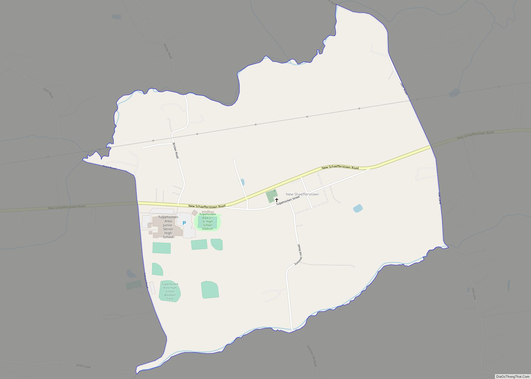
Map of Newburg borough, Pennsylvania
Newburg (also known as La Jose) is a borough in Clearfield County, Pennsylvania, United States. The population was 82 at the 2020 census. Newburg borough overview: Name: Newburg borough LSAD Code: 21 LSAD Description: borough (suffix) State: Pennsylvania County: Clearfield County Incorporated: 1885 Elevation: 1,320 ft (400 m) Total Area: 1.85 sq mi (4.80 km²) Land Area: 1.84 sq mi (4.78 km²) Water ... Read more
Map of Newburg borough, Pennsylvania
Map of New Wilmington borough
New Wilmington is a borough in Lawrence County, Pennsylvania, United States, first platted in 1824 and established as a borough on April 9, 1863. The population was 2,097 at the 2020 census. It is home to Westminster College and serves the Old Order Amish community in the surrounding Wilmington Township. It is part of the ... Read more
Map of New Wilmington borough
Map of New Washington borough, Pennsylvania
New Washington is a borough in Clearfield County, Pennsylvania, United States. The population was 50 at the 2020 census. New Washington borough overview: Name: New Washington borough LSAD Code: 21 LSAD Description: borough (suffix) State: Pennsylvania County: Clearfield County Incorporated: 1859 Elevation: 1,669 ft (509 m) Total Area: 2.30 sq mi (5.95 km²) Land Area: 2.29 sq mi (5.94 km²) Water Area: 0.00 sq mi ... Read more
Map of New Washington borough, Pennsylvania
Map of New Tripoli CDP
New Tripoli (/trɪˈpoʊli/ trih-POH-lee) is an unincorporated community and census-designated place (CDP) in Lynn Township in Lehigh County, Pennsylvania. As of the 2020 census, the population was 840. New Tripoli is part of the Lehigh Valley, which had a population of 861,899 and was the 68th-most populous metropolitan area in the U.S. as of the ... Read more
Map of New Tripoli CDP
Map of Nixon CDP, Pennsylvania
Nixon is a census-designated place (CDP) in Butler County, Pennsylvania, United States. The population was 1,373 at the 2010 census. Nixon CDP overview: Name: Nixon CDP LSAD Code: 57 LSAD Description: CDP (suffix) State: Pennsylvania County: Butler County Elevation: 1,240 ft (380 m) Total Area: 2.70 sq mi (6.99 km²) Land Area: 2.69 sq mi (6.97 km²) Water Area: 0.01 sq mi (0.03 km²) Total Population: ... Read more
Map of Nixon CDP, Pennsylvania
Map of Nittany CDP
Nittany is an unincorporated community and census-designated place in Walker Township, Centre County, Pennsylvania, United States. As of the 2010 census, the population was 658. It is located along the northeastern border of Centre County, next to Lamar in Clinton County. It lies in the Nittany Valley, between the long ridge of Nittany Mountain to ... Read more
Map of Nittany CDP
Map of Nicholson borough, Pennsylvania
Nicholson is a borough in Wyoming County, Pennsylvania. The population was 698 at the 2020 census. Nicholson borough overview: Name: Nicholson borough LSAD Code: 21 LSAD Description: borough (suffix) State: Pennsylvania County: Wyoming County Founded: August 23, 1875 Elevation: 728 ft (222 m) Total Area: 1.17 sq mi (3.04 km²) Land Area: 1.16 sq mi (3.00 km²) Water Area: 0.02 sq mi (0.04 km²) Total Population: ... Read more
Map of Nicholson borough, Pennsylvania
Map of Newville borough, Pennsylvania
Newville is a borough in Cumberland County, Pennsylvania, United States. The borough is located west of Carlisle. The population was 1,376 at the 2020 census. It is part of the Harrisburg–Carlisle metropolitan statistical area. Newville is served by the Big Spring School District. Newville borough overview: Name: Newville borough LSAD Code: 21 LSAD Description: borough ... Read more
Map of Newville borough, Pennsylvania
Map of Newtown CDP, Pennsylvania
Newtown is a census-designated place (CDP) in Reilly Township, Schuylkill County in the U.S. state of Pennsylvania. The population was 244 at the 2000 census. Newtown CDP overview: Name: Newtown CDP LSAD Code: 57 LSAD Description: CDP (suffix) State: Pennsylvania County: Schuylkill County Total Area: 0.7 sq mi (1.7 km²) Land Area: 0.7 sq mi (1.7 km²) Total Population: 244 Population ... Read more
Map of Newtown CDP, Pennsylvania
Map of Newtown Grant CDP
Newtown Grant is a census-designated place (CDP) in Bucks County, Pennsylvania, United States. The population was 3,620 at the 2010 census. Newtown Grant CDP overview: Name: Newtown Grant CDP LSAD Code: 57 LSAD Description: CDP (suffix) State: Pennsylvania County: Bucks County Elevation: 289 ft (88 m) Total Area: 1.86 sq mi (4.82 km²) Land Area: 1.86 sq mi (4.81 km²) Water Area: 0.01 sq mi ... Read more
Map of Newtown Grant CDP
Map of Newton Hamilton borough
Newton Hamilton is a borough (established April 12, 1843) in Mifflin County, Pennsylvania, United States. The population was 197 at the time of the 2020 census. Newton Hamilton borough overview: Name: Newton Hamilton borough LSAD Code: 21 LSAD Description: borough (suffix) State: Pennsylvania County: Mifflin County Incorporated: 1843 Total Area: 0.18 sq mi (0.48 km²) Land Area: 0.15 sq mi ... Read more
Map of Newton Hamilton borough
Map of Newry borough, Pennsylvania
Newry is a borough in Blair County, Pennsylvania, United States. The population was 231 at the 2020 census. It is part of the Altoona, PA Metropolitan Statistical Area and one of the communities comprising the Altoona Urban Area. It was named after the town of Newry in Northern Ireland. Newry borough overview: Name: Newry borough ... Read more
Map of Newry borough, Pennsylvania