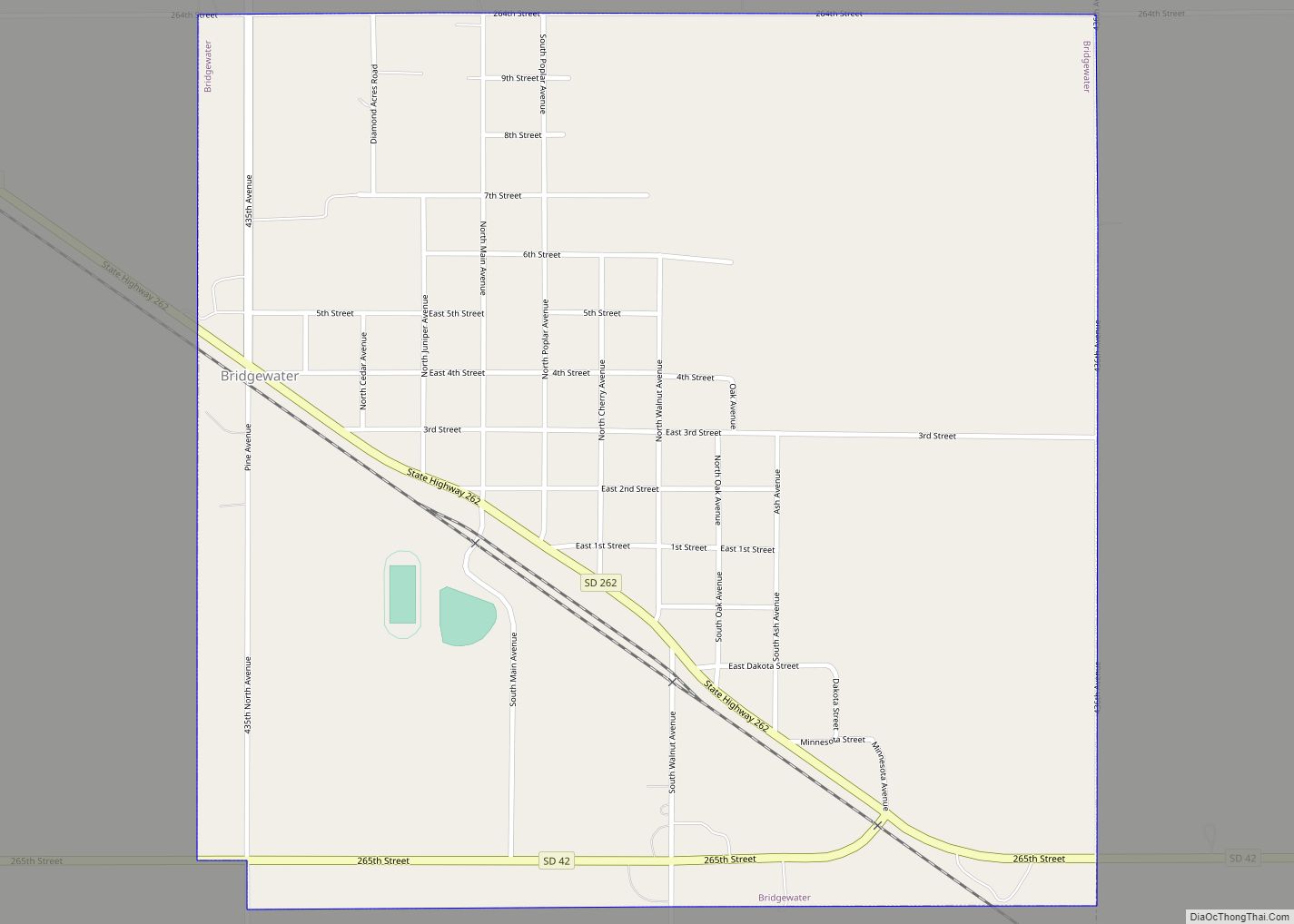
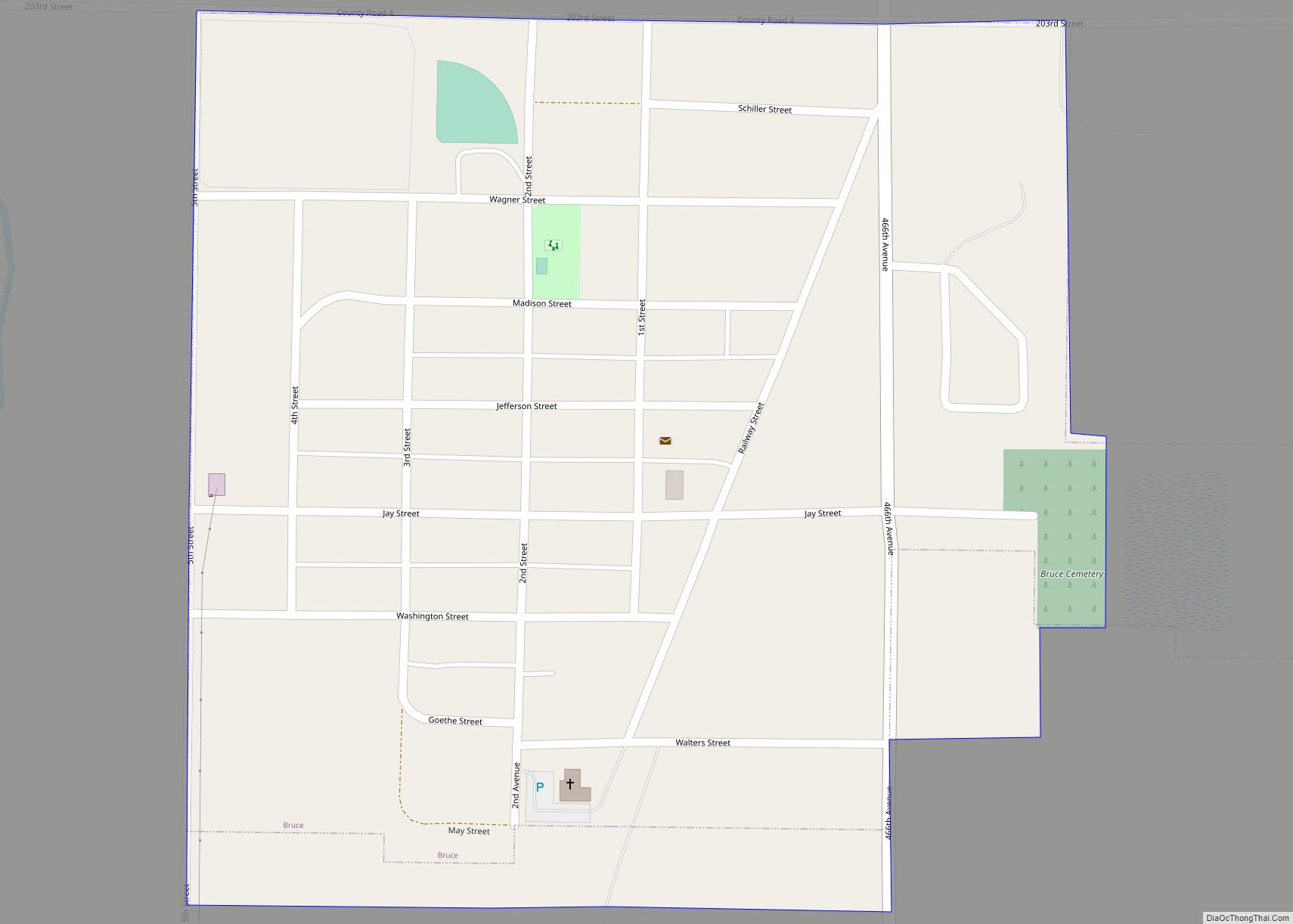
Map of Brentford town
Brentford is a town in Spink County, South Dakota, United States. The population was 88 at the 2020 census. Brentford town overview: Name: Brentford town LSAD Code: 43 LSAD Description: town (suffix) State: South Dakota County: Spink County Incorporated: 1906 Elevation: 1,299 ft (396 m) Total Area: 0.16 sq mi (0.42 km²) Land Area: 0.16 sq mi (0.42 km²) Water Area: 0.00 sq mi (0.00 km²) ... Read more
Map of Brentford town
Map of Brant Lake city
Brant Lake is a city in Lake County, South Dakota, United States. Its population was 56 as of the 2020 census. It was counted as a census-designated place prior to the 2020 census, as it had not yet incorporated. The town’s residents voted to incorporate in a 61–9 vote on March 29, 2016. Brant Lake ... Read more
Map of Brant Lake city
Map of Brant Lake South CDP
Brant Lake South CDP overview: Name: Brant Lake South CDP LSAD Code: 57 LSAD Description: CDP (suffix) State: South Dakota FIPS code: 4607044 Online Interactive Map Brant Lake South online map. Source: Basemap layers from Google Map, Open Street Map (OSM), Arcgisonline, Wmflabs. Boundary Data from Database of Global Administrative Areas. Brant Lake South location ... Read more
Map of Brant Lake South CDP
Map of Brandt town
Brandt is a town in Deuel County, South Dakota, United States. The population was 114 at the 2020 census. Brandt town overview: Name: Brandt town LSAD Code: 43 LSAD Description: town (suffix) State: South Dakota County: Deuel County Incorporated: 1880 Elevation: 1,850 ft (564 m) Total Area: 1.26 sq mi (3.27 km²) Land Area: 1.26 sq mi (3.27 km²) Water Area: 0.00 sq mi (0.00 km²) ... Read more
Map of Brandt town
Map of Brandon city, South Dakota
Brandon is a city in Minnehaha County, South Dakota, United States. Brandon is located five miles east of Sioux Falls. The population was 11,048 as of the 2020 census. Brandon city overview: Name: Brandon city LSAD Code: 25 LSAD Description: city (suffix) State: South Dakota County: Minnehaha County Incorporated: 1973 Elevation: 1,352 ft (412 m) Total Area: ... Read more
Map of Brandon city, South Dakota
Map of Bradley town, South Dakota
Bradley is a town in Clark County, South Dakota, United States. The population was 65 at the 2020 census. Bradley town overview: Name: Bradley town LSAD Code: 43 LSAD Description: town (suffix) State: South Dakota County: Clark County Incorporated: 1902 Elevation: 1,814 ft (553 m) Total Area: 0.24 sq mi (0.63 km²) Land Area: 0.24 sq mi (0.63 km²) Water Area: 0.00 sq mi (0.00 km²) ... Read more
Map of Bradley town, South Dakota
Map of Broadland town
Broadland is a town in Beadle County, South Dakota, United States. The population was 27 at the 2020 census. Broadland town overview: Name: Broadland town LSAD Code: 43 LSAD Description: town (suffix) State: South Dakota County: Beadle County Incorporated: 1911 Elevation: 1,306 ft (398 m) Total Area: 1.01 sq mi (2.61 km²) Land Area: 1.01 sq mi (2.61 km²) Water Area: 0.00 sq mi (0.00 km²) ... Read more
Map of Broadland town
Map of Camp Crook town
Camp Crook is an incorporated small town in Harding County, South Dakota, United States, on the Little Missouri River. The population was 60 at the 2020 census. The town celebrated 125 years of existence in August 2008 during the annual county fair. It is the only town west of the Little Missouri River in South ... Read more
Map of Camp Crook town
Map of Butler town, South Dakota
Butler is a town in Day County, South Dakota, United States. The population was 4 at the 2020 census. Butler town overview: Name: Butler town LSAD Code: 43 LSAD Description: town (suffix) State: South Dakota County: Day County Incorporated: 1905 Elevation: 1,827 ft (557 m) Total Area: 0.29 sq mi (0.75 km²) Land Area: 0.29 sq mi (0.75 km²) Water Area: 0.00 sq mi (0.00 km²) ... Read more
Map of Butler town, South Dakota
Map of Bushnell town, South Dakota
Bushnell is a town in Brookings County, South Dakota, United States. The population was 71 at the 2020 census. Bushnell town overview: Name: Bushnell town LSAD Code: 43 LSAD Description: town (suffix) State: South Dakota County: Brookings County Incorporated: 1915 Elevation: 1,690 ft (515 m) Total Area: 0.71 sq mi (1.84 km²) Land Area: 0.71 sq mi (1.84 km²) Water Area: 0.00 sq mi (0.00 km²) ... Read more
Map of Bushnell town, South Dakota
Map of Burke city, South Dakota
Burke is a city in and county seat of Gregory County, South Dakota, United States. The population was 575 at the 2020 census. Burke city overview: Name: Burke city LSAD Code: 25 LSAD Description: city (suffix) State: South Dakota County: Gregory County Incorporated: 1906 Elevation: 2,195 ft (669 m) Total Area: 0.56 sq mi (1.45 km²) Land Area: 0.56 sq mi (1.45 km²) ... Read more
Map of Burke city, South Dakota
Map of Bullhead CDP
Bullhead is a census-designated place (CDP) in Corson County, South Dakota, United States, within the Standing Rock Indian Reservation. The population was 348 at the 2010 census. Bullhead CDP overview: Name: Bullhead CDP LSAD Code: 57 LSAD Description: CDP (suffix) State: South Dakota County: Corson County Elevation: 1,775 ft (541 m) Total Area: 3.09 sq mi (8.00 km²) Land Area: ... Read more
Map of Bullhead CDP