Map of Pinehurst CDP, Texas

Map of Pinehurst CDP, Texas

Pinehurst is a census-designated place (CDP) in Montgomery County, Texas, United States. The population was 5,195 at the 2020 census. Pinehurst CDP overview: Name: Pinehurst CDP LSAD Code: 57 LSAD Description: CDP (suffix) State: Texas County: Montgomery County Total Area: 9.0 sq mi (23 km²) Land Area: 9.0 sq mi (23 km²) Water Area: 0 sq mi (0 km²) Total Population: 5,195 Population Density: … Read more

Map of Pine Island town, Texas

Map of Pine Island town, Texas

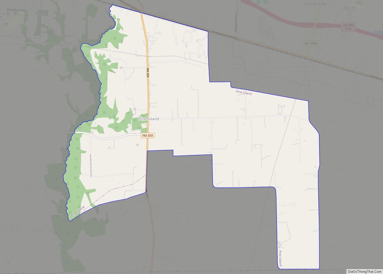
Pine Island is a town in Waller County, Texas, United States near the intersection of Farm to Market Road 359 and Farm to Market Road 3346. The population was 988 at the 2010 census. It is not affiliated with the uninhabited island of the same name in Lake Livingston. Pine Island town overview: Name: Pine … Read more

Map of Pine Harbor CDP

Map of Pine Harbor CDP

Pine Harbor is an unincorporated community and census-designated place in Marion County, Texas, United States. Its population was 810 as of the 2010 census. In 2020, its population was 785. Pine Harbor CDP overview: Name: Pine Harbor CDP LSAD Code: 57 LSAD Description: CDP (suffix) State: Texas County: Marion County Elevation: 292 ft (89 m) Total Area: … Read more

Map of Pine Forest city

Map of Pine Forest city

Pine Forest is a city in Orange County, Texas, United States. The population was 487 at the 2010 census. It is part of the Beaumont–Port Arthur Metropolitan Statistical Area. Pine Forest city overview: Name: Pine Forest city LSAD Code: 25 LSAD Description: city (suffix) State: Texas County: Orange County Elevation: 16 ft (5 m) Total Area: 2.83 sq mi … Read more

Map of Pilot Point city, Texas

Map of Pilot Point city, Texas

Pilot Point is a city in Denton County, Texas, United States. Its population was 3,856 at the 2010 census, increasing to 4,381 at the 2020 census. Pilot Point city overview: Name: Pilot Point city LSAD Code: 25 LSAD Description: city (suffix) State: Texas County: Denton County Elevation: 696 ft (212 m) Total Area: 4.35 sq mi (11.27 km²) Land Area: … Read more

Map of Pharr city

Map of Pharr city

Pharr is a city in Hidalgo County, Texas, United States. As of the 2010 census, the city population was 70,400, and in 2019, the estimated population was 79,112. Pharr is connected by bridge to the Mexican city of Reynosa, Tamaulipas. Pharr is part of the McAllen–Edinburg–Mission and Reynosa–McAllen metropolitan areas. Pharr city overview: Name: Pharr … Read more

Map of Pflugerville city

Map of Pflugerville city

Pflugerville (/ˈfluːɡərvɪl/ FLOO-gər-vil) is a city in Travis County, Texas, United States, with a small portion in Williamson County. The population was 65,191 at the 2020 census. Pflugerville is a suburb of Austin and part of the Austin–Round Rock– Metropolitan Statistical Area. It was named after the original German settlers who farmed the area; Pflüger … Read more

Map of Pettus CDP

Map of Pettus CDP

Pettus is a census-designated place (CDP) in Bee County, Texas, United States. The population was 558 at the 2010 census. Pettus CDP overview: Name: Pettus CDP LSAD Code: 57 LSAD Description: CDP (suffix) State: Texas County: Bee County Elevation: 299 ft (91 m) Total Area: 5.8 sq mi (15.1 km²) Land Area: 5.8 sq mi (15.1 km²) Water Area: 0.0 sq mi (0.0 km²) Total Population: … Read more

Map of Plantersville city, Texas

Map of Plantersville city, Texas

Plantersville was incorporated as a city on May 15, 2017. It is in Grimes County, Texas, United States, at the junction of State Highway 105, Farm Road 1774, and the Atchison, Topeka and Santa Fe Railway in southeast Grimes County. It is adjacent to the city of Todd Mission. Plantersville city overview: Name: Plantersville city … Read more

Map of Plainview city, Texas

Map of Plainview city, Texas

Plainview is a city in and the county seat of Hale County, Texas, United States. As of the 2010 census, the population was 22,194. Plainview city overview: Name: Plainview city LSAD Code: 25 LSAD Description: city (suffix) State: Texas County: Hale County Elevation: 3,366 ft (1,026 m) Total Area: 13.89 sq mi (35.99 km²) Land Area: 13.89 sq mi (35.99 km²) Water Area: … Read more

Map of Plains town, Texas

Map of Plains town, Texas

Plains is a town and the county seat of Yoakum County of western Texas, United States, particularly the south (inner) half of the panhandle’s plains. The city’s population was 1,481 at the 2010 census. Plains in the Texas High Plains Wine country. Plains town overview: Name: Plains town LSAD Code: 43 LSAD Description: town (suffix) … Read more

Map of Placedo CDP

Map of Placedo CDP

Placedo is a census-designated place (CDP) in Victoria County, Texas, United States. This was a new CDP for the 2010 census with a population of 692. It is part of the Victoria, Texas Metropolitan Statistical Area. Placedo CDP overview: Name: Placedo CDP LSAD Code: 57 LSAD Description: CDP (suffix) State: Texas County: Victoria County Total … Read more