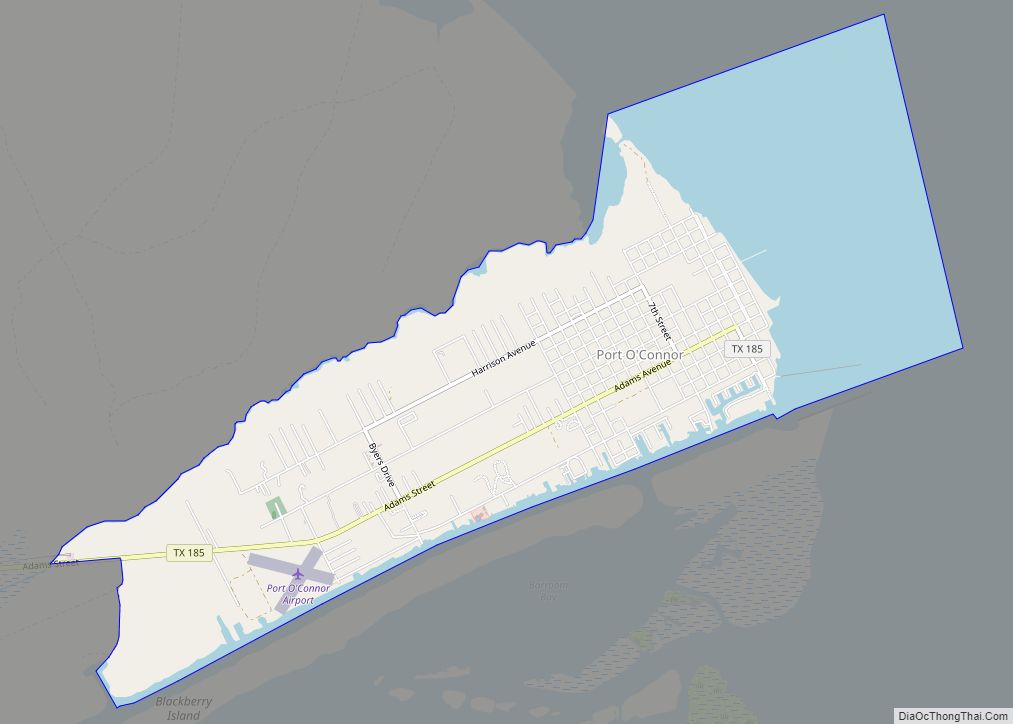
Map of Poteet city

Map of Poteet city

Poteet is a city in Atascosa County, Texas, United States. The population was 3,260 as of the 2010 census. It is part of the San Antonio Metropolitan Statistical Area. It was named for its first postmaster, Francis Marion Poteet. It is best known as the birthplace of country music legend, George Strait. Poteet is known … Read more

Map of Post city

Map of Post city

Post is a city in and the county seat of Garza County, Texas, United States. Its population was 5,376 at the 2010 census. Post city overview: Name: Post city LSAD Code: 25 LSAD Description: city (suffix) State: Texas County: Garza County Elevation: 2,605 ft (794 m) Total Area: 3.77 sq mi (9.77 km²) Land Area: 3.75 sq mi (9.70 km²) Water Area: 0.03 sq mi … Read more

Map of Preston CDP, Texas

Map of Preston CDP, Texas

Preston, also known as Preston Bend, is an unincorporated community and census-designated place located on the Red River in Grayson County, Texas, United States. It grew in the 19th century at the intersection of several military and trade roads and was an important crossing on the Shawnee cattle trail. Preston lost prominence after the MK&T … Read more

Map of Presidio city

Map of Presidio city

Presidio is a city in Presidio County, Texas, United States. It is situated on the Rio Grande (Río Bravo del Norte) River, on the opposite side of the U.S.–Mexico border from Ojinaga, Chihuahua. The name originates from Spanish and means “fortress”. The population was 4,169 at the 2000 census, and had increased to 4,426 as … Read more

Map of Premont city

Map of Premont city

Premont is a city in Jim Wells County, Texas, United States. The population was 2,653 at the 2010 census. Premont city overview: Name: Premont city LSAD Code: 25 LSAD Description: city (suffix) State: Texas County: Jim Wells County Elevation: 161 ft (49 m) Total Area: 1.71 sq mi (4.43 km²) Land Area: 1.71 sq mi (4.43 km²) Water Area: 0.00 sq mi (0.00 km²) Total Population: … Read more

Map of Prairie View city, Texas

Map of Prairie View city, Texas

Prairie View is a city in Waller County, Texas, United States, situated on the northwestern edge of the Houston–The Woodlands–Sugar Land metropolitan area. The population was 8,184 at the 2020 census. Prairie View A&M University, the second oldest public university in Texas, is based in the city. Prairie View city overview: Name: Prairie View city … Read more

Map of Prado Verde CDP

Map of Prado Verde CDP

Prado Verde is a census-designated place (CDP) in El Paso County, Texas, United States. The population is 246 according to the 2010 census. It is part of the El Paso Metropolitan Statistical Area. The ZIP Code encompassing the CDP area is 79932. Prado Verde CDP overview: Name: Prado Verde CDP LSAD Code: 57 LSAD Description: … Read more

Map of Poynor town

Map of Poynor town

Poynor is a town in Henderson County, Texas, United States. The population was 305 at the 2010 census. Poynor town overview: Name: Poynor town LSAD Code: 43 LSAD Description: town (suffix) State: Texas County: Henderson County Elevation: 440 ft (130 m) Total Area: 2.36 sq mi (6.11 km²) Land Area: 2.36 sq mi (6.11 km²) Water Area: 0.00 sq mi (0.00 km²) Total Population: 305 Population … Read more

Map of Powell town, Texas

Map of Powell town, Texas

Powell is a town in Navarro County, Texas, United States. The population was 136 at the 2010 census. Powell town overview: Name: Powell town LSAD Code: 43 LSAD Description: town (suffix) State: Texas County: Navarro County Elevation: 374 ft (114 m) Total Area: 1.21 sq mi (3.13 km²) Land Area: 1.21 sq mi (3.13 km²) Water Area: 0.00 sq mi (0.00 km²) Total Population: 136 Population … Read more

Map of Powderly CDP, Texas

Map of Powderly CDP, Texas

Powderly is a census-designated place (CDP) and unincorporated community in Lamar County, Texas, United States. As of the 2010 census, the population was 1,178. Powderly CDP overview: Name: Powderly CDP LSAD Code: 57 LSAD Description: CDP (suffix) State: Texas County: Lamar County Elevation: 530 ft (160 m) Total Area: 7.44 sq mi (19.27 km²) Land Area: 7.25 sq mi (18.79 km²) Water Area: … Read more

Map of Pottsboro town

Map of Pottsboro town

Pottsboro is a town in Grayson County, Texas, United States. Its population was 2,160 at the 2010 census, up from 1,579 at the 2000 census. It is part of the Sherman–Denison metropolitan statistical area. Pottsboro town overview: Name: Pottsboro town LSAD Code: 43 LSAD Description: town (suffix) State: Texas County: Grayson County Elevation: 761 ft (232 m) … Read more

Map of Potosi CDP, Texas

Map of Potosi CDP, Texas

Potosi is a census-designated place (CDP) in Taylor County, Texas, United States. Its population was 2,991 at the 2010 census. It is part of the Abilene, Texas metropolitan statistical area. Potosi CDP overview: Name: Potosi CDP LSAD Code: 57 LSAD Description: CDP (suffix) State: Texas County: Taylor County Elevation: 1,821 ft (555 m) Total Area: 18.5 sq mi (47.8 km²) … Read more