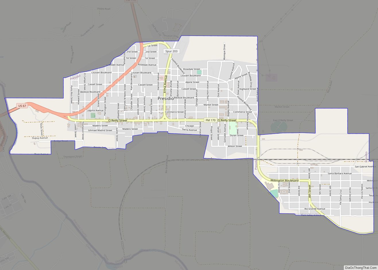
Presidio is a city in Presidio County, Texas, United States. It is situated on the Rio Grande (Río Bravo del Norte) River, on the opposite side of the U.S.–Mexico border from Ojinaga, Chihuahua. The name originates from Spanish and means “fortress”. The population was 4,169 at the 2000 census, and had increased to 4,426 as of the 2010 US census.
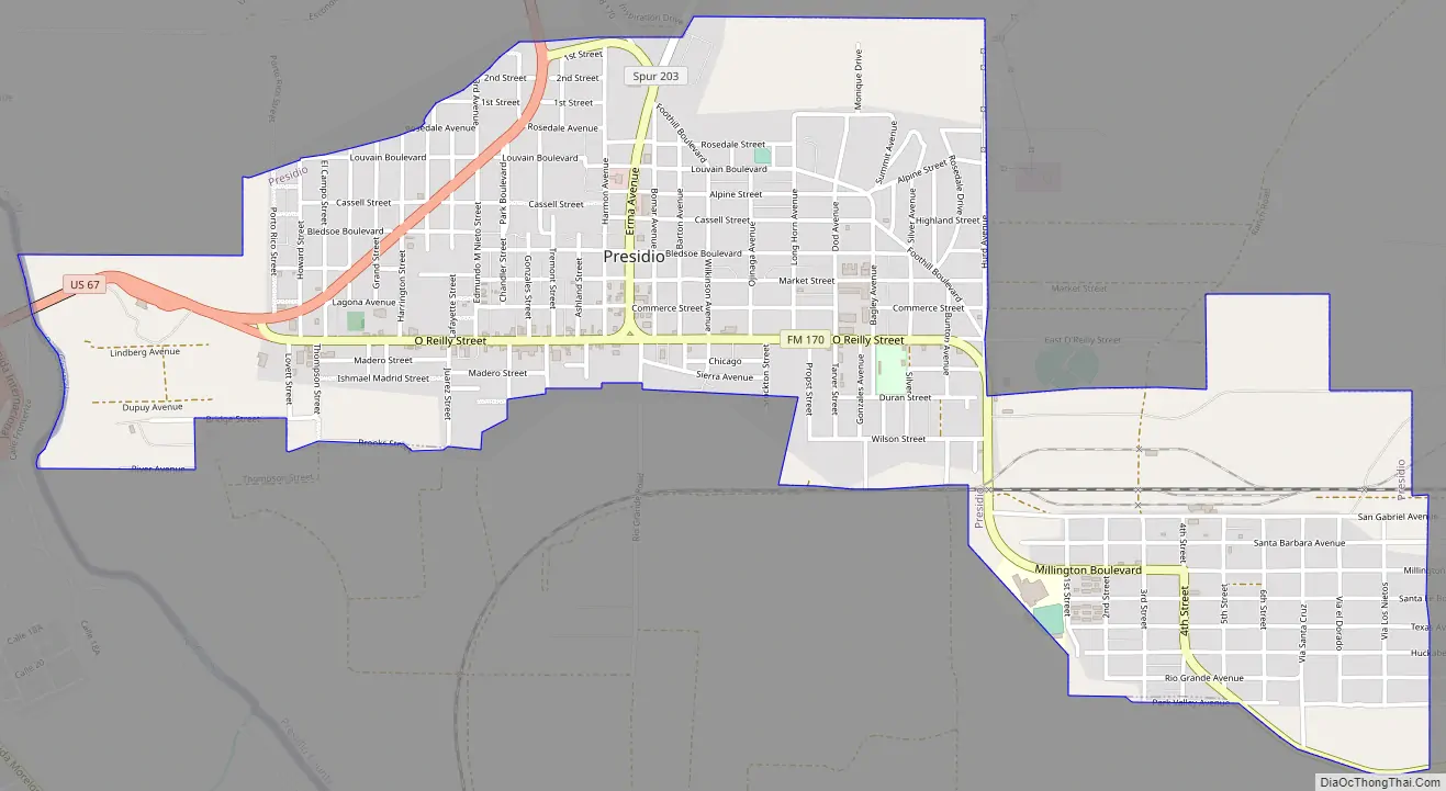
Presidio is on the Farm to Market Road 170, and U.S. Route 67, 18 miles (29 km) south of Shafter in Presidio County. Presidio is approximately 250 miles (400 km) southeast of El Paso, 240 miles (390 km) southwest of Odessa, and 145 miles (233 km) northeast of Chihuahua City.
| Name: | Presidio city |
|---|---|
| LSAD Code: | 25 |
| LSAD Description: | city (suffix) |
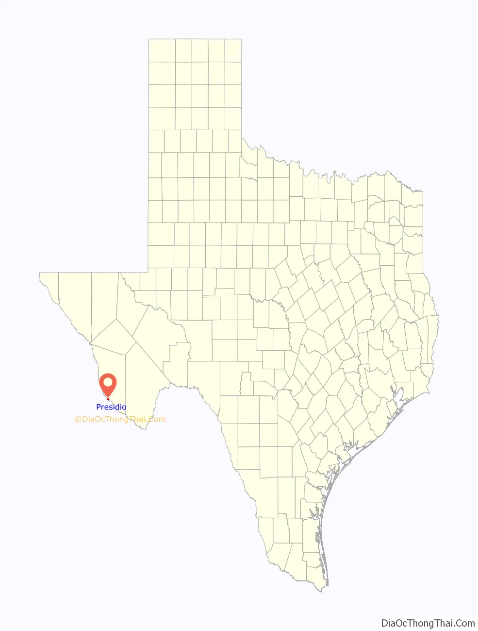
| State: | Texas |
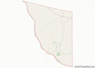
| County: | Presidio County |
| Elevation: | 2,582 ft (787 m) |
| Total Area: | 2.58 sq mi (6.67 km²) |
| Land Area: | 2.58 sq mi (6.67 km²) |
| Water Area: | 0.00 sq mi (0.00 km²) |
| Total Population: | 4,426 |
| Population Density: | 1,512.23/sq mi (583.96/km²) |
| ZIP code: | 79845-79846 |
| Area code: | 432 |
| FIPS code: | 4859396 |
| GNISfeature ID: | 1344545 |
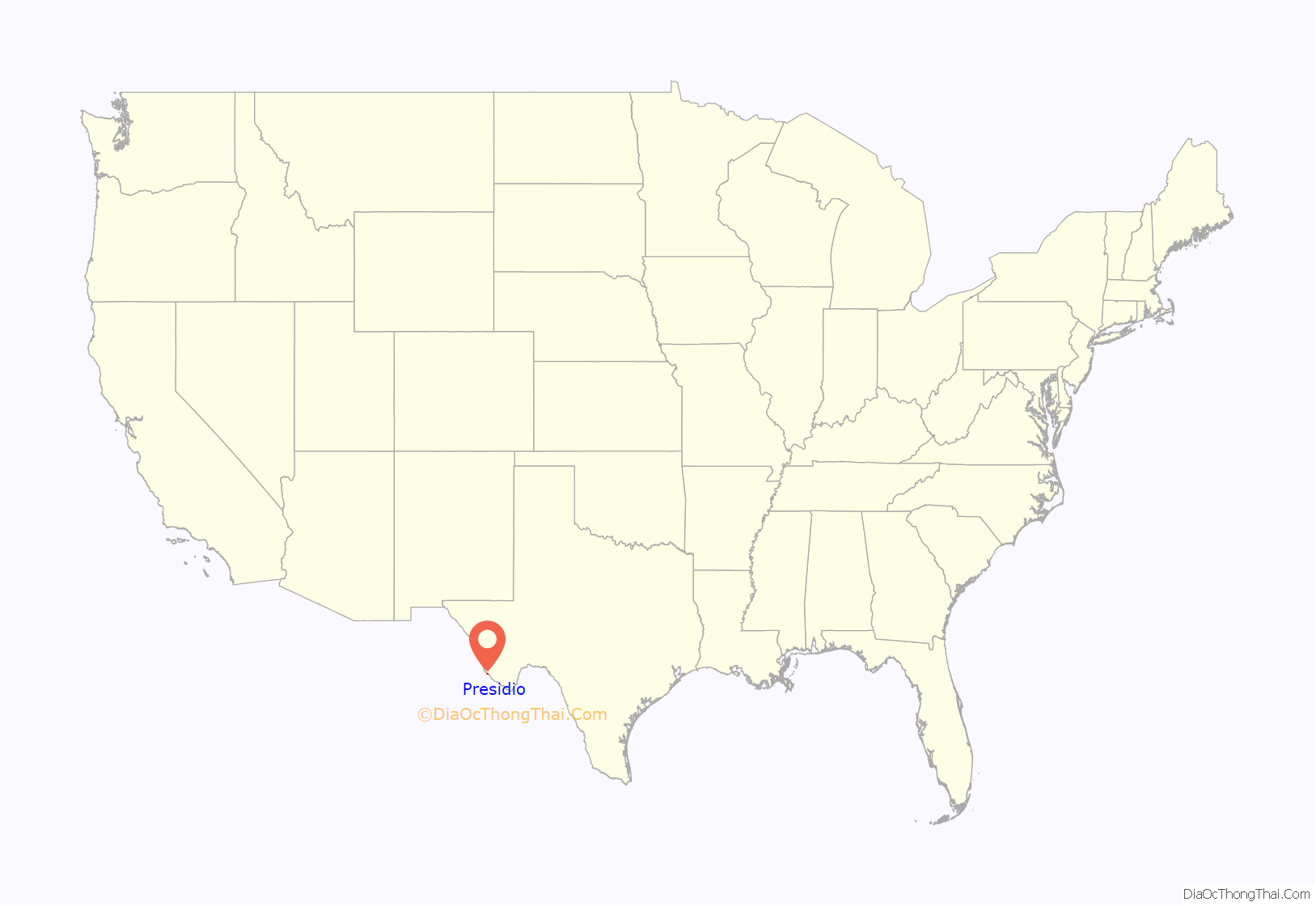
Online Interactive Map
Click on ![]() to view map in "full screen" mode.
to view map in "full screen" mode.
Presidio location map. Where is Presidio city?
History
The junction of the Rio Conchos and Rio Grande at Presidio was settled thousands of years ago by hunting and gathering peoples. By 1200 CE, the local Native Americans had adopted agriculture and lived in small, closely knit settlements, which the Spaniards later called pueblos. (See La Junta Indians)
The first Spaniards came to Presidio in 1535 CE, Álvar Núñez Cabeza de Vaca and his three companions stopped at the Native American pueblo, placed a cross on the mountainside, and called the village La Junta de las Cruces. On December 10, 1582, Antonio de Espejo and his company arrived at the site and called the pueblo San Juan Evangelista. By 1681, the area of Presidio was known as La Junta de los Ríos, or the Junction of the Rivers. Five Jumano towns were located along the Rio Grande to the north of the junction, consisting largely of permanent houses. In 1683, Juan Sabeata, the chief of the Jumano nation, reported having seen a fiery cross on the mountain at Presidio and requested that a mission be established at La Junta. The settlement in 1684 became known as La Navidad en Las Cruces. The missions La Navidad en las Cruces, San Francisco de los Julimes, San Antonio de los Puliques, Apostol Santiago, and Santa María de la Redonda may have been established on the Texas side of the Rio Grande at La Junta.
About 1760, a penal colony and military garrison of 60 men were established near Presidio. In 1830, the name of the area around Presidio was changed from La Junta de los Rios to Presidio del Norte. White American settlers came to Presidio in 1848 after the Mexican War. Among them was John Spencer, who operated a horse ranch on the United States side of the Rio Grande near Presidio. Ben Leaton and Milton Faver, former scalp hunters for the Mexican government, built private forts in the area.
In 1849, a Comanche raid almost destroyed Presidio, and in 1850, Indians drove off most of the cattle in town. A post office was established at Presidio in 1868, and the first public school was opened in 1887.
During the Mexican Revolution, General Pancho Villa often used Ojinaga as his headquarters for operations and visited Presidio on numerous occasions. As a result of Pancho Villa’s force’s raid and capture of Ojinaga on January 10, 1914, many Mexican army troops and civilians fled to Presidio, seeking safe-haven. U.S. forces detained 2,000 Mexican refugees in Presidio, eventually marching them north 60 miles to Camp Marfa. The refugees would later be sent by train to Ft. Bliss (El Paso).
In 1930, the Kansas City, Mexico and Orient Railway reached Presidio and the Presidio–Ojinaga International Rail Bridge was built. The population grew from 96 in 1925 to 1,671 in 1988, but the number of businesses declined from 70 in 1933 to 22 in 1988. At the end of 1988, Presidio experienced a population boom, due in part to previously undocumented immigrants enrolled in the amnesty program. The population in 1990 was 3,422. Despite Presidio’s having been occupied continuously since ancient times, the community was finally incorporated in 1980, with Herb Myers elected as Presidio’s first mayor.
The 1959 movie Rio Bravo featured the town, and in 1964 the movie Rio Conchos.
In 1986, the Texas Department of Transportation opened a two-lane bridge, connecting Presidio and Ojinaga, the Presidio–Ojinaga International Bridge. By 2019, a second span will be constructed, with the original bridge being refurbished. The increased bridge capacity is projected to meet higher traffic, mainly commercial and agricultural in nature.
As of 2020, Presidio’s local economy is based largely upon employment at Presidio Independent School District, United States Customs and Border Protection, and local retail businesses.
In 2010, Presidio built the world’s largest sodium-sulfur battery to provide power when the city’s lone line to the United States power grid goes down.
Presidio Road Map
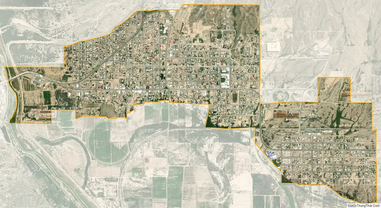
Presidio city Satellite Map
Geography
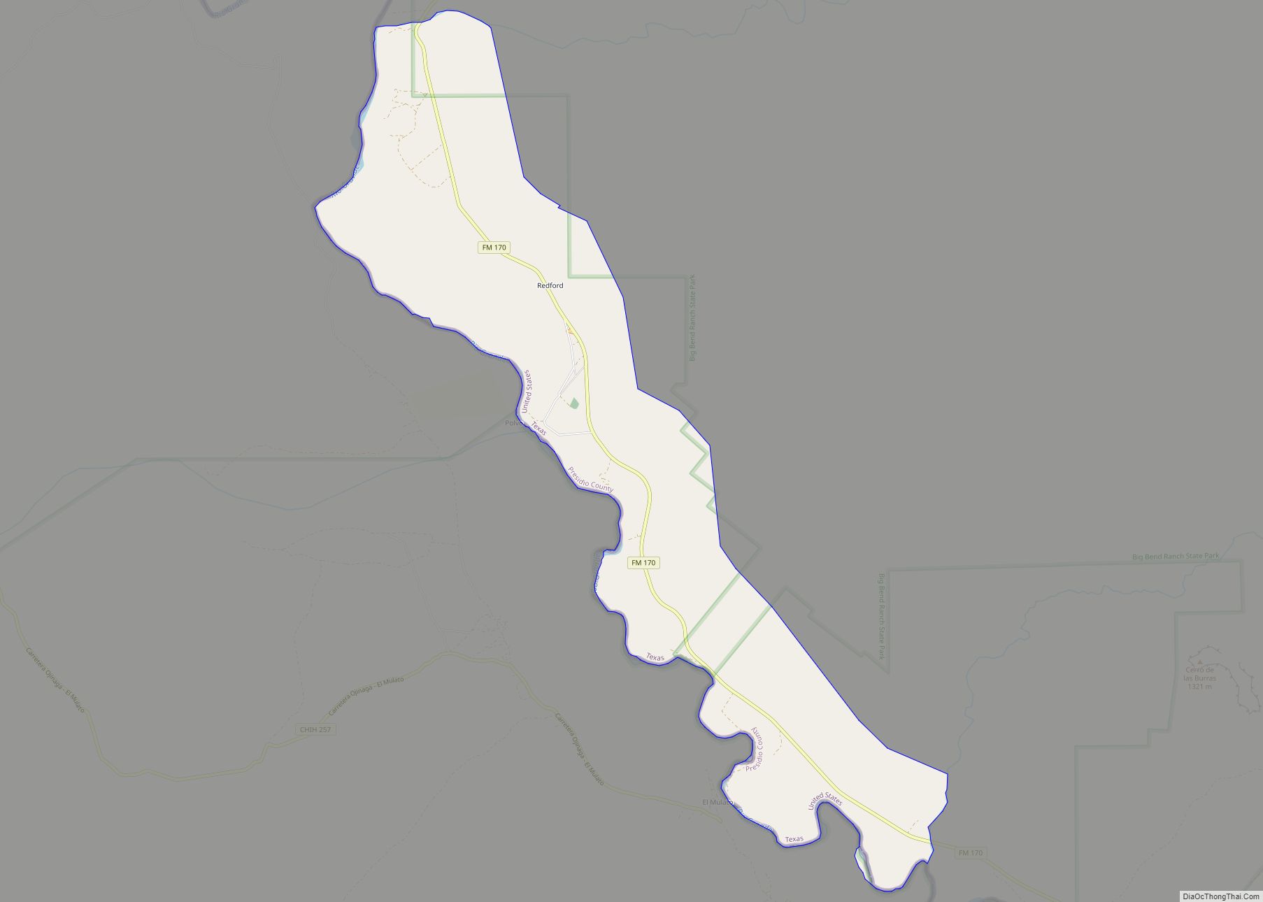
Presidio is located at 29°33′41″N 104°21′59″W / 29.56139°N 104.36639°W / 29.56139; -104.36639 (29.561272, –104.366522).
According to the United States Census Bureau, the city has a total area of 2.6 square miles (6.7 km), all land. Presidio is located near the confluence of the Rio Conchos and the Rio Grande. The Rio Conchos flows in a northeasterly direction from its source in the Sierra Madre in the state of Chihuahua, Mexico. Commonly referred to as “La Junta” (the joining), the two rivers resulted in plentiful water, creating a flood plain that is ideal for farming.
See also
Map of Texas State and its subdivision:- Anderson
- Andrews
- Angelina
- Aransas
- Archer
- Armstrong
- Atascosa
- Austin
- Bailey
- Bandera
- Bastrop
- Baylor
- Bee
- Bell
- Bexar
- Blanco
- Borden
- Bosque
- Bowie
- Brazoria
- Brazos
- Brewster
- Briscoe
- Brooks
- Brown
- Burleson
- Burnet
- Caldwell
- Calhoun
- Callahan
- Cameron
- Camp
- Carson
- Cass
- Castro
- Chambers
- Cherokee
- Childress
- Clay
- Cochran
- Coke
- Coleman
- Collin
- Collingsworth
- Colorado
- Comal
- Comanche
- Concho
- Cooke
- Coryell
- Cottle
- Crane
- Crockett
- Crosby
- Culberson
- Dallam
- Dallas
- Dawson
- Deaf Smith
- Delta
- Denton
- Dewitt
- Dickens
- Dimmit
- Donley
- Duval
- Eastland
- Ector
- Edwards
- El Paso
- Ellis
- Erath
- Falls
- Fannin
- Fayette
- Fisher
- Floyd
- Foard
- Fort Bend
- Franklin
- Freestone
- Frio
- Gaines
- Galveston
- Garza
- Gillespie
- Glasscock
- Goliad
- Gonzales
- Gray
- Grayson
- Gregg
- Grimes
- Guadalupe
- Hale
- Hall
- Hamilton
- Hansford
- Hardeman
- Hardin
- Harris
- Harrison
- Hartley
- Haskell
- Hays
- Hemphill
- Henderson
- Hidalgo
- Hill
- Hockley
- Hood
- Hopkins
- Houston
- Howard
- Hudspeth
- Hunt
- Hutchinson
- Irion
- Jack
- Jackson
- Jasper
- Jeff Davis
- Jefferson
- Jim Hogg
- Jim Wells
- Johnson
- Jones
- Karnes
- Kaufman
- Kendall
- Kenedy
- Kent
- Kerr
- Kimble
- King
- Kinney
- Kleberg
- Knox
- La Salle
- Lamar
- Lamb
- Lampasas
- Lavaca
- Lee
- Leon
- Liberty
- Limestone
- Lipscomb
- Live Oak
- Llano
- Loving
- Lubbock
- Lynn
- Madison
- Marion
- Martin
- Mason
- Matagorda
- Maverick
- McCulloch
- McLennan
- McMullen
- Medina
- Menard
- Midland
- Milam
- Mills
- Mitchell
- Montague
- Montgomery
- Moore
- Morris
- Motley
- Nacogdoches
- Navarro
- Newton
- Nolan
- Nueces
- Ochiltree
- Oldham
- Orange
- Palo Pinto
- Panola
- Parker
- Parmer
- Pecos
- Polk
- Potter
- Presidio
- Rains
- Randall
- Reagan
- Real
- Red River
- Reeves
- Refugio
- Roberts
- Robertson
- Rockwall
- Runnels
- Rusk
- Sabine
- San Augustine
- San Jacinto
- San Patricio
- San Saba
- Schleicher
- Scurry
- Shackelford
- Shelby
- Sherman
- Smith
- Somervell
- Starr
- Stephens
- Sterling
- Stonewall
- Sutton
- Swisher
- Tarrant
- Taylor
- Terrell
- Terry
- Throckmorton
- Titus
- Tom Green
- Travis
- Trinity
- Tyler
- Upshur
- Upton
- Uvalde
- Val Verde
- Van Zandt
- Victoria
- Walker
- Waller
- Ward
- Washington
- Webb
- Wharton
- Wheeler
- Wichita
- Wilbarger
- Willacy
- Williamson
- Wilson
- Winkler
- Wise
- Wood
- Yoakum
- Young
- Zapata
- Zavala
- Alabama
- Alaska
- Arizona
- Arkansas
- California
- Colorado
- Connecticut
- Delaware
- District of Columbia
- Florida
- Georgia
- Hawaii
- Idaho
- Illinois
- Indiana
- Iowa
- Kansas
- Kentucky
- Louisiana
- Maine
- Maryland
- Massachusetts
- Michigan
- Minnesota
- Mississippi
- Missouri
- Montana
- Nebraska
- Nevada
- New Hampshire
- New Jersey
- New Mexico
- New York
- North Carolina
- North Dakota
- Ohio
- Oklahoma
- Oregon
- Pennsylvania
- Rhode Island
- South Carolina
- South Dakota
- Tennessee
- Texas
- Utah
- Vermont
- Virginia
- Washington
- West Virginia
- Wisconsin
- Wyoming