Map of Woodway city

Map of Woodway city, Texas

Woodway is a city in McLennan County, Texas, United States. The population was 9,383 at the 2020 census. It is part of the Waco Metropolitan Statistical Area. Woodway city overview: Name: Woodway city LSAD Code: 25 LSAD Description: city (suffix) State: Texas County: McLennan County Elevation: 633 ft (193 m) Total Area: 6.58 sq mi (17.05 km²) Land Area: 6.57 sq mi … Read more

Map of Woodville town, Texas

Map of Woodville town, Texas

Woodville is a town in Tyler County, Texas, United States. The town is intersected by three U.S. highways: U.S. Highway 69, U.S. Highway 190, and U.S. Highway 287. The population was 2,403 at the 2020 census. It is the county seat of Tyler County. The town was named after George Tyler Wood, governor of Texas … Read more

Map of Zuehl CDP

Map of Zuehl CDP

Zuehl (/ziːl/ zeel) is an unincorporated area and census-designated place in western Guadalupe County, Texas, United States. It is part of the San Antonio Metropolitan Statistical Area. Located on Cibolo Creek, it lies 13 miles (21 km) southwest of Seguin. The population was 362 at the 2010 census. Once known as “Perryman’s Crossing”, it was a … Read more

Map of Zavalla city

Map of Zavalla city

Zavalla is a city in Angelina County, Texas, United States. The population was 603 at the 2020 census. The town is named for Lorenzo de Zavala, a Mexican rancher, politician, and signer of the Texas Declaration of Independence who served as the first Vice-President of the Republic of Texas. Its city limits stretch several miles … Read more

Map of Zarate CDP

Map of Zarate CDP

Zarate is a census-designated place (CDP) in Starr County, Texas, United States. This was a new CDP for the 2010 census with a population of 59. Zarate CDP overview: Name: Zarate CDP LSAD Code: 57 LSAD Description: CDP (suffix) State: Texas County: Starr County Total Area: 59 FIPS code: 4880724 Online Interactive Map Zarate online … Read more

Map of Zapata CDP

Map of Zapata CDP

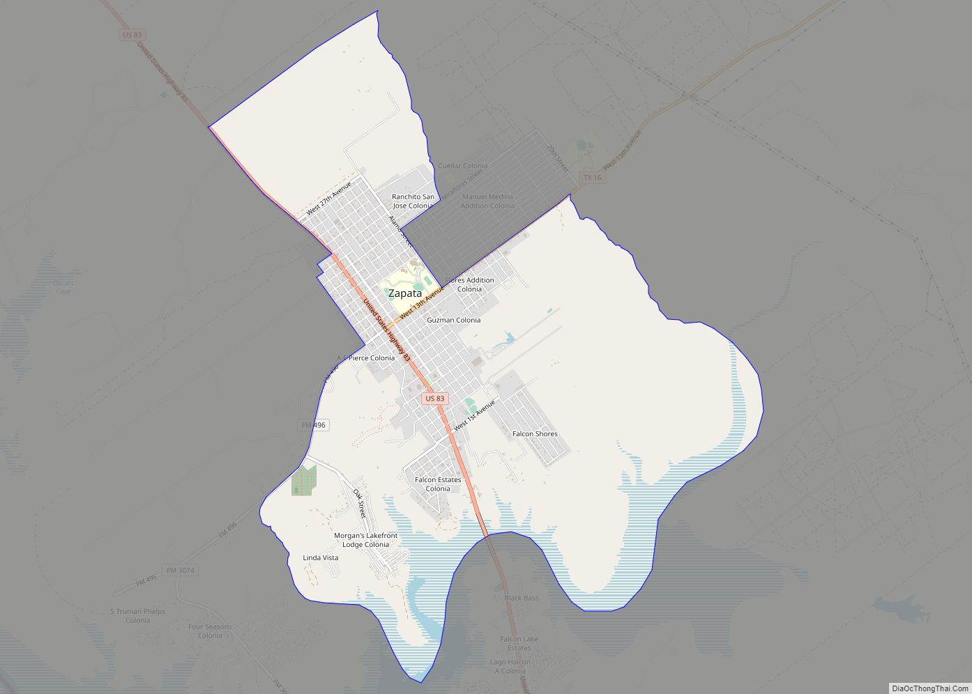
Zapata is a census-designated place (CDP) in and the county seat of Zapata County, Texas, United States. The population was 5,089 at the 2010 census. As an unincorporated community, Zapata has no municipal government but like all 254 Texas counties has four elected county commissioners chosen by single-member districts and a countywide elected administrative judge. … Read more

Map of Zapata Ranch CDP

Map of Zapata Ranch CDP

Zapata Ranch is a census-designated place (CDP) in Willacy County, Texas, United States. The population was 108 at the 2010 census. Zapata Ranch CDP overview: Name: Zapata Ranch CDP LSAD Code: 57 LSAD Description: CDP (suffix) State: Texas County: Willacy County Elevation: 39 ft (12 m) Total Area: 1.4 sq mi (3.6 km²) Land Area: 1.4 sq mi (3.6 km²) Water Area: 0.0 sq mi … Read more

Map of Yznaga CDP

Map of Yznaga CDP

Yznaga is a census-designated place (CDP) in Cameron County, Texas, United States. The population was 91 at the 2010 census. It is part of the Brownsville–Harlingen Metropolitan Statistical Area. Yznaga CDP overview: Name: Yznaga CDP LSAD Code: 57 LSAD Description: CDP (suffix) State: Texas County: Cameron County Elevation: 43 ft (13 m) Total Area: 5.46 sq mi (14.15 km²) Land … Read more

Map of Yorktown city, Texas

Map of Yorktown city, Texas

Yorktown is a city in DeWitt County, Texas, United States. The population was 1,810 at the 2020 census. Yorktown city overview: Name: Yorktown city LSAD Code: 25 LSAD Description: city (suffix) State: Texas County: DeWitt County Elevation: 276 ft (84 m) Total Area: 1.73 sq mi (4.47 km²) Land Area: 1.73 sq mi (4.47 km²) Water Area: 0.00 sq mi (0.00 km²) Total Population: 1,810 Population … Read more