Yorktown is a city in DeWitt County, Texas, United States. The population was 1,810 at the 2020 census.
| Name: | Yorktown city |
|---|---|
| LSAD Code: | 25 |
| LSAD Description: | city (suffix) |
| State: | Texas |
| County: | DeWitt County |
| Elevation: | 276 ft (84 m) |
| Total Area: | 1.73 sq mi (4.47 km²) |
| Land Area: | 1.73 sq mi (4.47 km²) |
| Water Area: | 0.00 sq mi (0.00 km²) |
| Total Population: | 1,810 |
| Population Density: | 1,186.34/sq mi (458.11/km²) |
| ZIP code: | 78164 |
| Area code: | 361 |
| FIPS code: | 4880584 |
| GNISfeature ID: | 1377672 |
| Website: | www.yorktowntx.com |
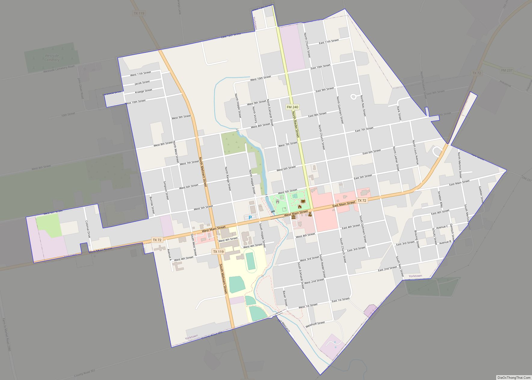
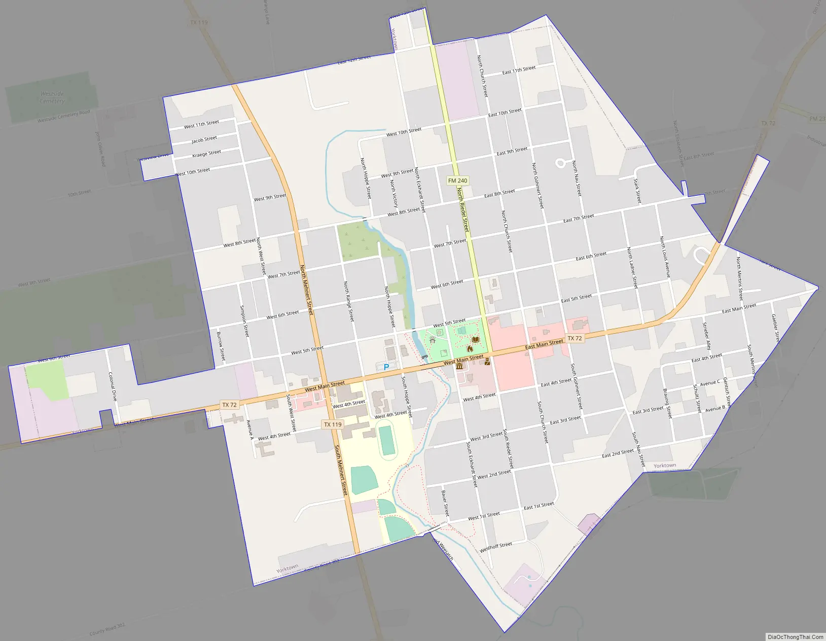
Online Interactive Map
Click on ![]() to view map in "full screen" mode.
to view map in "full screen" mode.
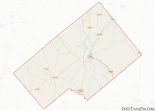
Yorktown location map. Where is Yorktown city?


History
The city was founded by Captain John York and Charles Eckhardt and named in honor of Captain John York, a famous Indian fighter and was in command of a company of citizens who, under Ben Milam, defeated General Cos in 1835 at the Siege of Béxar. For his military services, York received many acres of land in the Coleto Creek area.
Charles Eckhardt started a mercantile business in Indianola which at that time was a major Texas seaport. Eckhardt participated in the Texas Revolution and may have met Captain York during military service. Eckhardt contracted with John A. King, one of the pioneers of West Texas, to survey a road from Indianola through Yorktown to New Braunfels, later known as the Old Indianola Trail. From its inception in February, 1848, this road remained the chief thoroughfare for this part of the state to New Braunfels and San Antonio. This trail shortened the former route by twenty miles and established Yorktown as an important relay station for freighters, prairie schooners, trail drivers, and stagecoaches bringing mail and passengers. They came through upper town on North Riedel Street.
Early in 1848, after the founders had the proposed town surveyed, they offered 10 acres (40,000 m) and the choice of a lot free to the first ten families to settle the townsite. Many German, Bohemian, Lithuanian and Polish families came and soon changed this wilderness into one of the most prosperous sections of the entire state.
In May, 1848, Peter Metz and John Frank built the first house in the settlement of Yorktown for Charles Eckhardt. It was built of logs, twelve by twenty feet, with a back room and chimney. This house was later occupied by a brother, Caesar Eckhardt, who was the founder of C. Eckhardt and Sons Mercantile Company, known for half a century as the leading firm of its kind in western DeWitt County.
Unfortunately, neither of the founders lived to see the town develop beyond this point. In October 1848, in a battle with Marauding Indians, Captain York and his son-in-law, James Madison Bell, were killed. They were buried in a single hand-made coffin in the Yorktown Cemetery some seven miles (11 km) east of Yorktown; a historical marker designates York’s grave. In 1852, on an inspection of some of his properties in Central America, Eckhardt contracted yellow fever and died at sea on his return trip. He is buried in New Orleans. The Eckhardts did not have any children while the Yorks had ten children.
The Catholics established a church in 1867 and the Lutherans in 1872. The huge oak tree on the lawn of the latter church is one of the oldest in the state. The town was incorporated in 1871.
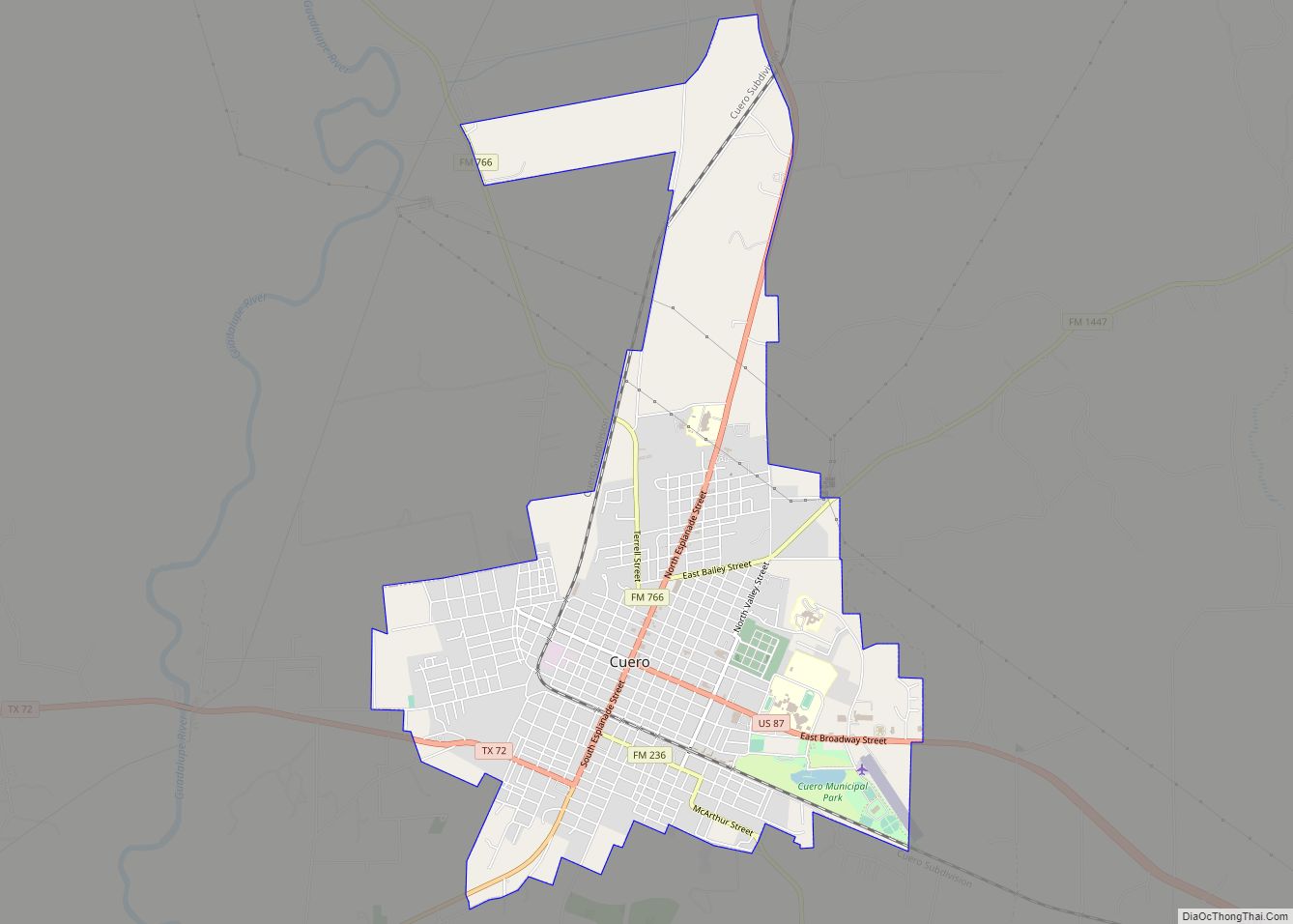
Yorktown Road Map
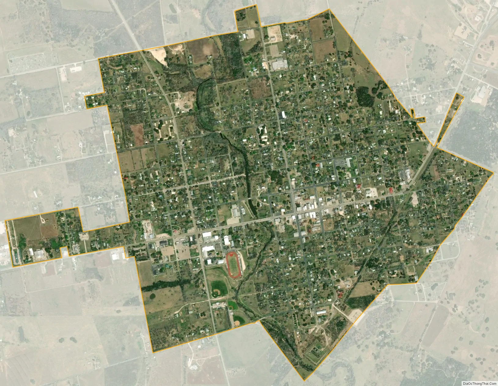
Yorktown city Satellite Map
Geography
Yorktown is located in southwestern DeWitt County at 28°59′00″N 97°30′09″W / 28.983196°N 97.502415°W / 28.983196; -97.502415 (28.983196, –97.502415). State Highways 72 and 119 intersect on the western side of town. Highway 72 leads northeast 16 miles (26 km) to Cuero and southwest 25 miles (40 km) to Kenedy, while Highway 119 leads northwest 35 miles (56 km) to Stockdale and south 24 miles (39 km) to Goliad.
According to the United States Census Bureau, Yorktown has a total area of 1.7 square miles (4.5 km), all of it land.
Climate
The climate in this area is characterized by hot, humid summers and generally mild to cool winters. According to the Köppen Climate Classification system, Yorktown has a humid subtropical climate, abbreviated “Cfa” on climate maps.
See also
Map of Texas State and its subdivision:- Anderson
- Andrews
- Angelina
- Aransas
- Archer
- Armstrong
- Atascosa
- Austin
- Bailey
- Bandera
- Bastrop
- Baylor
- Bee
- Bell
- Bexar
- Blanco
- Borden
- Bosque
- Bowie
- Brazoria
- Brazos
- Brewster
- Briscoe
- Brooks
- Brown
- Burleson
- Burnet
- Caldwell
- Calhoun
- Callahan
- Cameron
- Camp
- Carson
- Cass
- Castro
- Chambers
- Cherokee
- Childress
- Clay
- Cochran
- Coke
- Coleman
- Collin
- Collingsworth
- Colorado
- Comal
- Comanche
- Concho
- Cooke
- Coryell
- Cottle
- Crane
- Crockett
- Crosby
- Culberson
- Dallam
- Dallas
- Dawson
- Deaf Smith
- Delta
- Denton
- Dewitt
- Dickens
- Dimmit
- Donley
- Duval
- Eastland
- Ector
- Edwards
- El Paso
- Ellis
- Erath
- Falls
- Fannin
- Fayette
- Fisher
- Floyd
- Foard
- Fort Bend
- Franklin
- Freestone
- Frio
- Gaines
- Galveston
- Garza
- Gillespie
- Glasscock
- Goliad
- Gonzales
- Gray
- Grayson
- Gregg
- Grimes
- Guadalupe
- Hale
- Hall
- Hamilton
- Hansford
- Hardeman
- Hardin
- Harris
- Harrison
- Hartley
- Haskell
- Hays
- Hemphill
- Henderson
- Hidalgo
- Hill
- Hockley
- Hood
- Hopkins
- Houston
- Howard
- Hudspeth
- Hunt
- Hutchinson
- Irion
- Jack
- Jackson
- Jasper
- Jeff Davis
- Jefferson
- Jim Hogg
- Jim Wells
- Johnson
- Jones
- Karnes
- Kaufman
- Kendall
- Kenedy
- Kent
- Kerr
- Kimble
- King
- Kinney
- Kleberg
- Knox
- La Salle
- Lamar
- Lamb
- Lampasas
- Lavaca
- Lee
- Leon
- Liberty
- Limestone
- Lipscomb
- Live Oak
- Llano
- Loving
- Lubbock
- Lynn
- Madison
- Marion
- Martin
- Mason
- Matagorda
- Maverick
- McCulloch
- McLennan
- McMullen
- Medina
- Menard
- Midland
- Milam
- Mills
- Mitchell
- Montague
- Montgomery
- Moore
- Morris
- Motley
- Nacogdoches
- Navarro
- Newton
- Nolan
- Nueces
- Ochiltree
- Oldham
- Orange
- Palo Pinto
- Panola
- Parker
- Parmer
- Pecos
- Polk
- Potter
- Presidio
- Rains
- Randall
- Reagan
- Real
- Red River
- Reeves
- Refugio
- Roberts
- Robertson
- Rockwall
- Runnels
- Rusk
- Sabine
- San Augustine
- San Jacinto
- San Patricio
- San Saba
- Schleicher
- Scurry
- Shackelford
- Shelby
- Sherman
- Smith
- Somervell
- Starr
- Stephens
- Sterling
- Stonewall
- Sutton
- Swisher
- Tarrant
- Taylor
- Terrell
- Terry
- Throckmorton
- Titus
- Tom Green
- Travis
- Trinity
- Tyler
- Upshur
- Upton
- Uvalde
- Val Verde
- Van Zandt
- Victoria
- Walker
- Waller
- Ward
- Washington
- Webb
- Wharton
- Wheeler
- Wichita
- Wilbarger
- Willacy
- Williamson
- Wilson
- Winkler
- Wise
- Wood
- Yoakum
- Young
- Zapata
- Zavala
- Alabama
- Alaska
- Arizona
- Arkansas
- California
- Colorado
- Connecticut
- Delaware
- District of Columbia
- Florida
- Georgia
- Hawaii
- Idaho
- Illinois
- Indiana
- Iowa
- Kansas
- Kentucky
- Louisiana
- Maine
- Maryland
- Massachusetts
- Michigan
- Minnesota
- Mississippi
- Missouri
- Montana
- Nebraska
- Nevada
- New Hampshire
- New Jersey
- New Mexico
- New York
- North Carolina
- North Dakota
- Ohio
- Oklahoma
- Oregon
- Pennsylvania
- Rhode Island
- South Carolina
- South Dakota
- Tennessee
- Texas
- Utah
- Vermont
- Virginia
- Washington
- West Virginia
- Wisconsin
- Wyoming