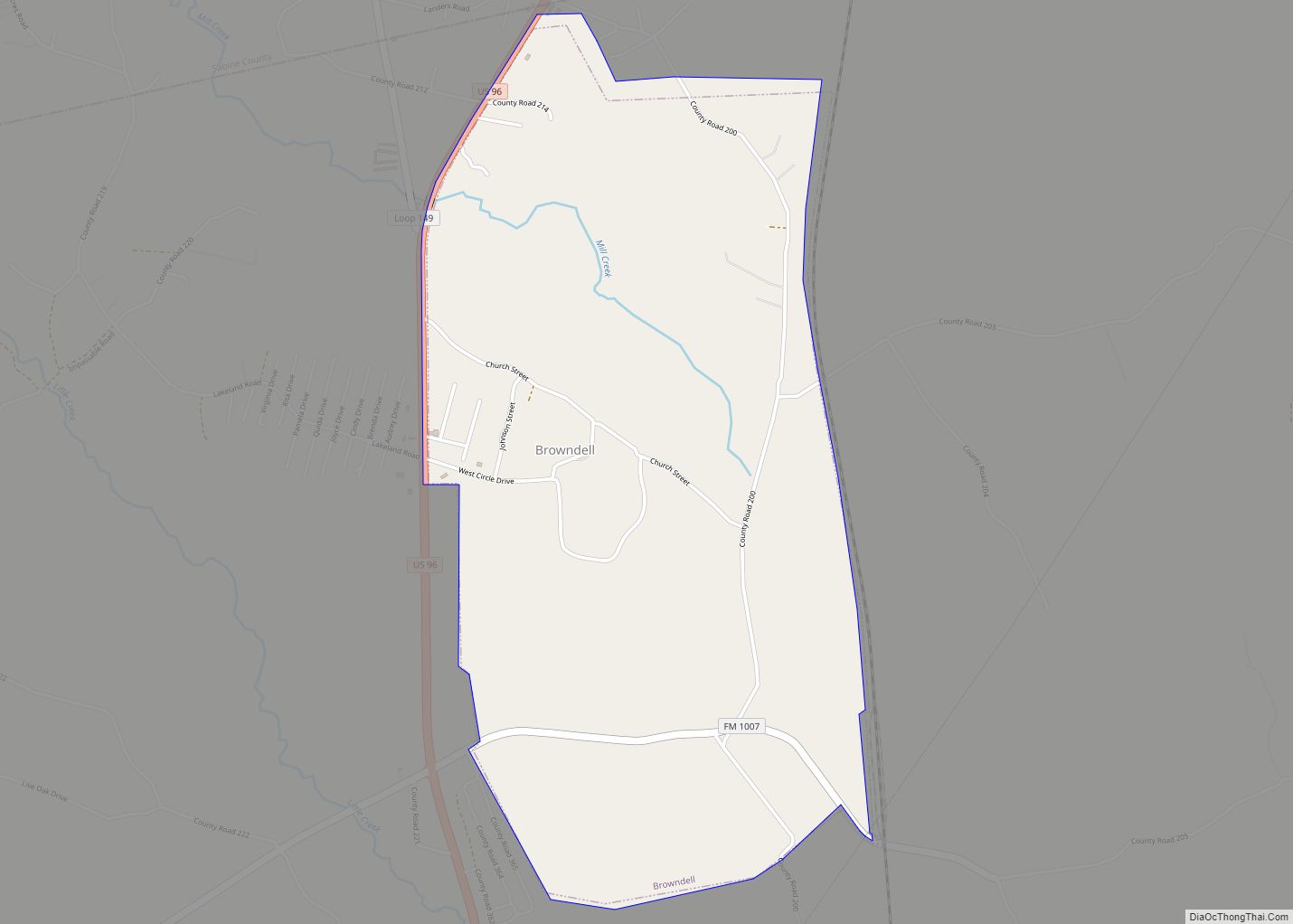
Map of Brownwood city

Map of Brownwood city

Brownwood is a city in and the county seat of Brown County, Texas, United States. The population was 18,862 as of the 2020 census. Brownwood is located in the Northern Texas Hill Country and is home to Howard Payne University, which was founded in 1889. Brownwood city overview: Name: Brownwood city LSAD Code: 25 LSAD … Read more

Map of Brownsboro city

Map of Brownsboro city

Brownsboro is a city in Henderson County, Texas, United States. The population was 1,212 at the 2020 census, up from 1,039 at the 2010 census. The city is on Texas State Highway 31. Brownsboro city overview: Name: Brownsboro city LSAD Code: 25 LSAD Description: city (suffix) State: Texas County: Henderson County Elevation: 381 ft (116 m) Total … Read more

Map of Buffalo city, Texas

Map of Buffalo city, Texas

Buffalo is a city in Leon County, Texas, United States. The population was 1,767 at the 2020 census. Buffalo city overview: Name: Buffalo city LSAD Code: 25 LSAD Description: city (suffix) State: Texas County: Leon County Elevation: 384 ft (117 m) Total Area: 4.73 sq mi (12.25 km²) Land Area: 4.71 sq mi (12.20 km²) Water Area: 0.02 sq mi (0.05 km²) Total Population: 1,767 Population … Read more

Map of Buffalo Springs village

Map of Buffalo Springs village

Buffalo Springs is a village in Lubbock County, Texas, United States. The population was 453 at the 2010 census. It is part of the Lubbock Metropolitan Statistical Area. Buffalo Springs village overview: Name: Buffalo Springs village LSAD Code: 47 LSAD Description: village (suffix) State: Texas County: Lubbock County Elevation: 3,022 ft (921 m) Total Area: 1.91 sq mi (4.94 km²) … Read more

Map of Buffalo Gap town, Texas

Map of Buffalo Gap town, Texas

Buffalo Gap is an incorporated town in Taylor County, Texas, United States. It is part of the Abilene, Texas Metropolitan Statistical Area. The population was 464 at the 2010 census. It is the former county seat of Taylor County, having been supplanted in 1883 by the much larger Abilene to its north. Abilene won the … Read more

Map of Buena Vista CDP, Texas

Map of Buena Vista CDP, Texas

Buena Vista (Spanish: “good view”, /ˌbweɪnəˈviːstə/ BWAY-nə-VEES-tə) is a census-designated place (CDP) in Starr County, Texas, United States. This was a new CDP for the 2010 census with a population of 102. Buena Vista CDP overview: Name: Buena Vista CDP LSAD Code: 57 LSAD Description: CDP (suffix) State: Texas County: Starr County Total Area: 102 … Read more

Map of Buda city, Texas

Map of Buda city, Texas

Buda (/ˈbjuːdə/ BYOO-də) is a city in Hays County, Texas, United States. The population was 15,108 in 2020, up from 7,295 counted in 2010. Buda is part of the Austin-Round Rock-San Marcos metropolitan statistical area and is one of Austin’s fastest growing suburbs. Residents of Buda are referred to as Budans. Buda city overview: Name: … Read more

Map of Buckholts town

Map of Buckholts town

Buckholts is a town in Milam County, Texas, United States. Its population was 515 at the 2010 census. The town was founded in 1887, and had a movie theater and a hospital in the early 1920s, with a population around 1000 people. Buckholts town overview: Name: Buckholts town LSAD Code: 43 LSAD Description: town (suffix) … Read more

Map of Buchanan Lake Village CDP

Map of Buchanan Lake Village CDP

Buchanan Lake Village is an unincorporated community and census-designated place in Llano County, Texas, United States. Its population was 692 as of the 2010 census. Buchanan Lake Village CDP overview: Name: Buchanan Lake Village CDP LSAD Code: 57 LSAD Description: CDP (suffix) State: Texas County: Llano County Elevation: 1,053 ft (321 m) Total Area: 3.325 sq mi (8.61 km²) Land … Read more

Map of Buchanan Dam CDP

Map of Buchanan Dam CDP

Buchanan Dam (/bəkˈhænən/ bək-HAN-ən) is a census-designated place (CDP) in Llano County, Texas, United States. The population was 1,519 at the 2010 census, down from 1,688 at the 2000 census. Buchanan Dam CDP overview: Name: Buchanan Dam CDP LSAD Code: 57 LSAD Description: CDP (suffix) State: Texas County: Llano County Elevation: 1,053 ft (321 m) Total Area: … Read more

Map of Bryson city

Map of Bryson city

Bryson is a city in Jack County, Texas, United States. As of the 2010 census, its population was 539. Bryson city overview: Name: Bryson city LSAD Code: 25 LSAD Description: city (suffix) State: Texas County: Jack County Elevation: 1,247 ft (380 m) Total Area: 1.43 sq mi (3.69 km²) Land Area: 1.32 sq mi (3.41 km²) Water Area: 0.11 sq mi (0.28 km²) Total Population: 539 … Read more

Map of Bullard town

Map of Bullard town

Bullard is a small town in Smith and Cherokee counties in the east-central part of U.S. state of Texas. U.S. Route 69 and Farm-to-Market Roads 2137, 2493, and 344 intersect here, about 15 miles (24 km) south of the city of Tyler. Its population was 2,463 at the 2010 census, up from 1,150 at the 2000 … Read more