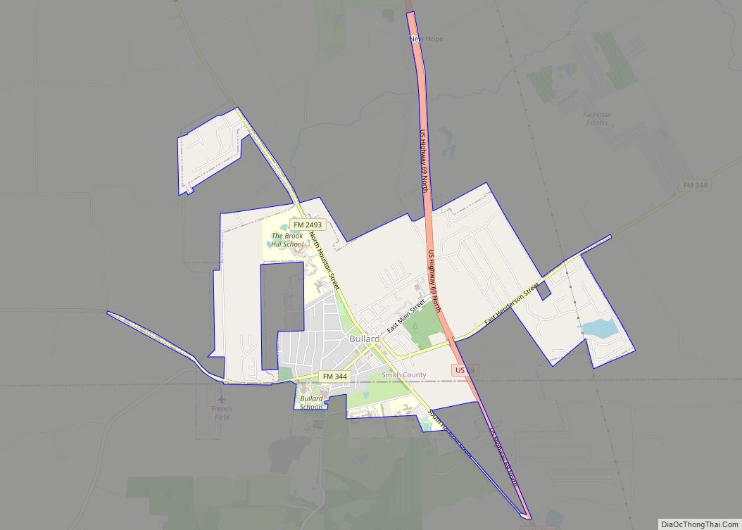
Bullard is a small town in Smith and Cherokee counties in the east-central part of U.S. state of Texas. U.S. Route 69 and Farm-to-Market Roads 2137, 2493, and 344 intersect here, about 15 miles (24 km) south of the city of Tyler. Its population was 2,463 at the 2010 census, up from 1,150 at the 2000 census; by 2020, its population was 3,318.
The Smith County portion of the town is part of the Tyler metropolitan statistical area, while the Cherokee County portion is part of the Jacksonville micropolitan statistical area.
Bullard was earlier known as “Etna” and “Hewsville”. The town is named for John H. Bullard, a Confederate soldier, and Emma Eugenia (Erwin) Bullard. In 1881, John Bullard opened the Hewsville post office in his store. In 1883, the Etna post office, near Hewsville, was closed. Then, the Hewsville office was renamed “Bullard”. Many rural residents in northern Cherokee County are served by the Bullard post office. The bypassing of the railroad brought about the demise of Etna and the rise of Bullard.
| Name: | Bullard town |
|---|---|
| LSAD Code: | 43 |
| LSAD Description: | town (suffix) |
| State: | Texas |
| County: | Cherokee County, Smith County |
| Founded: | 1881 |
| Incorporated: | 1948 |
| Elevation: | 505 ft (154 m) |
| Total Area: | 3.36 sq mi (8.69 km²) |
| Land Area: | 3.34 sq mi (8.66 km²) |
| Water Area: | 0.01 sq mi (0.03 km²) |
| Total Population: | 3,318 |
| Population Density: | 990/sq mi (380/km²) |
| ZIP code: | 75757 |
| Area code: | 903 |
| FIPS code: | 4811212 |
| GNISfeature ID: | 1331622 |
| Website: | www.bullardtexas.net |
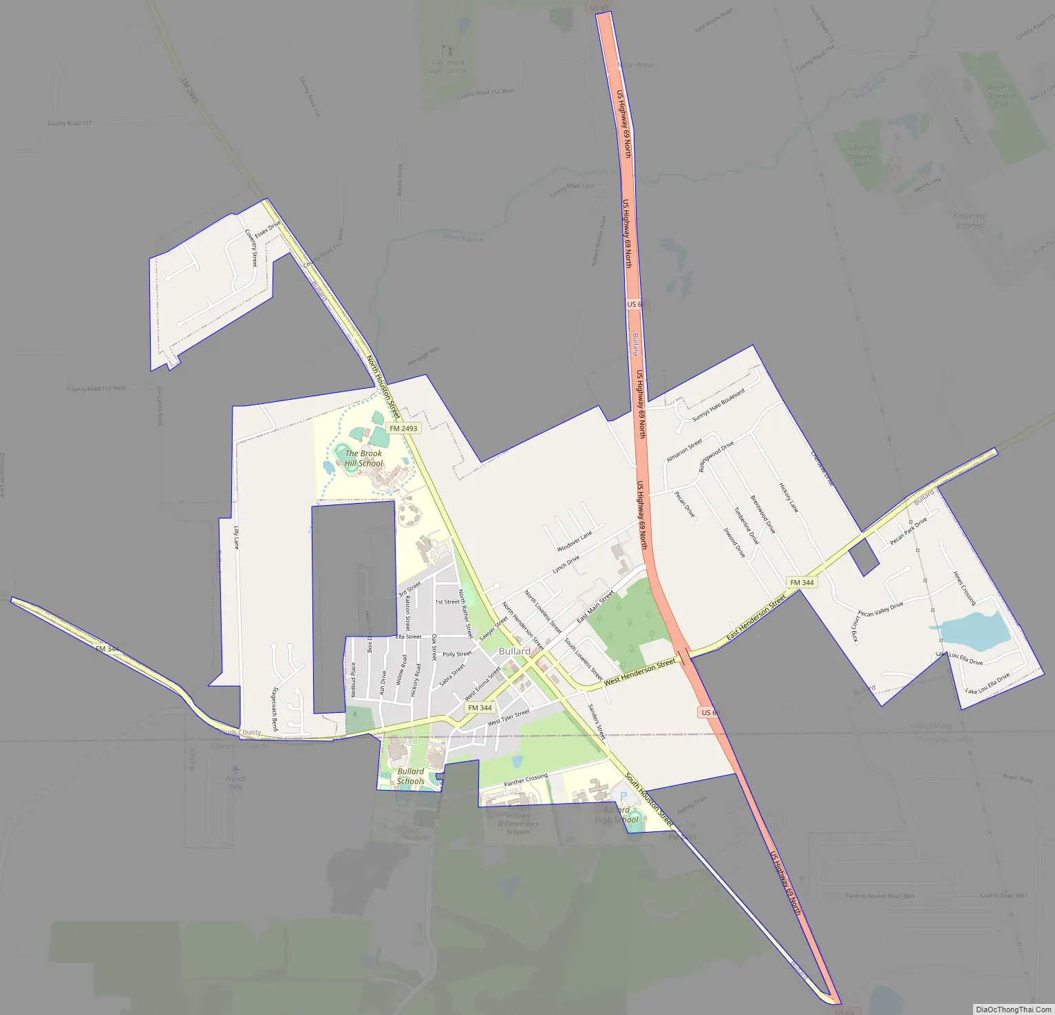
Online Interactive Map
Click on ![]() to view map in "full screen" mode.
to view map in "full screen" mode.
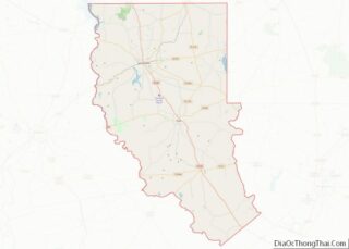
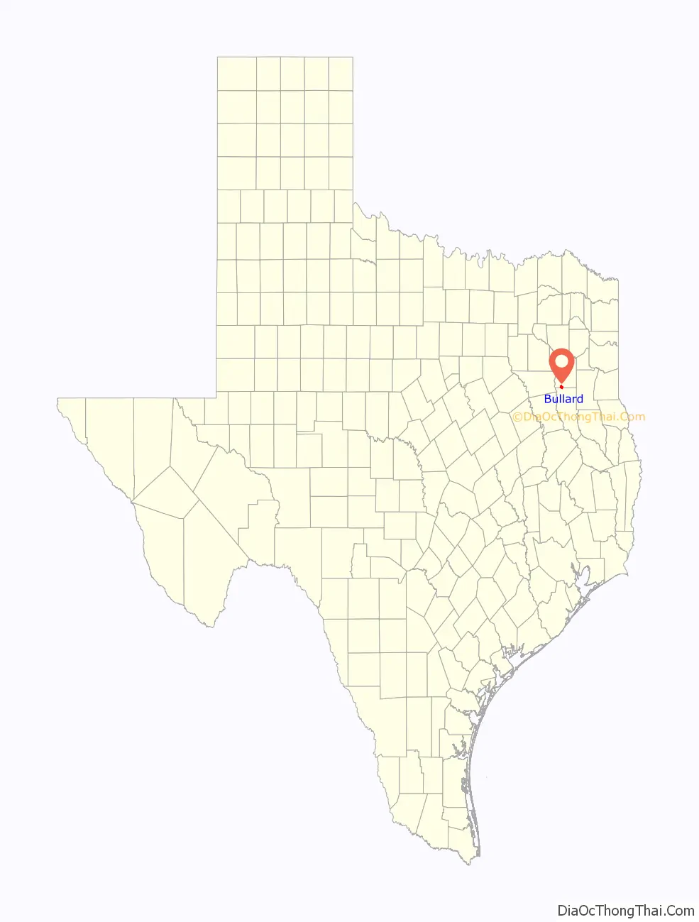
Bullard location map. Where is Bullard town?

History
The Etna post office, just west of Bullard, was granted in 1867, although settlers had been in the vicinity since the early 1850s. John and Emma Bullard arrived about 1870. A new post office named Hewsville was opened in the Bullards’ store in 1881. The Etna post office was closed in 1883 and the Hewsville post office was renamed as Bullard.
When the Kansas and Gulf Short Line Railroad extended its route from Tyler to Lufkin, it passed through Bullard and built a depot there. This attracted new residents and business. In 1890, the town had 200 residents and most essential businesses, plus a doctor and a telegraph office. The railroad was renamed several times – becoming the St. Louis, Arkansas and Texas Railway and then (1892) the Tyler and Southwestern Railway.
In 1903, the two public schools (segregated) had five teachers and 186 students between them. By 1914, the population had doubled to 400 and the railroad changed names once again – becoming the St. Louis Southwestern Railroad.
During the 1920s, a theater opened in town and a community band was formed. The town gained some notoriety for its unique holding tank – a 7-foot-diameter (2.1 m) wooden tub with bars mounted on a wagon frame. When full, the contraption was driven to Tyler for emptying.
The population was 450 after World War II. The community did not organize to elect a city council until 1948.
By the mid-1960s, the population had declined to 300, but it rebounded by 1973, when it reached 573. The community is now concentrated around the crossroads. Most residents commute for work to nearby Tyler.
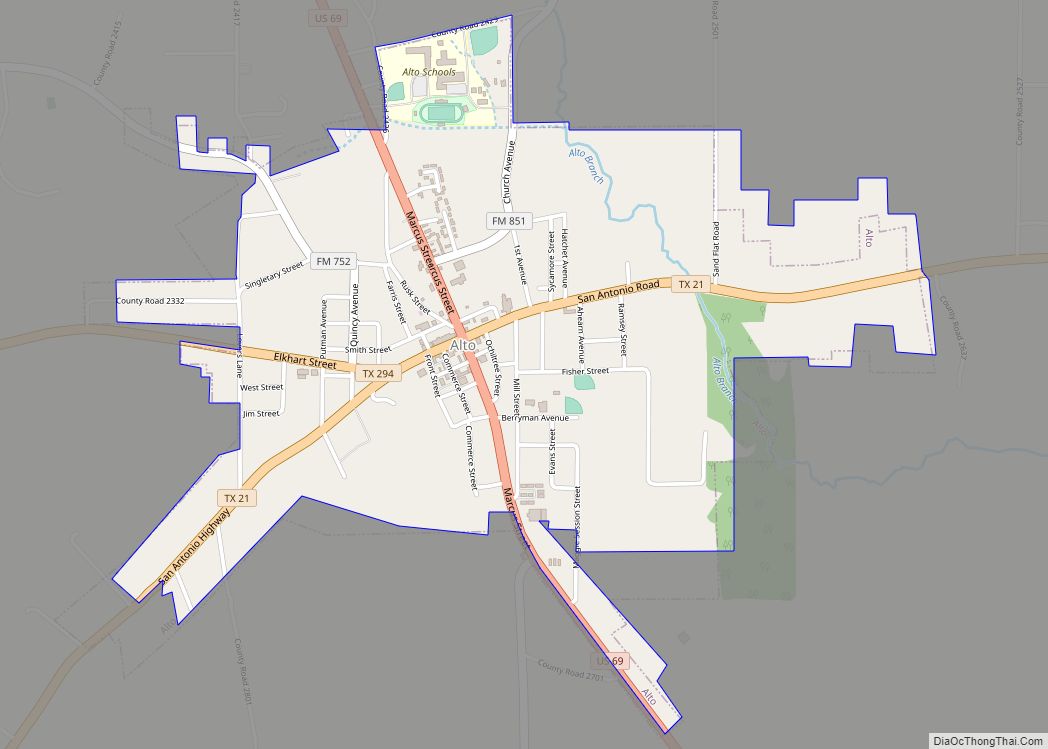
Bullard Road Map
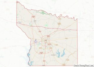
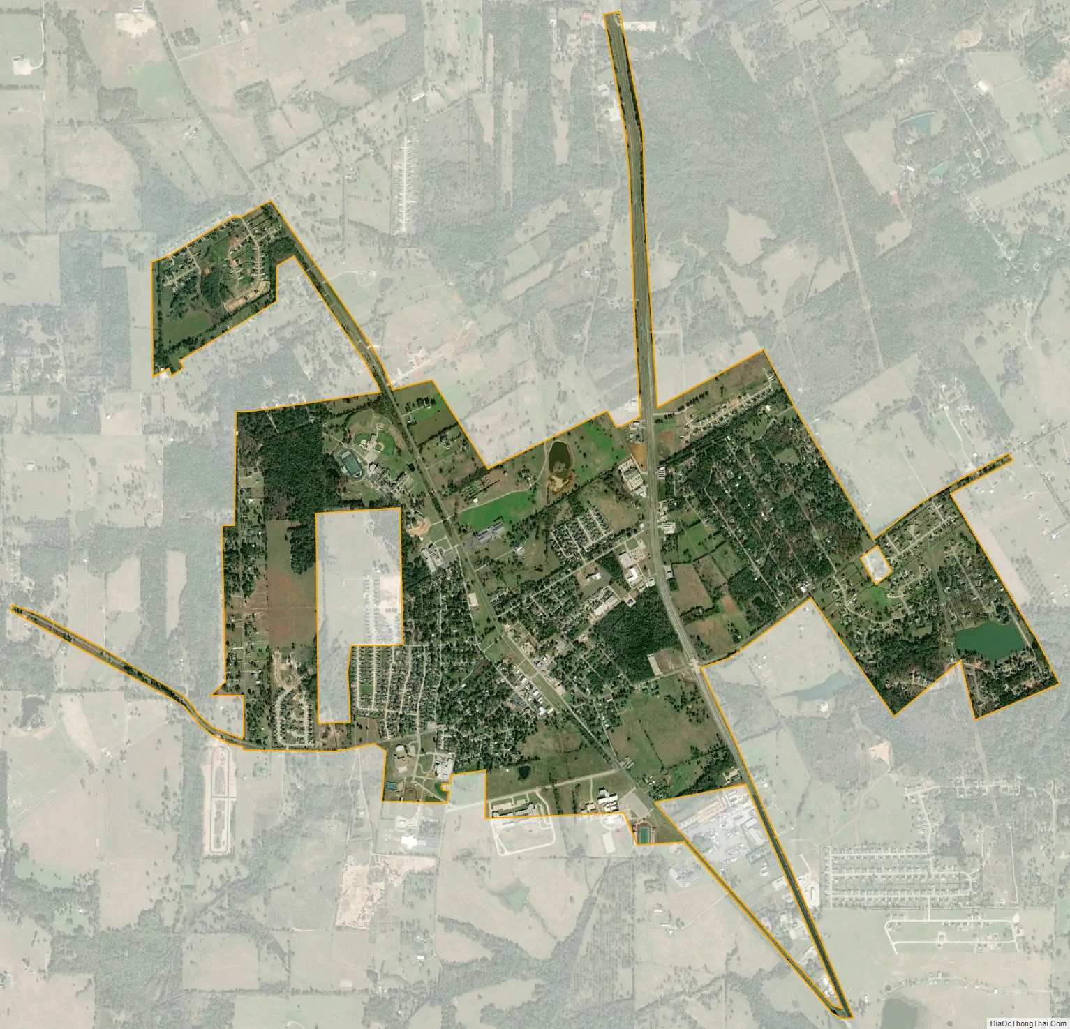
Bullard city Satellite Map
Geography
Bullard is located in southern Smith County, with a small portion extending south into Cherokee County. Four-lane U.S. Route 69 passes through the east side of town, leading north to Tyler and south to Jacksonville.
According to the U.S. Census Bureau, Bullard has a total area of 3.4 square miles (8.7 km), of which 0.01 square miles (0.03 km), or 0.36%, is covered by water.
See also
Map of Texas State and its subdivision:- Anderson
- Andrews
- Angelina
- Aransas
- Archer
- Armstrong
- Atascosa
- Austin
- Bailey
- Bandera
- Bastrop
- Baylor
- Bee
- Bell
- Bexar
- Blanco
- Borden
- Bosque
- Bowie
- Brazoria
- Brazos
- Brewster
- Briscoe
- Brooks
- Brown
- Burleson
- Burnet
- Caldwell
- Calhoun
- Callahan
- Cameron
- Camp
- Carson
- Cass
- Castro
- Chambers
- Cherokee
- Childress
- Clay
- Cochran
- Coke
- Coleman
- Collin
- Collingsworth
- Colorado
- Comal
- Comanche
- Concho
- Cooke
- Coryell
- Cottle
- Crane
- Crockett
- Crosby
- Culberson
- Dallam
- Dallas
- Dawson
- Deaf Smith
- Delta
- Denton
- Dewitt
- Dickens
- Dimmit
- Donley
- Duval
- Eastland
- Ector
- Edwards
- El Paso
- Ellis
- Erath
- Falls
- Fannin
- Fayette
- Fisher
- Floyd
- Foard
- Fort Bend
- Franklin
- Freestone
- Frio
- Gaines
- Galveston
- Garza
- Gillespie
- Glasscock
- Goliad
- Gonzales
- Gray
- Grayson
- Gregg
- Grimes
- Guadalupe
- Hale
- Hall
- Hamilton
- Hansford
- Hardeman
- Hardin
- Harris
- Harrison
- Hartley
- Haskell
- Hays
- Hemphill
- Henderson
- Hidalgo
- Hill
- Hockley
- Hood
- Hopkins
- Houston
- Howard
- Hudspeth
- Hunt
- Hutchinson
- Irion
- Jack
- Jackson
- Jasper
- Jeff Davis
- Jefferson
- Jim Hogg
- Jim Wells
- Johnson
- Jones
- Karnes
- Kaufman
- Kendall
- Kenedy
- Kent
- Kerr
- Kimble
- King
- Kinney
- Kleberg
- Knox
- La Salle
- Lamar
- Lamb
- Lampasas
- Lavaca
- Lee
- Leon
- Liberty
- Limestone
- Lipscomb
- Live Oak
- Llano
- Loving
- Lubbock
- Lynn
- Madison
- Marion
- Martin
- Mason
- Matagorda
- Maverick
- McCulloch
- McLennan
- McMullen
- Medina
- Menard
- Midland
- Milam
- Mills
- Mitchell
- Montague
- Montgomery
- Moore
- Morris
- Motley
- Nacogdoches
- Navarro
- Newton
- Nolan
- Nueces
- Ochiltree
- Oldham
- Orange
- Palo Pinto
- Panola
- Parker
- Parmer
- Pecos
- Polk
- Potter
- Presidio
- Rains
- Randall
- Reagan
- Real
- Red River
- Reeves
- Refugio
- Roberts
- Robertson
- Rockwall
- Runnels
- Rusk
- Sabine
- San Augustine
- San Jacinto
- San Patricio
- San Saba
- Schleicher
- Scurry
- Shackelford
- Shelby
- Sherman
- Smith
- Somervell
- Starr
- Stephens
- Sterling
- Stonewall
- Sutton
- Swisher
- Tarrant
- Taylor
- Terrell
- Terry
- Throckmorton
- Titus
- Tom Green
- Travis
- Trinity
- Tyler
- Upshur
- Upton
- Uvalde
- Val Verde
- Van Zandt
- Victoria
- Walker
- Waller
- Ward
- Washington
- Webb
- Wharton
- Wheeler
- Wichita
- Wilbarger
- Willacy
- Williamson
- Wilson
- Winkler
- Wise
- Wood
- Yoakum
- Young
- Zapata
- Zavala
- Alabama
- Alaska
- Arizona
- Arkansas
- California
- Colorado
- Connecticut
- Delaware
- District of Columbia
- Florida
- Georgia
- Hawaii
- Idaho
- Illinois
- Indiana
- Iowa
- Kansas
- Kentucky
- Louisiana
- Maine
- Maryland
- Massachusetts
- Michigan
- Minnesota
- Mississippi
- Missouri
- Montana
- Nebraska
- Nevada
- New Hampshire
- New Jersey
- New Mexico
- New York
- North Carolina
- North Dakota
- Ohio
- Oklahoma
- Oregon
- Pennsylvania
- Rhode Island
- South Carolina
- South Dakota
- Tennessee
- Texas
- Utah
- Vermont
- Virginia
- Washington
- West Virginia
- Wisconsin
- Wyoming