Map of Early city, Texas

Map of Early city, Texas

Early is a city located in Brown County in west-central Texas, in the United States. It is a suburb of Brownwood, and the population was 2,762 at the 2010 census. It is named for Walter U. Early, who donated land for the schools. It is home to the Early Independent School District and the Heartland … Read more

Map of Eagle Pass city

Map of Eagle Pass city

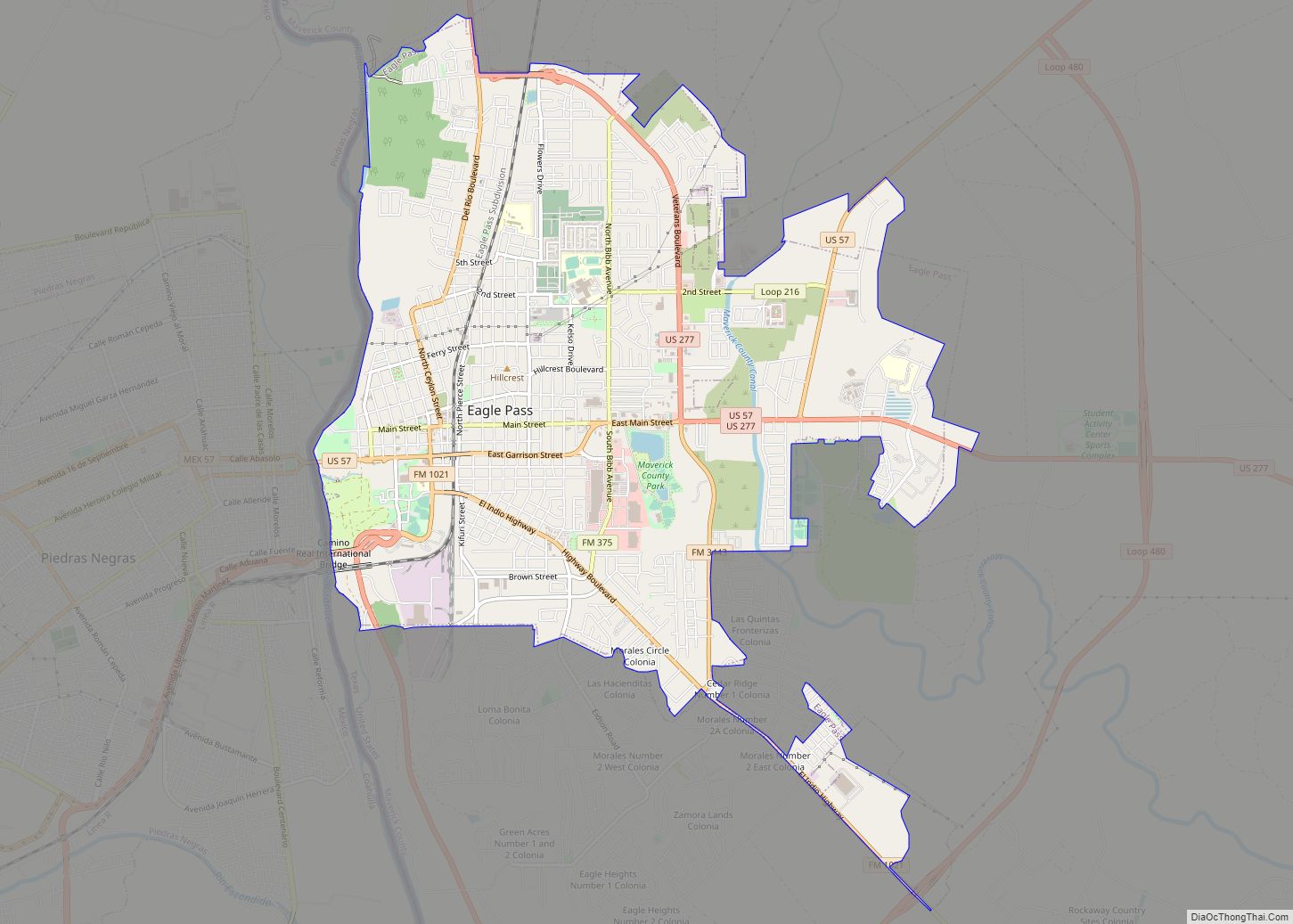
Eagle Pass is a city in and the county seat of Maverick County in the U.S. state of Texas. Its population was 28,130 as of the 2020 census. Eagle Pass borders the city of Piedras Negras, Coahuila, Mexico, which is to the southwest and across the Rio Grande. The Eagle Pass-Piedras Negras metropolitan area (EP-PN) … Read more

Map of Eagle Lake city, Texas

Map of Eagle Lake city, Texas

Eagle Lake is a city in southeastern Colorado County, Texas, United States. The population was 3,442 at the 2020 census. It is home to a golf course, the largest private lake in Texas, and the Eagle Lake Regional Airport, which serves light aircraft. The lake, along with adjacent rice fields, attracts a large variety of … Read more

Map of E. Lopez CDP

Map of E. Lopez CDP

E. Lopez CDP overview: Name: E. Lopez CDP LSAD Code: 57 LSAD Description: CDP (suffix) State: Texas FIPS code: 4823398 Online Interactive Map E. Lopez online map. Source: Basemap layers from Google Map, Open Street Map (OSM), Arcgisonline, Wmflabs. Boundary Data from Database of Global Administrative Areas. E. Lopez location map. Where is E. Lopez … Read more

Map of Duncanville city

Map of Duncanville city

Duncanville is a city in southwest Dallas County, Texas, in the United States. Duncanville’s population was 40,706 at the 2020 census. The city is part of the Best Southwest area, which includes Duncanville, Cedar Hill, DeSoto, and Lancaster. Duncanville city overview: Name: Duncanville city LSAD Code: 25 LSAD Description: city (suffix) State: Texas County: Dallas … Read more

Map of Dumas city, Texas

Map of Dumas city, Texas

Dumas (/ˈdjuːməs/ DEW-məs) is a city in Moore County, Texas, United States. The population was 14,501 at the 2020 census. It is the county seat of Moore County. Located about 40 miles north of Amarillo, the city is named for its founder, Louis Dumas (1856–1923). Dumas Avenue, the main thoroughfare, is also United States Highways … Read more

Map of Eden city, Texas

Map of Eden city, Texas

Eden is a city in Concho County, Texas, United States. The population was 2,766 at the 2010 census. The community is a rural trading center for agricultural products for the many large ranches and farms in West Texas. Eden city overview: Name: Eden city LSAD Code: 25 LSAD Description: city (suffix) State: Texas County: Concho … Read more

Map of Edcouch city

Map of Edcouch city

Edcouch is a city in Hidalgo County, Texas, United States. The population was 3,161 at the 2010 census. It is part of the McAllen–Edinburg–Mission and Reynosa–McAllen metropolitan areas. The town was founded in 1927 and named for Edward Couch, landowner and banker. Edcouch city overview: Name: Edcouch city LSAD Code: 25 LSAD Description: city (suffix) … Read more

Map of Ector city

Map of Ector city

Ector is a city in Fannin County, Texas, United States. The population was 695 at the 2010 census, up from 600 at the 2000 census. Ector city overview: Name: Ector city LSAD Code: 25 LSAD Description: city (suffix) State: Texas County: Fannin County Elevation: 650 ft (198 m) Total Area: 1.17 sq mi (3.04 km²) Land Area: 1.17 sq mi (3.04 km²) Water … Read more

Map of Easton city, Texas

Map of Easton city, Texas

Easton is a city in Gregg and Rusk counties in the U.S. state of Texas. The population was 510 at the 2010 census, and 499 at the 2020 census. “Easton, Texas” is the title of the fourth episode of the CBS Western television series Trackdown, starring Robert Culp as Texas Ranger Hoby Gilman. The episode … Read more

Map of Eastland city

Map of Eastland city

Eastland is a city in Eastland County, Texas, United States. Its population was 3,960 at the 2010 census. It is the county seat of Eastland County. Eastland city overview: Name: Eastland city LSAD Code: 25 LSAD Description: city (suffix) State: Texas County: Eastland County Elevation: 1,440 ft (439 m) Total Area: 4.39 sq mi (11.38 km²) Land Area: 4.36 sq mi (11.30 km²) … Read more

Map of East Tawakoni city

Map of East Tawakoni city

East Tawakoni (/təˈwɑːkəni/ tə-WAH-kə-nee) is a city in Rains County, Texas, United States. The population was 883 at the 2010 census. East Tawakoni is located on the east side of Lake Tawakoni, while its twin city West Tawakoni is located on the west side of the lake. East Tawakoni city overview: Name: East Tawakoni city … Read more