Map of East Tawakoni city

Map of East Tawakoni city

East Tawakoni (/təˈwɑːkəni/ tə-WAH-kə-nee) is a city in Rains County, Texas, United States. The population was 883 at the 2010 census. East Tawakoni is located on the east side of Lake Tawakoni, while its twin city West Tawakoni is located on the west side of the lake. East Tawakoni city overview: Name: East Tawakoni city … Read more

Map of East Mountain city

Map of East Mountain city

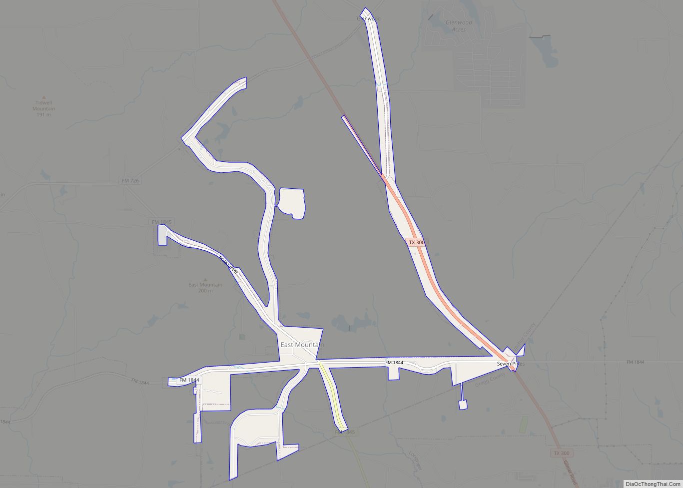
East Mountain is a city in Upshur and Gregg counties, Texas, United States. The population was 899 at the 2020 census, up from 797 at the 2010 census. East Mountain city overview: Name: East Mountain city LSAD Code: 25 LSAD Description: city (suffix) State: Texas County: Gregg County, Upshur County Elevation: 430 ft (131 m) Total Area: … Read more

Map of East Bernard city

Map of East Bernard city

East Bernard is a city in Wharton County, Texas, United States. The population was 2,218 at the 2020 census. U.S. Highway 90 Alternate (US 90A) and Texas State Highway 60 (SH 60) intersect within the city limits. East Bernard has its own school district, two auto dealerships and a number of other businesses. The San Bernard River … Read more

Map of East Alto Bonito CDP

Map of East Alto Bonito CDP

East Alto Bonito is a census-designated place (CDP) in Starr County, Texas, United States. This was a new CDP for the 2010 census with a population of 824. East Alto Bonito CDP overview: Name: East Alto Bonito CDP LSAD Code: 57 LSAD Description: CDP (suffix) State: Texas County: Starr County Total Area: 0.1 sq mi (0.3 km²) Land … Read more

Map of Edinburg city, Texas

Map of Edinburg city, Texas

Edinburg (/ˈɛdɪnbɜːrɡ/ ED-in-burg) is a city in and the county seat of Hidalgo County, Texas, United States. Its population was 74,569 as of the 2010 census, and in 2019, its estimated population was 101,170, making it the second-largest city in Hidalgo County, and the third-largest city in the larger Rio Grande Valley region. Edinburg is … Read more

Map of Edgewood town, Texas

Map of Edgewood town, Texas

Edgewood is a city in Van Zandt County, Texas, United States. The population was 1,441 at the 2010 census. The town draws its name from its location on the far western edge of the East Texas timberline on U.S. Highway 80, approximately 60 miles east of Dallas. Edgewood town overview: Name: Edgewood town LSAD Code: … Read more

Map of Edgewater Estates CDP

Map of Edgewater Estates CDP

Edgewater Estates is a census-designated place (CDP) in San Patricio County, Texas, United States. The population was 72 at the 2010 census. Prior to the 2010 census Edgewater Estates was part of the Edgewater-Paisano CDP. Edgewater Estates CDP overview: Name: Edgewater Estates CDP LSAD Code: 57 LSAD Description: CDP (suffix) State: Texas County: San Patricio … Read more

Map of El Camino Angosto CDP

Map of El Camino Angosto CDP

El Camino Angosto is a census-designated place (CDP) in Cameron County, Texas, United States. The population was 253 at the 2010 census. It is part of the Brownsville–Harlingen Metropolitan Statistical Area. El Camino Angosto CDP overview: Name: El Camino Angosto CDP LSAD Code: 57 LSAD Description: CDP (suffix) State: Texas County: Cameron County Elevation: 36 ft … Read more

Map of El Brazil CDP

Map of El Brazil CDP

El Brazil is a census-designated place (CDP) in Starr County, Texas, United States. This was a new CDP for the 2010 census with a population of 47. El Brazil CDP overview: Name: El Brazil CDP LSAD Code: 57 LSAD Description: CDP (suffix) State: Texas County: Starr County Total Area: 0.2 sq mi (0.5 km²) Land Area: 0.2 sq mi (0.5 km²) … Read more

Map of Eidson Road CDP

Map of Eidson Road CDP

Eidson Road is a census-designated place (CDP) in Maverick County, Texas, United States. The population was 8,960 at the 2010 census. Eidson Road CDP overview: Name: Eidson Road CDP LSAD Code: 57 LSAD Description: CDP (suffix) State: Texas County: Maverick County Elevation: 751 ft (229 m) Total Area: 7.5 sq mi (19.4 km²) Land Area: 7.1 sq mi (18.4 km²) Water Area: 0.4 sq mi … Read more

Map of Edroy CDP

Map of Edroy CDP

Edroy is a census-designated place (CDP) in San Patricio County, Texas, United States. The population was 331 at the 2010 census. Edroy CDP overview: Name: Edroy CDP LSAD Code: 57 LSAD Description: CDP (suffix) State: Texas County: San Patricio County Elevation: 95 ft (29 m) Total Area: 2.1 sq mi (5.4 km²) Land Area: 2.1 sq mi (5.4 km²) Water Area: 0.0 sq mi (0.0 km²) … Read more

Map of Edom city

Map of Edom city

Edom is a city in Van Zandt County, Texas, United States. The population was 375 at the 2010 census. Edom city overview: Name: Edom city LSAD Code: 25 LSAD Description: city (suffix) State: Texas County: Van Zandt County Elevation: 509 ft (155 m) Total Area: 2.55 sq mi (6.60 km²) Land Area: 2.51 sq mi (6.50 km²) Water Area: 0.04 sq mi (0.10 km²) Total Population: … Read more