Map of Grandview city, Texas
Grandview is a city in Johnson County, Texas, United States. The population was 1,561 at the 2010 census and an estimated 1,753 in 2018. David’s Supermarkets, an independent chain of grocery stores, was headquartered in Grandview before being acquired by Brookshire Brothers in 2014. Grandview’s school district was ranked one of the best school districts ... Read more
Map of Grandview city, Texas
Map of Grandfalls town
Grandfalls is a town in Ward County, Texas, United States. It was named for its location near the “grand falls” of the Pecos River, located roughly 3 miles (4.8 km) to the west. Early settlers were attracted to the Grandfalls area in the late 1880s by the steady supply of water flowing in the Pecos River. ... Read more
Map of Grandfalls town
Map of Grand Saline city
Grand Saline is a city in Van Zandt County, Texas, United States, located in East Texas. The population was 3,107 as of 2020, making Grand Saline the third-largest city in Van Zandt County. The city is located roughly 75 miles (120 km) east of Dallas and 35 miles (56 km) northwest of Tyler, the two nearest metropolitan ... Read more
Map of Grand Saline city
Map of Grays Prairie village
Grays Prairie is a village in Kaufman County, Texas, United States. The population was 337 at the 2010 census. Grays Prairie village overview: Name: Grays Prairie village LSAD Code: 47 LSAD Description: village (suffix) State: Texas County: Kaufman County Elevation: 449 ft (137 m) Total Area: 1.22 sq mi (3.17 km²) Land Area: 1.22 sq mi (3.17 km²) Water Area: 0.00 sq mi (0.00 km²) Total ... Read more
Map of Grays Prairie village
Map of Grapevine city
Grapevine is a city located in northeast Tarrant County, Texas, United States, with minor portions extending into Dallas County and Denton County. The city is located in the Mid-Cities suburban region between Dallas and Fort Worth and includes a larger portion of Dallas/Fort Worth International Airport than other cities. The city is adjacent to Grapevine ... Read more
Map of Grapevine city
Map of Grapeland city
Grapeland is a city in Houston County, Texas, United States. Its population was 1,465 as of the 2020 census. Grapeland city overview: Name: Grapeland city LSAD Code: 25 LSAD Description: city (suffix) State: Texas County: Houston County Elevation: 472 ft (144 m) Total Area: 2.59 sq mi (6.70 km²) Land Area: 2.58 sq mi (6.68 km²) Water Area: 0.01 sq mi (0.03 km²) Total Population: 1,465 ... Read more
Map of Grapeland city
Map of Grape Creek CDP
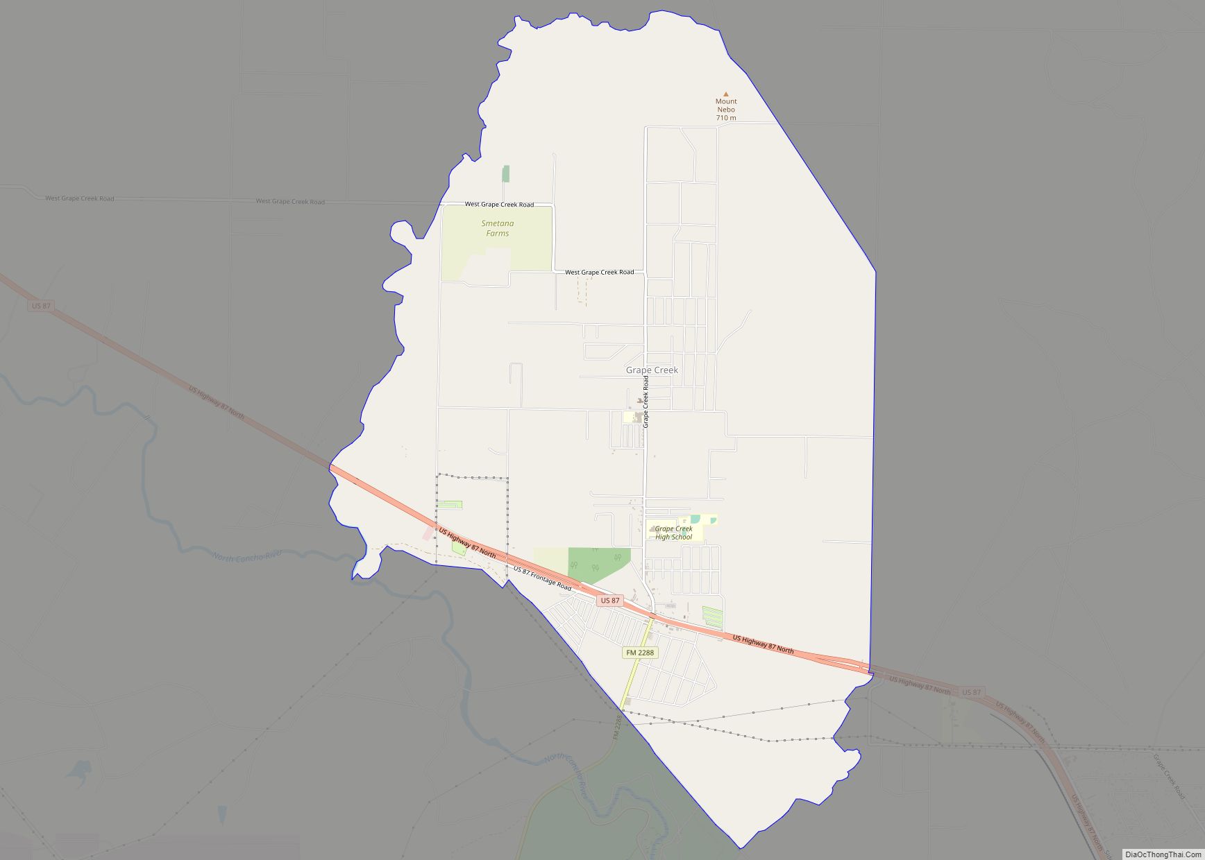
Grape Creek is a census-designated place (CDP) in Tom Green County, Texas, United States. It is part of the San Angelo, Texas Metropolitan Statistical Area. The population of Grape Creek was 3,154 at the 2010 census. Grape Creek CDP overview: Name: Grape Creek CDP LSAD Code: 57 LSAD Description: CDP (suffix) State: Texas County: Tom ... Read more
Map of Grape Creek CDP
Map of Granjeno city
Granjeno is a city in Hidalgo County, Texas, United States. The population was 293 at the 2010 census. The city sits on the banks of the Rio Grande, near the border with Mexico. Its name comes from the granjeno tree (Celtis pallida) or spiny hackberry. Granjeno city overview: Name: Granjeno city LSAD Code: 25 LSAD ... Read more
Map of Granjeno city
Map of Guadalupe Guerra CDP
Guadalupe-Guerra is a census-designated place (CDP) in Starr County, Texas, United States. It is a new CDP formed from part of the Fronton CDP prior to the 2010 census with a population of 37. Guadalupe Guerra CDP overview: Name: Guadalupe Guerra CDP LSAD Code: 57 LSAD Description: CDP (suffix) State: Texas County: Starr County Total ... Read more
Map of Guadalupe Guerra CDP
Map of Gruver city, Texas
Gruver is a city in Hansford County, Texas, United States. The population was 1,162 at the 2010 census. Farwell, in the center of Hansford County about 3 miles east of what became Gruver, was established in 1880 by the Canott family of Illinois, and was the first town in the county. Gruver was established shortly ... Read more
Map of Gruver city, Texas
Map of Groveton city, Texas
Groveton is a city in Trinity County, Texas, United States. The population was 918 at the 2020 census. It is the county seat of Trinity County. Groveton city overview: Name: Groveton city LSAD Code: 25 LSAD Description: city (suffix) State: Texas County: Trinity County Elevation: 328 ft (100 m) Total Area: 2.62 sq mi (6.77 km²) Land Area: 2.58 sq mi (6.69 km²) ... Read more
Map of Groveton city, Texas
Map of Groves city
Groves is a city in Jefferson County, Texas, United States. The population was 17,335 at the 2020 census. It is part of the Beaumont–Port Arthur Metropolitan Statistical Area. Groves city overview: Name: Groves city LSAD Code: 25 LSAD Description: city (suffix) State: Texas County: Jefferson County Elevation: 13 ft (4 m) Total Area: 5.19 sq mi (13.44 km²) Land Area: ... Read more
Map of Groves city