Granjeno is a city in Hidalgo County, Texas, United States. The population was 293 at the 2010 census. The city sits on the banks of the Rio Grande, near the border with Mexico. Its name comes from the granjeno tree (Celtis pallida) or spiny hackberry.
| Name: | Granjeno city |
|---|---|
| LSAD Code: | 25 |
| LSAD Description: | city (suffix) |
| State: | Texas |
| County: | Hidalgo County |
| Elevation: | 108 ft (33 m) |
| Total Area: | 0.30 sq mi (0.79 km²) |
| Land Area: | 0.30 sq mi (0.79 km²) |
| Water Area: | 0.00 sq mi (0.00 km²) |
| Total Population: | 293 |
| Population Density: | 1,036.18/sq mi (400.67/km²) |
| ZIP code: | 78572 |
| Area code: | 956 |
| FIPS code: | 4830608 |
| GNISfeature ID: | 1336821 |
Online Interactive Map
Click on ![]() to view map in "full screen" mode.
to view map in "full screen" mode.
Granjeno location map. Where is Granjeno city?


History
Founded in the late 18th century, Granjeno has a history that predates Texas statehood. Granjeno Cemetery was established in 1872 with burials from both sides of the Rio Grande. By the mid-1930s, the community consisted of several dwellings. A school established in Granjeno by 1948. Our Lady of Fatima Church was established in 1954 on land donated by Jose Concepcion Anzaldua. During the 1960s, growth in the community was stimulated by the development of a colonia. The population was estimated at 545 in 1976. Ten years later, that figure had decreased to 450. On January 26, 1993, Granjeno was incorporated as a city. The population was just over 300 in 2000. Mayor (Yvette Cabrera) and two commissioners (Jennifer Alvarez and Mike Cisneros)
Granjeno is adjacent to the Anzalduas County Park, which is known for its moss-covered trees. Construction on the nearby Anzalduas International Bridge began in mid-2007 and the bridge became operational in late 2009.
El Granjeno Cemetery (Texas Historic Landmark) was established in 1872 with the burial of Don Antonio Garza. His brother, Don Juan Garza Escheverria, donated the surrounding land for use by the communities of El Granjeno and nearby Madero. A native of Reynosa, Mexico, Don Juan (born 1854) is buried there, along with many of his descendants. Specific instructions were spelled out in historic documents that the rear of the cemetery was to be reserved only for the burial of direct descendants of Don Juan Garza Escheverria. Also interred there are veterans of the Civil War, World War I and the Vietnam War.
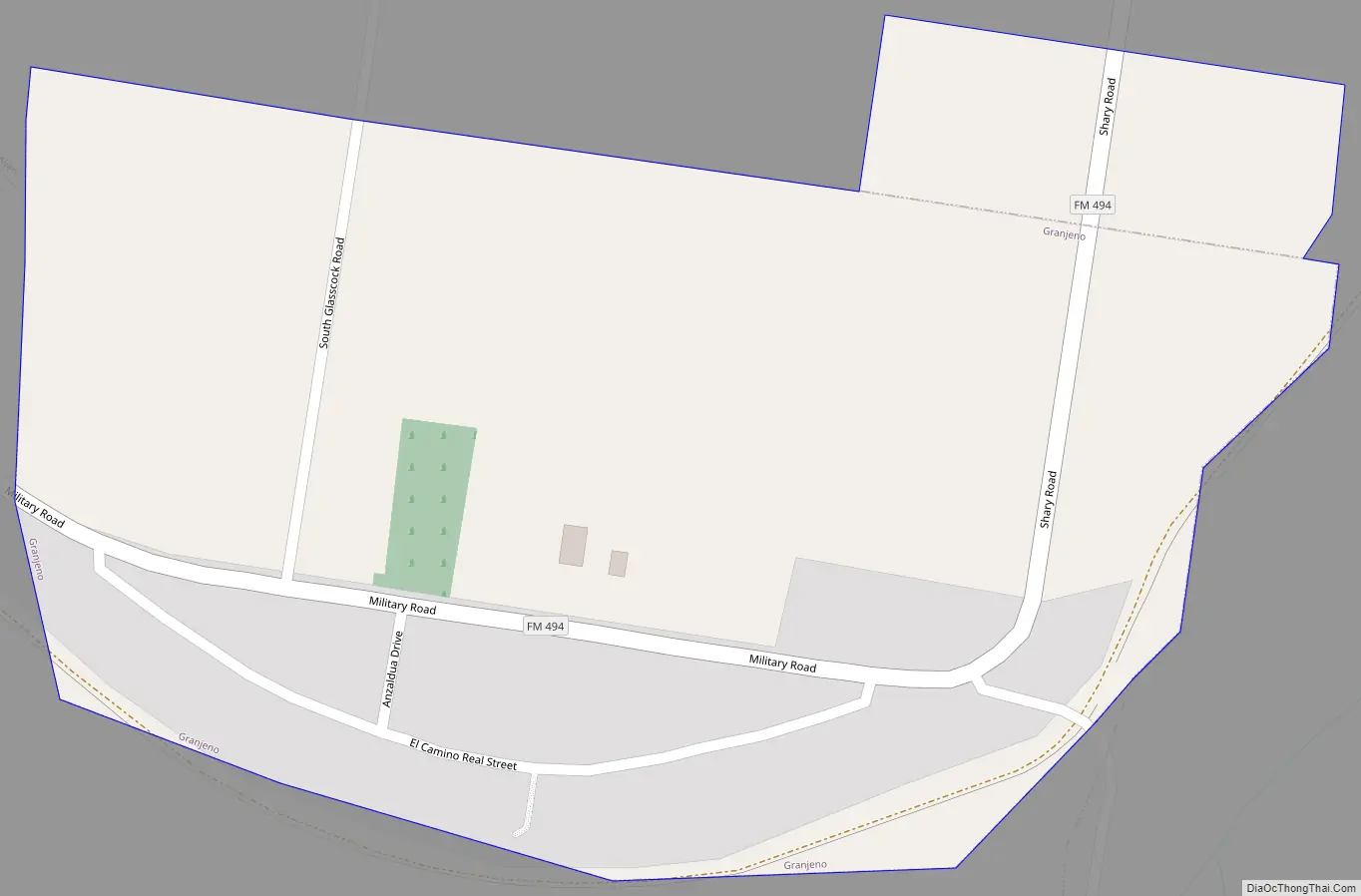
Granjeno Road Map
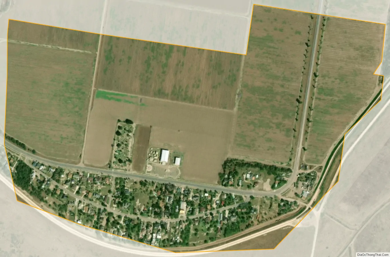
Granjeno city Satellite Map
Geography
Granjeno is located at 26°8′18″N 98°18′13″W / 26.13833°N 98.30361°W / 26.13833; -98.30361 (26.138316, –98.303484). It is situated off the junction of FM 494 and Old Military Road in southern Hidalgo County, approximately four miles southwest of McAllen. According to the United States Census Bureau, the city has a total area of 0.3 square miles (0.78 km), all land.
See also
Map of Texas State and its subdivision:- Anderson
- Andrews
- Angelina
- Aransas
- Archer
- Armstrong
- Atascosa
- Austin
- Bailey
- Bandera
- Bastrop
- Baylor
- Bee
- Bell
- Bexar
- Blanco
- Borden
- Bosque
- Bowie
- Brazoria
- Brazos
- Brewster
- Briscoe
- Brooks
- Brown
- Burleson
- Burnet
- Caldwell
- Calhoun
- Callahan
- Cameron
- Camp
- Carson
- Cass
- Castro
- Chambers
- Cherokee
- Childress
- Clay
- Cochran
- Coke
- Coleman
- Collin
- Collingsworth
- Colorado
- Comal
- Comanche
- Concho
- Cooke
- Coryell
- Cottle
- Crane
- Crockett
- Crosby
- Culberson
- Dallam
- Dallas
- Dawson
- Deaf Smith
- Delta
- Denton
- Dewitt
- Dickens
- Dimmit
- Donley
- Duval
- Eastland
- Ector
- Edwards
- El Paso
- Ellis
- Erath
- Falls
- Fannin
- Fayette
- Fisher
- Floyd
- Foard
- Fort Bend
- Franklin
- Freestone
- Frio
- Gaines
- Galveston
- Garza
- Gillespie
- Glasscock
- Goliad
- Gonzales
- Gray
- Grayson
- Gregg
- Grimes
- Guadalupe
- Hale
- Hall
- Hamilton
- Hansford
- Hardeman
- Hardin
- Harris
- Harrison
- Hartley
- Haskell
- Hays
- Hemphill
- Henderson
- Hidalgo
- Hill
- Hockley
- Hood
- Hopkins
- Houston
- Howard
- Hudspeth
- Hunt
- Hutchinson
- Irion
- Jack
- Jackson
- Jasper
- Jeff Davis
- Jefferson
- Jim Hogg
- Jim Wells
- Johnson
- Jones
- Karnes
- Kaufman
- Kendall
- Kenedy
- Kent
- Kerr
- Kimble
- King
- Kinney
- Kleberg
- Knox
- La Salle
- Lamar
- Lamb
- Lampasas
- Lavaca
- Lee
- Leon
- Liberty
- Limestone
- Lipscomb
- Live Oak
- Llano
- Loving
- Lubbock
- Lynn
- Madison
- Marion
- Martin
- Mason
- Matagorda
- Maverick
- McCulloch
- McLennan
- McMullen
- Medina
- Menard
- Midland
- Milam
- Mills
- Mitchell
- Montague
- Montgomery
- Moore
- Morris
- Motley
- Nacogdoches
- Navarro
- Newton
- Nolan
- Nueces
- Ochiltree
- Oldham
- Orange
- Palo Pinto
- Panola
- Parker
- Parmer
- Pecos
- Polk
- Potter
- Presidio
- Rains
- Randall
- Reagan
- Real
- Red River
- Reeves
- Refugio
- Roberts
- Robertson
- Rockwall
- Runnels
- Rusk
- Sabine
- San Augustine
- San Jacinto
- San Patricio
- San Saba
- Schleicher
- Scurry
- Shackelford
- Shelby
- Sherman
- Smith
- Somervell
- Starr
- Stephens
- Sterling
- Stonewall
- Sutton
- Swisher
- Tarrant
- Taylor
- Terrell
- Terry
- Throckmorton
- Titus
- Tom Green
- Travis
- Trinity
- Tyler
- Upshur
- Upton
- Uvalde
- Val Verde
- Van Zandt
- Victoria
- Walker
- Waller
- Ward
- Washington
- Webb
- Wharton
- Wheeler
- Wichita
- Wilbarger
- Willacy
- Williamson
- Wilson
- Winkler
- Wise
- Wood
- Yoakum
- Young
- Zapata
- Zavala
- Alabama
- Alaska
- Arizona
- Arkansas
- California
- Colorado
- Connecticut
- Delaware
- District of Columbia
- Florida
- Georgia
- Hawaii
- Idaho
- Illinois
- Indiana
- Iowa
- Kansas
- Kentucky
- Louisiana
- Maine
- Maryland
- Massachusetts
- Michigan
- Minnesota
- Mississippi
- Missouri
- Montana
- Nebraska
- Nevada
- New Hampshire
- New Jersey
- New Mexico
- New York
- North Carolina
- North Dakota
- Ohio
- Oklahoma
- Oregon
- Pennsylvania
- Rhode Island
- South Carolina
- South Dakota
- Tennessee
- Texas
- Utah
- Vermont
- Virginia
- Washington
- West Virginia
- Wisconsin
- Wyoming


