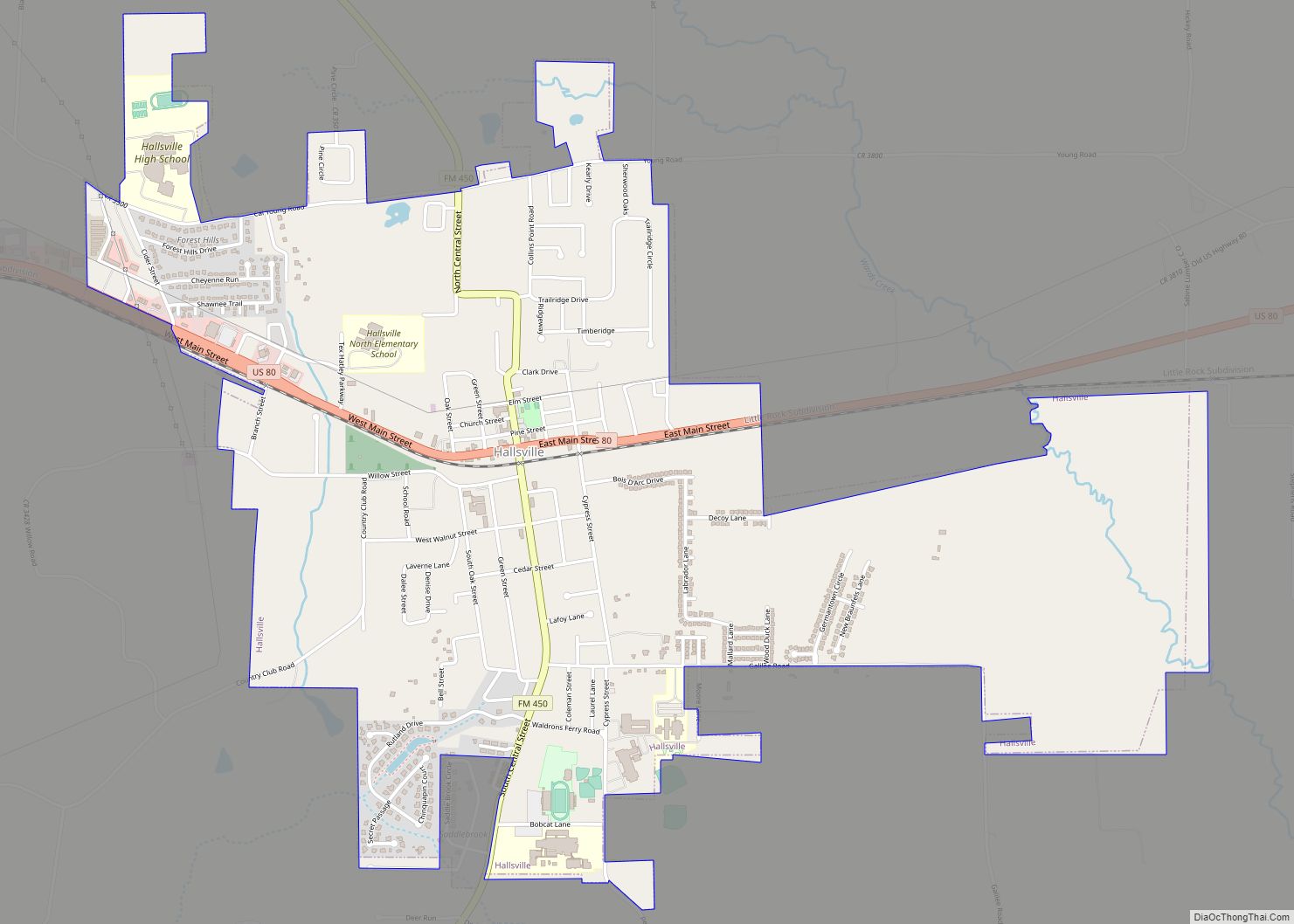
Map of Hamilton city, Texas

Map of Hamilton city, Texas

Hamilton is a city in and the county seat of Hamilton County, Texas, United States, located in the state’s central region. Its population was 3,095 at the 2010 census. Hamilton city overview: Name: Hamilton city LSAD Code: 25 LSAD Description: city (suffix) State: Texas County: Hamilton County Elevation: 1,168 ft (356 m) Total Area: 3.53 sq mi (9.15 km²) Land … Read more

Map of Haltom City city

Map of Haltom City

Haltom City is a city, part of the Dallas–Fort Worth region, in Tarrant County, Texas, United States. Its population was 46,073 at the 2020 census. Haltom City is an inner suburb of Fort Worth, a principal city of the DFW Metroplex. The city is 6 miles from downtown Fort Worth, 30 miles from the American … Read more

Map of Hawkins city

Map of Hawkins city, Texas

Hawkins is a city in Wood County, Texas, United States. The population was 1,274 at the 2020 census. It is located twenty miles north of the larger city of Tyler. Just east of the community is Jarvis Christian University, a historically black institution of higher learning. Hawkins city overview: Name: Hawkins city LSAD Code: 25 … Read more

Map of Hawk Cove city

Map of Hawk Cove city

Hawk Cove is a city in Hunt County, Texas, United States. The population was recorded as 483 at the 2010 census. Hawk Cove and Hunt County are both part of the Dallas–Fort Worth–Arlington Metropolitan Statistical Area. Hawk Cove city overview: Name: Hawk Cove city LSAD Code: 25 LSAD Description: city (suffix) State: Texas County: Hunt … Read more

Map of Havana CDP, Texas

Map of Havana CDP, Texas

Havana is a census-designated place (CDP) in Hidalgo County, Texas. The population was 407 at the 2010 United States Census. It is part of the McAllen–Edinburg–Mission Metropolitan Statistical Area. Havana CDP overview: Name: Havana CDP LSAD Code: 57 LSAD Description: CDP (suffix) State: Texas County: Hidalgo County Elevation: 157 ft (48 m) Total Area: 0.8 sq mi (2.1 km²) Land … Read more

Map of Haslet city

Map of Haslet city

Haslet is a city in mostly Tarrant County and partly in Denton County within the Dallas–Fort Worth metroplex in the U.S. state of Texas, and is located 15 miles north of downtown Fort Worth and 20 miles south of Denton. Haslet borders Interstate 35W, U.S. Highway 287, and Alliance Airport. Haslet city overview: Name: Haslet … Read more

Map of Haskell city, Texas

Map of Haskell city, Texas

Haskell is a city in central Haskell County, Texas, in the United States. As of the 2010 census, the city population was 3,322. It is the Haskell county seat. Haskell city overview: Name: Haskell city LSAD Code: 25 LSAD Description: city (suffix) State: Texas County: Haskell County Elevation: 1,581 ft (482 m) Total Area: 3.60 sq mi (9.32 km²) Land … Read more

Map of Hartley CDP, Texas

Map of Hartley CDP, Texas

Hartley is a census-designated place (CDP) in Hartley County, Texas, United States. The population was 540 at the 2010 census. Hartley CDP overview: Name: Hartley CDP LSAD Code: 57 LSAD Description: CDP (suffix) State: Texas County: Hartley County Elevation: 3,908 ft (1,191 m) Total Area: 7.0 sq mi (18.1 km²) Land Area: 7.0 sq mi (18.1 km²) Water Area: 0.0 sq mi (0.0 km²) Total Population: … Read more

Map of Hart city, Texas

Map of Hart city, Texas

Hart is a city in Castro County, Texas, United States. The population was 1,114 at the 2010 census. Hart city overview: Name: Hart city LSAD Code: 25 LSAD Description: city (suffix) State: Texas County: Castro County Elevation: 3,671 ft (1,119 m) Total Area: 0.74 sq mi (1.92 km²) Land Area: 0.74 sq mi (1.91 km²) Water Area: 0.00 sq mi (0.01 km²) Total Population: 1,114 Population … Read more

Map of Harper CDP, Texas

Map of Harper CDP, Texas

Harper is an unincorporated community and census-designated place (CDP), located 23 miles (37 km) west of Fredericksburg on U.S. Highway 290, in Gillespie County, in the U.S. state of Texas. The population was 1,192 at the 2010 census. Harper CDP overview: Name: Harper CDP LSAD Code: 57 LSAD Description: CDP (suffix) State: Texas County: Gillespie County … Read more

Map of Hays city, Texas

Map of Hays city, Texas

Hays is a city in Hays County, Texas, United States. The population was 217 at the 2010 census. Hays city overview: Name: Hays city LSAD Code: 25 LSAD Description: city (suffix) State: Texas County: Hays County Elevation: 728 ft (222 m) Total Area: 0.22 sq mi (0.58 km²) Land Area: 0.22 sq mi (0.58 km²) Water Area: 0.00 sq mi (0.00 km²) Total Population: 217 Population … Read more

Map of Hawley city, Texas

Map of Hawley city, Texas

Hawley is a city in Jones County, Texas, United States. The population was 634 at the 2010 census. Named for Congressman Robert B. Hawley, it is part of the Abilene metropolitan area. Hawley city overview: Name: Hawley city LSAD Code: 25 LSAD Description: city (suffix) State: Texas County: Jones County Elevation: 1,640 ft (500 m) Total Area: … Read more