Map of Lakewood Village city

Map of Lakewood Village city

Lakewood Village is a city in Denton County, Texas, United States located near Lewisville Lake. The population was 545 at the 2010 census. Lakewood Village city overview: Name: Lakewood Village city LSAD Code: 25 LSAD Description: city (suffix) State: Texas County: Denton County Elevation: 561 ft (171 m) Total Area: 2.32 sq mi (3.74 km²) Land Area: 0.8 sq mi (1.29 km²) Water … Read more

Map of Lakeway city

Map of Lakeway city

Lakeway is a city in Travis County, Texas, United States. The population was 19,189 at the 2020 census; up from 11,391 in 2010. The city is located next to Lake Travis. It is an exurb in Greater Austin. Lakeway city overview: Name: Lakeway city LSAD Code: 25 LSAD Description: city (suffix) State: Texas County: Travis … Read more

Map of Lakeview town, Texas

Map of Lakeview town, Texas

Lakeview is a town in Hall County, Texas, United States. The population was 107 at the 2010 census, down from 152 at the 2000 census. Lakeview town overview: Name: Lakeview town LSAD Code: 43 LSAD Description: town (suffix) State: Texas County: Hall County Elevation: 2,129 ft (649 m) Total Area: 0.21 sq mi (0.53 km²) Land Area: 0.21 sq mi (0.53 km²) Water … Read more

Map of Lakeside town, Texas

Map of Lakeside town, Texas

Lakeside is a town in Tarrant County, Texas, United States. The population was 1,307 at the 2010 census. Lakeside town overview: Name: Lakeside town LSAD Code: 43 LSAD Description: town (suffix) State: Texas County: Tarrant County Total Area: 1.75 sq mi (4.52 km²) Land Area: 1.75 sq mi (4.52 km²) Water Area: 0.00 sq mi (0.00 km²) Total Population: 1,307 Population Density: 912.89/sq mi (352.44/km²) … Read more

Map of Lakeside City town

Map of Lakeside City town

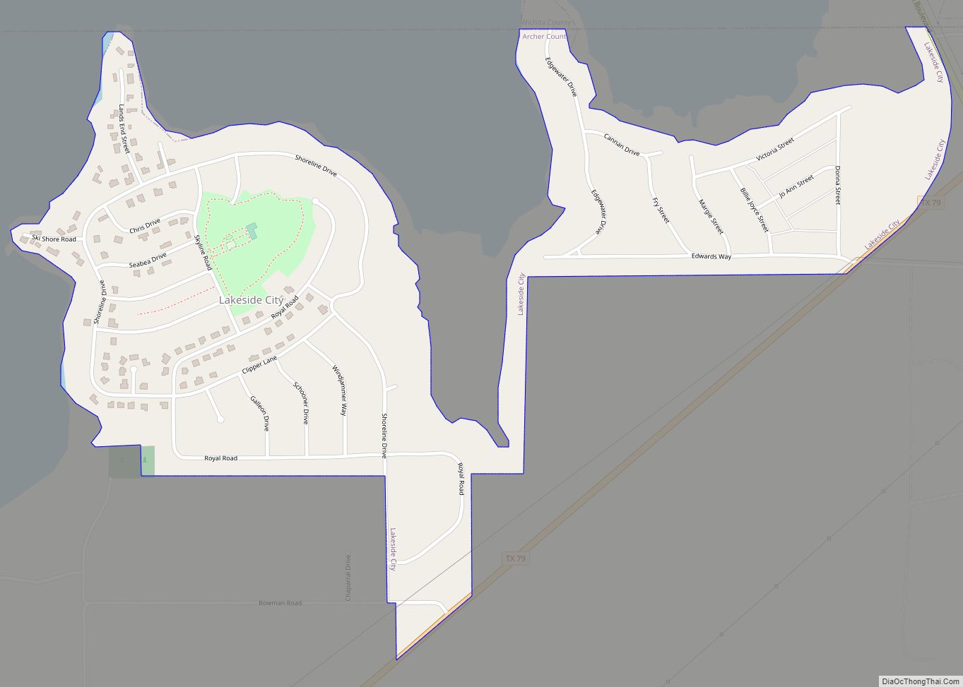
Lakeside City is a town in Archer County, Texas, United States. It is part of the Wichita Falls, Texas Metropolitan Statistical Area. The population was 997 at the 2010 census. Lakeside City town overview: Name: Lakeside City town LSAD Code: 43 LSAD Description: town (suffix) State: Texas County: Archer County Elevation: 1,004 ft (306 m) Total Area: … Read more

Map of Lakeshore Gardens-Hidden Acres CDP

Map of Lakeshore Gardens-Hidden Acres CDP

Lakeshore Gardens-Hidden Acres is a census-designated place (CDP) in San Patricio County, Texas, United States. The population was 504 at the 2010 census. Lakeshore Gardens-Hidden Acres CDP overview: Name: Lakeshore Gardens-Hidden Acres CDP LSAD Code: 57 LSAD Description: CDP (suffix) State: Texas County: San Patricio County Total Area: 2.0 sq mi (5.1 km²) Land Area: 2.0 sq mi (5.1 km²) Water … Read more

Map of Lantana CDP, Texas

Map of Lantana CDP, Texas

Lantana is an upscale census-designated place (CDP) and master-planned community originally developed by Republic Property Group, 8 miles (13 km) south of Denton in unincorporated Denton County, Texas, United States. The population of the CDP at the 2010 census was 6,874. Lantana had 3,274 occupied homes as of December 31, 2015, with an estimated population of … Read more

Map of Las Quintas Fronterizas CDP

Map of Las Quintas Fronterizas CDP

Las Quintas Fronterizas is a census-designated place (CDP) in Maverick County, Texas, United States. The population was 2,030 at the 2000 census. Las Quintas Fronterizas CDP overview: Name: Las Quintas Fronterizas CDP LSAD Code: 57 LSAD Description: CDP (suffix) State: Texas County: Maverick County Elevation: 745 ft (227 m) Total Area: 0.7 sq mi (1.7 km²) Land Area: 0.7 sq mi (1.7 km²) … Read more

Map of Las Pilas CDP

Map of Las Pilas CDP

Las Pilas is a census-designated place (CDP) in Webb County, Texas, United States. This was a new CDP formed from parts of the Ranchitos Las Lomas CDP prior to the 2010 census with a population of 28. Las Pilas CDP overview: Name: Las Pilas CDP LSAD Code: 57 LSAD Description: CDP (suffix) State: Texas County: … Read more

Map of Las Palmas CDP

Map of Las Palmas CDP

Las Palmas is a census-designated place (CDP) in Zapata County in the U.S. state of Texas. It was a new CDP from the 2010 census with a population of 67. It is part of the Zapata Micropolitan Statistical Area. Las Palmas CDP overview: Name: Las Palmas CDP LSAD Code: 57 LSAD Description: CDP (suffix) State: … Read more

Map of Las Palmas II CDP

Map of Las Palmas II CDP

Las Palmas II is a census-designated place (CDP) in Cameron County, in the U.S. state of Texas. (The “II” distinguishes the CDP from Las Palmas, a CDP in Zapata County, Texas.) The population was 1,605 at the 2010 census. Prior to the 2010 census the community was part of the Las Palmas-Juarez CDP. It is … Read more

Map of Las Lomitas CDP

Map of Las Lomitas CDP

Las Lomitas is an unincorporated community and census-designated place (CDP) in Jim Hogg County, Texas, United States. The population was 244 at the 2010 census. Las Lomitas CDP overview: Name: Las Lomitas CDP LSAD Code: 57 LSAD Description: CDP (suffix) State: Texas County: Jim Hogg County Elevation: 571 ft (174 m) Total Area: 3.9 sq mi (10.2 km²) Land Area: … Read more