Map of Navasota city

Map of Navasota city

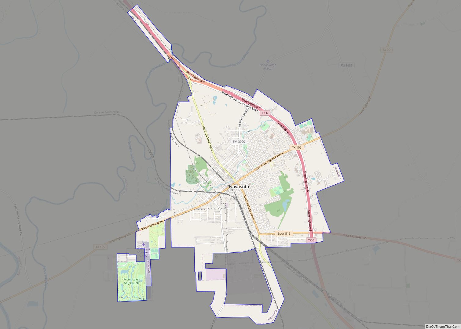
Navasota is a city in Grimes County, Texas, United States. The population was 7,643 at the 2020 census. In 2005, the Texas Legislature designated Navasota as the “Blues Capital of Texas” in honor of the late Mance Lipscomb, a Navasota native and blues musician. Navasota city overview: Name: Navasota city LSAD Code: 25 LSAD Description: … Read more

Map of Navarro town

Map of Navarro town

Navarro (/nəˈværoʊ/ nə-VARR-oh) is a town in Navarro County, Texas, United States. The population was 210 at the 2010 census. Navarro town overview: Name: Navarro town LSAD Code: 43 LSAD Description: town (suffix) State: Texas County: Navarro County Elevation: 417 ft (127 m) Total Area: 0.67 sq mi (1.73 km²) Land Area: 0.67 sq mi (1.73 km²) Water Area: 0.00 sq mi (0.00 km²) Total Population: … Read more

Map of Natalia city

Map of Natalia city

Natalia is a city in Medina County, Texas, United States. The population was 1,202 at the 2020 census. It was founded in 1912 and was named after Natalie Pearson Nicholson, daughter of Frederick Stark Pearson, engineer, designer and builder of the Medina Dam. Natalia is part of the San Antonio Metropolitan Statistical Area. Natalia city … Read more

Map of Nassau Bay city

Map of Nassau Bay city

Nassau Bay is a city in Harris County, Texas, United States, bordering the outermost southeastern edge of the city of Houston. It is located in the Clear Lake Area near Galveston Bay, directly adjacent to the Lyndon B. Johnson Space Center. The population was 5,347 at the 2020 census. Nassau Bay city overview: Name: Nassau … Read more

Map of Nash city, Texas

Map of Nash city, Texas

Nash is a city in Bowie County, Texas, United States, and a suburb of Texarkana. It is part of the Texarkana metropolitan area. The population was 2,960 at the 2010 census, up from 2,169 at the 2000 census. In 2020, its population was 3,814, representing continued population growth as a suburban community. Nash city overview: … Read more

Map of Narciso Pena CDP

Map of Narciso Pena CDP

Narciso Pena is a census-designated place (CDP) in Starr County, Texas, United States. This was a new CDP for the 2010 census with a population of 30. Narciso Pena CDP overview: Name: Narciso Pena CDP LSAD Code: 57 LSAD Description: CDP (suffix) State: Texas County: Starr County Total Area: 30 FIPS code: 4850322 Online Interactive … Read more

Map of Naples city, Texas

Map of Naples city, Texas

Naples is a city in Morris County, Texas, United States. The population was 1,378 at the 2010 census. Naples city overview: Name: Naples city LSAD Code: 25 LSAD Description: city (suffix) State: Texas County: Morris County Elevation: 407 ft (124 m) Total Area: 2.38 sq mi (6.18 km²) Land Area: 2.37 sq mi (6.13 km²) Water Area: 0.02 sq mi (0.05 km²) Total Population: 1,378 Population … Read more

Map of Nacogdoches city

Map of Nacogdoches city

Nacogdoches (/ˌnækəˈdoʊtʃɪs/ NAK-ə-DOH-chis) is a small city in deep East Texas and the county seat of Nacogdoches County, Texas, United States. The 2020 U.S. census recorded the city’s population at 32,147. Stephen F. Austin State University is located in Nacogdoches and specializes in forestry and agriculture. Nacogdoches city overview: Name: Nacogdoches city LSAD Code: 25 … Read more

Map of Myrtle Springs CDP

Map of Myrtle Springs CDP

Myrtle Springs is a census-designated place (CDP) in Van Zandt County, Texas, United States. It was a new CDP for the 2010 census with a population of 828. Myrtle Springs CDP overview: Name: Myrtle Springs CDP LSAD Code: 57 LSAD Description: CDP (suffix) State: Texas County: Van Zandt County Total Area: 7.4 sq mi (19.2 km²) Land Area: … Read more

Map of Mustang town, Texas

Map of Mustang town, Texas

Mustang is a town in Navarro County, Texas, United States. The population was zero at the 2020 census. In December 2021, Mark Cuban, entrepreneur and owner of the Dallas Mavericks, purchased the 77-acre (31 ha) town for roughly $2 million. Mustang town overview: Name: Mustang town LSAD Code: 43 LSAD Description: town (suffix) State: Texas County: Navarro … Read more

Map of New Chapel Hill city

Map of New Chapel Hill city

New Chapel Hill is a city in Smith County, Texas, United States. The population was 620 at the 2020 census. It is part of the Tyler, Texas Metropolitan Statistical Area. New Chapel Hill city overview: Name: New Chapel Hill city LSAD Code: 25 LSAD Description: city (suffix) State: Texas County: Smith County Elevation: 430 ft (131 m) … Read more

Map of New Braunfels city

Map of New Braunfels city

New Braunfels (/ˈbrɔːnfəlz/ (listen) BRAWN-fəlz) is a city in Comal and Guadalupe counties in the U.S. state of Texas known for its German Texan heritage. It is the seat of Comal County. The city covers 44.9 square miles (116 km) and had a population of 90,403 as of the 2020 Census. A suburb just north of … Read more