Map of Orange Grove city

Map of Orange Grove city

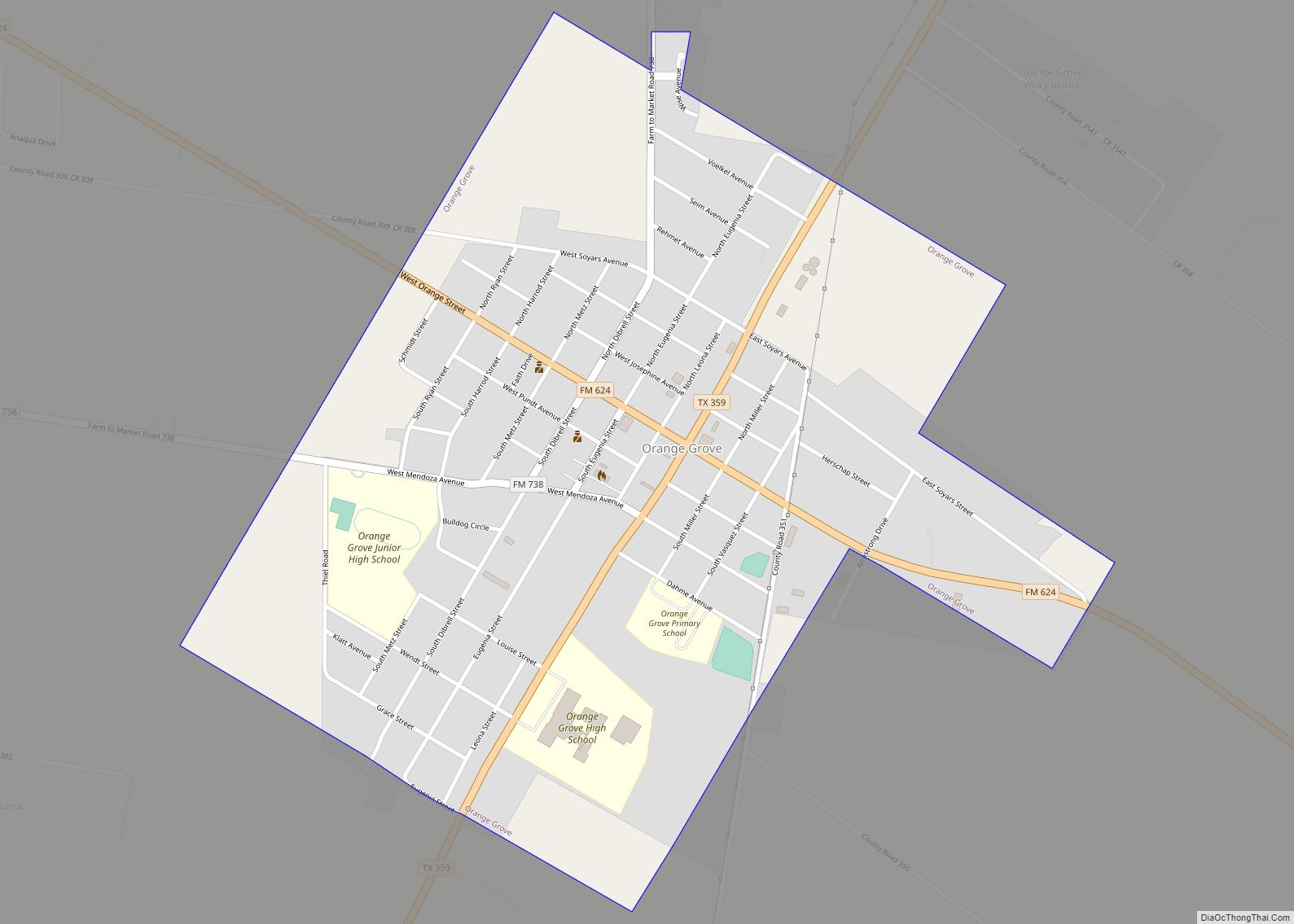
Orange Grove is a city in Jim Wells County, Texas, United States. The population was 1,318 at the 2010 census. Orange Grove city overview: Name: Orange Grove city LSAD Code: 25 LSAD Description: city (suffix) State: Texas County: Jim Wells County Elevation: 194 ft (59 m) Total Area: 1.08 sq mi (6,969 km²) Land Area: 1.08 sq mi (2.80 km²) Water Area: 0.00 sq mi … Read more

Map of Opdyke West town

Map of Opdyke West town

Opdyke West (pronounced “Oh-Pee-Dyke”) is a town in Hockley County, Texas, United States. The population was 174 at the 2010 census. It takes its name from the nearby community of Opdyke, founded 1925, which was named either for Charles W. Opdyke, railroad director, or for the family of W. A. Dykes, who established the first … Read more

Map of Onalaska city

Map of Onalaska city, Texas

Onalaska is a city in Polk County, Texas, United States. Situated on a peninsula between the main channel and one arm of Lake Livingston, the population was 3,020 at the 2020 census. Onalaska city overview: Name: Onalaska city LSAD Code: 25 LSAD Description: city (suffix) State: Texas County: Polk County Elevation: 177 ft (54 m) Total Area: … Read more

Map of Omaha city, Texas

Map of Omaha city, Texas

Omaha is a city in Morris County, northeast Texas, United States. The population at the 2010 U.S. Census was 1,024. Omaha city overview: Name: Omaha city LSAD Code: 25 LSAD Description: city (suffix) State: Texas County: Morris County Elevation: 400 ft (122 m) Total Area: 1.46 sq mi (3.78 km²) Land Area: 1.45 sq mi (3.76 km²) Water Area: 0.01 sq mi (0.02 km²) Total Population: … Read more

Map of Olton city

Map of Olton city

Olton is a city in Lamb County, Texas, United States. The population was 2,215 at the 2010 census. Olton city overview: Name: Olton city LSAD Code: 25 LSAD Description: city (suffix) State: Texas County: Lamb County Elevation: 3,612 ft (1,101 m) Total Area: 1.36 sq mi (3.52 km²) Land Area: 1.36 sq mi (3.52 km²) Water Area: 0.00 sq mi (0.00 km²) Total Population: 2,215 Population … Read more

Map of Olney city, Texas

Map of Olney city, Texas

Olney is a city in Young County, Texas, United States. Its population was 3,007 in 2020. Olney city overview: Name: Olney city LSAD Code: 25 LSAD Description: city (suffix) State: Texas County: Young County Elevation: 1,184 ft (361 m) Total Area: 2.03 sq mi (5.25 km²) Land Area: 2.02 sq mi (5.24 km²) Water Area: 0.01 sq mi (0.01 km²) Total Population: 3,007 Population Density: 1,531.88/sq mi … Read more

Map of Olmos Park city

Map of Olmos Park city

Olmos Park is a city in Bexar County, Texas, United States. The population was 2,237 at the 2010 census. The town is noted for its park-like setting, oak-tree lined streets, and large estates, many of which were constructed during the 1920s. The town is four miles north of downtown San Antonio and is surrounded by … Read more

Map of Olmito CDP

Map of Olmito CDP

Olmito is a census-designated place (CDP) in Cameron County, Texas, United States. Olmito is Spanish for “little elm”. The population was 1,210 at the 2010 census. It is part of the Brownsville–Harlingen Metropolitan Statistical Area. Olmito is the self-described “mesquite capital of the world.” Olmito CDP overview: Name: Olmito CDP LSAD Code: 57 LSAD Description: … Read more

Map of Ore City city

Map of Ore City

Ore City is a city in Upshur County, Texas, United States. The population was 1,108 at the 2020 census. Ore City overview: Name: Ore City LSAD Code: 25 LSAD Description: city (suffix) State: Texas County: Upshur County Elevation: 328 ft (100 m) Total Area: 2.18 sq mi (5.65 km²) Land Area: 2.16 sq mi (5.59 km²) Water Area: 0.02 sq mi (0.06 km²) Total Population: 1,108 … Read more

Map of Orchard city, Texas

Map of Orchard city, Texas

Orchard is a city in western Fort Bend County, Texas, United States, within the Houston–Sugar Land–Baytown metropolitan area. The community is located along State Highway 36 (SH 36) and the BNSF Railway between Rosenberg in Fort Bend County and Wallis in Austin County. The population was 352 at the 2010 census, down from 408 at the 2000 … Read more

Map of Paint Rock town, Texas

Map of Paint Rock town, Texas

Paint Rock is a town in and the county seat of Concho County, Texas, United States. The population was 273 at the 2010 census, down from 320 at the 2000 census. The town’s name comes from Indian pictographs painted on cliffs overlooking the nearby Concho River. These pictographs cover nearly half a mile upstream from … Read more

Map of Paducah town, Texas

Map of Paducah town, Texas

Paducah is a town in Cottle County, Texas, United States. The population was 1,186 at the 2010 census, down from 1,498 in 2000. It is the county seat of Cottle County. It is just south of the Texas Panhandle and east of the Llano Estacado. Paducah town overview: Name: Paducah town LSAD Code: 43 LSAD … Read more