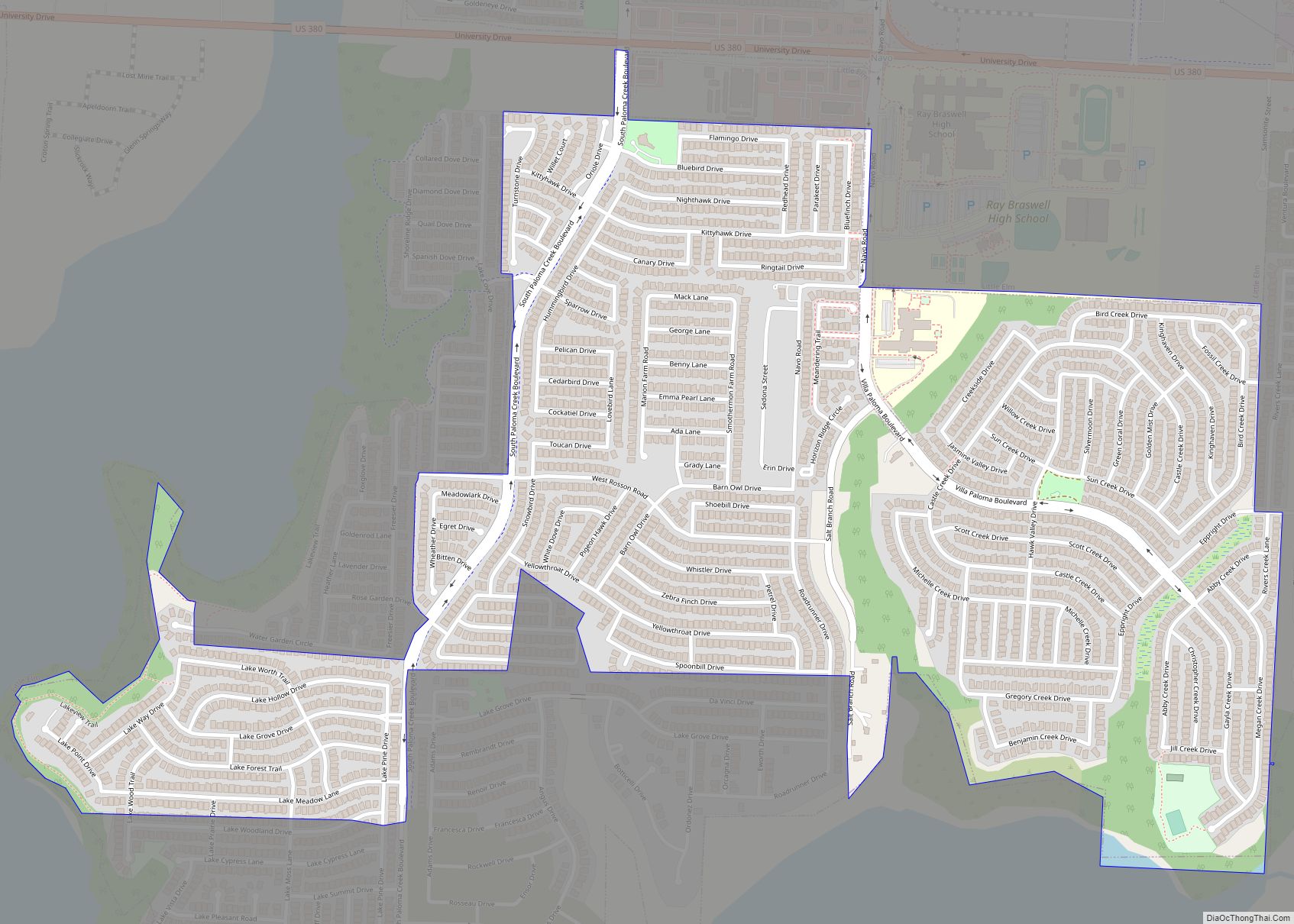
Map of Paris city, Texas

Map of Paris city, Texas

Paris is a city and county seat of Lamar County, Texas, United States. Located in Northeast Texas at the western edge of the Piney Woods, the population of the city was 24,171 in 2020. Paris city overview: Name: Paris city LSAD Code: 25 LSAD Description: city (suffix) State: Texas County: Lamar County Elevation: 600 ft (183 m) … Read more

Map of Paradise city, Texas

Map of Paradise city, Texas

Paradise is a city in Wise County, Texas, United States. The population was 475 in 2020. According to tradition, the area was a cowboy’s “paradise”, hence the name. In 1985, Blue Bell Ice Cream filmed a television commercial in Paradise, TX. The commercial starred some residents of the town. Paradise city overview: Name: Paradise city … Read more

Map of Pecan Plantation CDP

Map of Pecan Plantation CDP

Pecan Plantation is an unincorporated community and census-designated place (CDP) in southeast Hood County, Texas, United States. Its population was 5,294 at the 2010 census, up from 3,544 at the 2000 census. It is part of the Granbury, Texas, micropolitan statistical area. Pecan Plantation CDP overview: Name: Pecan Plantation CDP LSAD Code: 57 LSAD Description: … Read more

Map of Pecan Hill city

Map of Pecan Hill city

Pecan Hill is a city in Ellis County, Texas, United States. The population was 626 at the 2010 census, down from 672 at the 2000 census. Pecan Hill city overview: Name: Pecan Hill city LSAD Code: 25 LSAD Description: city (suffix) State: Texas County: Ellis County Elevation: 541 ft (165 m) Total Area: 2.13 sq mi (5.51 km²) Land Area: … Read more

Map of Pecan Grove CDP

Map of Pecan Grove CDP

Pecan Grove is a census-designated place and master-planned community within the extraterritorial jurisdiction of Richmond in Fort Bend County, Texas, United States. The population was 22,782 at the 2020 census. Pecan Grove CDP overview: Name: Pecan Grove CDP LSAD Code: 57 LSAD Description: CDP (suffix) State: Texas County: Fort Bend County Elevation: 82 ft (25 m) Total … Read more

Map of Pecan Gap city

Map of Pecan Gap city

Pecan Gap is a city in Delta and Fannin counties within the U.S. state of Texas. It is sometimes informally referred to as “The Gap” by area residents. The population was 178 at the time of the 2020 census. It is named for the gap between two pecan trees, but unfortunately one of the two … Read more

Map of Pecan Acres CDP

Map of Pecan Acres CDP

Pecan Acres is a census-designated place (CDP) in Tarrant and Wise counties in the U.S. state of Texas. The population was 4,099 at the 2010 census. Pecan Acres CDP overview: Name: Pecan Acres CDP LSAD Code: 57 LSAD Description: CDP (suffix) State: Texas County: Tarrant County, Wise County Elevation: 712 ft (217 m) Total Area: 20.8 sq mi (54.0 km²) … Read more

Map of Pearsall city

Map of Pearsall city

Pearsall (/ˈpɪərsɔːl/ PEER-sawl) is a city in and the county seat of Frio County, Texas, United States. The population was 9,146 at the 2010 census, up from 7,157 at the 2000 census. Pearsall city overview: Name: Pearsall city LSAD Code: 25 LSAD Description: city (suffix) State: Texas County: Frio County Elevation: 633 ft (193 m) Total Area: … Read more

Map of Payne Springs town

Map of Payne Springs town

Payne Springs is a town in Henderson County, Texas, United States. The population was 767 at the 2010 census, up from 683 at the 2000 census. Payne Springs town overview: Name: Payne Springs town LSAD Code: 43 LSAD Description: town (suffix) State: Texas County: Henderson County Elevation: 367 ft (112 m) Total Area: 2.11 sq mi (5.48 km²) Land Area: … Read more

Map of Pawnee CDP, Texas

Map of Pawnee CDP, Texas

Pawnee is a census-designated place (CDP) in Bee County, Texas, United States. The population was 166 at the 2010 census. Pawnee CDP overview: Name: Pawnee CDP LSAD Code: 57 LSAD Description: CDP (suffix) State: Texas County: Bee County Elevation: 384 ft (117 m) Total Area: 5.3 sq mi (13.6 km²) Land Area: 5.3 sq mi (13.6 km²) Water Area: 0.0 sq mi (0.0 km²) Total Population: … Read more

Map of Patton Village city, Texas

Map of Patton Village city, Texas

Patton Village is a city in Montgomery County, Texas, United States. The population was 1,647 at the 2020 census. It is located in Greater Houston. Patton Village city overview: Name: Patton Village city LSAD Code: 25 LSAD Description: city (suffix) State: Texas County: Montgomery County Incorporated: 1966 Elevation: 89 ft (27 m) Total Area: 2.41 sq mi (6.24 km²) Land … Read more

Map of Pattison city

Map of Pattison city

Pattison is a city in Waller County, Texas, United States. As of the 2010 census, the population was 472. Pattison city overview: Name: Pattison city LSAD Code: 25 LSAD Description: city (suffix) State: Texas County: Waller County Elevation: 171 ft (52 m) Total Area: 3.53 sq mi (9.14 km²) Land Area: 3.53 sq mi (9.14 km²) Water Area: 0.00 sq mi (0.00 km²) Total Population: 472 … Read more