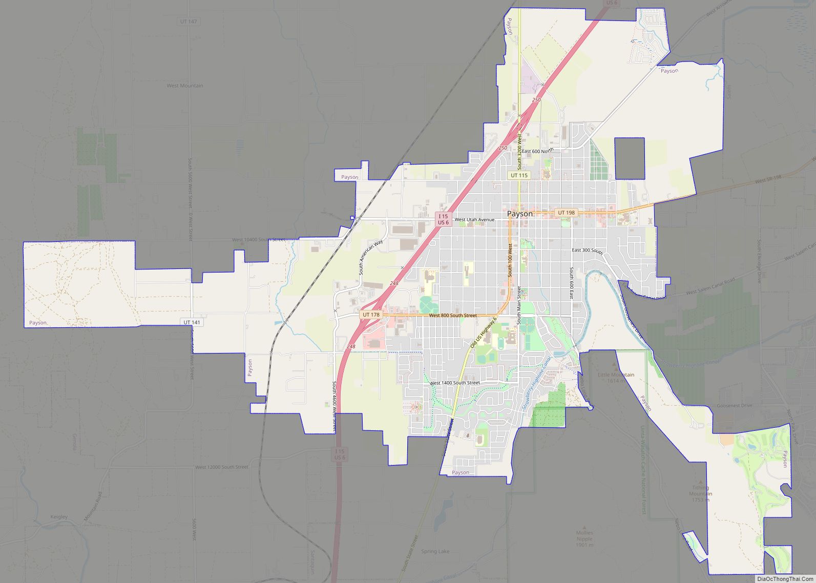
Map of Kearns metro township

Map of Kearns metro township

Kearns (/kɜːrnz/ kurnz) is a metro township in Salt Lake County, Utah, United States. Named after Utah’s U.S. Senator Thomas Kearns, it had a population of 36,723 at the 2020 Census. This was a 2.8 percent increase over the 2010 figure of 35,731. Kearns is home to the Utah Olympic Oval, an indoor speed skating … Read more

Map of Kaysville city

Map of Kaysville city

Kaysville is a city in Davis County, Utah. It is part of the Ogden–Clearfield metropolitan area. The population was 27,300 at the time of the 2010 census, with an estimated population of 32,390 in 2019. Kaysville city overview: Name: Kaysville city LSAD Code: 25 LSAD Description: city (suffix) State: Utah County: Davis County Elevation: 4,357 ft … Read more

Map of Leamington town

Map of Leamington town

Leamington is a town in Millard County, Utah. The population was 217 at the time of the 2000 census. Leamington town overview: Name: Leamington town LSAD Code: 43 LSAD Description: town (suffix) State: Utah County: Millard County Incorporated: 1936 Elevation: 4,731 ft (1,442 m) Total Area: 1.53 sq mi (3.97 km²) Land Area: 1.53 sq mi (3.97 km²) Water Area: 0.00 sq mi (0.00 km²) Total … Read more

Map of Lyman town, Utah

Map of Lyman town, Utah

Lyman is a town along State Route 24 in Wayne County, Utah, United States. The population was 258 at the 2010 census. Lyman was originally known as East Loa. It became a distinct place from Loa in 1893. Lyman town overview: Name: Lyman town LSAD Code: 43 LSAD Description: town (suffix) State: Utah County: Wayne … Read more

Map of Logan city, Utah

Map of Logan city, Utah

Logan is a city in Cache County, Utah, United States. The 2020 census recorded the population was 52,778. Logan is the county seat of Cache County and the principal city of the Logan metropolitan area, which includes Cache County and Franklin County, Idaho. The Logan metropolitan area contained 125,442 people as of the 2010 census … Read more

Map of Loa town

Map of Loa town

Loa is a town in, and the county seat of, Wayne County, Utah, United States, along State Route 24. The population was 572 at the 2010 census. Loa town overview: Name: Loa town LSAD Code: 43 LSAD Description: town (suffix) State: Utah County: Wayne County Elevation: 7,064 ft (2,153 m) Total Area: 0.95 sq mi (2.46 km²) Land Area: 0.95 sq mi … Read more

Map of Lindon city

Map of Lindon city

Lindon is a city in Utah County, Utah, United States. It is part of the Provo–Orem, Utah Metropolitan Statistical Area. The population was 10,070 at the 2010 census. In July 2019 it was estimated to be to 11,100 by the US Census Bureau. Lindon city overview: Name: Lindon city LSAD Code: 25 LSAD Description: city … Read more

Map of Liberty CDP, Utah

Map of Liberty CDP, Utah

Liberty is a census-designated place in Weber County, Utah, United States. The population was 1,257 at the 2010 census. It is part of the Ogden–Clearfield, Utah Metropolitan Statistical Area, as well as the Ogden Valley census county division. Liberty CDP overview: Name: Liberty CDP LSAD Code: 57 LSAD Description: CDP (suffix) State: Utah County: Weber … Read more

Map of Lewiston city, Utah

Map of Lewiston city, Utah

Lewiston is a city in Cache County, Utah, United States. It is situated at the northern Utah border and borders the state of Idaho. The population was 1,766 at the 2010 census. It is included in the Logan, Utah–Idaho (partial) Metropolitan Statistical Area. Lewiston city overview: Name: Lewiston city LSAD Code: 25 LSAD Description: city … Read more

Map of Levan town

Map of Levan town

Levan (/ləˈvæn/ lə-VAN) is a town in Juab County, Utah, United States. As of the 2020 census it had a population of 862. It is often said that the name of the town derives from its location near the center of Utah, because the name is “navel” spelled backwards. Several other origins have been suggested … Read more

Map of Lehi city

Map of Lehi city

Lehi (/ˈliːhaɪ/ LEE-hy) is a city in Utah County, Utah, United States. It is named after Lehi, a prophet in the Book of Mormon. The population was 75,907 at the 2020 census, up from 47,407 in 2010. The rapid growth in Lehi is due, in part, to the rapid development of the tech industry region … Read more

Map of Leeds town, Utah

Map of Leeds town, Utah

Leeds is a town in Washington County, Utah, United States. The population was 820 at the 2010 census. Leeds town overview: Name: Leeds town LSAD Code: 43 LSAD Description: town (suffix) State: Utah County: Washington County Elevation: 3,481 ft (1,061 m) Total Area: 6.29 sq mi (16.30 km²) Land Area: 6.29 sq mi (16.30 km²) Water Area: 0.00 sq mi (0.00 km²) Total Population: 820 Population … Read more