Randolph is a town in Rich County, Utah, United States. As of the 2010 census, the town population was 464. It is the county seat of Rich County. Randolph had the highest percentage of people of any city in the country vote for George W. Bush in the 2004 election, at 95.6% Randolph’s municipal classification was officially changed from a city to a town on January 1, 2009. The controversial WWASPS boarding school Old West Academy (formerly Majestic Ranch Academy) is located just outside Randolph.
| Name: | Randolph town |
|---|---|
| LSAD Code: | 43 |
| LSAD Description: | town (suffix) |
| State: | Utah |
| County: | Rich County |
| Founded: | March 14, 1870 |
| Elevation: | 6,283 ft (1,915 m) |
| Total Area: | 1.29 sq mi (3.34 km²) |
| Land Area: | 1.29 sq mi (3.34 km²) |
| Water Area: | 0.00 sq mi (0.00 km²) |
| Total Population: | 464 |
| Population Density: | 393.80/sq mi (152.10/km²) |
| ZIP code: | 84064 |
| Area code: | 435 |
| FIPS code: | 4963020 |
| GNISfeature ID: | 1431567 |
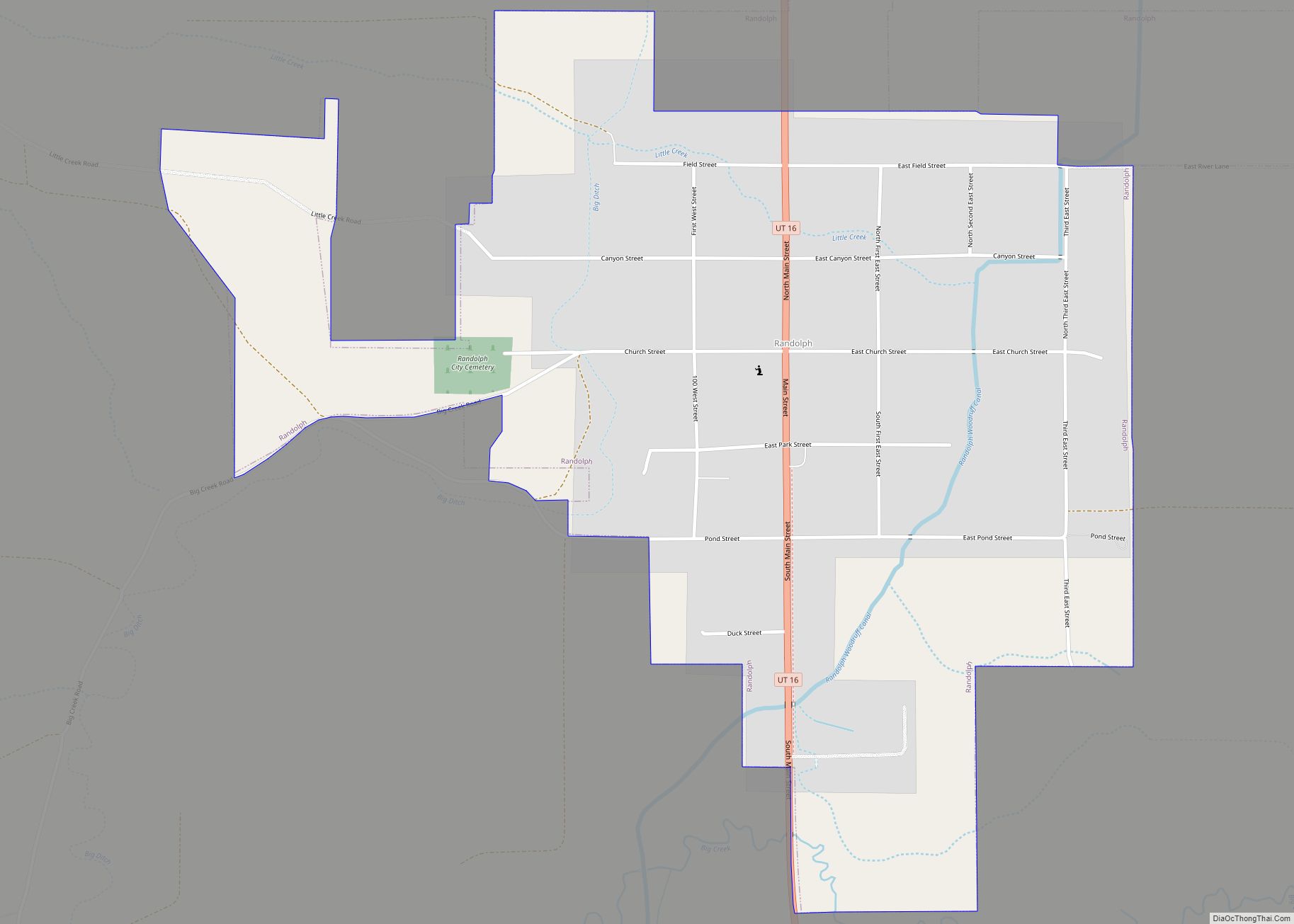
Online Interactive Map
Click on ![]() to view map in "full screen" mode.
to view map in "full screen" mode.
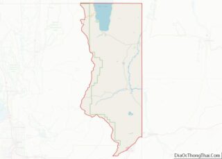
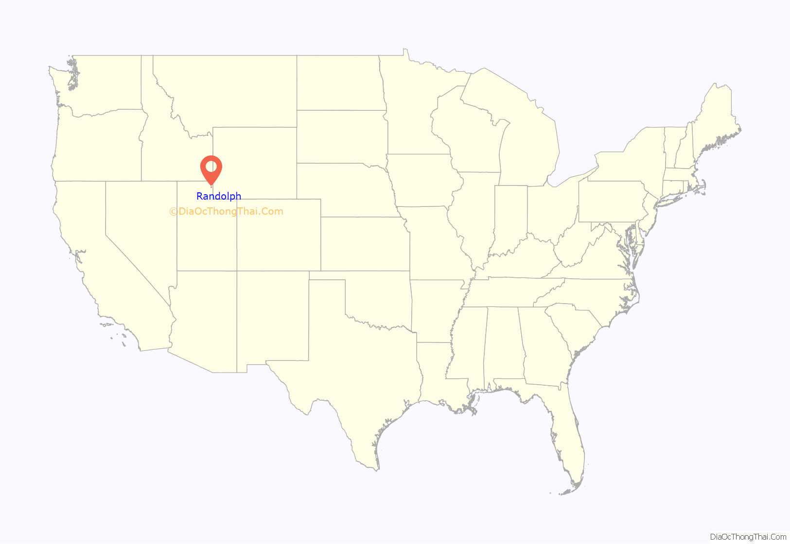
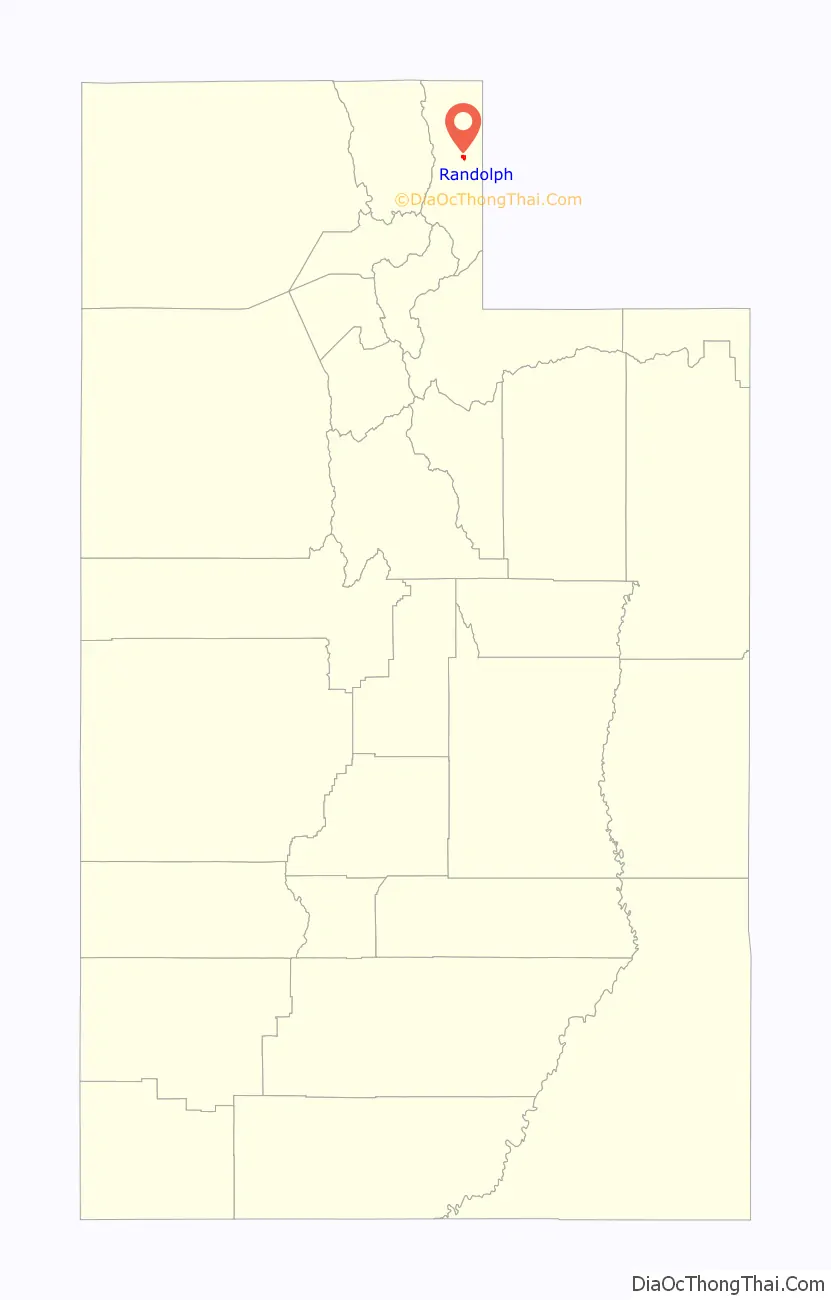
Randolph location map. Where is Randolph town?
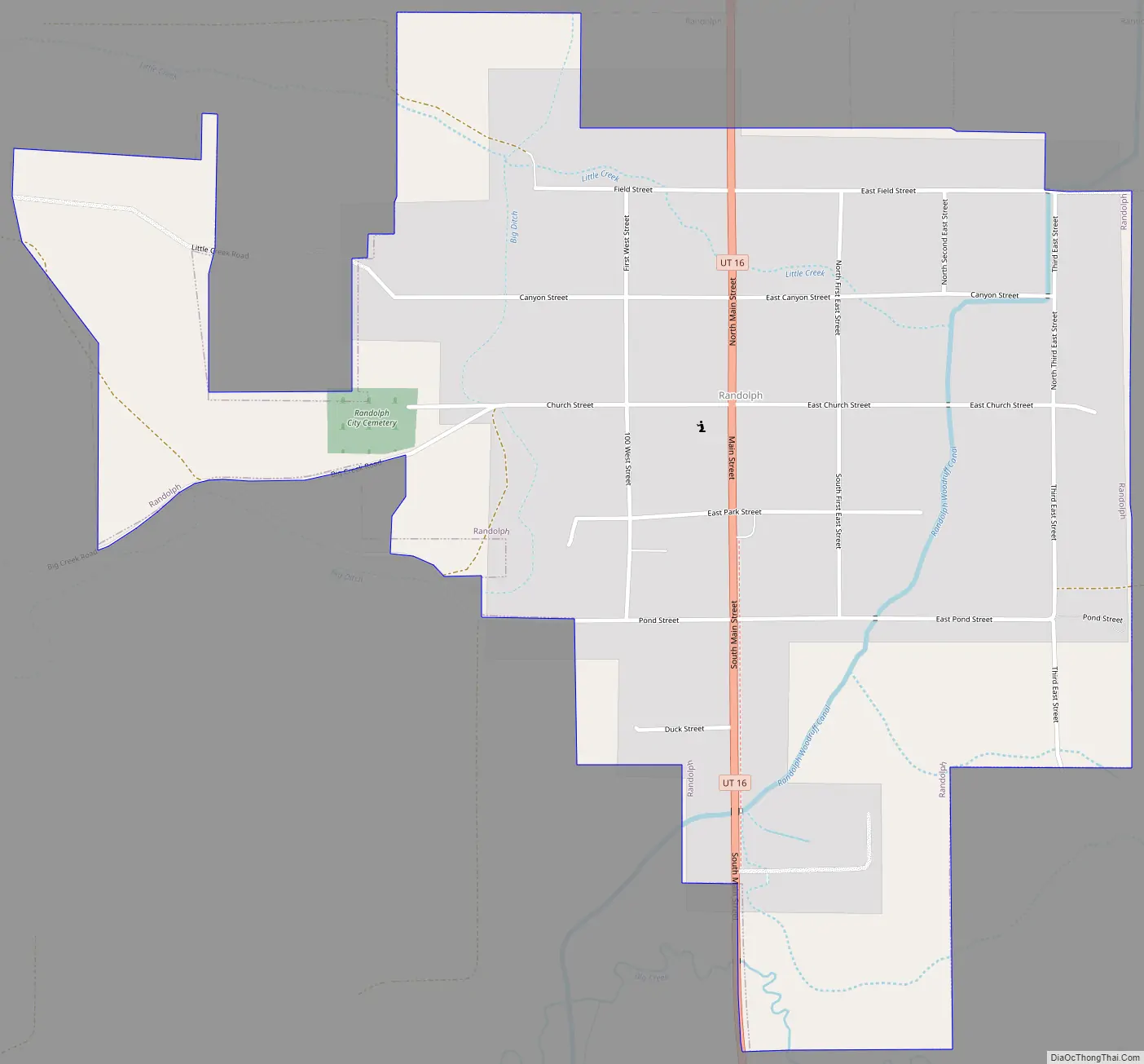
Randolph Road Map
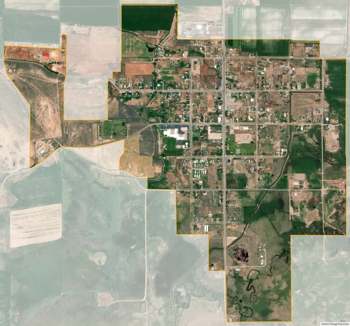
Randolph city Satellite Map
Geography
According to the United States Census Bureau, the town has a total area of 1.0 square mile (2.7 km), all land.
Randolph has a humid continental climate (Köppen Dfb), with long and cold winters, short summers with very warm days and cold nights, and fairly heavy winter snowfall totalling 70.8 inches or 1.80 metres during an average year. Between July 2008 and June 2009, there was as much as 98.9 inches (2.51 m), whilst the most precipitation in a calendar year has been 23.42 inches or 594.9 millimetres in 1998, although as much as 27.25 inches (692.1 mm) fell between July 1997 and June 1998. The driest calendar year has been 2020 with 7.07 inches or 179.6 millimetres, but as little as 6.28 inches (159.5 mm) fell between July 1988 and June 1989. The most precipitation in one day has been 2.26 inches (57.4 mm) on July 31, 1912, and the most in one month 5.16 inches (131.1 mm) in June 1998.
The hottest temperature has been 97 °F (36.1 °C) on July 19, 1893, whilst the coldest has been −43 °F (−41.7 °C) on February 1, 1985.
See also
Map of Utah State and its subdivision: Map of other states:- Alabama
- Alaska
- Arizona
- Arkansas
- California
- Colorado
- Connecticut
- Delaware
- District of Columbia
- Florida
- Georgia
- Hawaii
- Idaho
- Illinois
- Indiana
- Iowa
- Kansas
- Kentucky
- Louisiana
- Maine
- Maryland
- Massachusetts
- Michigan
- Minnesota
- Mississippi
- Missouri
- Montana
- Nebraska
- Nevada
- New Hampshire
- New Jersey
- New Mexico
- New York
- North Carolina
- North Dakota
- Ohio
- Oklahoma
- Oregon
- Pennsylvania
- Rhode Island
- South Carolina
- South Dakota
- Tennessee
- Texas
- Utah
- Vermont
- Virginia
- Washington
- West Virginia
- Wisconsin
- Wyoming