Map of Sutherland CDP, Utah
Sutherland is a census-designated place in northeastern Millard County, Utah, United States. The population was 165 at the 2010 census. Sutherland CDP overview: Name: Sutherland CDP LSAD Code: 57 LSAD Description: CDP (suffix) State: Utah County: Millard County Founded: 1909 Elevation: 4,626 ft (1,410 m) Total Area: 2.2 sq mi (6 km²) Land Area: 2.2 sq mi (6 km²) Water Area: 0.0 sq mi (0 km²) ... Read more
Map of Sutherland CDP, Utah
Map of Sunset city, Utah
Sunset is a city in Davis County, Utah, United States. It is part of the Ogden–Clearfield, Utah Metropolitan Statistical Area. The population was 5,122 at the 2010 census. Sunset emerged as a distinct place in 1916. Sunset city overview: Name: Sunset city LSAD Code: 25 LSAD Description: city (suffix) State: Utah County: Davis County Incorporated: ... Read more
Map of Sunset city, Utah
Map of Summit CDP, Utah
Summit is an unincorporated community and census-designated place (CDP) in east-central Iron County, Utah, United States. The population was 160 at the 2010 census. Summit CDP overview: Name: Summit CDP LSAD Code: 57 LSAD Description: CDP (suffix) State: Utah County: Iron County Elevation: 5,955 ft (1,815 m) Total Area: 0.7 sq mi (1.8 km²) Land Area: 0.7 sq mi (1.8 km²) Water Area: ... Read more
Map of Summit CDP, Utah
Map of Summit Park CDP
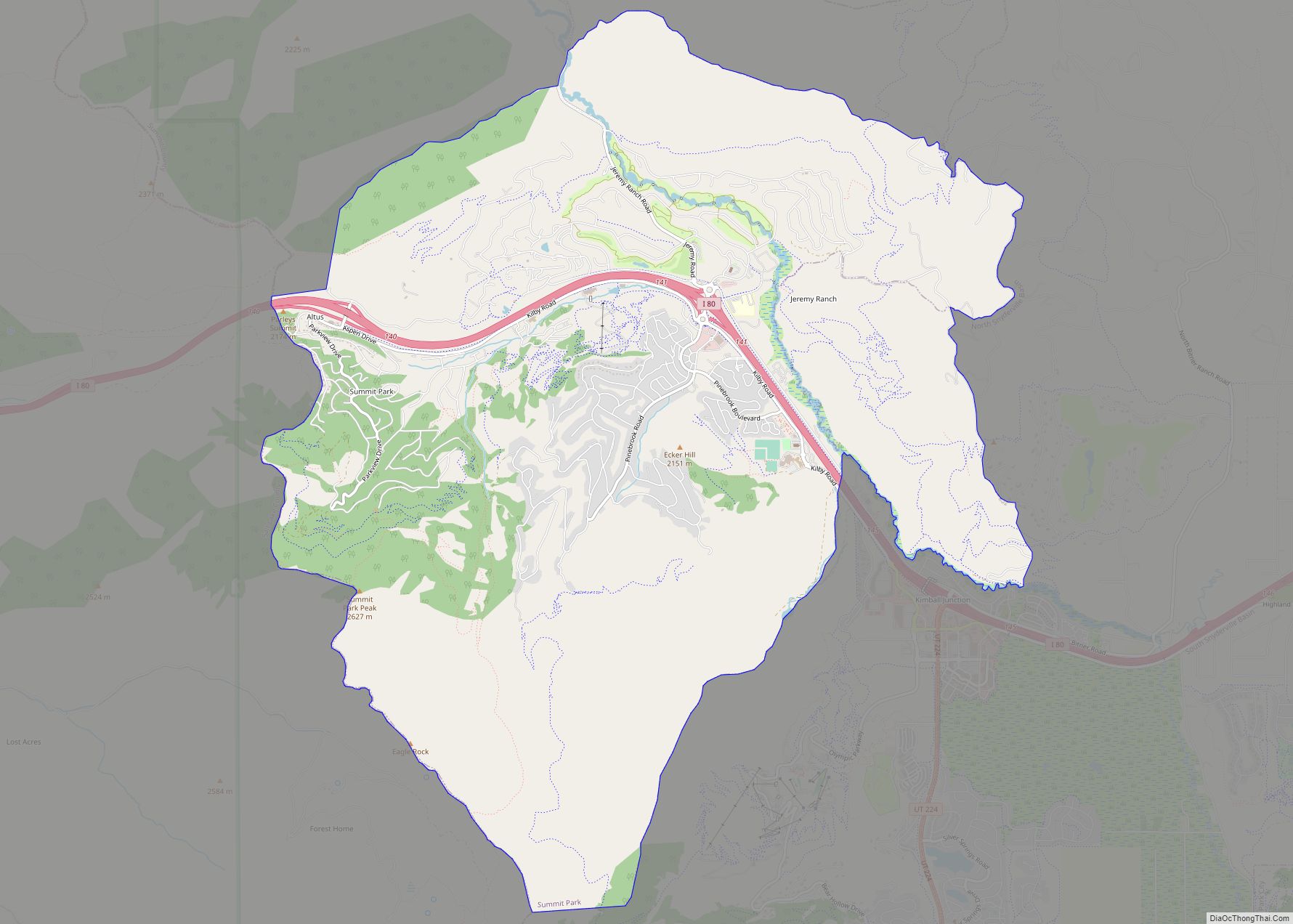
Summit Park is a census-designated place (CDP) on the western edge of Summit County, Utah, United States. The population was 6,597 at the 2000 census. Summit Park CDP overview: Name: Summit Park CDP LSAD Code: 57 LSAD Description: CDP (suffix) State: Utah County: Summit County Elevation: 6,886 ft (2,099 m) Total Area: 21.7 sq mi (56.2 km²) Land Area: 21.7 sq mi ... Read more
Map of Summit Park CDP
Map of Stockton town, Utah
Stockton is a town in Tooele County, Utah, United States. It is part of the Salt Lake City, Utah Metropolitan Statistical Area. The population was 616 at the 2010 census. Stockton town overview: Name: Stockton town LSAD Code: 43 LSAD Description: town (suffix) State: Utah County: Tooele County Incorporated: 1901 Elevation: 5,118 ft (1,560 m) Total Area: ... Read more
Map of Stockton town, Utah
Map of Sterling town, Utah
Sterling is a town in Sanpete County, Utah, United States. The population was 235 at the 2000 census. Sterling town overview: Name: Sterling town LSAD Code: 43 LSAD Description: town (suffix) State: Utah County: Sanpete County Incorporated: 1934 Elevation: 5,574 ft (1,699 m) Total Area: 0.32 sq mi (0.84 km²) Land Area: 0.32 sq mi (0.84 km²) Water Area: 0.00 sq mi (0.00 km²) Total Population: ... Read more
Map of Sterling town, Utah
Map of Teasdale CDP
Teasdale is a census-designated place in western Wayne County, Utah, United States, between the Dixie and Fishlake National Forests and near Capitol Reef National Park. The population was 191 at the 2010 census. Teasdale lies along local roads south of State Route 24, southeast of the town of Loa, the county seat of Wayne County. ... Read more
Map of Teasdale CDP
Map of Taylorsville city, Utah
Taylorsville is a city in Salt Lake County, Utah. It is part of the Salt Lake City metropolitan area. The population was 60,448 at the time of the 2020 census. Taylorsville was incorporated from the Taylorsville–Bennion CDP and portions of the Kearns metro township on July 1, 1996. The city is located adjacent to Interstate ... Read more
Map of Taylorsville city, Utah
Map of Tabiona town
Tabiona (/tæbiˈoʊnə/ TAB-ee-OH-nə) is a town in Duchesne County, Utah, United States. It is eighty-six miles southeast of the Salt Lake City metropolitan area. The population was 171 at the 2010 United States Census. Tabiona town overview: Name: Tabiona town LSAD Code: 43 LSAD Description: town (suffix) State: Utah County: Duchesne County Incorporated: 1935 Elevation: ... Read more
Map of Tabiona town
Map of Tselakai Dezza CDP
Tselakai Dezza is a census-designated place (CDP) in San Juan County, Utah, United States. The population was 103 at the 2000 census. Tselakai Dezza CDP overview: Name: Tselakai Dezza CDP LSAD Code: 57 LSAD Description: CDP (suffix) State: Utah County: San Juan County Elevation: 4,580 ft (1,396 m) Total Area: 19.8 sq mi (51.2 km²) Land Area: 19.8 sq mi (51.2 km²) Water ... Read more
Map of Tselakai Dezza CDP
Map of Tropic town
Tropic is a town in Garfield County, Utah, United States, along Utah Scenic Byway 12. As of the 2010 census, the town had a population of 530. Tropic was founded in 1891. Tropic town overview: Name: Tropic town LSAD Code: 43 LSAD Description: town (suffix) State: Utah County: Garfield County Elevation: 6,309 ft (1,923 m) Total Area: ... Read more
Map of Tropic town
Map of Trenton town, Utah
Trenton is a town in Cache County, Utah, United States. The population was 464 at the 2010 census. It is included in the Logan, Utah–Idaho (partial) Metropolitan Statistical Area. Trenton town overview: Name: Trenton town LSAD Code: 43 LSAD Description: town (suffix) State: Utah County: Cache County Elevation: 4,462 ft (1,360 m) Total Area: 8.29 sq mi (21.47 km²) Land ... Read more
Map of Trenton town, Utah