Map of Danville CDP, Vermont
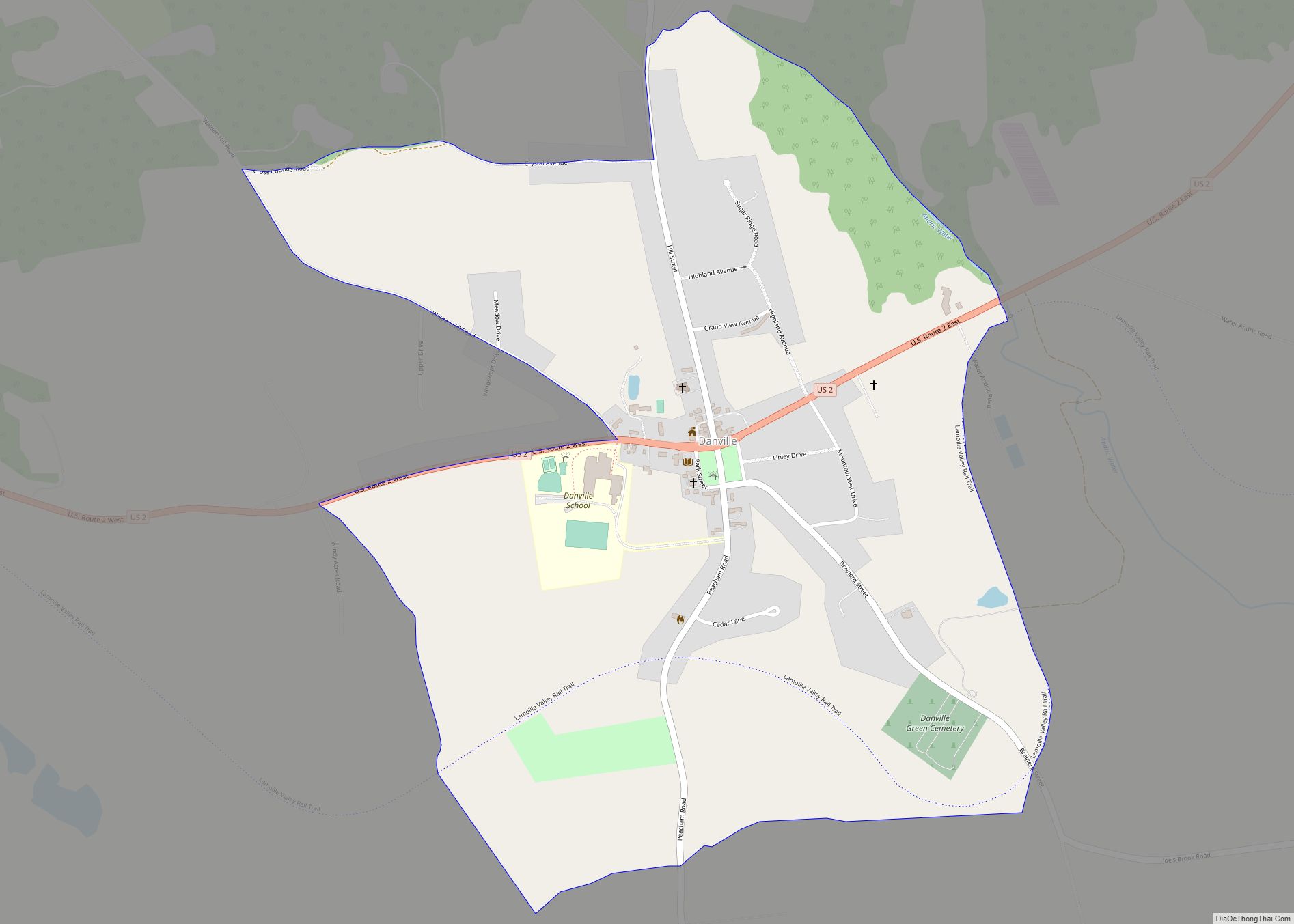
Danville is the primary village and a census-designated place (CDP) in the town of Danville, Caledonia County, Vermont, United States. As of the 2020 census, the CDP had a population of 385, out of 2,335 in the entire town of Danville. The village is in west-central Caledonia County, south of the center of the town ... Read more
Map of Danville CDP, Vermont
Map of Concord CDP, Vermont
Concord is a census-designated place comprising the main settlement in the town of Concord, Essex County, Vermont, United States. As of the 2010 census, it had a population of 271, out of a total town population of 1,235. The Concord CDP is in the western part of the town of Concord, along the Moose River, ... Read more
Map of Concord CDP, Vermont
Map of Fairfax CDP, Vermont
Fairfax is a town in Franklin County, Vermont, United States. The population was 5,014 at the 2020 census. Fairfax CDP overview: Name: Fairfax CDP LSAD Code: 57 LSAD Description: CDP (suffix) State: Vermont County: Franklin County Elevation: 659 ft (201 m) Total Area: 40.4 sq mi (104.7 km²) Land Area: 39.8 sq mi (103.2 km²) Water Area: 0.6 sq mi (1.5 km²) Total Population: 5,014 Population ... Read more
Map of Fairfax CDP, Vermont
Map of Essex Junction village
Essex Junction village overview: Name: Essex Junction village LSAD Code: 47 LSAD Description: village (suffix) State: Vermont County: Chittenden County FIPS code: 5024400 Online Interactive Map Essex Junction online map. Source: Basemap layers from Google Map, Open Street Map (OSM), Arcgisonline, Wmflabs. Boundary Data from Database of Global Administrative Areas. Essex Junction location map. Where ... Read more
Map of Essex Junction village
Map of Enosburg Falls village
Enosburg Falls village overview: Name: Enosburg Falls village LSAD Code: 47 LSAD Description: village (suffix) State: Vermont County: Franklin County FIPS code: 5024025 Online Interactive Map Enosburg Falls online map. Source: Basemap layers from Google Map, Open Street Map (OSM), Arcgisonline, Wmflabs. Boundary Data from Database of Global Administrative Areas. Enosburg Falls location map. Where ... Read more
Map of Enosburg Falls village
Map of Groton CDP, Vermont
Groton is the primary village and a census-designated place (CDP) in the town of Groton, Caledonia County, Vermont, United States. As of the 2020 census, the CDP had a population of 419, out of 984 in the entire town of Groton. Groton village is in southern Caledonia County, in the southeast corner of the town ... Read more
Map of Groton CDP, Vermont
Map of Greensboro CDP, Vermont
Greensboro is the central village and a census-designated place (CDP) in the town of Greensboro, Orleans County, Vermont, United States. As of the 2020 census, it had a population of 156, out of 811 in the entire town of Greensboro. The CDP is in southern Orleans County, stretching from the center to the southern border ... Read more
Map of Greensboro CDP, Vermont
Map of Greensboro Bend CDP
Greensboro Bend is a census-designated place in the town of Greensboro, Orleans County, Vermont, United States. Its population was 232 as of the 2010 census. Greensboro Bend CDP overview: Name: Greensboro Bend CDP LSAD Code: 57 LSAD Description: CDP (suffix) State: Vermont County: Orleans County Elevation: 1,178 ft (359 m) Total Area: 2.228 sq mi (5.77 km²) Land Area: 2.210 sq mi ... Read more
Map of Greensboro Bend CDP
Map of Glover CDP
Glover is the primary village and a census-designated place (CDP) in the town of Glover, Orleans County, Vermont, United States. As of the 2020 census, it had a population of 256, out of 1,114 in the entire town of Glover. The CDP is in southeastern Orleans County, along the northern edge of the town of ... Read more
Map of Glover CDP
Map of Fairlee CDP, Vermont
Fairlee is the primary village and a census-designated place (CDP) in the town of Fairlee, Orange County, Vermont, United States. As of the 2020 census, it had a population of 198 out of 988 in the entire town of Fairlee. The CDP is on the eastern edge Orange County, in the southeast part of the ... Read more
Map of Fairlee CDP, Vermont
Map of Johnson village, Vermont
Johnson is a town in Lamoille County, Vermont, United States. The population was 3,491 at the 2020 census. The town is home to Northern Vermont University-Johnson, a part the Vermont State Colleges system. The Vermont Studio Center is located in the village of Johnson. Johnson village overview: Name: Johnson village LSAD Code: 47 LSAD Description: ... Read more
Map of Johnson village, Vermont
Map of Jericho village, Vermont
Jericho is a town in Chittenden County, Vermont, United States. As of the 2020 census, the population was 5,104. The town was named after the ancient city of Jericho. Jericho village overview: Name: Jericho village LSAD Code: 47 LSAD Description: village (suffix) State: Vermont County: Chittenden County Elevation: 121 ft (37 m) Total Area: 35.6 sq mi (92.1 km²) Land ... Read more
Map of Jericho village, Vermont