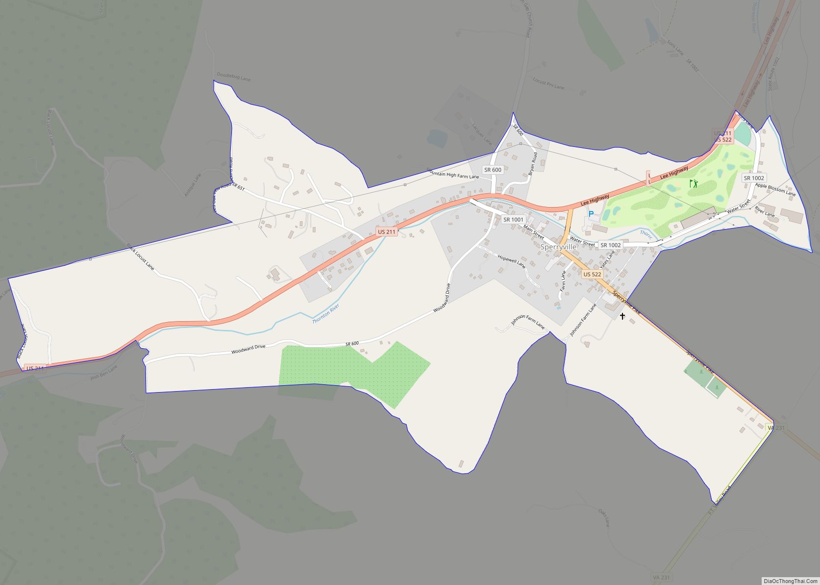
Sperryville is a census-designated place (CDP) located in the western section of Rappahannock County, Virginia, United States, near Shenandoah National Park. It consists of a village with two main streets along the two branches of the Thornton River, together with surrounding pasture- and farmland. The population as of the 2010 Census was 342. Sperryville CDP ... Read more
Virginia Cities and Places
Southside Chesconessex CDP overview: Name: Southside Chesconessex CDP LSAD Code: 57 LSAD Description: CDP (suffix) State: Virginia County: Accomack County FIPS code: 5174160 Online Interactive Map Southside Chesconessex online map. Source: Basemap layers from Google Map, Open Street Map (OSM), Arcgisonline, Wmflabs. Boundary Data from Database of Global Administrative Areas. Southside Chesconessex location map. Where ... Read more
Southern Gateway is a census-designated place in Stafford County, Virginia. The population as of the 2010 Census was 2,805. The “Southern Gateway” is described by the county as the area adjoining U.S. Route 17 between Interstate 95 and Berea Road to the west. Southern Gateway CDP overview: Name: Southern Gateway CDP LSAD Code: 57 LSAD ... Read more
Southampton Meadows is a mobile home community and census-designated place in southeastern Southampton County, Virginia. The population as of the 2010 Census was 592. Southampton Meadows CDP overview: Name: Southampton Meadows CDP LSAD Code: 57 LSAD Description: CDP (suffix) State: Virginia County: Southampton County Total Area: 592 ZIP code: 23851 FIPS code: 5173624 GNISfeature ID: ... Read more
South Run is a census-designated place in Fairfax County, Virginia, United States. The population as of the 2010 census was 6,389. South Run CDP overview: Name: South Run CDP LSAD Code: 57 LSAD Description: CDP (suffix) State: Virginia County: Fairfax County Elevation: 300 ft (90 m) Total Area: 2.60 sq mi (6.73 km²) Land Area: 2.53 sq mi (6.56 km²) Water Area: 0.07 sq mi ... Read more
South Riding is a census-designated place and planned community in Loudoun County, Virginia, United States. The South Riding homeowner association was founded in January 1995 to provide services to the community. Neighboring U.S. Route 50 and State Route 28 provide access to the Dulles/Reston/Tysons Corner technology corridor and other major employment centers in Northern Virginia ... Read more
Strasburg /ˈstrɑːzbɜːrɡ/ is a town in Shenandoah County, Virginia, United States, which was founded in 1761 by Peter Stover. It is the largest town by population in the county and is known for its grassroots art culture, pottery, antiques, and American Civil War history. The population was 6,398 at the 2010 census. Strasburg town overview: ... Read more
Stony Creek is a town in Sussex County, Virginia, United States. The population was 198 at the 2010 census. Stony Creek town overview: Name: Stony Creek town LSAD Code: 43 LSAD Description: town (suffix) State: Virginia County: Sussex County Elevation: 95 ft (29 m) Total Area: 0.58 sq mi (1.49 km²) Land Area: 0.58 sq mi (1.49 km²) Water Area: 0.00 sq mi (0.00 km²) Total ... Read more
Stone Ridge is a census-designated place in Loudoun County, Virginia, United States. Residences use Aldie mailing addresses, and it is near Washington Dulles International Airport. The population as of the 2020 census was 15,039. Stone Ridge is a Van Metre Homes planned, mixed-use community. Stone Ridge CDP overview: Name: Stone Ridge CDP LSAD Code: 57 ... Read more
Sterling, Virginia, refers most specifically to a census-designated place (CDP) in Loudoun County, Virginia, United States. The population of the CDP as of the 2010 United States Census was 27,822. The CDP boundaries are confined to a relatively small area between Virginia State Route 28 on the west and Virginia State Route 7 on the ... Read more
Stephens City (/ˈstiːvənz/ STEE-vənz) is an incorporated town in the southern part of Frederick County, Virginia, United States, with a population of 1,829 at the time of the 2010 census. and an estimated population in 2018 of 2,041. Founded by Peter Stephens in the 1730s, the colonial town was chartered and named for Lewis Stephens (Peter’s ... Read more
Stanleytown is a census-designated place (CDP) in Henry County, Virginia, United States. The population was 1,422 at the 2010 census. It is part of the Martinsville Micropolitan Statistical Area. Stanleytown CDP overview: Name: Stanleytown CDP LSAD Code: 57 LSAD Description: CDP (suffix) State: Virginia County: Henry County Elevation: 781 ft (238 m) Total Area: 2.7 sq mi (7.0 km²) Land ... Read more