Map of Olympia city
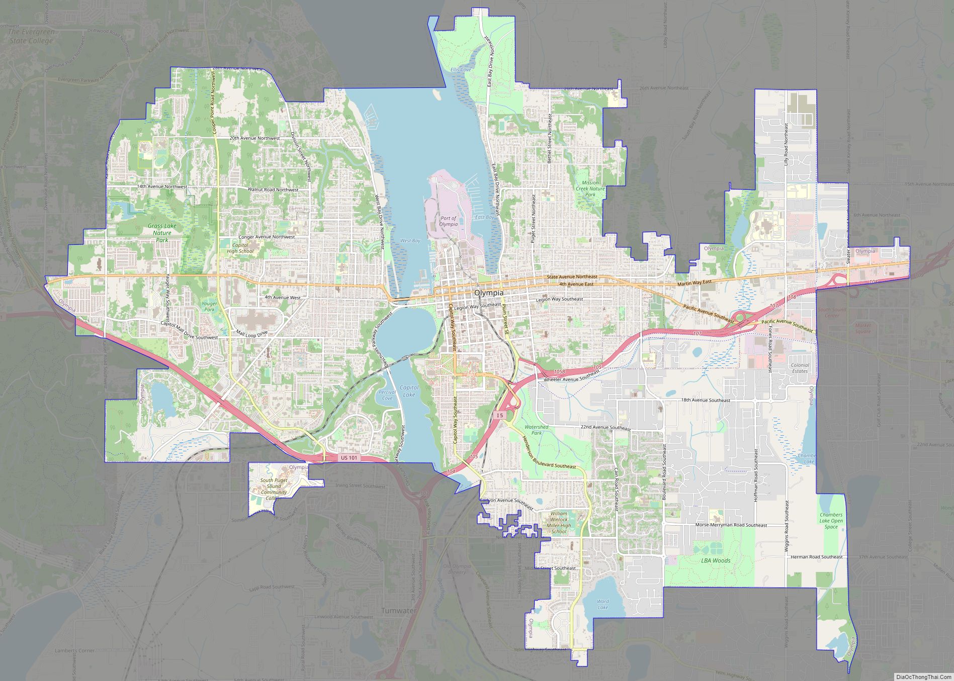
Olympia is the capital of the U.S. state of Washington and the county seat and largest city of Thurston County. It is 60 miles (100 km) southwest of the state’s most populous city, Seattle, and is a cultural center of the southern Puget Sound region. The Squaxin and other Coast Salish peoples inhabited the southern Puget ... Read more
Map of Olympia city
Map of Aberdeen Gardens CDP
Aberdeen Gardens is a census-designated place (CDP) in Grays Harbor County, Washington, United States. The population was 279 at the 2010 census. Aberdeen Gardens CDP overview: Name: Aberdeen Gardens CDP LSAD Code: 57 LSAD Description: CDP (suffix) State: Washington County: Grays Harbor County Elevation: 46 ft (14 m) Total Area: 1.62 sq mi (4.19 km²) Land Area: 1.62 sq mi (4.19 km²) Water ... Read more
Map of Aberdeen Gardens CDP
Map of Barstow CDP, Washington
Barstow is a census-designated place (CDP) and unincorporated community in Ferry County in the U.S. state of Washington. As of the 2010 census it had a population of 59. Barstow CDP overview: Name: Barstow CDP LSAD Code: 57 LSAD Description: CDP (suffix) State: Washington County: Ferry County Elevation: 1,400 ft (400 m) Total Area: 0.56 sq mi (1.45 km²) Land ... Read more
Map of Barstow CDP, Washington
Map of Bay Center CDP
Bay Center is a census-designated place (CDP) in Pacific County, Washington, United States. The population was 174 at the 2000 census. The population increased to 276 at the 2010 census. A post office called Bay Center has been in operation since 1876. The community was named for its central location on the harbor. Bay Center ... Read more
Map of Bay Center CDP
Map of Basin City CDP
Basin City (/ˈbeɪsən ˈsɪtiː/) is an unincorporated community and census-designated place (CDP) in Franklin County, Washington, United States. The population was 1,092 at the 2010 census, up from 968 at the 2000 census. Basin City CDP overview: Name: Basin City CDP LSAD Code: 57 LSAD Description: CDP (suffix) State: Washington County: Franklin County Elevation: 702 ft ... Read more
Map of Basin City CDP
Map of Big Lake CDP, Washington
Big Lake is a census-designated place (CDP) in Skagit County, Washington, United States. The population was 1,835 at the 2010 census. It is included in the Mount Vernon–Anacortes, Washington Metropolitan Statistical Area. Big Lake is an exurban community in a fairly rural setting, although recent years have seen significant suburban development. The area, however, has ... Read more
Map of Big Lake CDP, Washington
Map of Bingen city
Bingen is a city in Klickitat County, Washington, United States. The population was 712 at the 2010 census, a 6% increase over the 2000 census. Bingen city overview: Name: Bingen city LSAD Code: 25 LSAD Description: city (suffix) State: Washington County: Klickitat County Elevation: 131 ft (40 m) Total Area: 0.89 sq mi (2.30 km²) Land Area: 0.62 sq mi (1.61 km²) Water ... Read more
Map of Bingen city
Map of Bridgeport city, Washington
Bridgeport is a city in Douglas County, Washington. It is part of the Wenatchee−East Wenatchee Metropolitan Statistical Area. Bridgeport’s population was 2,409 at the 2010 census. Bridgeport is located near the Chief Joseph Dam. Bridgeport city overview: Name: Bridgeport city LSAD Code: 25 LSAD Description: city (suffix) State: Washington County: Douglas County Elevation: 850 ft (259 m) ... Read more
Map of Bridgeport city, Washington
Map of Brewster city, Washington
Brewster is a city in Okanogan County, Washington, United States. The population was 2,370 at the 2010 census. Brewster city overview: Name: Brewster city LSAD Code: 25 LSAD Description: city (suffix) State: Washington County: Okanogan County Elevation: 814 ft (248 m) Total Area: 1.51 sq mi (3.90 km²) Land Area: 1.15 sq mi (2.98 km²) Water Area: 0.35 sq mi (0.92 km²) Total Population: 2,370 Population ... Read more
Map of Brewster city, Washington
Map of Boyds CDP
Boyds is an unincorporated community and census-designated place (CDP) in Ferry County, Washington, United States. Boyds is located along U.S. Route 395 at the north end of the Lake Roosevelt National Recreation Area on the west side of the Kettle River, which serves as a boundary with Stevens County. The community of Barstow is 4 ... Read more
Map of Boyds CDP
Map of Brinnon CDP
Brinnon is a census-designated place (CDP) in Jefferson County, Washington, United States. The population was 797 at the 2010 census. The community is named for Ewell P. Brinnon, who in 1860 took a donation land claim at the mouth of the Duckabush River. Its known landmarks include Dosewallips State Park and Black Point Marina. Camp ... Read more
Map of Brinnon CDP
Map of Burien city
Burien (/ˈbjʊəriən/ BYUR-ee-ən) is a suburban city in King County, Washington, United States, located south of Seattle on Puget Sound. As of the 2020 census, Burien’s population was 52,066, which is a 56.3% increase since incorporation in 1993. An annexation in 2010 increased the city’s population significantly. Burien city overview: Name: Burien city LSAD Code: ... Read more
Map of Burien city