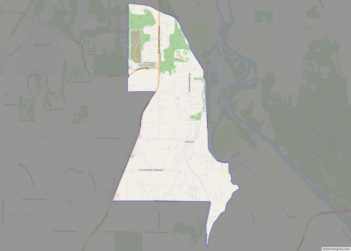
Map of Barstow CDP, Washington

Map of Barstow CDP, Washington

Barstow is a census-designated place (CDP) and unincorporated community in Ferry County in the U.S. state of Washington. As of the 2010 census it had a population of 59. Barstow CDP overview: Name: Barstow CDP LSAD Code: 57 LSAD Description: CDP (suffix) State: Washington County: Ferry County Elevation: 1,400 ft (400 m) Total Area: 0.56 sq mi (1.45 km²) Land … Read more

Map of Barney's Junction CDP

Map of Barney’s Junction CDP

Barney’s Junction is a census-designated place in Ferry County, Washington, in the United States. Barney’s Junction CDP overview: Name: Barney’s Junction CDP LSAD Code: 57 LSAD Description: CDP (suffix) State: Washington County: Ferry County Elevation: 1,365 ft (416 m) Total Area: 0.26 sq mi (0.67 km²) Land Area: 0.26 sq mi (0.67 km²) Water Area: 0.0 sq mi (0.0 km²) Total Population: 146 Population Density: 561/sq mi … Read more

Map of Baring CDP, Washington

Map of Baring CDP, Washington

Baring is an unincorporated community and census-designated place (CDP) in King County, Washington, United States. The population was 220 at the 2010 United States Census. It is located on U.S. Highway 2 about 23 miles (37 km) west of Stevens Pass, along a very flat and straight three-mile section of highway that has been dubbed the … Read more

Map of Barberton CDP, Washington

Map of Barberton CDP, Washington

Barberton is a census-designated place (CDP) in Clark County, Washington, United States. The population was 5,661 at the 2010 census, up from 4,617 at the 2000 census. Based on per capita income, one of the more reliable measures of affluence, Barberton ranks 90th of 522 areas in the state of Washington to be ranked. Barberton … Read more

Map of Banks Lake South CDP

Map of Banks Lake South CDP

Banks Lake South is a census-designated place (CDP) in Grant County, Washington, United States. The population was 174 at the 2010 census. Banks Lake South CDP overview: Name: Banks Lake South CDP LSAD Code: 57 LSAD Description: CDP (suffix) State: Washington County: Grant County Elevation: 1,634 ft (498 m) Total Area: 2.9 sq mi (7.5 km²) Land Area: 2.4 sq mi (6.3 km²) … Read more

Map of Bangor Base CDP

Map of Bangor Base CDP

Bangor Base is a census-designated place (CDP) in Kitsap County, Washington, within U.S. Naval Base Kitsap on the Kitsap Peninsula. Its population was 6,054 at the 2010 census. Bangor Base CDP overview: Name: Bangor Base CDP LSAD Code: 57 LSAD Description: CDP (suffix) State: Washington County: Kitsap County Elevation: 380 ft (120 m) Total Area: 11.14 sq mi (28.84 km²) … Read more

Map of Bainbridge Island city

Map of Bainbridge Island city

Bainbridge Island is a city and island in Kitsap County, Washington. It is located in Puget Sound. The population was 23,025 at the 2010 census and an estimated 25,298 in 2019, making Bainbridge Island the second largest city in Kitsap County. The island is separated from the Kitsap Peninsula by Port Orchard, with Bremerton lying … Read more

Map of Auburn city, Washington

Map of Auburn city, Washington

Auburn is a city in King County, Washington, United States (with a small portion crossing into neighboring Pierce County). The population was 87,256 at the 2020 Census. Auburn is a suburb in the Seattle metropolitan area, and is currently ranked as the 14th largest city in the state of Washington. Auburn is bordered by the … Read more

Map of Asotin city

Map of Asotin city

Asotin /əˈsoʊtən/ is the county seat of the county of the same name, in the state of Washington, United States. The population of the city was 1,204 at the 2020 census. It is part of the Lewiston, ID-WA Metropolitan Statistical Area. Asotin city overview: Name: Asotin city LSAD Code: 25 LSAD Description: city (suffix) State: … Read more

Map of Ashford CDP, Washington

Map of Ashford CDP, Washington

Ashford is a census-designated place (CDP) mostly within Pierce County, Washington, United States. Its population was 217 as of the 2010 census. The town is west of the main (Nisqually River) entrance to Mount Rainier National Park. Surrounding mountains and the narrow Nisqually River valley are heavily forested. Some of Ashford is across the Nisqually … Read more

Map of Bay Center CDP

Map of Bay Center CDP

Bay Center is a census-designated place (CDP) in Pacific County, Washington, United States. The population was 174 at the 2000 census. The population increased to 276 at the 2010 census. A post office called Bay Center has been in operation since 1876. The community was named for its central location on the harbor. Bay Center … Read more

Map of Battle Ground city, Washington

Map of Battle Ground city, Washington

Battle Ground is a city in Clark County, Washington, United States. The population was 20,743 at the 2020 census. Between 2000 and 2005, Battle Ground ranked fourth in the state for population growth, out of 279 eligible incorporated communities. As of 2021, its population is 21,119. Battle Ground city overview: Name: Battle Ground city LSAD … Read more