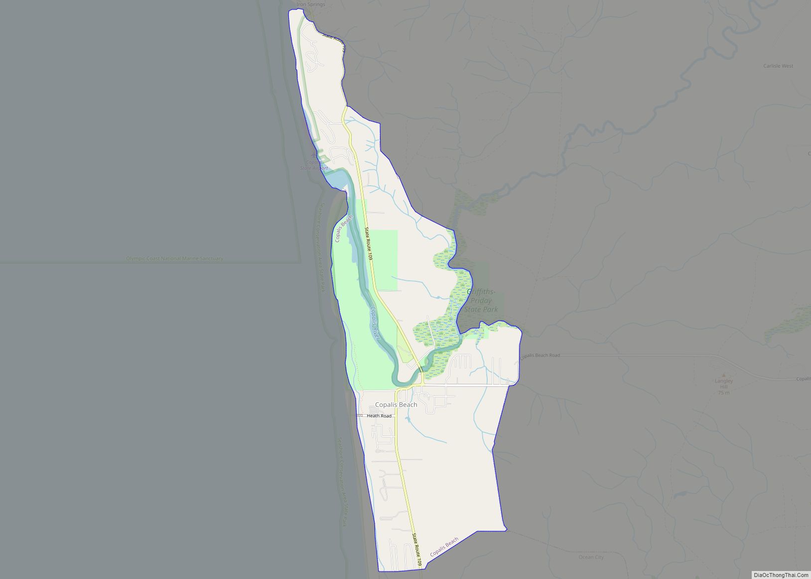
Conway is a census-designated place (CDP) in Skagit County, Washington, United States. First settled in 1873 by Thomas P. Jones and Charles Villeneuves, its population was 91 at the 2010 census. It is included in the Mount Vernon–Anacortes, Washington Metropolitan Statistical Area. Conway CDP overview: Name: Conway CDP LSAD Code: 57 LSAD Description: CDP (suffix) ... Read more
Washington Cities and Places
Connell (/kɑːˈnɛl/) is a city in Franklin County, Washington, United States. The population was 5,441 at the 2020 census. Connell city overview: Name: Connell city LSAD Code: 25 LSAD Description: city (suffix) State: Washington County: Franklin County Elevation: 846 ft (258 m) Total Area: 7.69 sq mi (19.91 km²) Land Area: 7.69 sq mi (19.91 km²) Water Area: 0.00 sq mi (0.00 km²) Total Population: 5,441 ... Read more
Concrete town overview: Name: Concrete town LSAD Code: 43 LSAD Description: town (suffix) State: Washington County: Skagit County FIPS code: 5314380 Online Interactive Map Concrete online map. Source: Basemap layers from Google Map, Open Street Map (OSM), Arcgisonline, Wmflabs. Boundary Data from Database of Global Administrative Areas. Concrete location map. Where is Concrete town? Concrete ... Read more
Conconully town overview: Name: Conconully town LSAD Code: 43 LSAD Description: town (suffix) State: Washington County: Okanogan County FIPS code: 5314310 Online Interactive Map Conconully online map. Source: Basemap layers from Google Map, Open Street Map (OSM), Arcgisonline, Wmflabs. Boundary Data from Database of Global Administrative Areas. Conconully location map. Where is Conconully town? Conconully ... Read more
Colville is a city in Stevens County, Washington, United States. The population was 4,673 at the 2010 census. It is the county seat of Stevens County. Colville city overview: Name: Colville city LSAD Code: 25 LSAD Description: city (suffix) State: Washington County: Stevens County Elevation: 1,614 ft (492 m) Land Area: 3.08 sq mi (7.99 km²) Water Area: 0.00 sq mi (0.00 km²) ... Read more
Coulee City town overview: Name: Coulee City town LSAD Code: 43 LSAD Description: town (suffix) State: Washington County: Grant County FIPS code: 5315080 Online Interactive Map Coulee City online map. Source: Basemap layers from Google Map, Open Street Map (OSM), Arcgisonline, Wmflabs. Boundary Data from Database of Global Administrative Areas. Coulee City location map. Where ... Read more
Curlew is an unincorporated community and census-designated place (CDP) located in northwestern Ferry County, Washington, United States, between Malo and Danville on State Route 21. The BNSF Railway ran through the town. The historic Ansorge Hotel is located in Curlew. As of the 2010 census, the population of the community was 118. The settlement is ... Read more
Curlew Lake is a census-designated place (CDP) in Ferry County, Washington. Curlew Lake CDP overview: Name: Curlew Lake CDP LSAD Code: 57 LSAD Description: CDP (suffix) State: Washington County: Ferry County Elevation: 2,356 ft (718 m) Total Area: 5.7 sq mi (14.8 km²) Land Area: 4.4 sq mi (11.3 km²) Water Area: 1.4 sq mi (3.5 km²) Total Population: 462 Population Density: 106/sq mi (40.9/km²) Area code: ... Read more
Cowiche (pronounced Cow-witch-ee) is a census-designated place and unincorporated community northwest of Yakima, Washington, near the eastern foothills of the Cascade Mountain range, in central Washington State (US). Cowiche, sometimes spelled Cowychee, is said to mean “footbridge between the valley and the mountains.” The town had 428 people at the 2010 census. Cowiche CDP overview: ... Read more
Coupeville town overview: Name: Coupeville town LSAD Code: 43 LSAD Description: town (suffix) State: Washington County: Island County FIPS code: 5315185 Online Interactive Map Coupeville online map. Source: Basemap layers from Google Map, Open Street Map (OSM), Arcgisonline, Wmflabs. Boundary Data from Database of Global Administrative Areas. Coupeville location map. Where is Coupeville town? Coupeville ... Read more
Country Homes is a census-designated place (CDP) in Spokane County, Washington, United States. The population was 6,251 at the 2020 census. The campus of Whitworth University is located in Country Homes. Country Homes CDP overview: Name: Country Homes CDP LSAD Code: 57 LSAD Description: CDP (suffix) State: Washington County: Spokane County Elevation: 1,952 ft (595 m) Total ... Read more
Coulee Dam town overview: Name: Coulee Dam town LSAD Code: 43 LSAD Description: town (suffix) State: Washington County: Douglas County, Grant County, Okanogan County FIPS code: 5315115 Online Interactive Map Coulee Dam online map. Source: Basemap layers from Google Map, Open Street Map (OSM), Arcgisonline, Wmflabs. Boundary Data from Database of Global Administrative Areas. Coulee ... Read more