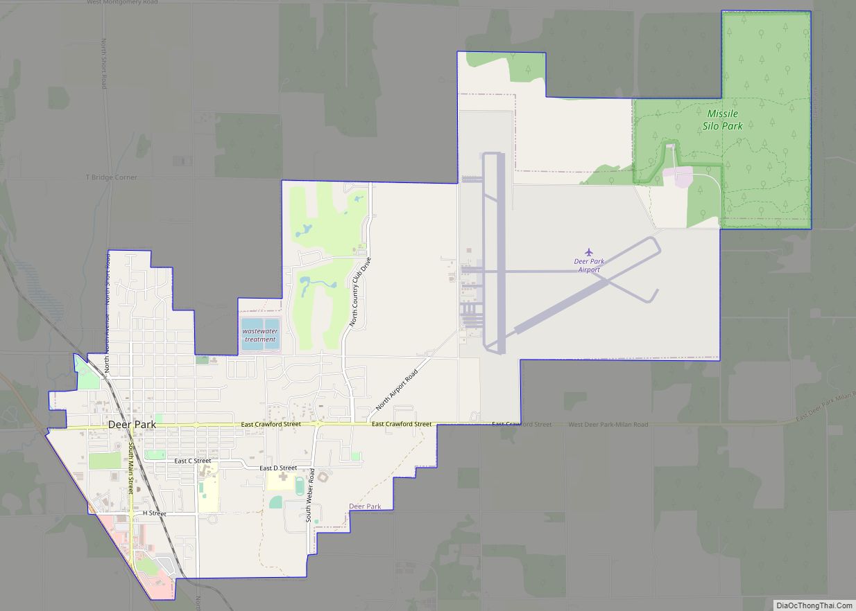
Map of Summit CDP, Washington

Map of Summit CDP, Washington

Summit is a census-designated place (CDP) in Pierce County, Washington, United States. The population was 8,270 at the 2020 census. Summit CDP overview: Name: Summit CDP LSAD Code: 57 LSAD Description: CDP (suffix) State: Washington County: Pierce County Elevation: 476 ft (145 m) Total Area: 8,270 Land Area: 5.09 sq mi (13.2 km²) Population Density: 1,626/sq mi (628/km²) ZIP code: 98371 … Read more

Map of Summit View CDP

Map of Summit View CDP

Summit View is a census-designated place (CDP) located in Snohomish County, Washington. Summit View CDP overview: Name: Summit View CDP LSAD Code: 57 LSAD Description: CDP (suffix) State: Washington County: Pierce County Elevation: 479 ft (146 m) Total Area: 3.24 sq mi (8.4 km²) Land Area: 3.24 sq mi (8.4 km²) Total Population: 9,758 Population Density: 3,016.4/sq mi (1,164.6/km²) Area code: 360 FIPS code: … Read more

Map of Sumas city

Map of Sumas city

Sumas (SOO-mas) is a city in Whatcom County, Washington, United States. It had a population of 1,307 as of the 2010 census. Sumas is located adjacent to the Canada–U.S. border and borders the city of Abbotsford, British Columbia. The Sumas-Huntingdon port of entry at the north end of State Route 9 operates 24 hours a … Read more

Map of Sultan city

Map of Sultan city

Sultan is a city in Snohomish County, Washington, United States. It is located approximately 23 miles (37 km) east of Everett at the confluence of the Skykomish River and the Sultan River, a minor tributary. The city had a population of 4,651 at the 2010 census. The city was founded in 1880 at the site of … Read more

Map of Sudden Valley CDP

Map of Sudden Valley CDP

Sudden Valley is a census-designated place (CDP) just outside of Bellingham in Whatcom County, Washington. Sudden Valley is the second-largest homeowner association in western Washington, with over 7,000 residents. There are eleven neighborhood parks, miles of hiking trails in woodlands and along Lake Whatcom, beaches, two pools, sports fields, tennis courts, a basketball court, a … Read more

Map of Tanner CDP

Map of Tanner CDP

Riverpoint is an unincorporated community and census-designated place (CDP) in east King County, Washington, United States. As of the 2020 census, it had a population of 774. At the 2010 census, the area was listed as the Tanner CDP and had a population of 1,018 over a larger area. In 2010, the Tanner CDP ranked … Read more

Map of Tanglewilde CDP

Map of Tanglewilde CDP

Tanglewilde (also Tanglewilde-Thompson Place) is a census-designated place (CDP) in Thurston County, Washington, United States, part of the Urban Growth Area of the city of Lacey. The community is surrounded by the city of Lacey and borders Mushroom Corner. The sections of Tanglewilde and Thompson Place are divided south and north, respectively, by Martin Way. … Read more

Map of Tampico CDP, Washington

Map of Tampico CDP, Washington

Tampico is a census-designated place and unincorporated community in Yakima County, Washington, United States, located approximately eighteen miles west of Yakima on Ahtanum Creek. The population was 312 at the 2010 United States Census. Tampico CDP overview: Name: Tampico CDP LSAD Code: 57 LSAD Description: CDP (suffix) State: Washington County: Yakima County Total Area: 312 … Read more

Map of Town and Country CDP, Washington

Map of Town and Country CDP, Washington

Town and Country (often referred to locally as ‘Lynwood’) is a census-designated place (CDP) in Spokane County, Washington, United States. The population was 5,068 at the 2020 census. Town and Country CDP overview: Name: Town and Country CDP LSAD Code: 57 LSAD Description: CDP (suffix) State: Washington County: Spokane County Elevation: 2,060 ft (628 m) Total Area: … Read more

Map of Taholah CDP

Map of Taholah CDP

Taholah is a census-designated place (CDP) on the Quinault Indian Reservation, in Grays Harbor County, Washington, United States. Named for a Quinault chief in 1905, its population was 840 at the 2010 census. The headquarters for the Quinault Indian Nation was moved to Taholah from the town of Quinault on the shore of Lake Quinault. … Read more

Map of Touchet CDP

Map of Touchet CDP

Touchet (/ˈtuːʃi/ TOO-shee) is a census-designated place (CDP) in Walla Walla County, Washington, United States. The population was 421 at the 2010 census. Touchet CDP overview: Name: Touchet CDP LSAD Code: 57 LSAD Description: CDP (suffix) State: Washington County: Walla Walla County Elevation: 443 ft (135 m) Total Area: 1.2 sq mi (3.1 km²) Land Area: 1.2 sq mi (3.1 km²) Water Area: … Read more

Map of Swede Heaven CDP

Map of Swede Heaven CDP

Swede Heaven is a census-designated place (CDP) in Snohomish County, Washington, United States. The population was 768 at the 2010 census. Swede Heaven CDP overview: Name: Swede Heaven CDP LSAD Code: 57 LSAD Description: CDP (suffix) State: Washington County: Snohomish County Elevation: 413 ft (126 m) Total Area: 7.014 sq mi (18.17 km²) Land Area: 7.007 sq mi (18.15 km²) Water Area: 0.007 sq mi … Read more