East Wenatchee is a city in Douglas County, Washington, United States. The population at the 2010 census was 13,190, a 129.1% increase on the 2000 census, having annexed much of the East Wenatchee Bench CDP. As of 2019, the Office of Financial Management estimates that the current population was 14,219.
East Wenatchee lies on the east shore of the Columbia River, opposite Wenatchee on the west shore. On November 10, 2002, East Wenatchee was designated a principal city of the Wenatchee – East Wenatchee Metropolitan Statistical Area by the Office of Management and Budget.
| Name: | East Wenatchee city |
|---|---|
| LSAD Code: | 25 |
| LSAD Description: | city (suffix) |
| State: | Washington |
| County: | Douglas County |
| Incorporated: | March 11, 1935 |
| Elevation: | 712 ft (217 m) |
| Total Area: | 4.10 sq mi (10.61 km²) |
| Land Area: | 3.79 sq mi (9.81 km²) |
| Water Area: | 0.31 sq mi (0.79 km²) |
| Total Population: | 13,190 |
| Population Density: | 3,752.71/sq mi (1,448.92/km²) |
| ZIP code: | 98802 |
| Area code: | 509 |
| FIPS code: | 5320155 |
| GNISfeature ID: | 1519148 |
| Website: | east-wenatchee.com |
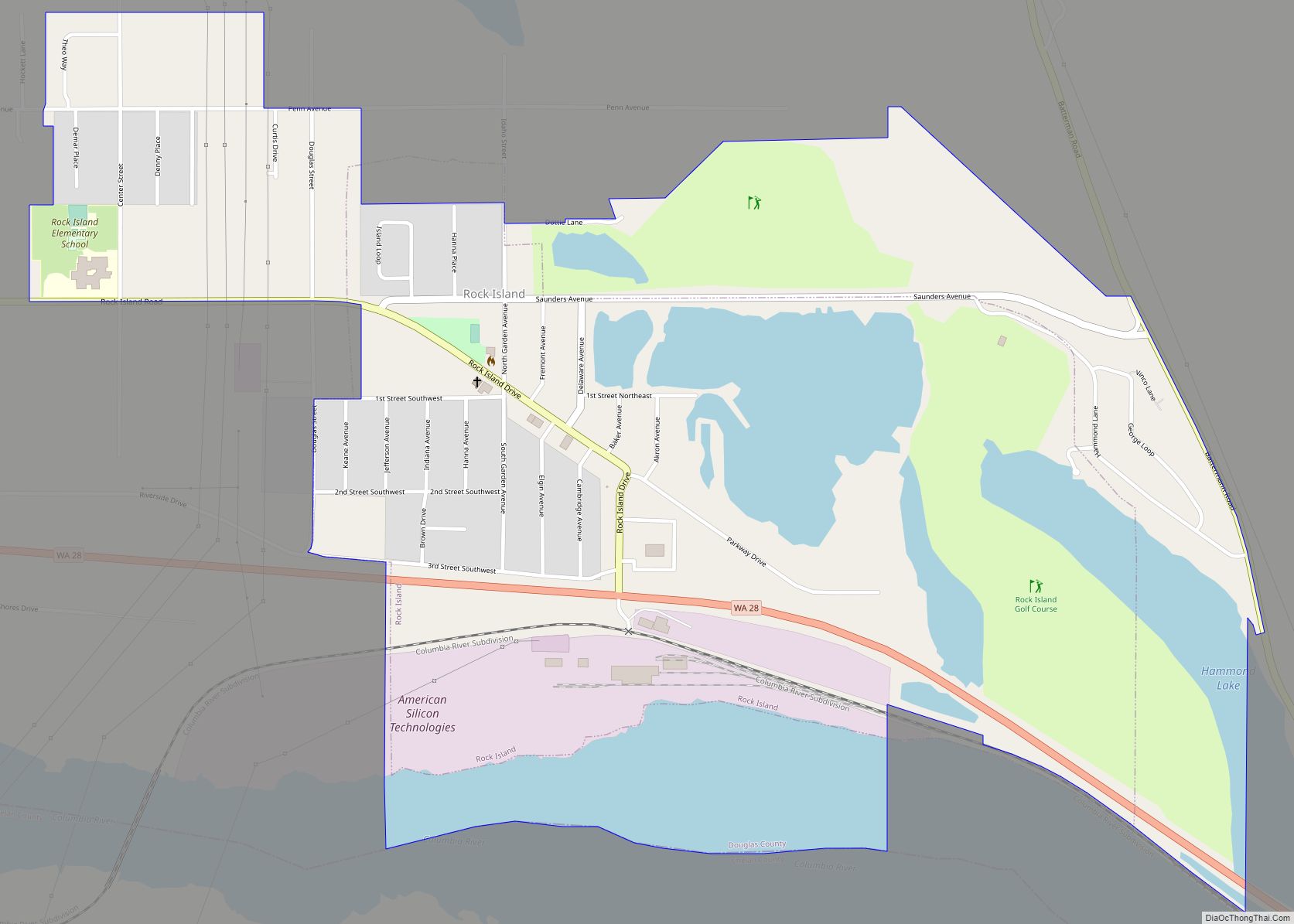
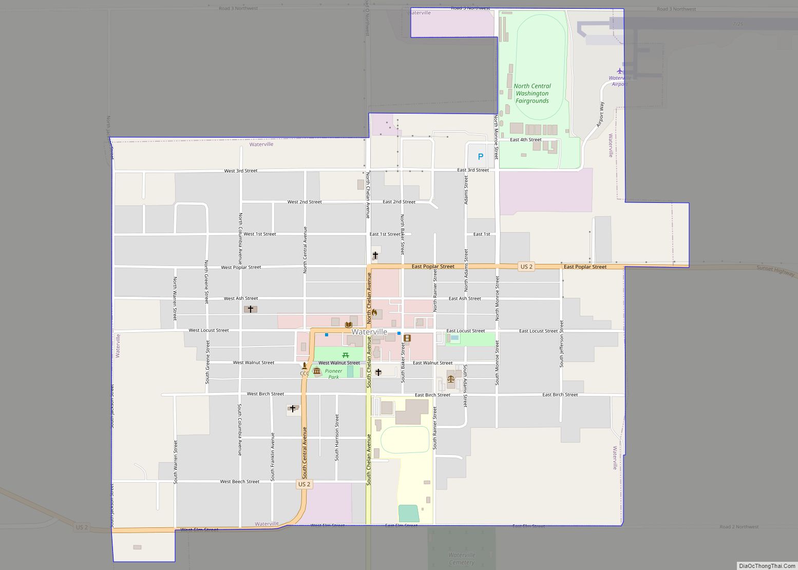
Online Interactive Map
Click on ![]() to view map in "full screen" mode.
to view map in "full screen" mode.
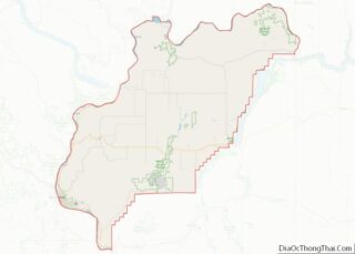
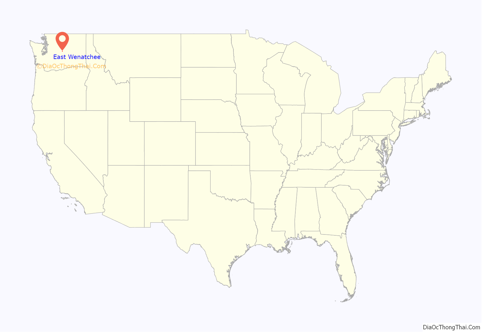
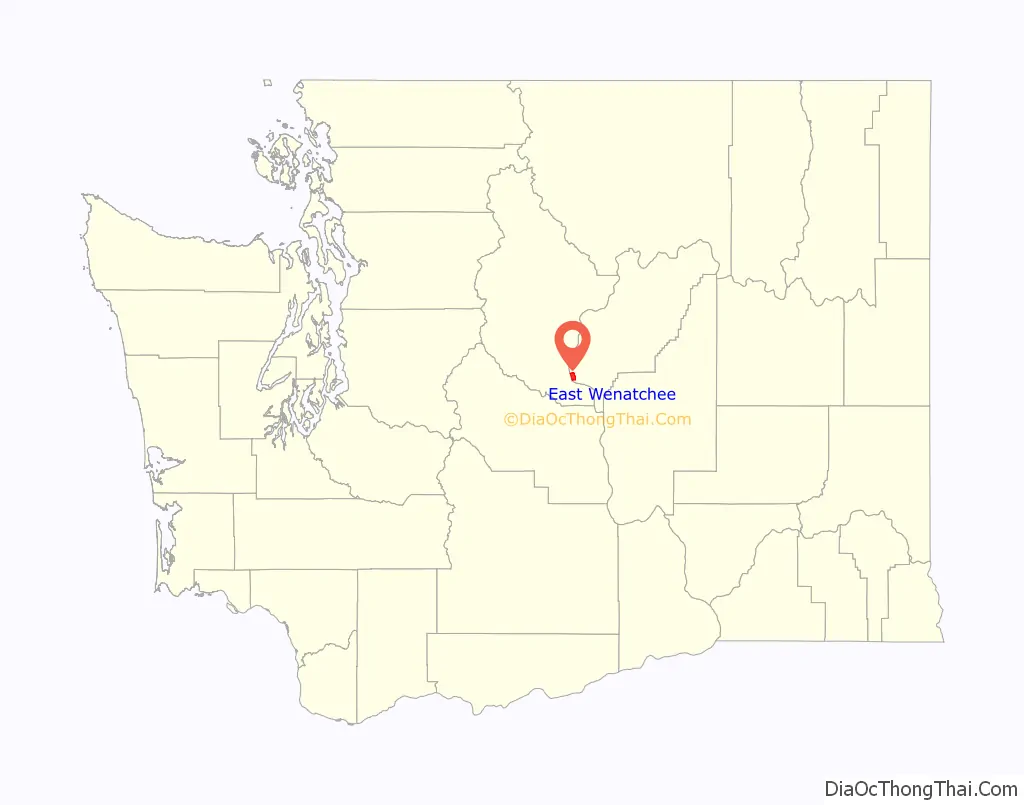
East Wenatchee location map. Where is East Wenatchee city?
History
At the turn of the 20th Century irrigation projects, including the Columbia Basin Project east of the region, fostered the development of intensive agriculture in the shrub-steppe native to the region. Fruit orchards become one of the area’s leading industries.
In 1908, the first highway bridge to span the Columbia River opened. The privately owned bridge carried people, horses, wagons, and automobiles; it also supported two large water pipelines along its sides. It connected Chelan County on the west (Wenatchee) shore with Douglas County on the East Wenatchee shore. The bridge opened East Wenatchee and the rest of Douglas County to apple orchard development. Still standing today, the bridge is a 1,060-foot (320 m) pin-connected steel cantilever bridge and cost $177,000 to build. It once carried Sunset Highway (State Highway 2) across the river.
The bridge was the brainchild of W. T. Clark, one of the builders of the Highline Canal, a major irrigation project to water the apple orchards in the valley. It was financed in part by James J. Hill (1838–1916), of the Great Northern Railway (which arrived in Wenatchee in 1892). In its second year of operation the canal firm that owned it decided to start charging tolls.
This prompted local leaders to hasten to the state legislature to persuade the state to purchase the bridge as part of the state highway system. The state purchased the bridge despite the state-employed consultant’s opinion “that the ugliness of the structure is very apparent” (Dorpat), despite defects in the timber floor and concrete piers, and despite leaks in the waterpipes.
The structure remained in full use until 1950 when the George Sellar bridge was built. Today, it remains as a footbridge on the Apple Capital Recreation Loop Trail and still has the old pipeline running across it.
From its foundation in agriculture, the region’s economy has diversified to include year-round tourism and a variety of other industries.
Founding
On February 28, 1935, citizens voted, 48 in favor and 46 against, to incorporate the town of East Wenatchee. When the town was incorporated on March 11, 1935, the original town site was 50 acres (200,000 m). Through subsequent annexations, the town has grown into a city. Today, East Wenatchee’s boundaries encompass 3.67 square miles (9.5 km).
Landing of first trans-pacific airplane flight
On October 5, 1931, East Wenatchee became part of aviation history. Having taken off from Misawa, Japan, pilots Clyde Pangborn and Hugh Herndon Jr. safely belly-landed their Bellanca airplane, Miss Veedol, on a nearby airstrip known then as Fancher Field. After take off, the pilots intentionally jettisoned the landing gear to conserve fuel. This flight was the first nonstop flight across the Pacific Ocean. In honor of this pioneering flight, East Wenatchee’s airport is called Pangborn Memorial Airport, the Pangborn-Herndon Memorial Site, listed on the National Register of Historic Places, is nearby, and Miss Veedol‘s propeller is displayed in the Wenatchee Valley Museum & Cultural Center.
Clovis points discovery
On May 27, 1987, East Wenatchee became part of archaeological history. On that date, while digging in an orchard just east of the city, farmworkers accidentally discovered a cache of 11,000-year-old Clovis points and other artifacts, left there by Pleistocene hunters. The East Wenatchee Clovis Site, explored in two subsequent archaeological digs in 1988 and 1990, was closed to science by the landowner after protests by local Native American tribes. The legal moratorium on new archaeological work at the site ended on June 1, 2007.[1]
Other
On January 8, 2007, East Wenatchee had a devastating wind storm with 100 MPH plus winds. The storm caused thousands of dollars worth of damage to homes, businesses, and city parks and many people went without power for days and even weeks.
East Wenatchee was also home to the only public school named after General Robert E. Lee in Washington State. The Robert E. Lee Elementary School (1955) and the school district rejected a name change in 2015 and again in August 2017. The school district voted to change the name from Robert E. Lee Elementary School to Lee Elementary School in 2018.
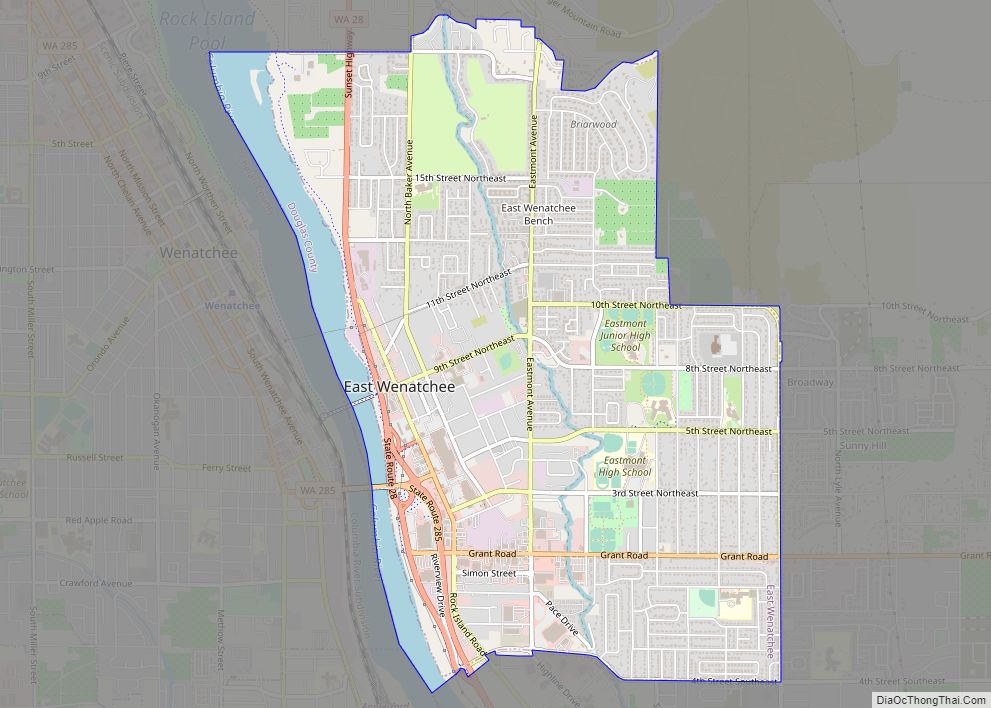
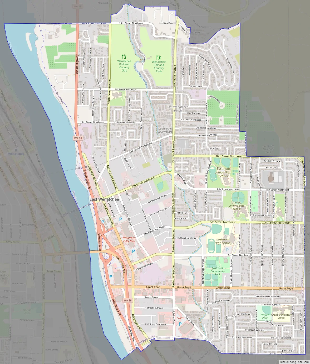
East Wenatchee Road Map
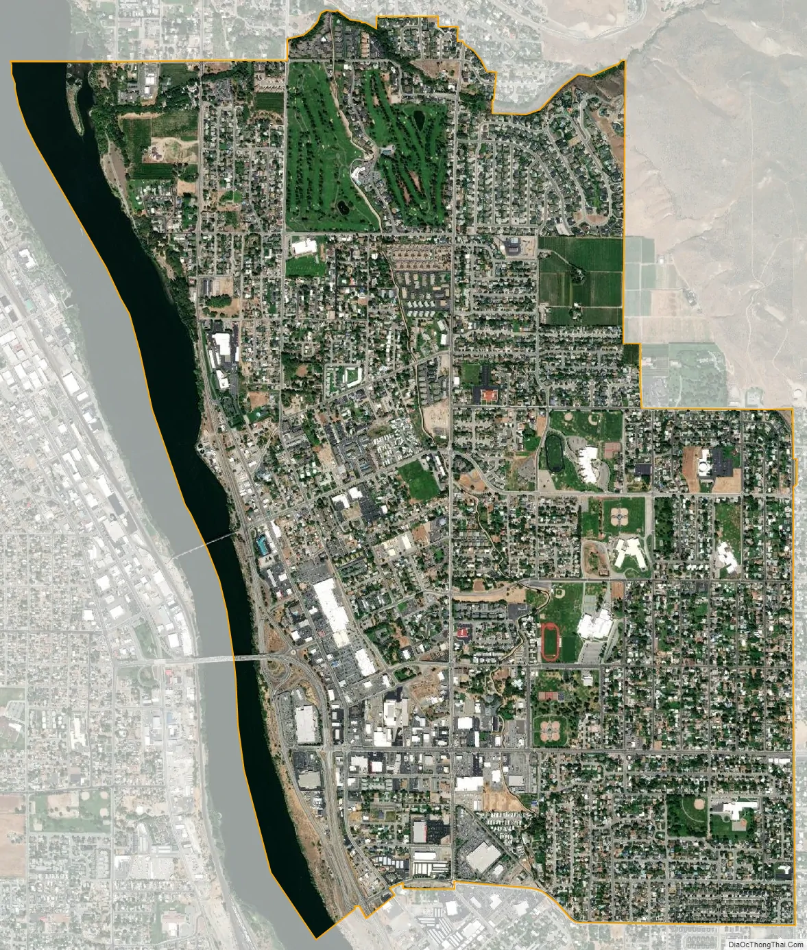
East Wenatchee city Satellite Map
Geography
East Wenatchee is located at 47°25′17″N 120°17′17″W / 47.421506°N 120.288094°W / 47.421506; -120.288094 (47.421506, -120.288094).
According to the United States Census Bureau, the city has a total area of 3.81 square miles (9.87 km), of which, 3.80 square miles (9.84 km) is land and 0.01 square miles (0.03 km) is water.
See also
Map of Washington State and its subdivision:- Adams
- Asotin
- Benton
- Chelan
- Clallam
- Clark
- Columbia
- Cowlitz
- Douglas
- Ferry
- Franklin
- Garfield
- Grant
- Grays Harbor
- Island
- Jefferson
- King
- Kitsap
- Kittitas
- Klickitat
- Lewis
- Lincoln
- Mason
- Okanogan
- Pacific
- Pend Oreille
- Pierce
- San Juan
- Skagit
- Skamania
- Snohomish
- Spokane
- Stevens
- Thurston
- Wahkiakum
- Walla Walla
- Whatcom
- Whitman
- Yakima
- Alabama
- Alaska
- Arizona
- Arkansas
- California
- Colorado
- Connecticut
- Delaware
- District of Columbia
- Florida
- Georgia
- Hawaii
- Idaho
- Illinois
- Indiana
- Iowa
- Kansas
- Kentucky
- Louisiana
- Maine
- Maryland
- Massachusetts
- Michigan
- Minnesota
- Mississippi
- Missouri
- Montana
- Nebraska
- Nevada
- New Hampshire
- New Jersey
- New Mexico
- New York
- North Carolina
- North Dakota
- Ohio
- Oklahoma
- Oregon
- Pennsylvania
- Rhode Island
- South Carolina
- South Dakota
- Tennessee
- Texas
- Utah
- Vermont
- Virginia
- Washington
- West Virginia
- Wisconsin
- Wyoming