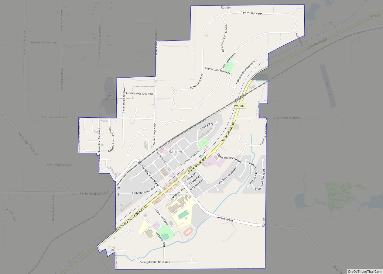
Map of Yacolt town

Map of Yacolt town

Yacolt town overview: Name: Yacolt town LSAD Code: 43 LSAD Description: town (suffix) State: Washington County: Clark County FIPS code: 5379975 Online Interactive Map Yacolt online map. Source: Basemap layers from Google Map, Open Street Map (OSM), Arcgisonline, Wmflabs. Boundary Data from Database of Global Administrative Areas. Yacolt location map. Where is Yacolt town? Yacolt … Read more

Map of Woodway city, Washington

Map of Woodway city, Washington

Woodway is a city in Snohomish County, Washington, United States. The population was 1,307 at the 2010 census. Based on per capita income, one of the more reliable measures of affluence, Woodway ranks 6th of 522 areas in the state of Washington to be ranked. It is also the highest rank achieved in Snohomish County. … Read more

Map of Woods Creek CDP

Map of Woods Creek CDP

Woods Creek is a census-designated place (CDP) in Snohomish County, Washington, United States. The population was 5,589 at the 2010 census. Based on per capita income, one of the more reliable measures of affluence, Woods Creek ranks 80th of 522 areas in the state of Washington to be ranked. Woods Creek CDP overview: Name: Woods … Read more

Map of Woodland city, Washington

Map of Woodland city, Washington

Woodland is a city in Clark and Cowlitz counties in Washington, United States. Most residents live within Cowlitz County, in which the majority of the city lies. It is part of the ‘Longview, Washington Metropolitan Statistical Area’. The population was 6,531 at the 2020 census. Woodland city overview: Name: Woodland city LSAD Code: 25 LSAD … Read more

Map of Woodinville city

Map of Woodinville city

Woodinville is a city in King County, Washington, United States. It is a part of the Seattle metropolitan area. There is also a much larger population with Woodinville mailing addresses in adjacent unincorporated areas of King (Cottage Lake) and Snohomish (Maltby) counties. Woodinville has waterfront parks on the Sammamish River, sweeping winery and brewery grounds, … Read more

Map of Wollochet CDP

Map of Wollochet CDP

Wollochet is located in Pierce County and is a census-designated place community with a 2010 census population of 6,651. Wollochet CDP overview: Name: Wollochet CDP LSAD Code: 57 LSAD Description: CDP (suffix) State: Washington County: Pierce County FIPS code: 5379555 Online Interactive Map Wollochet online map. Source: Basemap layers from Google Map, Open Street Map … Read more

Map of Wishram CDP

Map of Wishram CDP

Wishram is an unincorporated community and census-designated place (CDP) in Klickitat County, Washington, United States. The population was 342 at the 2010 census, up from 213 at the 2000 census. The site of the historic Celilo Falls is nearby. The community was originally named “Fallbridge”; it was changed to “Wishram” to honor the Wishram tribe … Read more

Map of Winthrop town, Washington

Map of Winthrop town, Washington

Winthrop town overview: Name: Winthrop town LSAD Code: 43 LSAD Description: town (suffix) State: Washington County: Okanogan County FIPS code: 5379380 Online Interactive Map Winthrop online map. Source: Basemap layers from Google Map, Open Street Map (OSM), Arcgisonline, Wmflabs. Boundary Data from Database of Global Administrative Areas. Winthrop location map. Where is Winthrop town? Winthrop … Read more

Map of Winlock city

Map of Winlock city

Winlock (/wɪnlək/) is a city in Lewis County, Washington, United States. The population was 1,472 at the 2020 census. It was named after territorial army general, Winlock M. Miller, who briefly resided there. Winlock is mostly famous for having the World’s Largest Egg, reflecting its former status as a major producer of eggs. Early in … Read more

Map of Wilson Creek town

Map of Wilson Creek town

Wilson Creek town overview: Name: Wilson Creek town LSAD Code: 43 LSAD Description: town (suffix) State: Washington County: Grant County FIPS code: 5379135 Online Interactive Map Wilson Creek online map. Source: Basemap layers from Google Map, Open Street Map (OSM), Arcgisonline, Wmflabs. Boundary Data from Database of Global Administrative Areas. Wilson Creek location map. Where … Read more

Map of Willapa CDP

Map of Willapa CDP

Willapa is a census-designated place (CDP) in Pacific County, Washington, east of the city of Raymond. The population was 210 as of the 2010 census. The name comes from that of the Willapa people, an Athapaskan-speaking people, now extinct, who occupied the Willapa River valley, which was similarly named after the Willapa people, along which … Read more

Map of Krupp (Marlin) town

Map of Krupp (Marlin) town, Washington

Krupp (Marlin) town overview: Name: Krupp (Marlin) town LSAD Code: 43 LSAD Description: town (suffix) State: Washington County: Grant County FIPS code: 5336395 Online Interactive Map Krupp (Marlin) online map. Source: Basemap layers from Google Map, Open Street Map (OSM), Arcgisonline, Wmflabs. Boundary Data from Database of Global Administrative Areas. Krupp (Marlin) location map. Where … Read more