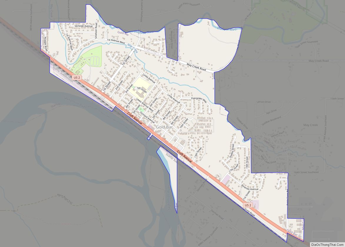
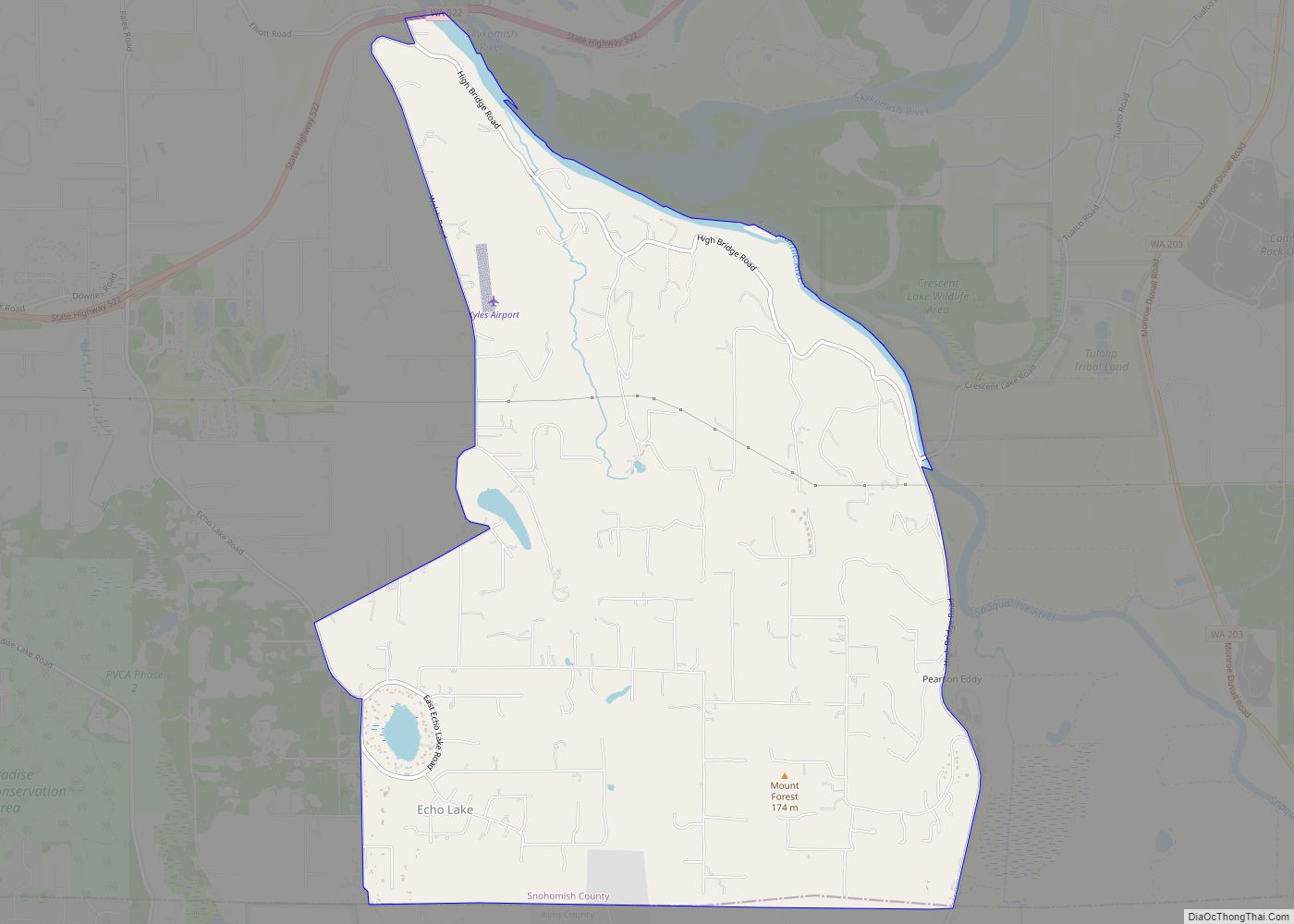
Map of Gorst CDP
Gorst is a census-designated place (CDP) at the head of Sinclair Inlet in Kitsap County, Washington, United States. The population was 592 at the 2010 census. Gorst, located on the shores of Puget Sound, is primarily a town consisting of stores, auto dealerships and espresso stands. A residential area, located west of the water along ... Read more
Map of Gorst CDP
Map of Greenwater CDP
Greenwater is a census-designated place (CDP) in the northwest United States in Pierce County, Washington. Southeast of Seattle, the population was 67 at the 2010 census, down from 91 in 2000. Based on per capita income, Greenwater ranks 17th of 522 areas in the state of Washington to be ranked, and is the highest in ... Read more
Map of Greenwater CDP
Map of Grays River CDP
Grays River is a census-designated place (CDP) in Wahkiakum County, Washington. Grays River stands on the north bank of the lower Grays River, which flows into the Columbia River Estuary. The National Register of Historic Places-listed Grays River Covered Bridge crosses the Grays River in the community. It is the only such bridge still in ... Read more
Map of Grays River CDP
Map of Grayland CDP
Grayland is a census-designated place (CDP) in Grays Harbor County, Washington, United States. The population was 953 at the 2010 census. Grayland CDP overview: Name: Grayland CDP LSAD Code: 57 LSAD Description: CDP (suffix) State: Washington County: Grays Harbor County Elevation: 26 ft (8 m) Total Area: 6.89 sq mi (17.83 km²) Land Area: 6.84 sq mi (17.71 km²) Water Area: 0.05 sq mi (0.12 km²) ... Read more
Map of Grayland CDP
Map of Grapeview CDP
Grapeview is a census-designated place (CDP) in Mason County, Washington, United States. The population was 954 at the 2010 census. It was part of the former Allyn-Grapeview CDP that was broken up into Allyn and Grapeview in 2010. Grapeview is connected to State Route 3 via Grapeview Loop Road. Grapeview is home to a small ... Read more
Map of Grapeview CDP
Map of Granite Falls city, Washington
Granite Falls is a city in Snohomish County, Washington, United States. It is located between the Pilchuck and Stillaguamish rivers in the western foothills of the Cascade Range, northeast of Lake Stevens and Marysville. The city is named for a waterfall north of downtown on the Stillagumish River, also accessible via the Mountain Loop Highway. ... Read more
Map of Granite Falls city, Washington
Map of Harrington city, Washington
Harrington is a city in Lincoln County, Washington, United States. The population was 424 at the 2010 census. It was named after W.P. Harrington, a banker from Colusa, California, who had heavily invested in local land. Harrington city overview: Name: Harrington city LSAD Code: 25 LSAD Description: city (suffix) State: Washington County: Lincoln County Elevation: ... Read more
Map of Harrington city, Washington
Map of Harrah town, Washington
Harrah town overview: Name: Harrah town LSAD Code: 43 LSAD Description: town (suffix) State: Washington County: Yakima County FIPS code: 5329710 Online Interactive Map Harrah online map. Source: Basemap layers from Google Map, Open Street Map (OSM), Arcgisonline, Wmflabs. Boundary Data from Database of Global Administrative Areas. Harrah location map. Where is Harrah town? Harrah ... Read more
Map of Harrah town, Washington
Map of Hansville CDP
Hansville is an unincorporated community and census-designated place (CDP) in Kitsap County, Washington, United States. Its population was 3,858 as of the 2020 census. The coastal community is located at the northern end of the Kitsap Peninsula and is about 16 miles (26 km) northeast of Poulsbo, the nearest city. Hansville CDP overview: Name: Hansville CDP ... Read more
Map of Hansville CDP
Map of Hobart CDP, Washington
Hobart is an unincorporated community and census-designated place (CDP) in King County, Washington, United States. The population was 6,767 at the 2020 census. Based on per capita income, one of the more reliable measures of affluence, Hobart ranks 31st of 522 areas in the state of Washington to be ranked. The Hobart area was first ... Read more
Map of Hobart CDP, Washington
Map of High Bridge CDP, Washington
High Bridge is a census-designated place (CDP) in Snohomish County, Washington, United States. The population was 2,994 at the 2010 census. High Bridge includes the Echo Lake community and the former Echo Lake CDP, which was superseded by the larger High Bridge CDP in 2010. High Bridge CDP overview: Name: High Bridge CDP LSAD Code: ... Read more
Map of High Bridge CDP, Washington
Map of Herron Island CDP
Herron Island is an island in central Case Inlet in the southern part of Puget Sound in the U.S. state of Washington. The Pierce County island has a land area of 1.2326 km² (304.57 acres) and a population of 151 persons as of the 2010 census. Herron Island is one of the few privately owned islands ... Read more
Map of Herron Island CDP