Gig Harbor is the name of both a bay on Puget Sound and a city on its shore in Pierce County, Washington,. The population was 12,029 at the 2020 census.
Gig Harbor bills itself as “the Maritime City” and maintains a strong connection to its maritime heritage. Due to its close access to several state and city parks, and historic waterfront that includes boutiques and fine dining, it has become a popular tourist destination. Gig Harbor is located along State Route 16, about 6 mi (10 km) from its origin at Interstate 5, over the Tacoma Narrows Bridge.
| Name: | Gig Harbor city |
|---|---|
| LSAD Code: | 25 |
| LSAD Description: | city (suffix) |
| State: | Washington |
| County: | Pierce County |
| Elevation: | 36 ft (11 m) |
| Total Area: | 6.12 sq mi (15.85 km²) |
| Land Area: | 5.90 sq mi (15.29 km²) |
| Water Area: | 0.22 sq mi (0.56 km²) |
| Total Population: | 12,029 |
| Population Density: | 1,815.83/sq mi (701.05/km²) |
| ZIP code: | 98329, 98332, 98335 |
| Area code: | 253 |
| FIPS code: | 5326735 |
| GNISfeature ID: | 1512239 |
| Website: | cityofgigharbor.net |
Online Interactive Map
Click on ![]() to view map in "full screen" mode.
to view map in "full screen" mode.
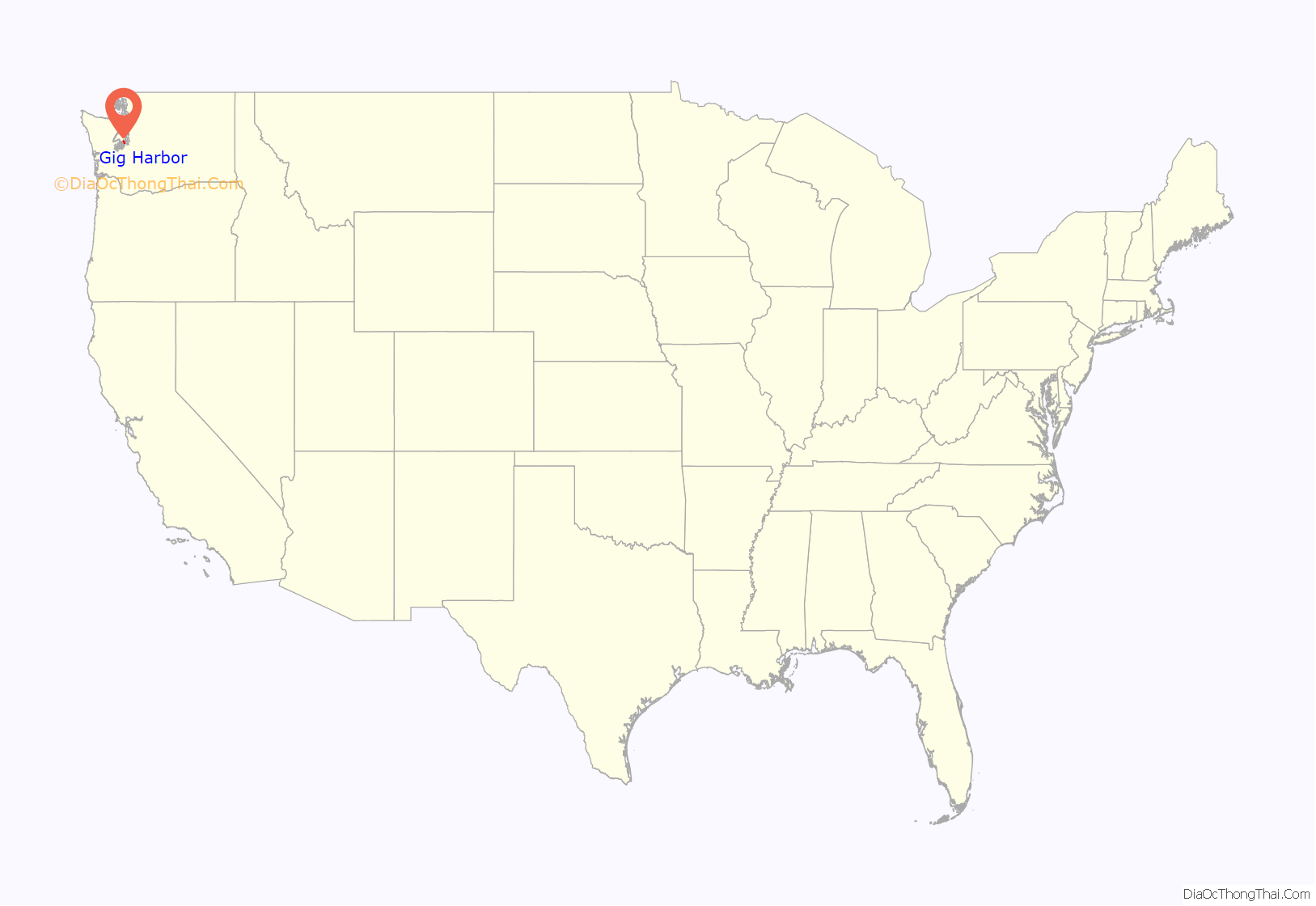
Gig Harbor location map. Where is Gig Harbor city?
History
During a heavy storm in 1840, Captain Charles Wilkes brought the captain’s gig (small boat) into the harbor for protection. Later, with the publication of Wilkes’ 1841 map of the Oregon Territory, the sheltered bay was named Gig Harbor by George Sinclair for his boat. A Puyallup settlement at the mouth of the harbor, named txʷaalqəł (“place where game exists”), had six buildings and a longhouse in the mid-19th century. The band were later relocated to the Puyallup Indian Reservation, but the longhouse at the camp survived until 1915.
In 1867, fisherman Samuel Jerisich came to the Gig Harbor area, along with many other immigrants from Sweden, Norway, and Croatia. The town was platted in 1888 by Alfred M. Burnham, the owner of a local general store and native of Albert Lea, Minnesota, where he advertised opportunities in Gig Harbor.
Commercial fishing, boat building, and logging dominated the economy of the Gig Harbor area, which developed two business districts in the 1920s on opposite sides of the harbor. Transportation between Gig Harbor and Tacoma was primarily handled by the “Mosquito fleet”, a network of mostly-passenger steamships that traversed various points on Puget Sound. Automobiles were required to drive 107 miles (172 km) through Olympia to reach Tacoma; the Washington Navigation Company later launched a Point Defiance–Gig Harbor ferry service in 1927 that could carry 80 vehicles. The first Tacoma Narrows Bridge was completed in July 1940 to replace the ferry crossing, but collapsed a few months later. The ferry service was restored until the modern-day westbound bridge was completed in 1950. A third bridge opened in 2007 to carry eastbound traffic on the expanded State Route 16 freeway.
Gig Harbor was officially incorporated as a town on July 12, 1946, after a previous attempt in September 1945 was rejected by 13 votes. The town had 803 residents in 1950, but soon grew due to the ease of access afforded by the replacement bridge that turned Gig Harbor into a bedroom community for Tacoma workers. Gig Harbor was re-incorporated as a city in 1981. By the 1980s and 1990s, substantial residential and retail development had pushed the city’s boundaries west to State Route 16, which had been upgraded to a partial freeway. The downtown area shifted towards tourism to compensate for lost business and attract new development. The city’s historic boat building industry declined, but its facilities remain preserved as historic landmarks. A fleet of commercial fishing boats is based in Gig Harbor and make annual trips to Alaska for the summer season to harvest salmon.
Skansie shipyard
In 1905, the Skansie brothers were the first in the area to build a gasoline-powered fishing boat. They did so at first by refitting boats with a gasoline-powered engine. Usually the motors were quite small, between 6 and 8 horsepower; the Skansie brothers originally used a 7-horsepower engine. Although these were powerboats, neither masts nor a turntable to hoist in the nets were used. This work was all done by hand. However, with the introduction of a motor, the boats were not able to go as far as Alaska. Skansie shipyards built fishing vessels from the late 1910s to the early 1950s.
Gig Harbor Road Map
Gig Harbor city Satellite Map
Geography
According to the U.S. Census Bureau, the city has a total area of 5.96 square miles (15.44 km), of which 5.95 square miles (15.41 km) are land and 0.01 square miles (0.03 km) is water.
Climate
Gig Harbor has a marine west coast climate: Warm and dry summers, transitional springs and autumns, and cool and wet winters, with occasional snow. The annual high and low temperatures of Gig Harbor are 59.3 °F (15.2 °C) and 44.8 °F (7.1 °C), respectively, making for an average of 52.05 °F (11.14 °C).
See also
Map of Washington State and its subdivision:- Adams
- Asotin
- Benton
- Chelan
- Clallam
- Clark
- Columbia
- Cowlitz
- Douglas
- Ferry
- Franklin
- Garfield
- Grant
- Grays Harbor
- Island
- Jefferson
- King
- Kitsap
- Kittitas
- Klickitat
- Lewis
- Lincoln
- Mason
- Okanogan
- Pacific
- Pend Oreille
- Pierce
- San Juan
- Skagit
- Skamania
- Snohomish
- Spokane
- Stevens
- Thurston
- Wahkiakum
- Walla Walla
- Whatcom
- Whitman
- Yakima
- Alabama
- Alaska
- Arizona
- Arkansas
- California
- Colorado
- Connecticut
- Delaware
- District of Columbia
- Florida
- Georgia
- Hawaii
- Idaho
- Illinois
- Indiana
- Iowa
- Kansas
- Kentucky
- Louisiana
- Maine
- Maryland
- Massachusetts
- Michigan
- Minnesota
- Mississippi
- Missouri
- Montana
- Nebraska
- Nevada
- New Hampshire
- New Jersey
- New Mexico
- New York
- North Carolina
- North Dakota
- Ohio
- Oklahoma
- Oregon
- Pennsylvania
- Rhode Island
- South Carolina
- South Dakota
- Tennessee
- Texas
- Utah
- Vermont
- Virginia
- Washington
- West Virginia
- Wisconsin
- Wyoming
