Map of East Troy village
East Troy is a town in Walworth County, Wisconsin, United States. The population was 3,392 as of the 2020 census. The unincorporated communities of Hilburn, Lake Beulah, and Potter Lake are located in the town, as was the ghost town of Army Lake. East Troy is also home to several summer camps. East Troy village ... Read more
Map of East Troy village
Map of Dickeyville village
Dickeyville is a village in Grant County, Wisconsin, United States. The population was 1,061 at the 2010 census. The Dickeyville Grotto is located in the heart of the village. Dickeyville village overview: Name: Dickeyville village LSAD Code: 47 LSAD Description: village (suffix) State: Wisconsin County: Grant County Elevation: 958 ft (292 m) Total Area: 1.01 sq mi (2.62 km²) Land ... Read more
Map of Dickeyville village
Map of Eagle village, Wisconsin
Eagle is a town in Waukesha County, Wisconsin, United States. The population was 3,478 at the 2020 census. The Village of Eagle is located within the town. The unincorporated community of Eagleville is also located in the town. Eagle village overview: Name: Eagle village LSAD Code: 47 LSAD Description: village (suffix) State: Wisconsin County: Waukesha ... Read more
Map of Eagle village, Wisconsin
Map of Eagle Lake CDP, Wisconsin
Eagle Lake is a census-designated place (CDP) in the town of Dover, Racine County, Wisconsin, United States. The population was 1,251 at the 2020 census. Eagle Lake CDP overview: Name: Eagle Lake CDP LSAD Code: 57 LSAD Description: CDP (suffix) State: Wisconsin County: Racine County Elevation: 801 ft (244 m) Total Area: 3.0 sq mi (7.8 km²) Land Area: 2.2 sq mi ... Read more
Map of Eagle Lake CDP, Wisconsin
Map of Dyckesville CDP
Dyckesville is an unincorporated census-designated place in Brown and Kewaunee counties in the U.S. state of Wisconsin located in the towns of Green Bay and Red River. As of the 2010 census its population was 538. Dyckesville is bypassed by Wisconsin Highway 57, which ran through the community until 2006. Dyckesville is part of the ... Read more
Map of Dyckesville CDP
Map of Drummond CDP, Wisconsin
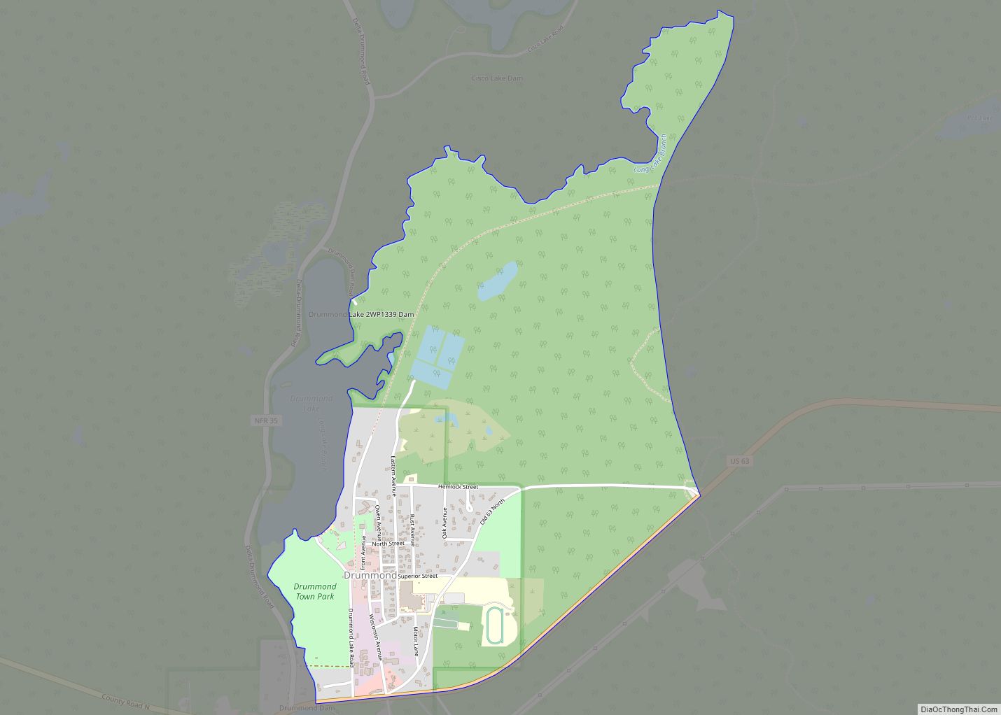
Drummond is an unincorporated, census-designated place located in the town of Drummond, Bayfield County, Wisconsin, United States. U.S. Highway 63 serves as a main route in the community. Drummond is located 31 miles southwest of the city of Ashland; and 26 miles northeast of the city of Hayward. Drummond has a post office with ZIP ... Read more
Map of Drummond CDP, Wisconsin
Map of Dousman village
Dousman is a village in Waukesha County, Wisconsin, United States. The population was 2,419 at the 2020 census. Dousman village overview: Name: Dousman village LSAD Code: 47 LSAD Description: village (suffix) State: Wisconsin County: Waukesha County Elevation: 866 ft (264 m) Total Area: 2.77 sq mi (7.17 km²) Land Area: 2.63 sq mi (6.82 km²) Water Area: 0.14 sq mi (0.35 km²) Total Population: 2,419 Population ... Read more
Map of Dousman village
Map of Elmwood village, Wisconsin
Elmwood is a village in Pierce County, Wisconsin, along the Eau Galle River. The population was 817 at the 2010 census. Elmwood village overview: Name: Elmwood village LSAD Code: 47 LSAD Description: village (suffix) State: Wisconsin County: Pierce County Elevation: 860 ft (262 m) Total Area: 1.54 sq mi (3.98 km²) Land Area: 1.51 sq mi (3.92 km²) Water Area: 0.02 sq mi (0.05 km²) Total ... Read more
Map of Elmwood village, Wisconsin
Map of Elmwood Park village, Wisconsin
Elmwood Park is a village in Racine County, Wisconsin, United States. The population was 510 at the 2020 census. Elmwood Park village overview: Name: Elmwood Park village LSAD Code: 47 LSAD Description: village (suffix) State: Wisconsin County: Racine County Elevation: 646 ft (197 m) Total Area: 0.15 sq mi (0.40 km²) Land Area: 0.15 sq mi (0.39 km²) Water Area: 0.00 sq mi (0.01 km²) Total ... Read more
Map of Elmwood Park village, Wisconsin
Map of Elm Grove village, Wisconsin
Elm Grove is a village in Waukesha County, Wisconsin, United States. The population was 6,524 at the 2020 census. Elm Grove was named as America’s best suburb by Business Insider in October 2014. Elm Grove village overview: Name: Elm Grove village LSAD Code: 47 LSAD Description: village (suffix) State: Wisconsin County: Waukesha County Elevation: 748 ft ... Read more
Map of Elm Grove village, Wisconsin
Map of Ellsworth village, Wisconsin
Ellsworth is a village in and the county seat of Pierce County, Wisconsin, United States. The population was 3,348 at the 2020 census. The village is adjacent to the Town of Ellsworth and now incorporates the formerly separate district known as East Ellsworth. The municipality of Ellsworth and its surroundings are slowly becoming incorporated into ... Read more
Map of Ellsworth village, Wisconsin
Map of Ellison Bay CDP
Ellison Bay is an unincorporated community and census-designated place in northern Door County, Wisconsin, United States, within the town of Liberty Grove and is located on Highway 42 along the Green Bay. As of the 2020 census, its population is 249. Sur La Baie, one of Wisconsin’s largest and most expensive homes, is located nearby. ... Read more
Map of Ellison Bay CDP