Map of Milwaukee city

Map of Milwaukee city

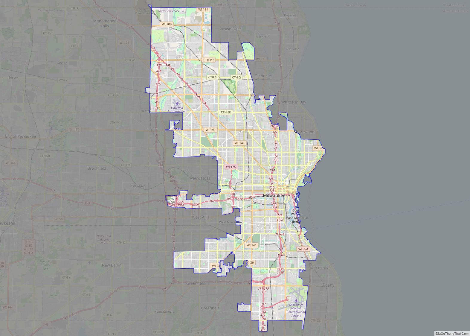
Milwaukee (/mɪlˈwɔːki/ mil-WAW-kee) is a city in the U.S. state of Wisconsin and the county seat of Milwaukee County. With a population of 577,222 at the 2020 census, Milwaukee is the 31st largest city in the United States, the fifth-largest city in the Midwest, and the largest city in the state of Wisconsin. It is … Read more

Map of Madison city, Wisconsin

Map of Madison city, Wisconsin

Madison is the county seat of Dane County and the capital city of the U.S. state of Wisconsin. As of the 2020 census the population was 269,840, making it the second-largest city in Wisconsin by population, after Milwaukee, and the 80th-largest in the U.S. The city forms the core of the Madison Metropolitan Area which … Read more

Map of Kenosha city

Map of Kenosha city

Kenosha (/kəˈnoʊʃə/) is a city in the U.S. state of Wisconsin and the seat of Kenosha County. Per the 2020 census, the population was 99,986 which made it the fourth-largest city in Wisconsin. Situated on the southwestern shore of Lake Michigan, Kenosha is part of the Chicago metropolitan area as defined by the U.S. Census … Read more

Map of Abrams CDP

Map of Abrams CDP

Abrams is an unincorporated community census-designated place located in the town of Abrams, Oconto County, Wisconsin, United States. Abrams is located near U.S. Route 41 and U.S. Route 141 8 miles (13 km) south-southeast of Oconto Falls. Abrams has a post office with ZIP code 54101. As of the 2020 census, its population was 358. Abrams … Read more

Map of Abbotsford city

Map of Abbotsford city

Abbotsford is a city in Clark (mostly) and Marathon counties in the U.S. state of Wisconsin. The population was 2,275 at the 2020 census. Of this, 1,665 were in Clark County, and 610 were in Marathon County. Abbotsford is nicknamed “Wisconsin’s First City” due to its alphabetical place on a list of Wisconsin cities. Abbotsford … Read more

Map of Amberg CDP

Map of Amberg CDP

Amberg is an unincorporated census-designated place in Marinette County, Wisconsin, United States, in the town of Amberg. It is located on U.S. Highway 141. As of the 2010 census, its population was 180. The Amberg Historical Society operates the Amberg Historical Museum Complex which consists of the historic town hall that is on the National … Read more

Map of Altoona city, Wisconsin

Map of Altoona city, Wisconsin

Altoona is a city in Eau Claire County, Wisconsin, United States. The population was 8,292 at the 2020 census with an estimated population in 2021 of 8,817. The city is a railroad terminal on the Union Pacific Railroad. Altoona city overview: Name: Altoona city LSAD Code: 25 LSAD Description: city (suffix) State: Wisconsin County: Eau … Read more

Map of Almond village, Wisconsin

Map of Almond village, Wisconsin

Almond is a town in Portage County, Wisconsin, United States. The population was 679 at the 2000 census. The unincorporated community of West Almond is located in the town. The Town of Almond was established in 1851. Almond village overview: Name: Almond village LSAD Code: 47 LSAD Description: village (suffix) State: Wisconsin County: Portage County … Read more