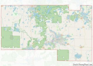
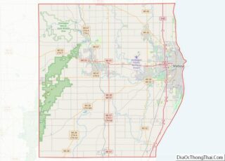
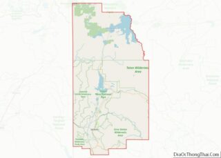
Sainte Genevieve County, often abbreviated Ste. Genevieve County (French: Ste-Geneviève), is a county located in the eastern portion of the U.S. state of Missouri. As of the 2020 census, the population was 18,479. The largest city and county seat is Ste. Genevieve. The county was officially organized on October 1, 1812, and is named after ... Read more
Map of US Counties
Webster County is a county located in the U.S. state of Missouri. As of the 2010 census, the population was 36,202. Its county seat is Marshfield. The county was organized in 1855 and named for U.S. Senator and U.S. Secretary of State Daniel Webster. Webster County is part of the Springfield, MO Metropolitan Statistical Area. ... Read more
Fergus County is a county in the U.S. state of Montana. As of the 2020 census, the population was 11,446. Its county seat is Lewistown. The county was founded in 1885 and named for James Fergus, a Montana politician who was instrumental in creating the county. Fergus County overview: Name: Fergus County FIPS code: 30-027 ... Read more
Meagher County (/ˈmɑːr/ MARR) is a county located in the U.S. state of Montana. As of the 2020 census, the population was 1,927. Its county seat is White Sulphur Springs. According to the United States Census Bureau, the 2010 center of population of Montana is located in Meagher County at 46°47′N 111°18′W / 46.78°N 111.3°W ... Read more