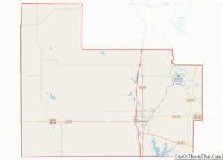
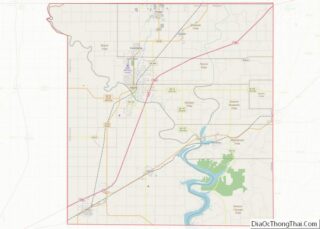
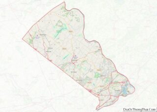
Map of Crawford County, Pennsylvania
Crawford County is a county in the Commonwealth of Pennsylvania. As of the 2020 census, the population was 83,938. Its county seat is Meadville. The county was created on March 12, 1800, from part of Allegheny County and named for Colonel William Crawford. Crawford County comprises the Meadville, PA Micropolitan Statistical Area, which is also ... Read more
Map of Crawford County, Pennsylvania
Map of Lancaster County, Pennsylvania
Lancaster County (/ˈlæŋkɪstər/; Pennsylvania Dutch: Lengeschder Kaundi), sometimes nicknamed the Garden Spot of America or Pennsylvania Dutch Country, is a county in the Commonwealth of Pennsylvania. It is located in the south central part of Pennsylvania. As of the 2020 census, the population was 552,984. Its county seat is Lancaster. Lancaster County comprises the Lancaster, ... Read more
Map of Lancaster County, Pennsylvania
Map of Pike County, Pennsylvania
Pike County is a county in the Commonwealth of Pennsylvania. It is part of Northeastern Pennsylvania. As of the 2020 census, the population was 58,535. Its county seat is Milford. Pike County is included in the New York-Newark–Jersey City, NY–NJ-PA Metropolitan Statistical Area. Pike County overview: Name: Pike County FIPS code: 42-103 State: Pennsylvania Founded: ... Read more
Map of Pike County, Pennsylvania
Map of Bristol County, Rhode Island
Bristol County is a county located in the U.S. state of Rhode Island. As of the 2020 census, the population was 50,793, making it the least populous county in Rhode Island. In terms of land area, it is the third-smallest county in the United States, at only 25 square miles (65 km). The county was created ... Read more
Map of Bristol County, Rhode Island
Map of Chester County, South Carolina
Chester County is a county located in the U.S. state of South Carolina. As of the 2020 census, its population was 32,294. Its county seat is Chester. Chester County is included in the Charlotte–Concord–Gastonia, NC-SC Metropolitan Statistical Area. Chester County overview: Name: Chester County FIPS code: 45-023 State: South Carolina Founded: 1785 Named for: Chester, ... Read more
Map of Chester County, South Carolina
Map of Kershaw County, South Carolina
Kershaw County is a county located in the U.S. state of South Carolina. As of the 2020 census, its population was 65,403. The county seat and largest city is Camden. The county was created in 1791 from parts of Claremont, Lancaster, Fairfield, and Richland counties. It is named for Col. Joseph Kershaw (1727–1791), an early ... Read more
Map of Kershaw County, South Carolina
Map of Union County, South Carolina
Union County is a county located in the U.S. state of South Carolina. As of the 2020 census, the population was 27,244. Its county seat is Union. The county was created in 1785. Union County is coterminous with the Union, SC, Micropolitan Statistical Area, which is also included in the Greenville–Spartanburg–Anderson, SC Combined Statistical Area. ... Read more
Map of Union County, South Carolina
Map of Codington County, South Dakota
Codington County is a county in the U.S. state of South Dakota. As of the 2020 United States Census, the population was 28,325. Its county seat is Watertown. The county was created in 1877 and organized in 1878. It is named for Rev. George S. S. Codington, Dakota Territory legislator. Codington County comprises the Watertown, ... Read more
Map of Codington County, South Dakota
Map of Hanson County, South Dakota
Hanson County is a county in the U.S. state of South Dakota. As of the 2020 census, the population was 3,461. Its county seat is Alexandria. The county was founded in 1871 and organized in 1873. It was named for Joseph R. Hanson, clerk of the first legislature. Hanson County is part of the Mitchell, ... Read more
Map of Hanson County, South Dakota
Map of Meade County, South Dakota
Meade County is a county in the U.S. state of South Dakota. As of the 2020 United States Census, the population was 29,852. Its county seat is Sturgis. The county was created in 1889 and named for Fort Meade, which was garrisoned as a United States military post in the area in 1878 and itself ... Read more
Map of Meade County, South Dakota
Map of Turner County, South Dakota
Turner County is a county in the U.S. state of South Dakota. As of the 2020 census, the population was 8,673. Its county seat is Parker. The county was established in 1871, and was named for Dakota Territory official John W. Turner. Turner County is a part of the Sioux Falls, SD Metropolitan Statistical Area. ... Read more
Map of Turner County, South Dakota
Map of Chester County, Tennessee
Chester County is a county located in the U.S. state of Tennessee. As of the 2020 census, the population was 17,341. Its county seat is Henderson. The county was created in 1879 and organized in 1882. Chester County is included in the Jackson, TN Metropolitan Statistical Area. Chester County overview: Name: Chester County FIPS code: ... Read more
Map of Chester County, Tennessee