Map of Villalba Municipio, Puerto Rico

Explore comprehensive maps and geographic information for Villalba Municipio, Puerto Rico. This page provides detailed cartographic resources including administrative boundaries, political divisions, street maps, satellite imagery, topographic details, and outline maps to help you understand the geographic layout and administrative structure of Villalba Municipio.

Villalba Municipio overview:
Founded:February 14, 1917
Founded by:José Ramón Figueroa, andWalter McJones
Area:37.69 sq mi (97.61 km)
Population:22,093
Population Rank:57thin Puerto Rico
Density:590/sq mi (230/km)
Demonym:Villalbeños

Villalba Municipio Administrative Map Online

Click on View map in full screen to view map in "full screen" mode.

Source: Boundary data is sourced from Database of Global Administrative Areas and OpenStreetMap.

High-Quality Maps of Villalba Municipio, Puerto Rico

Below are high-quality maps of Villalba Municipio, Puerto Rico compiled by Geographic Intelligence and shared freely with the community. You can download the file that best suits your needs.

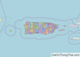
Political Map of Villalba Municipio, Puerto Rico

Political map of Villalba Municipio, Puerto Rico

Political Map with Labels

Political map with labels of Villalba Municipio, Puerto Rico

Street Map of Villalba Municipio, Puerto Rico

Street map of Villalba Municipio, Puerto Rico
Street map of Villalba Municipio, Puerto Rico based on OpenStreetMap

Villalba Municipio from Satellite View

Satellite view of Villalba Municipio, Puerto Rico

Topographic Map

Topographic map of Villalba Municipio, Puerto Rico

Outline Map

Outline map of Villalba Municipio, Puerto Rico
Rate this Post

Leave a Comment

Parent Unit Map

Map of Puerto Rico
The Commonwealth of Puerto Rico is an unincorporated island territory of the United States of America, located in north-eastern Caribbean Sea. It has a total area of 9,104 sq. km (3,515 sq mi). The territory consists of the main island, and a series of smaller islands, mostly off it’s eastern coastline.  Volcanic in origin, the big rectangular ... Read more
Map of Puerto Rico

Related Administrative Divisions