The Commonwealth of Puerto Rico is an unincorporated island territory of the United States of America, located in north-eastern Caribbean Sea. It has a total area of 9,104 sq. km (3,515 sq mi). The territory consists of the main island, and a series of smaller islands, mostly off it’s eastern coastline.
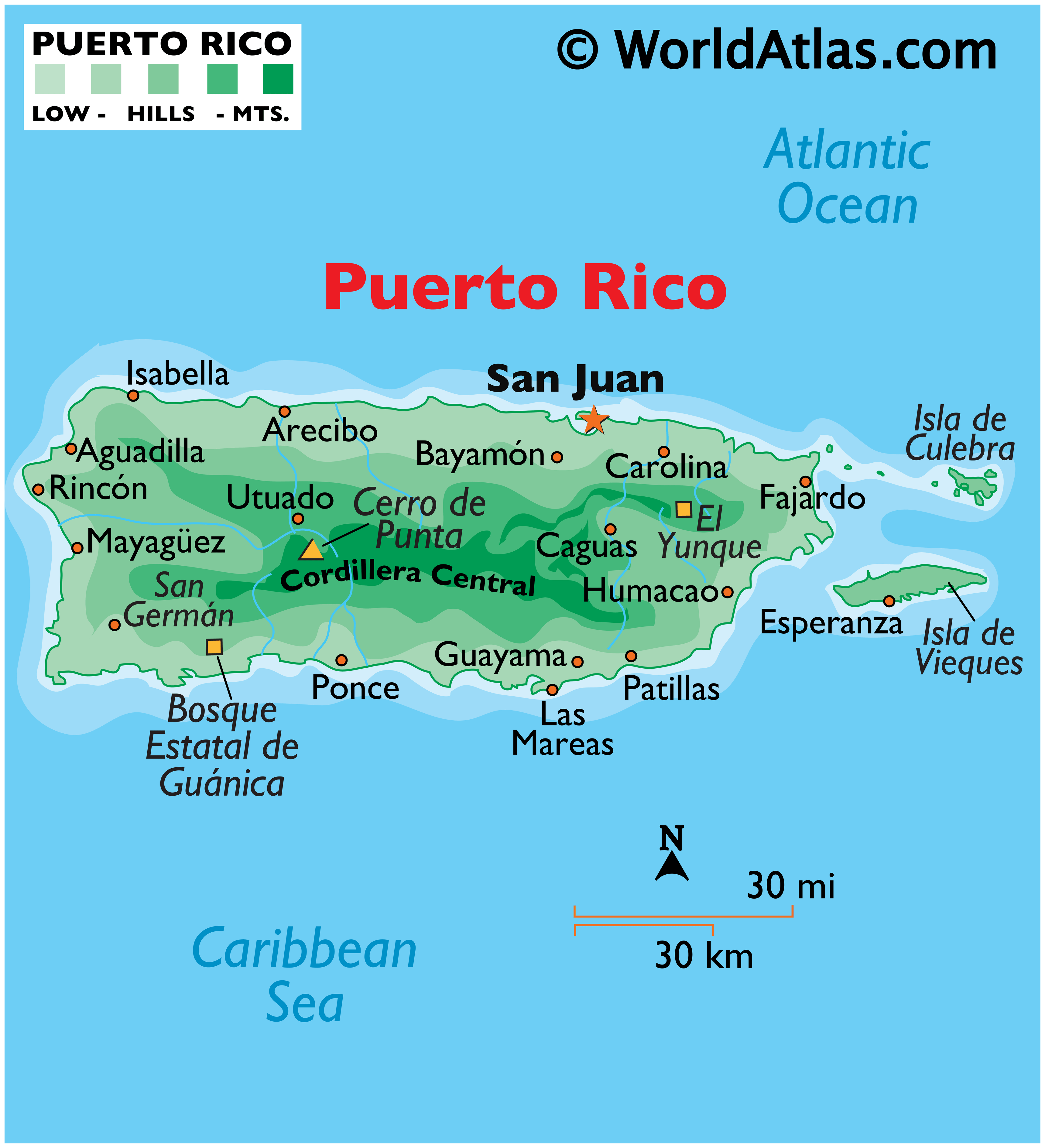
Volcanic in origin, the big rectangular shaped island is mountainous through its heart. As observed on the physical map of Puerto Rico above, the most significant mountain range “Cordillera Central” contains Puerto Rico’s highest point, Cerro de Punta at 1,339m ( 4,393 ft).
The coastal areas, north and south are mostly lowlands, fronted by hundreds of miles of sandy beaches. Rocky cliffs stretch across parts of the northern coastline, and in the north, Puerto Rico’s so called (karst region) contains small caves, caverns, rainforests, sinkholes, waterfalls and underground rivers.
A dozen (rather small) man-made lakes are scattered about, and more than 50 rivers drain the island. The Puerto Rico Trench, some 70 miles directly to the north, is the largest and the deepest trench in the Atlantic Ocean at 8,400m (27,600ft).
| Flag: |  |
|---|---|
| Legal Name: | Commonwealth of Puerto Rico |
| Capital Value: | San Juan |
| Official languages: |
|
| Demonym(s): |
|
| Government: | Devolved presidential constitutional dependency |
| Legislature: | Legislative Assembly |
| Total Area: | 9,104 km² |
| Land Area: | 8,959 km² |
| Water Area: | 145 km² |
| Population: | 3,193,694 |
| Density: | 350.8/km (908.6/sq mi) (39th) |
| GDP: | $104.99 Billion |
| GDP Per Capita: | $32,873.72 |
| Currency Value: | US Dollar (USD) |
| Driving side: | right |
| Calling code: | +1 (787), +1 (939) |
| Internet TLD: | .pr |
You are free to use our map of Puerto Rico for educational and commercial purposes. Proper attribution is required. To learn more about how to attribute, please refer to our How to Cite page.
Online Interactive Political Map
Click on ![]() to view map in "full screen" mode.
to view map in "full screen" mode.
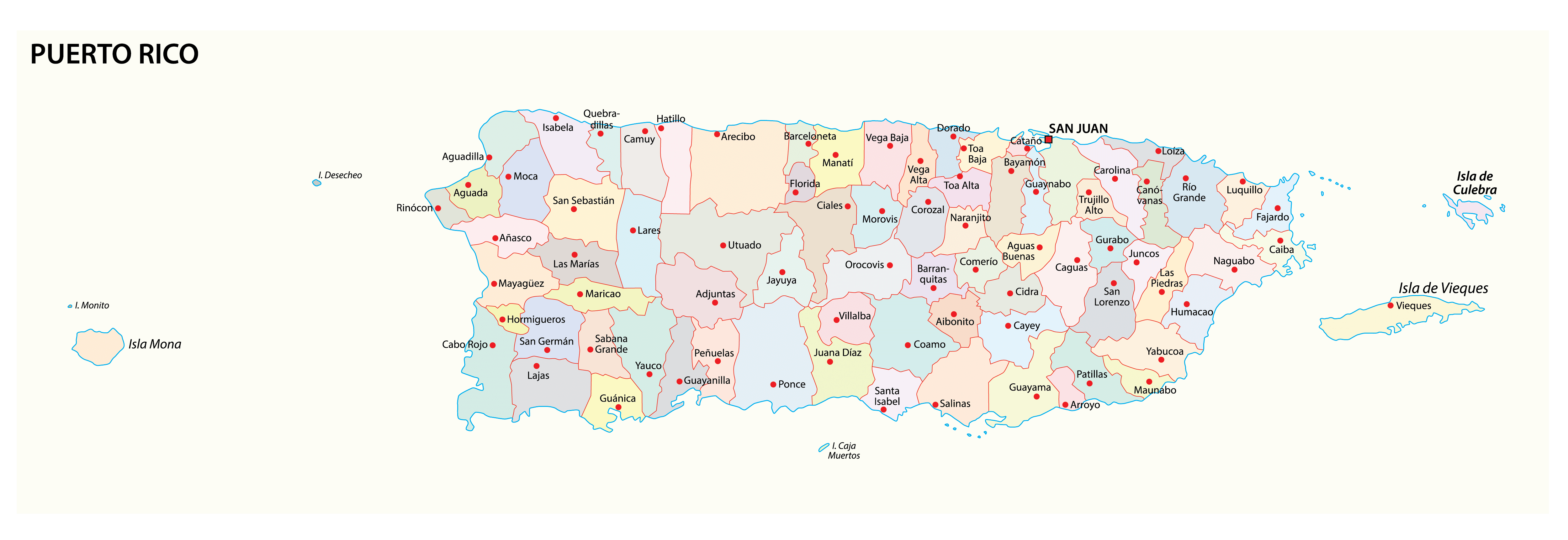
Puerto Rico (officially, the Commonwealth of Puerto Rico) has no first- order administrative divisions as defined by the US Government. There are 78 municipalities (municipios, singular – municipio), which are the 2nd order administrative divisions in Puerto Rico. In alphabetical order, the municipalities are: Adjuntas, Aguada, Aguadilla, Aguas Buenas, Aibonito, Anasco, Arecibo, Arroyo, Barceloneta, Barranquitas, Bayamon, Cabo Rojo, Caguas, Camuy, Canovanas, Carolina, Catano, Cayey, Ceiba, Ciales, Cidra, Coamo, Comerio, Corozal, Culebra, Dorado, Fajardo, Florida, Guanica, Guayama, Guayanilla, Guaynabo, Gurabo, Hatillo, Hormigueros, Humacao, Isabela, Jayuya, Juana Diaz, Juncos, Lajas, Lares, Las Marias, Las Piedras, Loiza, Luquillo, Manati, Maricao, Maunabo, Mayaguez, Moca, Morovis, Naguabo, Naranjito, Orocovis, Patillas, Penuelas, Ponce, Quebradillas, Rincon, Rio Grande, Sabana Grande, Salinas, San German, San Juan, San Lorenzo, San Sebastian, Santa Isabel, Toa Alta, Toa Baja, Trujillo Alto, Utuado, Vega Alta, Vega Baja, Vieques, Villalba, Yabucoa and Yauco. The municipalities are further subdivided into barrios.
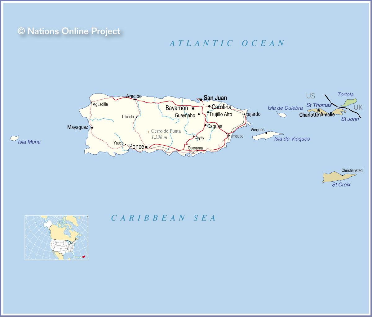
Located in the north-eastern coast of the island country is, San Juan – the capital, the largest city and the most populous municipality of Puerto Rico. It is the cultural, tourism and financial center of the country. San Juan is also the most important seaport of Puerto Rico.
Location Maps
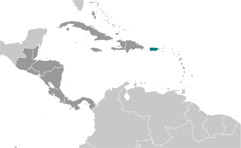
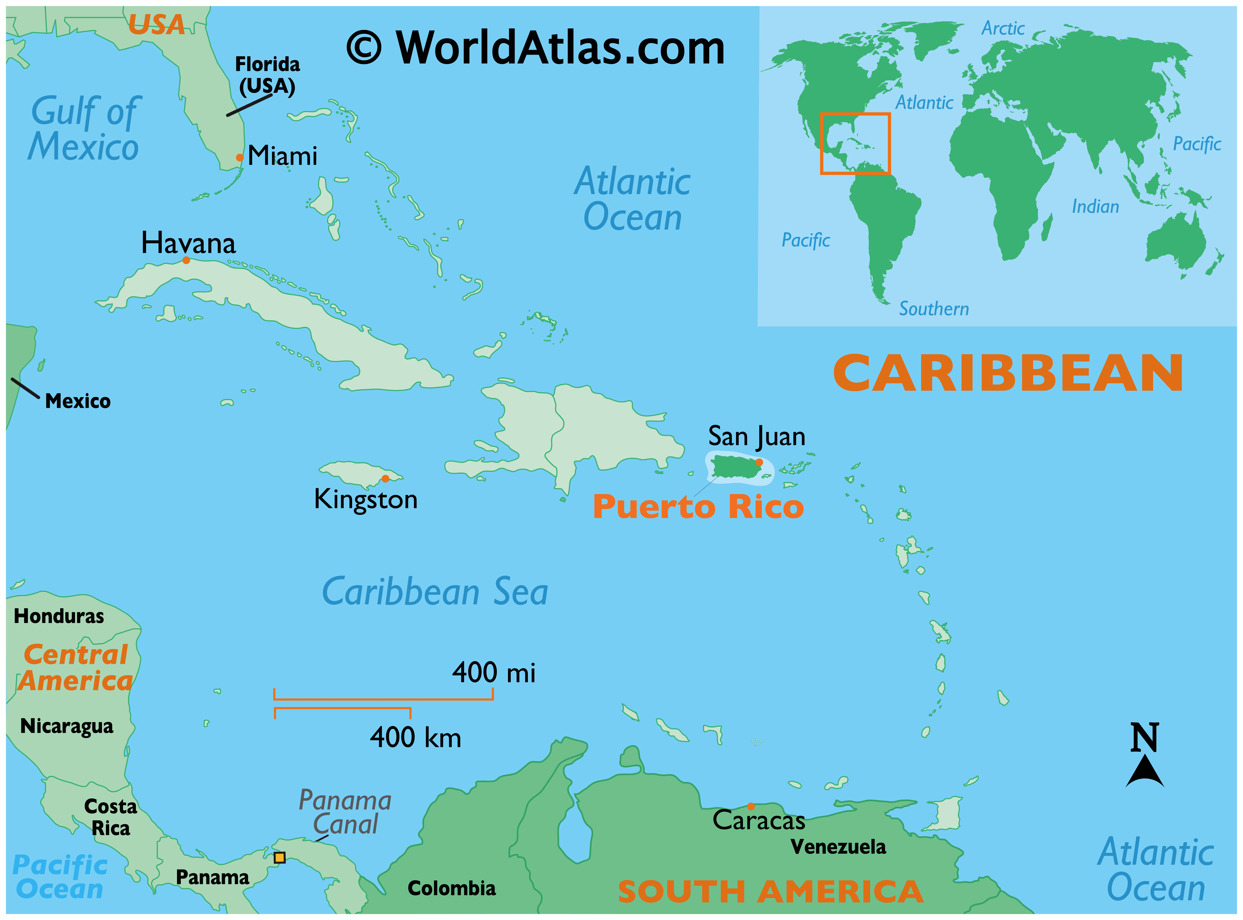
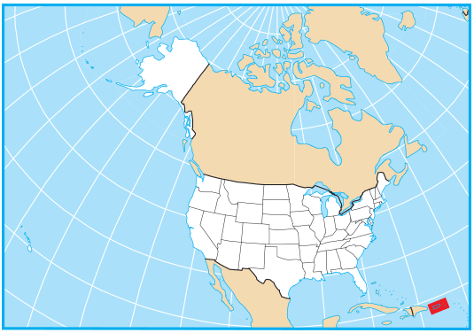
Where is Puerto Rico?
Exploring Puerto Rico: An Unincorporated Territory of the United States
Puerto Rico is an unincorporated territory of the United States, and it is not recognized as an independent country. Its official name is the “Commonwealth of Puerto Rico”. Located in the Caribbean, Puerto Rico has a mix of tropical rainforests, waterfalls, and mountains. As one of the smallest islands, Puerto Rico is only 100 miles long by 35 miles wide. San Juan is the capital and largest city in Puerto Rico, with about 3.2 million inhabitants. Spanish is the main language spoken in Puerto Rico.
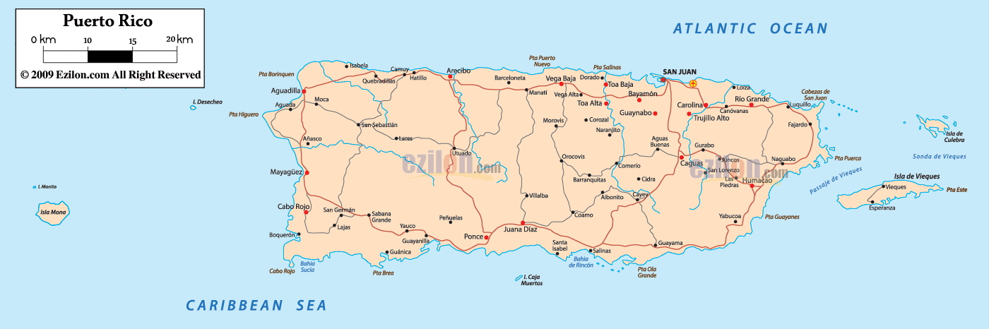
Map of Puerto Rico
This Puerto Rico map shows cities, roads, municipalities, and major landmarks. It is a useful tool to help you explore the island and learn more about its unique geography.
High Definition Political Map of Puerto Rico
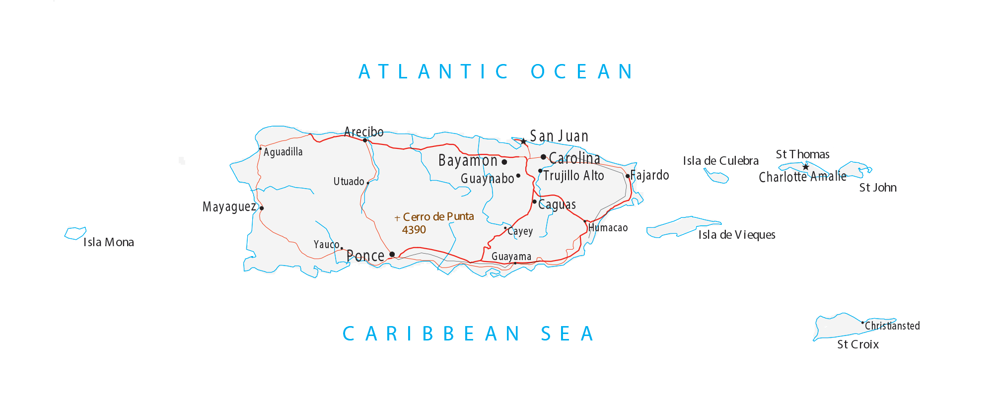
Physical Map of Puerto Rico