Map of Vietnam

Map of Vietnam

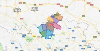
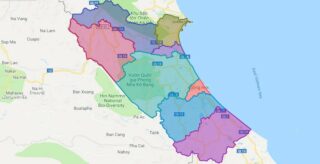
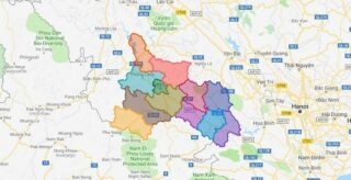
Located in the Indochinese Peninsula’s eastern edge, Vietnam covers an area of around 331,211.6 sq. km. The coastline of mainland Vietnam is about 3,260 km long. The country also includes several islands.  Vietnam is roughly S-shaped running for a distance of about 1,650 km in the north-to-south directions. It is about 50 km wide at … Read more

Map of Lao Cai province

Map of Lao Cai province

Lao Cai , is a province of the mountainous Northwest region of Vietnam bordering the province of Yunnan in China. The province covers an area of 6383.9 square kilometres and as of 2008 it had a population of 602,300 people. Lao Cai and Sa Pa are two important cities within the province at the border … Read more

Map of Vinh Long province

Map of Vinh Long province

Vinh Long is a province located in the Mekong Delta of southern Vietnam. Its capital is Vinh Long. Its population is 1,023,400 and its area is 1,475 km². Political Map of Vinh Long province Interactive online map of Vinh Long Click on to view map in “full screen” mode. Source: Database of Global Administrative Areas, … Read more

Map of Dien Bien province

Map of Dien Bien province

Dien Bien is a province in the Northwest region of Vietnam. It is bordered by Lai Chau to the north east, Son La provinces of Vietnam to the south east, Pu’er City, Yunnan, China, to the northwest, and Phongsaly Province in Laos to the west. Political Map of Dien Bien province Interactive online map of … Read more

Map of Ca Mau province

Map of Ca Mau province

Ca Mau is a province of Vietnam, named after its capital city. It is located in the Mekong Delta of southern Vietnam, and is the southernmost of Vietnam’s 58 provinces. It is bordered on the north by the Kien Giang and Bac Lieu provinces, on the west by the Gulf of Thailand, and on the … Read more

Map of Quang Tri province

Map of Quang Tri province

Quang Tri is a province on the North Central Coast region of Vietnam, north of the former imperial capital of Hue. Political Map of Quang Tri province Interactive online map of Quang Tri Click on to view map in “full screen” mode. Source: Database of Global Administrative Areas, Global Map of Vietnam ©ISCGM, Ministry of … Read more

Map of Dak Lak province

Map of Dak Lak province

Dak Lak is a province of Vietnam. It is located in Vietnam’s Central Highlands, and is home to quite a few indigenous ethnic minorities, such as the Rade, the Jarai and the Mnong, among others. The name comes from the Mnong (a Mon-Khmer language) word dak Lak (which would sound rather like “Dac Lac” in … Read more

Map of Dak Nong province

Map of Dak Nong province

Dak Nong, also Ðac Nong, is a province of Vietnam. It is located in the country’s Central Highlands. The provincial capital is Gia Nghia. Dak Nong borders Dak Lak Province in the north, Lam Dong Province in the south-east, Binh Phuoc Province and Cambodia in the west. It is located in the southern part of … Read more

Map of Nghe An province

Map of Nghe An province

Nghe An is a province in the North Central Coast region of Vietnam. It is Vietnam’s largest province by area. Nghe An is located in a central position in North Central Coast. To the east lies the Gulf of Tonkin; to the west the province is bordered by Laos; to the south Ha Tinh Province; … Read more

Map of Ha Giang province

Map of Ha Giang province

Ha Giang is a province in the Northeast region of Vietnam. It is located in the far north of the country, and contains Vietnam’s northernmost point. It shares a 270 km long border with Yunnan province of southern China, and thus is known as Vietnam’s final frontier. The province covers an area of 7,945.8 square … Read more

Map of Quang Binh province

Map of Quang Binh province

Quang Binh , formerly Tien Binh under the reign of Le Trung Hung of the Le Dynasty, this province was renamed Quang Binh in 1604) is a province along Vietnam’s north-central coast. The province has an area of 8,065.8 square kilometers and population of 857,818 inhabitants (as of 2008) The province is bordered by the … Read more

Map of Son La province

Map of Son La province

Son La is a province in the Northwest region of Vietnam. It borders Laos to the south. The population includes Black and White Tai ethnic group. Son La Dam, the largest hydroelectric power station in Southeast Asia. is located in this province. Son La is subdivided into 12 district-level sub-divisions: They are further subdivided into … Read more