Khanh Hoa is a province of Vietnam located in the South Central Coast. It has a population of 1,066,300 and spans an area of 5,197 km². Its capital is Nha Trang. Khanh Hoa is the site of Bao Dai’s summer home, the Pasteur Institute of Nha Trang, the Institute of Oceanography, the Institute of Vaccines and Biological Substances, and was headquarters of the US Army’s Special Forces (“the Green Berets”) during the Vietnam War in the late 1950s and 1960s. Cam Ranh Bay port is on land closest to a deep sea drop in Vietnam – the best site for submarine bases in Vietnam. An ancient temple of Champa is on the north side of Nha Trang.
The site of what is now Khanh Hoa had been within the territory of the Champa Kingdom before it was annexed to Dai Viet’s (Viet Nam’s) territory. In 1653, one of the Nguyen lords, Nguyen Phuc Tan, sent his troops to occupy Phan Rang. The Champa king Ba Tam surrendered to Nguyen’s troops and ceded an area from the east of the Phan Rang River to Phu Yen to the Nguyen lord. The Nguyen lord accepted the ceded territory and set up the Thai Khang garrison and divided it into two districts: Thai Khang and Dien Ninh.
In 1832, under the rule of emperor Minh Mang, this area was renamed Khanh Hoa and was divided into two districts which included four counties: Phu Dien Khanh inclusive of Phuoc Dien and Vinh Xuong county; Phu Ninh Hoa inclusive of Quang Phuoc and Tan Dinh county.
Under French Indochina, the provincial capital was located in Dien Khanh Citadel, but it was relocated in Nha Trang Town in 1945.
During the Vietnam War, Khanh Hoa was a hub of military activity for the Republic of Vietnam army (ARVN), the Republic of Vietnam Navy, the Republic of Vietnam Air Force, and for the U.S. Pacific Air Forces (USAF), particularly in Cam Ranh Bay and at the Nha Trang Air Base. The II Corp. headquarters was located in Nha trang and populated by general and field officers, intelligence groups and ARVN liaisons.
After the communists’ victory and the Fall of Saigon on April 30, 1975, the communist regime merged two provinces, Phu Yen and Khanh Hoa, into Phu Khanh Province on 29 October 1975. In 1977, Nha Trang Town was upgraded to city status. In 1982, the National Assembly decided to incorporate the Spratly Islands into Phu Khanh Province. On June 30, 1989, the National Assembly reversed its previous decision and split Phu Khanh Province into two provinces as they were before.
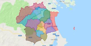
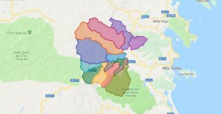
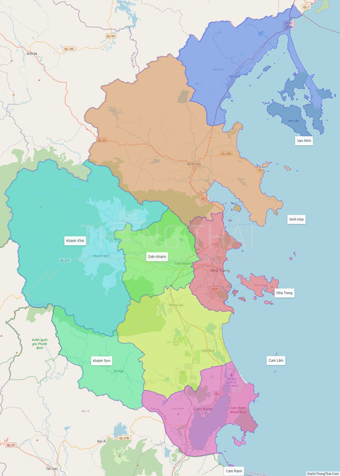
Political Map of Khanh Hoa province
Click on ![]() to view map in "full screen" mode.
to view map in "full screen" mode.
Base Map Layer: Open Street Map (OSM), Arcgisonline, Google Map, Wmflabs.
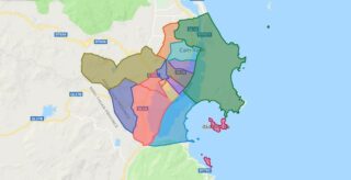
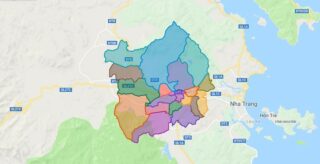
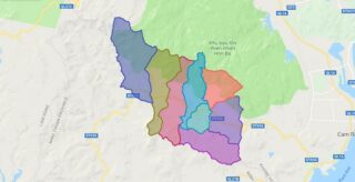
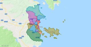
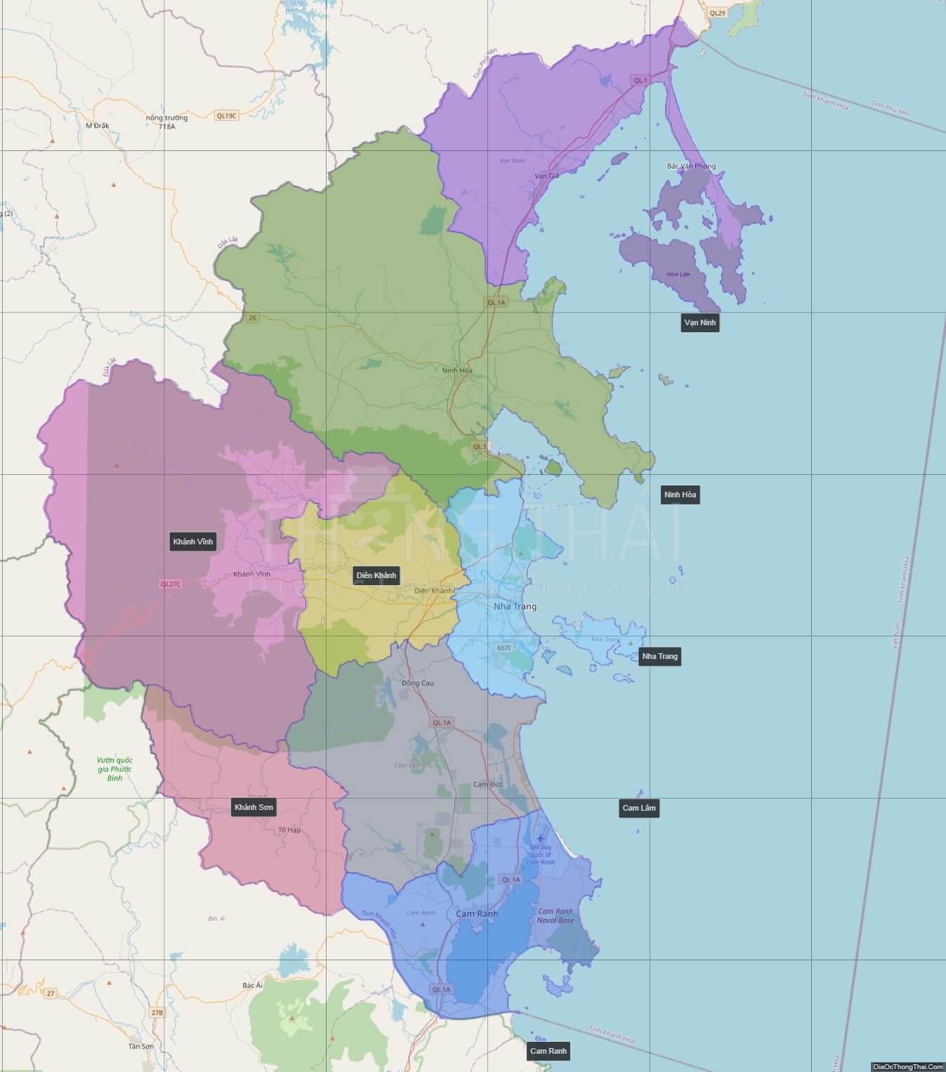
Large scale maps of Khanh Hoa province

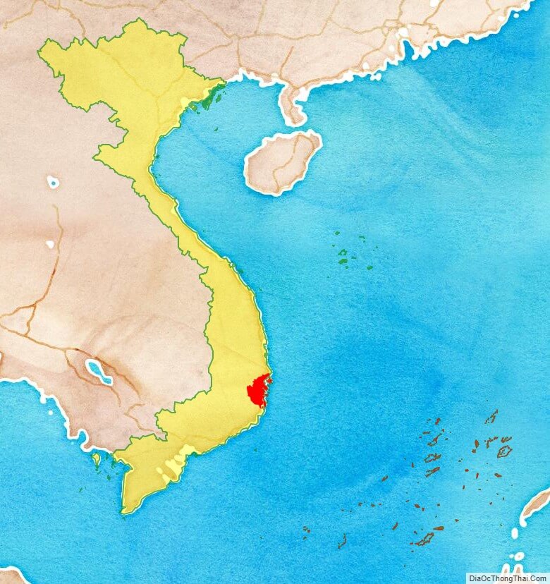
Khanh Hoa province location map
Khanh Hoa street map

Khanh Hoa satellite map