Sitka (Tlingit: Sheetʼká; Russian: Ситка) is a unified city-borough in the southeast portion of the U.S. state of Alaska. It was formerly known as New Archangel (Russian: Ново-Архангельск / Новоaрхангельск, romanized: Novo-Arkhangelsk / Novoarkhangelsk) while under Russian rule from 1799 to 1867. The city is situated on the west side of Baranof Island and the south half of Chichagof Island in the Alexander Archipelago of the Pacific Ocean (part of the Alaska Panhandle). As of the 2020 census, Sitka had a population of 8,458, the fifth-most populated city in the state.
With a consolidated land area of 2,870.3 square miles (7,434 square kilometers) and total area (including water) of 4,811.4 square miles (12,461 km), Sitka is the largest city-borough by total area in the U.S.
| Name: | Sitka City and Borough |
|---|---|
| FIPS code: | 02-220 |
| State: | Alaska |
| Named for: | Tlingit for “People on the outside of Shee” |
| Land Area: | 2,870.06 sq mi (7,433.42 km²) |
| Population Density: | 2.95/sq mi (1.14/km²) |
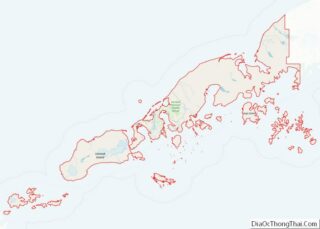
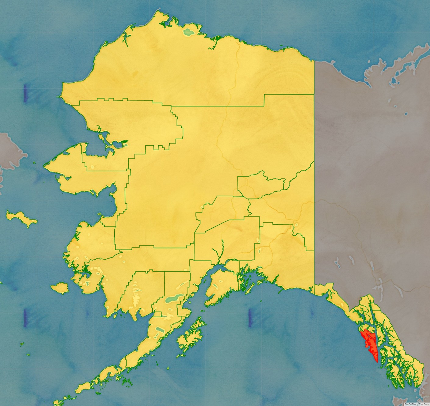
Sitka City and Borough location map. Where is Sitka City and Borough?
History
The current name Sitka (derived from Sheet’ká, a contraction of the Tlingit Shee At’iká) means “People on the Outside of Baranof Island”, whose Tlingit name is Sheet’-ká X’áat’l (here contracted to Shee).
Russian America
Russian explorers settled Old Sitka in 1799, naming it Fort of Archangel Michael (Russian: форт Архангела Михаила, t Fort Arkhangela Mikhaila). The governor of Russian America, Alexander Baranov, arrived under the auspices of the Russian-American Company, a colonial trading company chartered by Tsar Paul I. In June 1802, Tlingit warriors destroyed the original settlement, killing many of the Russians, with only a few managing to escape. Baranov was forced to levy 10,000 rubles in ransom for the safe return of the surviving settlers.
Baranov returned to Sitka in August 1804 with a large force, including Yuri Lisyansky’s Neva. The ship bombarded the Tlingit fortification on the 20th, but was not able to cause significant damage. The Russians then launched an attack on the fort and were repelled. Following two days of bombardment, the Tlingit “hung out a white flag” on the 22nd, deserting the fort on the 26th.
Following their victory at the Battle of Sitka, the Russians established the settlement “New Archangel”, named after Arkhangelsk. As a permanent settlement, New Archangel became the largest city in the region. The Tlingit re-established their fort on the Chatham Strait side of Peril Strait to enforce a trade embargo with the Russian establishment. In 1808, with Baranov still governor, Sitka was designated the capital of Russian America.
Bishop Innocent lived in Sitka after 1840. He was known for his interest in education, and his house, parts of which served as a schoolhouse, the Russian Bishop’s House has since been restored by the National Park Service as part of the Sitka National Historical Park.
The original Cathedral of Saint Michael was built in Sitka in 1848 and became the seat of the Russian Orthodox bishop of Kamchatka, the Kurile and Aleutian Islands, and Alaska. The original church burned to the ground in 1966, losing its handmade bells, the large icon of the Last Supper that decorated the top of the royal doors, and the clock in the bell tower. Also lost was the large library containing books in the Russian, Tlingit, and Aleut languages. Although the church was restored to its original appearance, one exception was its clock face which is black in photographs taken before 1966, but white in subsequent photos.
Swedes, Finns and other nationalities of Lutherans worked for the Russian-American Company, which led to the creation of a Lutheran congregation. The Sitka Lutheran Church building was built in 1840 and was the first Protestant church on the Pacific coast. After the transition to American control, following the purchase of Alaska from Russia by the United States in 1867, the influence of other Protestant religions increased, and Saint-Peter’s-by-the-Sea Episcopal Church was consecrated as “the Cathedral of Alaska” in 1900.
Territorial Alaska
Sitka was the site of the transfer ceremony for the Alaska purchase on October 18, 1867. Russia was going through economic and political turmoil after it lost the Crimean War to Britain, France, and the Ottoman Empire in 1856 and decided it wanted to sell Alaska before British Canadians tried to conquer the territory. Russia offered to sell it to the United States. Secretary of State William Seward had wanted to purchase Alaska for quite some time as he saw it as an integral part of Manifest Destiny and America’s reach to the Pacific Ocean. While the agreement to purchase Alaska was made in April 1867, the actual purchase and transfer of control took place on October 18, 1867. The cost to purchase Alaska was $7.2 million, 2 cents per acre.
Sitka served as the U.S. Government Capital of the Department of Alaska (1867–1884) and District of Alaska (1884–1906).
The seat of government was relocated north to Juneau in 1906 due to declining economic importance of Sitka relative to Juneau, which gained population in the Klondike Gold Rush.
Alaska Native Brotherhood, Alaska Native Sisterhood
The Alaska Native Brotherhood was founded in Sitka in 1912 to address racism against Alaska Native people in Alaska. By 1914, the organization had constructed the Alaska Native Brotherhood Hall on Katlian Street, which was named after a Tlingit war chief in the early period of Russian colonization.
World War II
In 1937, the United States Navy established the first seaplane base in Alaska on Japonski Island, across the Sitka Channel from the town. In 1941, construction began on Fort Ray, an army garrison to protect the naval air station. Both the army and navy remained in Sitka until the end of WWII, when the army base was put into caretaker status. The naval station in Sitka was deactivated in June 1944. A shore boat system was then established to transfer the approximately 1000 passengers a day until the O’Connell Bridge was built in 1972.
Economy
The Alaska Pulp Corporation was the first Japanese investment in the United States after WWII. In 1959, it began to produce pulp harvested from the Tongass National Forest under a 50-year contract with the US Forest Service. At its peak, the mill employed around 450 people before closing in 1993.
Sitka’s Filipino community established itself in Sitka before 1929. It later became institutionalized as the Filipino Community of Sitka in 1981.
Gold mining and fish canning paved the way for the town’s initial growth. Today Sitka encompasses portions of Baranof Island and the smaller Japonski Island, which is connected to Baranof Island by the O’Connell Bridge. The John O’Connell Bridge was the first cable-stayed bridge built in the Western Hemisphere. Japonski Island is home to Sitka Rocky Gutierrez Airport (IATA: SIT; ICAO: PASI), the Sitka branch campus of the University of Alaska Southeast, Mt. Edgecumbe High School (a state-run boarding school for rural Alaskans), Southeast Alaska Regional Health Consortium’s Mt. Edgecumbe Hospital, U.S. Coast Guard Air Station Sitka, and the port and facilities for the USCGC Kukui.
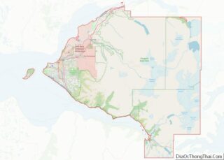
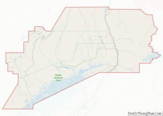
Sitka City and Borough Road Map
Geography
According to the United States Census Bureau, the borough is the largest incorporated city by area in the U.S., with a total area of 4,811 square miles (12,460.4 km), of which 2,870 square miles (7,400 km) is land and 1,941 square miles (5,030 km) (40.3%) is water. As a comparison, this is almost four times the size of the state of Rhode Island.
Sitka displaced Juneau, Alaska, as the largest incorporated city by area in the United States upon the 2000 incorporation with 2,874 square miles (7,440 km) of incorporated area. Juneau’s incorporated area is 2,717 square miles (7,040 km). Jacksonville, Florida, is the largest city in area in the contiguous 48 states at 758 square miles (1,960 km).
Climate
Sitka has an oceanic climate (Köppen Cfb) with moderate, but generally cool, temperatures and abundant precipitation. The average annual precipitation is 131.74 inches (3,350 mm); average seasonal snowfall is 33 inches (84 cm), falling on 233 and 19 days respectively. The mean annual temperature is 45.3 °F (7.4 °C), with monthly means ranging from 36.4 °F (2.4 °C) in January to 57.2 °F (14.0 °C) in August.
The climate is relatively mild when compared to other parts of the state. Only 5.1 days per year see highs at or above 70 °F (21 °C); conversely, there are only 10 days with the high not exceeding freezing. The winters are extremely mild compared to inland areas of similar and much more southerly parallels due to the intense maritime moderation. The relatively mild nights ensure that four months stay above the 50 °F (10 °C) isotherm that normally separates inland areas from being boreal in nature. Due to the mild winter nights, hardiness zone is low for the latitude (from 6b to 8a).
The highest temperature ever recorded was 88 °F (31.1 °C) on July 30, 1976, and July 31, 2020. The lowest temperature ever recorded was −1 °F (−18.3 °C) on February 16–17, 1948.
Geology
Mount Edgecumbe, a 3,200-foot (980 m) “historically active” stratovolcano, is located on southern Kruzof Island, approximately 24 km (15 mi) west of Sitka and can be seen from the city on a clear day.
On 22 April 2022, the Alaska Volcano Observatory reported that
Adjacent boroughs and census areas
- Hoonah-Angoon Census Area, Alaska – north, northeast
- Prince of Wales–Hyder Census Area, Alaska – southeast
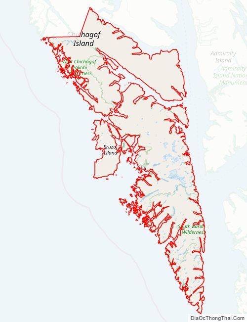
National protected areas
- Alaska Maritime National Wildlife Refuge (part of Gulf of Alaska unit)
- Saint Lazaria Wilderness (formerly Saint Lazaria National Wildlife Refuge)
- Sitka National Historical Park
- Tongass National Forest (part)
- South Baranof Wilderness
- West Chichagof-Yakobi Wilderness (part)
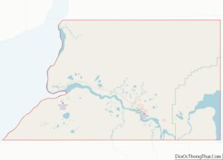
Sitka City and Borough Topographic Map
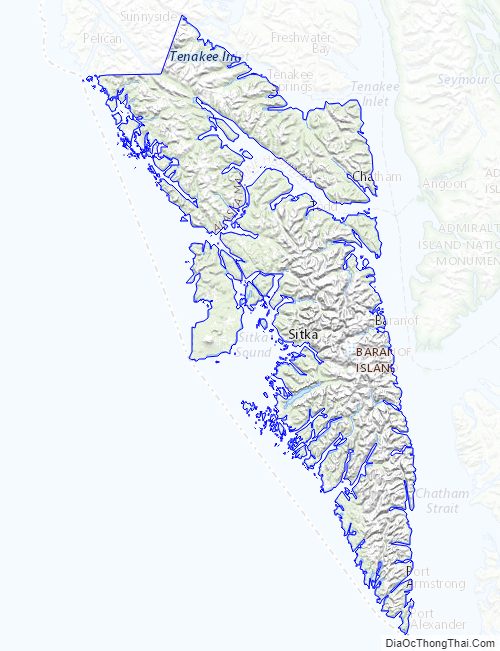
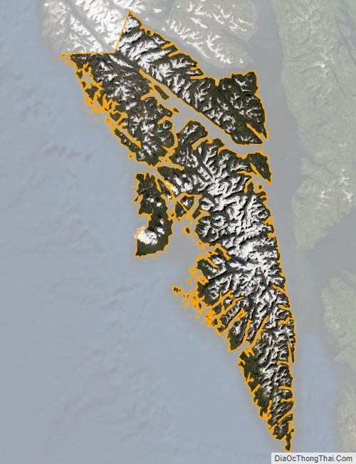
Sitka City and Borough Satellite Map
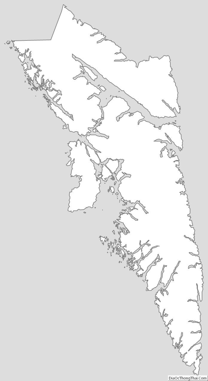
Sitka City and Borough Outline Map