Map of McDonald Chapel CDP

Map of McDonald Chapel CDP

McDonald Chapel is a census-designated place in Jefferson County, Alabama, United States. It is northeast of the Birmingham suburb of Pleasant Grove. At the 2020 census, the population was 739. Large portions of this area were damaged by violent tornadoes in 1956, 1998, and 2011. The 1998 tornado was rated F5 on the Fujita scale. … Read more

Map of Maytown town

Map of Maytown town, Alabama

Maytown is a town in Jefferson County, Alabama, United States. It is northwest from the Birmingham suburb of Pleasant Grove. It incorporated in October 1956. At the 2010 census the population was 385, down from 435 in 2000. This area was damaged by an F5 tornado on April 8, 1998. Maytown town overview: Name: Maytown … Read more

Map of McIntosh town

Map of McIntosh town, Alabama

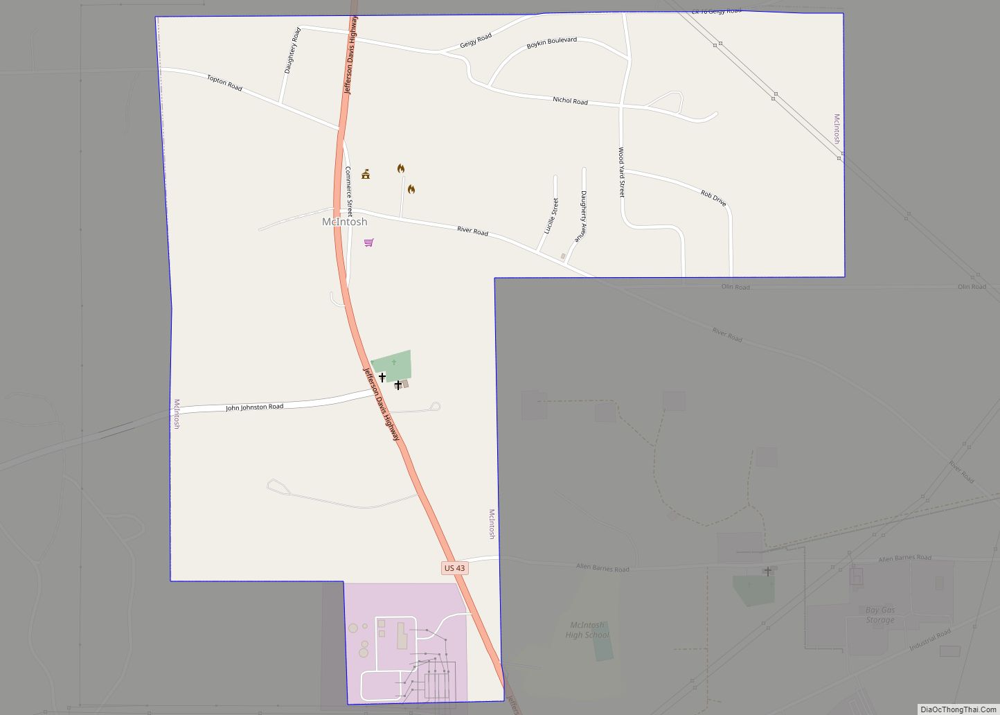
McIntosh is a town located in Washington County, Alabama, United States along U.S. Route 43. It is 12+1⁄2 miles (20.1 km) south of Wagarville and 44 miles (71 km) north of Mobile. It was named for William McIntosh, a prominent Creek chief of the nineteenth century. The town was incorporated on April 7, 1970. The population as … Read more

Map of Meadowbrook CDP

Map of Meadowbrook CDP, Alabama

Meadowbrook is an unincorporated community and census-designated place (CDP) in Shelby County, Alabama, United States. At the 2020 census, the population was 9,688. It is part of the Birmingham metropolitan area. Meadowbrook CDP overview: Name: Meadowbrook CDP LSAD Code: 57 LSAD Description: CDP (suffix) State: Alabama County: Shelby County Elevation: 627 ft (191 m) Total Area: 4.37 sq mi … Read more

Map of McMullen town

Map of McMullen town

McMullen is a town in Pickens County, Alabama, United States. The population was 10 at the 2010 census, down from 66 in 2000. It incorporated around 1976. A series of natural disasters has caused the population to dwindle. As of 2010, it was the smallest incorporated town in the state of Alabama. It was overtaken … Read more

Map of McKenzie town

Map of McKenzie town, Alabama

McKenzie is a town in Butler and Conecuh counties in the U.S. state of Alabama. The population was 530 at the 2010 census. McKenzie town overview: Name: McKenzie town LSAD Code: 43 LSAD Description: town (suffix) State: Alabama County: Butler County, Conecuh County Elevation: 453 ft (138 m) Total Area: 3.74 sq mi (9.69 km²) Land Area: 3.72 sq mi (9.64 km²) Water … Read more

Map of Mentone town

Map of Mentone town, Alabama

Mentone is a town in DeKalb County, Alabama, United States. It is located atop Lookout Mountain. A number of private summer camps are located near Mentone. For a number of years, Mentone has hosted an unusually large number of summer camps. Mentone attracts many visitors and tourists annually, partly due to the summer camps. Mentone … Read more

Map of Memphis city

Map of Memphis town, Alabama

Memphis, also known as Old Memphis, is a town in Pickens County, Alabama, United States. The population was 29 at the 2010 census, down from 33 in 2000. As long ago as 1850, it was listed as an incorporated community on the U.S. Census, but did not appear again on the rolls until its reincorporation … Read more

Map of Megargel CDP

Map of Megargel CDP, Alabama

Megargel is a census-designated place and unincorporated community in Monroe County, Alabama, United States. Its population was 60 as of the 2020 census. Megargel CDP overview: Name: Megargel CDP LSAD Code: 57 LSAD Description: CDP (suffix) State: Alabama County: Monroe County Elevation: 390 ft (120 m) Total Area: 0.69 sq mi (1.78 km²) Land Area: 0.69 sq mi (1.78 km²) Water Area: 0.00 sq mi … Read more

Map of Midland City town

Map of Midland City town

Midland City is a town in Dale County, Alabama, United States. At the 2010 U.S. Census the population was 2,344. It incorporated in 1890. It is part of the Ozark Micropolitan Statistical Area. Midland City town overview: Name: Midland City town LSAD Code: 43 LSAD Description: town (suffix) State: Alabama County: Dale County Elevation: 377 ft … Read more

Map of Midfield city

Map of Midfield city

Midfield is a town in Jefferson County, Alabama, United States, located two miles south of the Birmingham suburb of Fairfield. It incorporated in 1953. As of the 2010 census, it had a population of 5,365. Midfield city overview: Name: Midfield city LSAD Code: 25 LSAD Description: city (suffix) State: Alabama County: Jefferson County Elevation: 525 ft … Read more

Map of Meridianville CDP

Map of Meridianville CDP

Meridianville is an unincorporated community and census-designated place (CDP) in Madison County, Alabama, United States, and is included in the Huntsville-Decatur Combined Statistical Area. As of the 2020 census, the population of the CDP was 8,209. Meridianville CDP overview: Name: Meridianville CDP LSAD Code: 57 LSAD Description: CDP (suffix) State: Alabama County: Madison County Elevation: … Read more