Map of Ballplay CDP

Map of Ballplay CDP

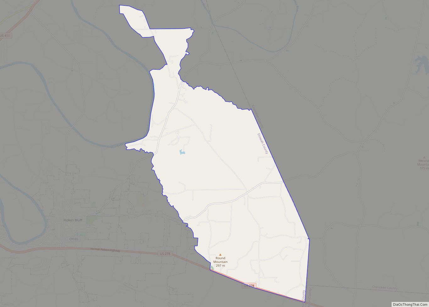
Ballplay is an unincorporated community and census-designated place (CDP) in Etowah County, Alabama, United States. Its population was 1,437 as of the 2020 census. Ballplay CDP overview: Name: Ballplay CDP LSAD Code: 57 LSAD Description: CDP (suffix) State: Alabama County: Etowah County Elevation: 594 ft (181 m) Total Area: 23.74 sq mi (61.48 km²) Land Area: 23.55 sq mi (61.00 km²) Water Area: … Read more

Map of Bakerhill town

Map of Bakerhill town

Bakerhill or Baker Hill is a town in Barbour County, Alabama, United States, near Eufaula. According to the 2010 U.S. Census, the town had a population of 279. Although it existed as an unincorporated village since before 1860, the town was officially incorporated in 1997. Bakerhill town overview: Name: Bakerhill town LSAD Code: 43 LSAD … Read more

Map of Baileyton town

Map of Baileyton town, Alabama

Baileyton is a town in Cullman County, Alabama, United States. At the 2020 census, the population was 649. The town’s mayor is Johnny Dyar. Baileyton town overview: Name: Baileyton town LSAD Code: 43 LSAD Description: town (suffix) State: Alabama County: Cullman County Elevation: 984 ft (300 m) Total Area: 5.31 sq mi (13.77 km²) Land Area: 5.25 sq mi (13.61 km²) Water Area: … Read more

Map of Bayou La Batre city

Map of Bayou La Batre city

Bayou La Batre (/ˌbaɪ.oʊ lə ˈbætri/ or locally /ˌbaɪlə ˈbætri/) is a city in Mobile County, Alabama, United States. It is part of the Mobile metropolitan area. As of the 2020 census, the population was 2,204, down from 2,558 at the 2010 census. Bayou La Batre is a fishing village with a seafood-processing harbor for … Read more

Map of Bay Minette city

Map of Bay Minette city

Bay Minette is a city in and the county seat of Baldwin County, Alabama, United States. As of the 2010 census, the population of the city was 8,044. Bay Minette city overview: Name: Bay Minette city LSAD Code: 25 LSAD Description: city (suffix) State: Alabama County: Baldwin County Elevation: 269 ft (82 m) Total Area: 17.34 sq mi (44.91 km²) … Read more

Map of Banks town

Map of Banks town, Alabama

Banks is a town in Pike County, Alabama, United States. As of the 2020 census it had a population of 156, down from 179 in 2010. It incorporated in December 1894. Banks town overview: Name: Banks town LSAD Code: 43 LSAD Description: town (suffix) State: Alabama County: Pike County Elevation: 554 ft (179 m) Total Area: 1.99 sq mi … Read more

Map of Beaverton town

Map of Beaverton town, Alabama

Beaverton is a town in Lamar County, Alabama, United States. At the 2010 census the population was 201, down from 226 in 2000. Beaverton town overview: Name: Beaverton town LSAD Code: 43 LSAD Description: town (suffix) State: Alabama County: Lamar County Elevation: 377 ft (115 m) Total Area: 4.59 sq mi (11.88 km²) Land Area: 4.59 sq mi (11.88 km²) Water Area: 0.00 sq mi … Read more

Map of Beatrice town

Map of Beatrice town, Alabama

Beatrice /biːˈætrɪs/ is a town in Monroe County, Alabama, United States. It incorporated in 1901. At the 2020 census the population was 204, down from 301 in 2010 and 412 in 2000. Beatrice town overview: Name: Beatrice town LSAD Code: 43 LSAD Description: town (suffix) State: Alabama County: Monroe County Elevation: 269 ft (82 m) Total Area: … Read more

Map of Bear Creek town, Alabama

Map of Bear Creek town, Alabama

Bear Creek is a town in Marion County, Alabama, United States. It incorporated in 1907, although the 1910 U.S. Census records indicated 1909. At the 2020 census, the population was 1,047. Bear Creek town overview: Name: Bear Creek town LSAD Code: 43 LSAD Description: town (suffix) State: Alabama County: Marion County Elevation: 807 ft (246 m) Total … Read more

Map of Bellamy CDP

Map of Bellamy CDP

Bellamy is a census-designated place and unincorporated community in Sumter County, Alabama, United States. Its population was 543 as of the 2010 census. Bellamy CDP overview: Name: Bellamy CDP LSAD Code: 57 LSAD Description: CDP (suffix) State: Alabama County: Sumter County Elevation: 112 ft (34 m) Total Area: 3.82 sq mi (9.89 km²) Land Area: 3.78 sq mi (9.78 km²) Water Area: 0.04 sq mi … Read more

Map of Belk town

Map of Belk town

Belk is a town in Fayette County, Alabama, United States. Its citizens voted to incorporate in January 1969. At the 2020 census, the population was 186. Belk town overview: Name: Belk town LSAD Code: 43 LSAD Description: town (suffix) State: Alabama County: Fayette County Elevation: 315 ft (96 m) Total Area: 1.39 sq mi (3.59 km²) Land Area: 1.39 sq mi (3.59 km²) … Read more

Map of Belgreen CDP

Map of Belgreen CDP

Belgreen is a census-designated place and unincorporated community in Franklin County, Alabama, United States, located nine miles west of Russellville and around 17 miles east of Red Bay on Alabama Highway 24. As of the 2010 census, its population was 129. Belgreen is a small district, composed of a condensed area of residency, the school, … Read more