Map of Sand Rock town

Map of Sand Rock town

Sand Rock is a town in Cherokee and DeKalb counties in the U.S. state of Alabama. It incorporated in 1988. At the 2020 census, the population was 591. Sand Rock town overview: Name: Sand Rock town LSAD Code: 43 LSAD Description: town (suffix) State: Alabama County: Cherokee County, DeKalb County Elevation: 860 ft (260 m) Total Area: … Read more

Map of Samson city

Map of Samson city

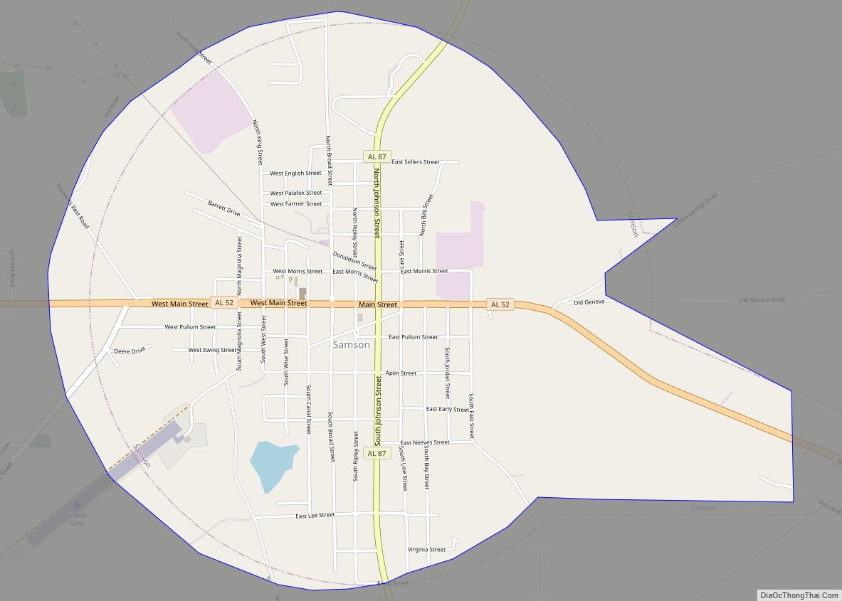
Samson is a city in Geneva County, Alabama, United States. It is part of the Dothan, Alabama Metropolitan Statistical Area. At the 2020 census the population was 1,874, down from 1,940 in 2010. Samson incorporated in 1905 (according to the 1910 U.S. Census), although other sources cited 1906. Samson city overview: Name: Samson city LSAD … Read more

Map of Saks CDP

Map of Saks CDP

Saks is a census-designated place (CDP) and Unincorporated community in Calhoun County, Alabama, United States. At the 2020 census, the population was 9,956. The community of Saks is served by the City of Anniston police and fire coverage. It is included in the Anniston-Oxford Metropolitan Statistical Area. Saks CDP overview: Name: Saks CDP LSAD Code: … Read more

Map of Sardis City town

Map of Sardis City town

Sardis City is a town in Etowah and Marshall counties in the U.S. state of Alabama. It is part of the Gadsden Metropolitan Statistical Area. It originally incorporated in May 1963 under the name of “Sardis”. It became Sardis City in the 1980s. At the 2020 census, the population was 1,814. Sardis City town overview: … Read more

Map of Saraland city

Map of Saraland city

Saraland is a city in Mobile County, Alabama, United States, and a suburb of Mobile. As of the 2020 census, the population of the city was 16,171, up from 13,405 at the 2010 census. Saraland, part of the Mobile metropolitan area, is the third largest city in Mobile County. Saraland city overview: Name: Saraland city … Read more

Map of Sanford town

Map of Sanford town, Alabama

Sanford is a town in Covington County, Alabama, United States. At the 2020 census, the population was 257. Sanford was originally incorporated in 1902 and was on the 1910 U.S. Census. It did not appear again on the census until 1960. Sanford town overview: Name: Sanford town LSAD Code: 43 LSAD Description: town (suffix) State: … Read more

Map of Satsuma city

Map of Satsuma city

Satsuma is a city in Mobile County, Alabama, United States. At the 2020 census, the population was 6,749, up from 6,168 at the 2010 census. Known prior to 1915 as “Fig Tree Island”, the city was named after the satsuma orange, which was successfully cultivated and grown in Alabama starting in 1878, a gift from … Read more

Map of Section town

Map of Section town

Section is a town in Jackson County, Alabama, United States and is included in the Chattanooga-Cleveland-Dalton, TN-GA-AL Combined Statistical Area. As of the 2010 census, the population of the town was 770, an increase of one person (769) from 2000. Section is located on top of Sand Mountain. Section town overview: Name: Section town LSAD … Read more

Map of Scottsboro city

Map of Scottsboro city

Scottsboro is a city in and the county seat of Jackson County, Alabama, United States. The city was named for its founder Robert T. Scott. As of the 2020 census, the population of the city is 15,578. From its incorporation in 1870 until 1890, it was the largest community in Jackson County, losing the distinction … Read more

Map of Semmes city

Map of Semmes city

Semmes city overview: Name: Semmes city LSAD Code: 25 LSAD Description: city (suffix) State: Alabama FIPS code: 0169240 Online Interactive Map Semmes online map. Source: Basemap layers from Google Map, Open Street Map (OSM), Arcgisonline, Wmflabs. Boundary Data from Database of Global Administrative Areas. Semmes location map. Where is Semmes city? Semmes Road Map Semmes … Read more

Map of Selmont-West Selmont CDP

Map of Selmont-West Selmont CDP

Selmont-West Selmont is a census-designated place (CDP) in Dallas County, Alabama, United States. At the 2020 census, the population was 2,158. Selmont-West Selmont CDP overview: Name: Selmont-West Selmont CDP LSAD Code: 57 LSAD Description: CDP (suffix) State: Alabama County: Dallas County Elevation: 117 ft (36 m) Total Area: 3.32 sq mi (8.59 km²) Land Area: 3.28 sq mi (8.49 km²) Water Area: 0.04 sq mi … Read more

Map of Selma city

Map of Selma city, Alabama

Selma is a city in and the county seat of Dallas County, in the Black Belt region of south central Alabama and extending to the west. Located on the banks of the Alabama River, the city has a population of 17,971 as of the 2020 census. About 80% of the population is African-American. Selma was … Read more